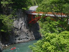
Nakatsugawa (Below the Red Bridge)
| Stretch: | Near Oakasawa |
| Difficulty: | Class II to III, then IV to IV+ |
| Distance: | 5.1 miles |
| Flows: | We had maybe ~1,000 cfs. It was low medium. |
| Gradient: | 123 fpm (Upper half is significantly less, if not for the big dam) |
| Put-in: | At the Red Bridge, just out of town. +36° 53' 7.04", +138° 38' 12.70" |
| Take-out: | At the Dam Access Road +36° 56' 38.84", +138° 39' 38.79" |
| Shuttle: | 6.5 miles (25 minutes one way) |
| Season: | Spring off of Rain/Snowmelt |
| Written: | © 2012 |
| Featured in Video Sixty-Five | |

Japan 2012 Day 3 and 9:
Leaving Lincoln's place in Minakami, we headed towards the Nakatsugawa and the Zakogawa rivers. The plan the first day was to get the short first descent of the Upper Zakogawa. However, as we drive of the Nakatsugawa we are greeted with crystal clear water and class IV to IV+ rapids directly below the road. After pulling over to inspect, the team's plans change and we decide to do this section instead.
Finding take-out was easy, there is a short lake formed by a dam with easy access up the side of the hill. Put-in, we decided to drive up as far as made sense to make a full day. We decide to drive up several miles to the Red Bridge which marks the take-out for the Nakatsugawa lower gorge (which we did the next day). Below, the run was surprisingly mellow. Class II to III for several miles before to our surprise the river plummeted over a 33 meter tall dam. With a quick (albeit steep and muddy) portage around the dam, we were greeted by the hardest rapid (maybe class IV) of the upper half. Soon, the road came back into view, we portaged around another dam, this time a two tiered drop with large recirculation and shallow launching pads. We knew that the run was going to get more challenging at this point from what we road scouted. (We also came back a few days later to repeat this lower section).
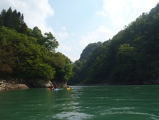
The river then begins to steepen, class III turns into class IV boulder gardens before you get to the main gorge. Really only a few rapids long, the first has a sieve in play on the right but is easy to avoid. The second is a fun boof, at higher water we were able to boof the nose of the rock, at lower water we went far left. The third is a blind S-turn. The fourth we snuck around at higher flow down the far left channel but at lower flows and a friendlier hole we main-lined the right. The last rapid was a cascade that led to a really fund s-turn that sadly was underwater our second day as the lake level fluctuated by tens of feet each day. The lake itself was between a quarter mile and nearly a half mile depending on how full it was, but either way was a short paddle.
The upper half of this run was pretty, but due to the lack of character and the portage around the first dam, is something that I wouldn't rush back for. It did however provide a nice way to make a full day out of paddling. The bottom half of the run is very worth doing, though as a downside the road is very much in view the entire time so is not the wilderness experience you will get on other sections of the Nakatsugawa.
That night, we headed up the Nakatsugawa to its tributary, the Zakogawa and found a nice roadside turnout at a trailhead that we set up camp at and called home for the next 4 nights. The highlights were the hot springs at the confluence of the Nakatsugawa and Zakogawa that we visited 3 of the nights. The lowlight, was forgetting my sleeping bag at Lincoln's and being forced to spend the next 5 or 6 nights sleeping in everyone's kayak bags from the flight over as well as using the paddle bag as a blanket. Additionally, it required I use my Kokatat onesy layer to stay warm which meant I couldn't boat in the only warm layer I brought with me due to not wanting it to be wet from sweat... in summary, I regretted forgetting my sleeping bag.
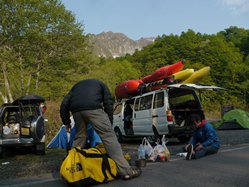
Also, check out Darin McQuoid's photos on his website, www.darinmcquoid.com
Day 3:
Last: Day 2 Afternoon (Yunokoyagawa)
Next: Day 4 (Nakatsugawa - Above the Red Bridge)
Day 9:
Last: Day 9 Morning (Shimagawa)
Next: Day 10 (Nakatsugawa - Lower)
Mi 0-1.0:
- Boogie (III-IV). The first starts off with some fun boogie. At the low flows we had, it was all class III. I could see as water rises the difficulty could increase.
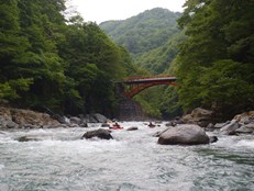

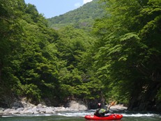
- The river mellows out to class II.
- Dam (P). Portage on the left around the 33m tall dam. Walk on the road no more than 30 or 40 yards you see the steep hill to drop down and back to the river.
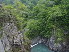
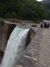
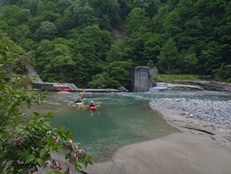
- Dam #2 (V to P). These were runnable, but we all opted to portage. The first one is maybe 15 feet tall and the second is maybe 10. They would be hard to boof due to shallow lips and are dangerous due to uniform holes. The walk was easy on the right, putting in a hundred yards downstream.

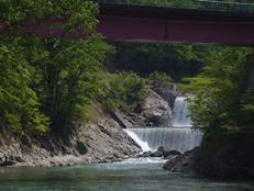
- Boogie (III to IV). The rapids get steeper and harder, but stay boulder bar in nature. Once you pass under the bridge you will see the main gorge of rapids.
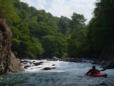
- Entrance (IV to IV+). At the low flows, it wasn't that hard. We went left of center to stay away from the sieve on the right. Below are two quick holes to boof. At higher flows, perhaps it pushes towards the sieve harder, perhaps the holes get worse. Easy to scout from the road.
Boof (IV). At higher flows, we boofed the right side of the center rock. At lower flows we boofed the left channel.
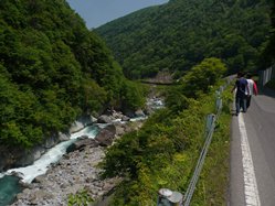
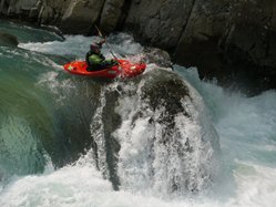
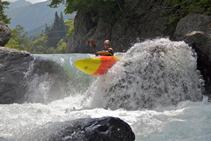
S-Turn (IV). A fun s-turn that could be mostly snuck around on the far left. The main s-turn line, you wanted to be driving left as a pocket hole formed on the right before the river bends around the large house size rock to the right.
Sievy (IV to IV+). At higher flows, we snuck it down the left micro channel boofing a nice 5 foot drop. At low flows, the hole in the mainline down the right was more doable and folks boofed through.
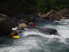
Last but not Least (IV to IV+). We ran this starting on the left but quickly getting to the right side to boof and punch a few holes. Below was a small eddy on the right that we caught to boat scout the exit. The exit was a tight s-turn that flipped some of the group. The second day we did this run, the lake level was a smidge higher and the exit was under water. The lake starts at mile 4.6 if it is all the way full.
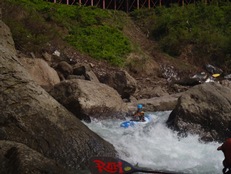
Directions: Use the GPS locations to get yourself to put-in and take-out... I wasn't driving most days and do not know enough of the directions to be useful.
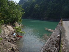
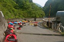
Take-out: Just before you get to the lake, there is a road that drops quickly down to the dam. We would park at the top of the road where the turnout is.
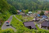
Put-in: Heading up river, you will drop down and cross it at the very picturesque red bridge. There is a small restaurant and shop (with really good food!) with a small parking lot. We asked permission to park here and they allowed. They also had a faucet to refill our water and a toilet.
HTML Comment Box is loading comments...
