Nakatsugawa (Lower)
| Stretch: | Near Ketto |
| Difficulty: | Class III |
| Distance: | 3.0 miles |
| Flows: | We had maybe ~900 cfs. It was low |
| Gradient: | 111 fpm average |
| Put-in: | At the Dam Access Road +36° 56' 38.84", +138° 39' 38.79" |
| Take-out: | At the Lower Fishladder Access Road +36° 58' 56.91", +138° 39' 57.83" |
| Shuttle: | 3.5 miles (10 minutes one way) |
| Season: | Spring off of Rain/Snowmelt |
| Written: | © 2012 |
| Featured in Video Sixty-Five | |

Japan 2012 Day 10 Morning:
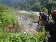
Looking for a mellow day to rest up, boat something new, and include everyone on the team... we opted to do the section of the Nakatsugawa below where we had taken out twice previously. This section of river at our lowish flows was fun class III in a scenic open gorge before opening up into a valley with a handful of runnable small dams. With high water, I think this run would be really good. The nature of the river, relatively continuous with boulder gardens I would imagine turn into a play boating paradise. As it was, I still found the fun to be entertaining. Despite how the bottom looked from the shuttle, the river even near the end actually channelized fairly well allowing for a fun low stress morning to be had. After our run, we headed into the nearby town to refresh our food suppliers, drink a beer or two, and begin to think about an after plan. At this time, we remembered seeing posters with an interesting waterfall on it... and so we heading off, seeking out the Kamagawa.
Also, check out Darin McQuoid's photos on his website, www.darinmcquoid.com
Last: Day 10 (Nakatsugawa - Below the Red Bridge)
Next: Day 11 (Kiyotsugawa - Canyon)
Mi 0-1.4:
- Boulder Gardens (Class III to III+). The rapids here are boulder garden affairs that don't have any particularly individualistic identity. One of the bigger ones is the last one before the canyon opens up. Run down the right and punch a few holes.
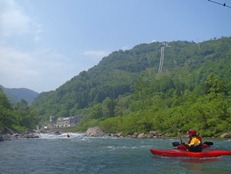
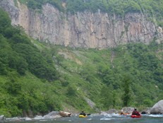
- Dam #1 (III). Runnable left of center. Too far left and you will piton a step in the dam.
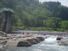
Dam #2 (III-). Runnable anywhere, looks big from above but it ends up being just a very low angle slide.
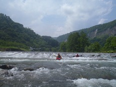
Dam #3 (III to IV). Runnable anywhere, this one was steeper and had nubby rock the whole way down. Not a place to flip.
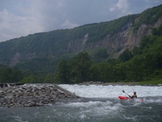
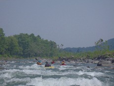
Dam #4 (III-). This one was actually not a dam, but a rock collector. Several large teeth stood midriver, just run between the ones in the main channel.
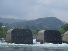
Dam #5 (IV). Not hard, but as dams go, they are consequential. This one had a small slide to an 8 foot boof. The slide was so shallow though that you couldn't run it straight as you would just piton, spin, and fall off the falls cockeyed. Instead, drop it with angle and straighten out to boof the ledge at the bottom. We ran far left and took out immediately below.
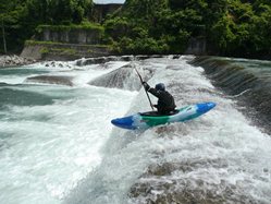
Directions: Use the GPS locations to get yourself to put-in and take-out... I wasn't driving most days and do not know enough of the directions to be useful.
Take-out: Across from the town of Akinari, there is a bridge that crossed the river, immediately on the other side we took a dirt road to the right that led downt o the water.
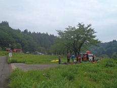
Put-in: Just before you get to the lake, there is a road that drops quickly down to the dam. We crossed the dam and put-in down near the houses on river left. It did involve roping boats down a cement wall that had a ladder to climb down.
HTML Comment Box is loading comments...
