Kiyotsugawa (Canyon)
| Stretch: | Mitsumata to Mugurasawa |
| Difficulty: | Class IV to V |
| Distance: | 6.4 miles |
| Flows: | Day 1 we had an optimal flow, ~800 cfs. The second day, we had a high flow of ~1,000 |
| Gradient: | 114 fpm average |
| Put-in: | Near an abandoned gym +36° 54' 25.27", +138° 46' 29.53" |
| Take-out: | At the trailhead for the snowcave hike +36° 58' 28.45", +138° 44' 57.08" |
| Shuttle: | ~20 miles (45 minutes one way) |
| Season: | Spring off of Snowmelt/Dam Release |
| Written: | © 2012 |
| Featured in Video A Wet State #67 and in A Wet State's contribution to World Kayak's Video Guide | |

Japan 2012 Day 7 and 11:
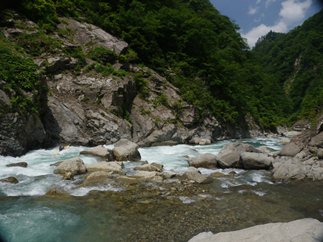
What a gem of a river. We heard reports that flows may be high, but typically if the Zakogawa is dropping out, that this river is in. I am not 100% sure how that works since this river is a dam release... perhaps it is the base flow is always a little low but with accrual things can get too high. As we arrive, we see a very shallow boulder garden, there is no way this is too low. Lincoln drove in late that night (with my sleeping bag!!!) and reported to us that the flow was too high. Luckily by morning, the river dropped a few inches and it was deemed about as high as it has been run, but still doable. At put-in, you think there is no way it could be too high. And if it weren't for a quarter mile long section of unportagable drops, that would be correct. However, at the top of the first gorge, the river constricts several times into cracks only ten feet across creating powerful hydraulics with recirculating eddies. A few days later, we went back in with the water four inches higher at put-in and were thankful we had been there before. Several of the eddies we scouted from were gone or we were unable/unwilling to catch them so we just bombed into the rapids who now had meatier holes, larger recirculation, and huge cushions bouncing and refracting off the walls. We ended up with a few surfings, a few beatings, and one swim in our group in this section. Happy to be out of the gorge, we proceeded downriver. (This river is by far the most intimidating part of the river... but it is also amazingly beautiful in the gorge and is certainly a highlight as well). Downriver the river maintains a class IV to IV+ feeling all the way to take-out. There is perhaps a class V- rapid in there, but nothing too strenuous, just high quality boulder gardens.
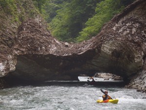
One of the more unique aspects of this run is the snow bridges. We portaged the first snow bridge due to a class III-IV drop being under it in addition to a blind corner. The portage involved a throw and go or a tricky seal launch. The last three snow bridges were awesome. Ranging between 100 yards long and just 20 feet long, the feeling of being under several million pounds of melting ice that is due to collapse any day is surreal. I tried to linger as much as possible to take it, but my instincts were there encouraging me to keep moving. Upon exit, we all shared our hoots and hollers of the experience and how we had never imagined we would do something like that.
Other than the first gorge that limits the flow range... the rest of the run is very manageable class IV and IV+. There is one long portage that will take about an hour for a group of 10 people. The rapid is a few hundred yards long and has several unrunnable tiers though most have been run with the right rock placement (varies year to year) and the right flow). The portage requires roping boats up and down a handful of times in addition to a at river level rock climb directly in front of a sieve. This portage is intimidating but actually was straight forward once the path was understood.
If the rapids are not enough to keep you occupied and happy, take a look around you. The canyon is reminiscent of Giant Gap on the North Fork American, or Burnt Ranch Gorge on the Trinity... but much lusher with green forest covering every non-cliffed-out inch of the mountains. Near the end of our trip, as flows were dropping out and we looked for one more day of boating... it was an easy decision that we would repeat this run. Truly the best full day of kayaking we had in Japan. It makes me sad that I will likely never do this run again. If you are in the area and find the flows to be good... you have to do it!
-As a side note, the next morning (day 8) the team tried to get a morning run on the Upper Kiyotsugawa. We had hoped to go from the dam to our camping site at the put-in for the downstream canyon. However the dam operators shot us down. We did find access downriver allowing for a quick 1-2 mile class II-III float to start the day off.
Also, check out Darin McQuoid's photos on his website, www.darinmcquoid.com
Day 7:
Last: Day 6 (Zakogawa - Upper)
Next: Day 8 (Shimagawa)
Day 11:
Last: Day 10 Afternoon (Kamagawa)
Next: Day 12 (Fuefukigawa)
Mi 0-2:
- The first two miles start off pretty mellow. Class III with maybe an occasional class IV. Periodically the gorge walls tighten for a rapid at a time, the biggest rapids of this section are when the walls are tight. None were harder than class IV though some had some good holes to punch.
- The river makes a 90 degree left turn with the walls tight all around you. We caught an eddy on the right and looked down the gorge. This is the start of the hardest section.
Lead-in (IV+). Straight forward... just don't mess these holes up. The first was a uniform ledge, punch it. The second was a sharp right turn with a pocket on the left, don't end up in it. We eddied out on the left just below.
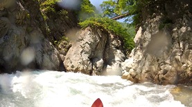
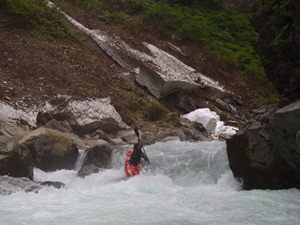
Crux (V). Unportageble, depending on the flow, unscoutable... luckily, our first day in was a normal "as high as it has been done flow." So you could catch the eddy at the lip on the right and boat scout or with some effort get out in the crack to scout from upstream. Leading to the eddy was a good hole that pushes you left away from the eddy. When we went back a few days later, you didn't want to catch the eddy as you couldn't get back out of it and onto the main lines (thanks Darin for sacrificing it to get pictures!) so we all just dropped straight in to mixed results. The two main lines were either down the left or down the middle. The hazard is the bottom hole that recirculates from a good 20 feet downstream, feeding itself along the right wall. Leading to it is 5-6 foot boof and a few guard rocks. Really stressful...
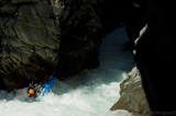
Exit (III to IV+). At low flows, it was easy, drive right and ride the cushion. At high flows, it rejected harder and had huge pillows forming on either wall to lock you in if you began to surf. One in our group got out after a huge battle. Another flushed quickly after pulling after an even bigger fight!
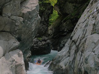
Falls (V). A quick boulder garden leads to an eddy on the left. From here you can scout the falls. At high flow... I just continued straight ahead down it as I wanted as much speed as I could get. The falls has a rock in the middle of the river that you can boof off of. At the high flows, you subbed out no matter what... for 20-30 feet. Just stay off the right wall which has a bad eddy/hole.
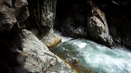
- Boogie (IV to IV+). Things boogied for a while. We had a snow bridge portage in here each of the two days. Most years it isn't there. When the river enters a landslide field on a 90 degree left bend, there is a section of continuous IV+ leading to a crux exit that is also IV+.
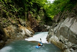
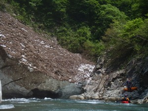
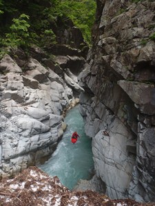
Landslide (V). Run down the right, stay away from the sieve on the left. Scout the exit from the left or right from the eddies at the bottom. Easy portage on the right too for the crux. The line through the crux is to boof the middle rock and punch the exit hole. The hole at the bottom looked much worse than it was. We also had some messy lines through the boof, but they all worked out.
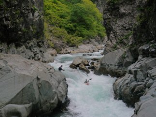
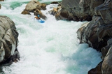
Boogie (III to IV+). Boogie continues but then quickly lightens up. Soon you begin to see amazing views of the mountains around you, waterfalls dropping in all around you. The exit of this serene place is the portage. It is a very obvious horizon line with eddy access at the lip on the left. There was also a long gravel bar in 2012 that could be used for the 100 yards upriver.
- Portage (V+ to U). With the right flows, sections have been run. This year however, rocks had moved and I think most of it was unrunnable. Plus water was way too high. Rope boats down, rock climb down the crack. Rope boats up, climb up. Rope boats back down. Traverse the landslide at river level, pass boats. Rope boats up. And then back down. Then walk down a screw field. Seriously... it all goes. You will figure it out I am sure.
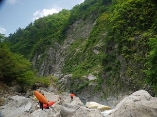
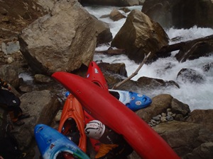
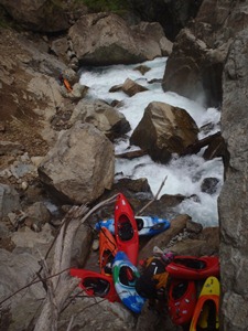
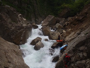
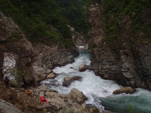
Exit (IV+). The exit from the portage had a nice boof right right of center. Made it much easier than it looked like it would be to get through the hole.
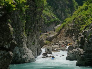
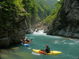
Boogie (IV+ to V-). Boogie starts at this point and continues the rest of the run. This first section has some fun rapids, one 6 foot ledge best run on the far right of the channel. Just downstream is another ledge also run far right of the main channel (left side of the river). The rapids continue and get gradually easier, but maintain a consistent nature. We had three snow bridges that we got to go under, the longest was 100 yards. Just amazing. Most years, there is at least one snow bridge to go under... such a cool experience.
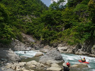
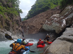
- Final Slide (IV). In sight of take-out, is a fun slide that drops into a healthy hole. Just punch it. Great to end such a good day with a rapid to push you around a bit and get your face soaked again.
Directions: Use the GPS locations to get yourself to put-in and take-out... I wasn't driving most days and do not know enough of the directions to be useful.
Take-out: Just off the freeway, go over the bridge and drive to the end of the road at the small village. The tourist attraction of the tunnel built along the hiking trail allowing folks to hike up and look at the snow caves is also here... so you might be able to explain that and get directions.
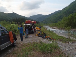
Put-in: Just before you drop all the way back to the river after going away from it for the entire shuttle, turn right towards the trekking area. Cross the river, and turn immediate right. We camped here and put-on here as well.
HTML Comment Box is loading comments...
