Zakogawa (Upper)
| Stretch: | Above "Oozen Falls" |
| Difficulty: | Class III to IV (with one V). |
| Distance: | 2.8 miles |
| Flows: | We had maybe ~200 cfs. It was low. |
| Gradient: | 131 fpm average (162 fpm near the end) |
| Put-in: | Either just above the falls... or like we did, at a turnout on the road upriver +36° 48' 17.90", +138° 31' 54.11" |
| Take-out: | At the Lower Fishladder Access Road +36° 49' 9.42", +138° 33' 15.56" |
| Shuttle: | 2.8 miles (5-10 minutes one way) |
| Season: | Spring off of Rain/Snowmelt |
| Written: | © 2012 |
| Featured in Video Sixty-Six | |

Japan 2012 Day 6:
With plans to drive to the Kiyotsugawa in the afternoon, this run seemed like a nice short and relatively easy plan for the day. That might seem weird, that our one first descent of the trip was an "easy" day but alas it was road side and we knew most of what to expect. Mostly class III with a big falls or two that may or may not be runnable that one member of the group scouted the day before while the rest of us were enjoying the lower run on the Zakogawa.
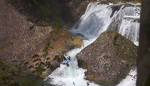
The water was low, very low... abusively low. We put on a bit above the bridge over the river but by the time we got to the bridge, we wished we had put in there. A short ways downstream, the river dropped over a 5 foot ledge that you could run anywhere. Below, the river fell over a two tiered drop that was good fun. Just below, was the large falls. A brief scouted showed us that there was the big line in the center, with a 20-25 foot drop into a hallway above an 8-10 foot boof before the exit pinch. Or there was the right line which was a slopping drop into the wall before rejoining the hallway. Members of the team took their turns on both sides. Personally, looking downriver at the hillside that would require a rope to get the boats and people out... I opted for the easy trail just above the rapid as I was still tired and sore and swearing off ropes and steep hillsides from the day before on the Lower Zako portage. After helping the rest of the team out of the canyon, and hiking on the easy trail back to the car, we saw that 100 yards further, just around the corner the river was close to the trail and would have required no rope assistance. Live and learn I guess. Just make sure you get out above the unrunnable cascade!
A few days later, looking for a half day run to do on our way from the Shimagawa back to the Kiyotsugawa for our second lap on its canyon, after getting skunked on the "White Sands" river (forgot the Japanese name) we drove up and over the tallest road in Japan (very pretty drive) to approach the Zakogawa from the headwaters in hopes of getting a second lap on the falls. Sadly, the water had dropped further and we opted to head down to get a small piece of the Nakatsu instead. In the future, I would treat this fall as a park and huck rather than part of a run. An option, if you get an early start would be to park and huck the Upper Falls... and then go to the dam and put on for lower run. Between the dam and the falls are two large cascades that are most likely unrunnable so connecting the two runs is not possible and portaging the cascades is way more work than just driving a quarter mile down the road to the dam.
Also, check out Darin McQuoid's photos on his website, www.darinmcquoid.com
Last: Day 5 (Zakogawa - Lower)
Next: Day 7 (Kiyotsugawa - Canyon)
Mi 0.5:
- One Class IV (IV). If you put in above the bridge like we did, you will see one road slide class IV. We ran it down the right. The rest of the rapids from here to the falls are class II-III and were painfully shallow the day we did it.
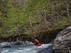
- Bridge Access: Optional Put-in / Take-out location
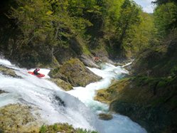
- Ledge (III). A very wide and very shallow uniform ledge can be run anywhere. The river then spreads out over a shallow slide that is super shallow but also super pretty as your slowly float over travertine like rock... until it got so shallow that we just stepped out of the boats and walked down the slide.
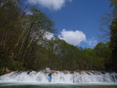
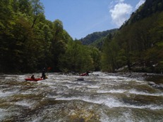
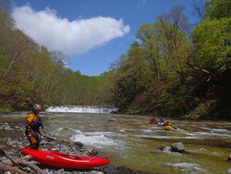
First Falls (IV). We ran down the far left side of the main channel. Slide, boof into the drop, slide some more, boof out of the drop. Scout from the island.
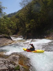
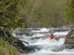
Second Falls (V to V+). Two lines to choose from (maybe more, never got a good look at river left). The center line was the harder line due to difficulty lining up the correct spot to boof the 20-25 foot entrance drop and very narrow landing zone. The right line is easier to line up but also isn't trivial due to the pocket and proximity of the wall where you land. Both channels then recombine and run down to a boof. Below, the river pinches again, most of the group took out above it to climb out. In hindsight take out further downriver... so I think the line on the exit pinch was down the right. This rapid is easy to scout from the trail when you set shuttle or hike in for a park and huck. You can also scout at river level on the right easily. Instead of portaging, just take out on the left and work to the top of the First Falls and find the trail to head back out heading downriver.
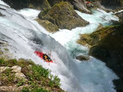
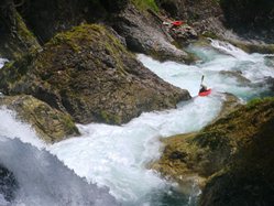
Directions: Use the GPS locations to get yourself to put-in and take-out... I wasn't driving most days and do not know enough of the directions to be useful.
Take-out: Driving up the Zakogawa, you will see a trailhead on the left marked by a blue sign (if I recall correctly), that is the trail to the dam. A quarter mile further on a right bend, there is another turnout on the left with a totem standing. This is the trailhead to the base of the falls. Go right at the fork to in the trail to scout the final falls. Keeping going up to park and huck the falls.
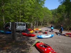
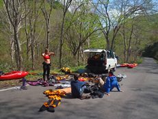
Put-in: Continue going up the river. Shortly, you get to a gated road, go left if the gate is open. You will quickly get to the bridge access. We continued until the river no longer looked runnable. It just happened that there was a turnout at this point.
HTML Comment Box is loading comments...
