Fuefukigawa (Nishizawa Canyon)
| Stretch: | Nishizawa Canyon |
| Difficulty: | Class IV to V |
| Distance: | 0.9 miles |
| Flows: | 50 cfs? Minimul Flow |
| Gradient: | 461 fpm average |
| Put-in: | At top of the trail +35° 51' 52.73", +138° 43' 52.78" |
| Take-out: | Get out a mile above the trailhead (trailhead marked) +35° 51' 47.41", +138° 45' 16.15" |
| Shuttle: | 2.8 or 3.4 miles of hiking in, ~2.0 miles hiking out. |
| Season: | Spring off of Snowmelt |
| Written: | © 2012 |
| Featured in A Wet State #68 and in A Wet State's contribution to World Kayak's Video Guide | |

Japan 2012 Day 12:
This creek is one of the reason I wanted to go to Japan. I first saw it in Cody Howard's "Risen Sun" video and then again saw pictures from the 2011 group's pictures. I remember thinking when I first saw it, well, I could do that!" (in addition to the obvious first reaction of the amazing beauty if the creek. Somehow though, through all my admiration, I had neglected to know that there was a hike to the creek. Even as I watched youtube videos a few weeks before leaving, I decided to neglect internalizing the statement of some Australians who had a video and talked about a long 2 hour hike. So somehow, when Darin stated there was a short hike of maybe 2 km that takes 30 minutes I was disappointed (I hate taking my boat on walks). Then a few days later when Yoshi said there was a 2 hour hike I was dismayed. It turned out, Yoshi was more accurate. There are two paths. One goes up and around the creek and is an "easier 5.5 km" while the other goes up and down slippery rocks and steps at creek level but is a more strenuous 4.5 km. We took the longer route and think we made the right decision. However, if you want to scout the creek on the way up perhaps the other way is better... but keep in mind, in between the good drops is steep boulder gardens reminiscent of the Green River in NC, doesn't look pretty but actually boats just fine and is rather fun.
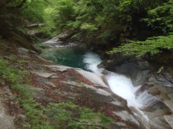
The good drops on this run are good... really good. Clean bedrock slides and falls, stacked on top of each other filled with crystal clear water shimmering a bright blue and lined by a almost florescent green forest. It really does not get more aesthetically pleasing than this run. The run starts off with a bang, straight into a set of tea cups that goes 8', 12', 4', 20', and 40'. The 40 footer will not be for everyone. One in our group took out above the 20 footer to skip the 40 footer, at the low flows this was possible with a little help from the trail. Two others opted for a throw and go around the 40 footer. This also allowed the group a re-scout after Rok and I did not sell the normal line at the reduced flow we had. Normally, the lined is to drive hard left and slide down into freefall. At the low flows, we were rejected back to the right, hitting the wall/crack hard and were sent cart-wheeling into the pool below. After revaluation, the remainder of the group went straight down the crack on the right to much greater success.
Below, the section enters some creeky boulder gardens, with the trail always nearby in case you feel like bypassing a section. With a freshly broken rib (from the 40 footer), and low water, after a handful of rapids I hit the trail to skip some of the rapids. Before long, the creek turns back to bedrock and the slides and falls continue, with the trail providing easy access just above the good section. The grand finale of this creek is a double drop of 5 feet followed by 15 feet. Below here, the river gets shallow and wide, with a few more fun slidey boofs before you should exit above the obvious and large bedrock horizon line. The top rapid is good to go but then walls you out for the bottom drop which is marginal and lands you in a crack (see the shot in Risen Sun where Cody drops in and his paddle wedges the crack and stays there forcing Cody to finish without his paddle). Below those two rapids, the river immediately turns to wide shallow shoals and dams so you really don't miss anything by hitting the trail and walking out from there (maybe 3 km).
Despite the high hike to kayak ratio on this run, this run should be on your list if visiting Japan. We boated it our last day as it was halfway from Minikami and Tokyo and not really out of the way. This allows for no wasted days of driving to make it back to Tokyo to depart! And the hike, although all uphill really could have been a lot worse. The steepest section is near the beginning and then the grade becomes more gradual. Plus, by the end of the day, with sore knees and perhaps sore backs... unlike park and hucks, you have a feeling like you accomplished something this day. And even if you don't feel exhausted... the hordes of Japanese tourist clapping and cheering you on will be a memorable experience!
Also, check out Darin McQuoid's photos on his website, www.darinmcquoid.com
Day 12:
Last: Day 11 (Kiyotsugawa - Canyon)
Mi 0:
- Tea Cups (IV to V). There were four tea cups leading to the final falls. The first one could be boofed right or left and was 6 feet tall. The second was best run down the left and was maybe 10 feet tall. The third was a small ledge runnable everywhere and lead quickly to the largest of the teacups, a 20-25 footer that we ran on the far right.
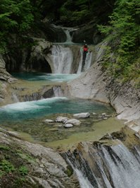
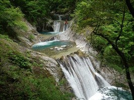
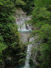
Final Falls (V). With more water you can drive left and slide down, off the falls. At the low water this proved difficult as we dried out too much and were sent into the wall and or crack a bit out of control and ate it below. After the first two of us went, a few in the group sent empty boats down the right line, through the crack itself. This proved to sell the line to Darin, David, and Yoshi and they all dropped through with success. The falls is easy to get to the base of via the trail or a few in the group decided to do a throw and go which was also not too difficult. Scout this and the tea cups from the trail before putting on.

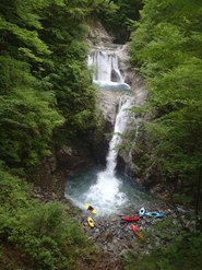
Green River (IV to V). For lack of a better name, and its similarity, the next few hundred yards I am dubbing the Green River. Steep boulder gardens, with slides and boofs are stacked back to back. We walked one that dropped into a crack and then had a log just downstream. On a right turn, you get back to bedrock.
Pothole (IV+). I hoped out to scout this one, telling people to boof the middle and paddle hard for the big hole. Rok went first and was pushed hard left and had to fight out against the wall. Laura then went next and got surfed for a solid minute before Rok climbed out and pulled her out, still in her boat! After that, the group started driving right, sloping into and through the hole, and paddling hard to get out. My bad, I thought you could boof the hole. Sometimes things are misleading.
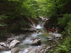
Partial Portage (IV). A small boulder garden needed a little more water. This is just downstream of the Pothole.
Slide (IV to IV+). A simply slide through a pinch. I give it a maybe IV+ just because just around the bend with only a few small eddies between this rapid and it, is a slopping falls with an undercut.
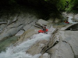
Undercut Falls (IV+). With more water, you could get left and boof off the shelf. At the low flows, there is only one channel sliding down directly in front of the undercut on the right. Point your bow left, sub out and surface in control. This falls is also in Risen Sun, near the end of the Japan section... someone gets stuffed into the undercut briefly. We had one too, but they paddled out nicely. Scout left or from the right at the lip.
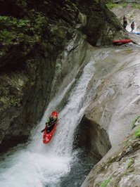
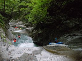
Narrows (IV). One or two boulder rapids led to a bedrock narrow straightaway that is class III leading to a 6 foot left best run far right.
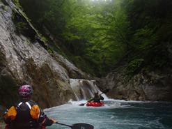
Double Falls (IV+). One of the marquee drops on the run. This falls starts with a 5-6 footer run on the right followed one short, sparkling blue pool later by a 15 footer run middle. Scout left.
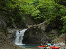
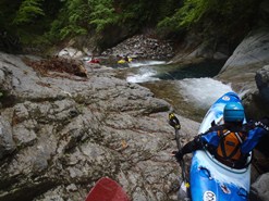
Below, there some low gradient mank. And a quick portage around a jumble. Some in our group started hiking from here. Others of us put on below and ran a few more fun bedrock rapids until we got to an obvious and large horizon line that led to another large horizon line. The top one looked good, the bottom didn't... but has been run. Egress would be hard once past the first one. A viewing platform at the bottom one just off the trail offers excellent scouting. From here though, hit the trail and hike downriver to your car.
Directions: Use the GPS locations to get yourself to put-in and take-out... I wasn't driving most days and do not know enough of the directions to be useful.
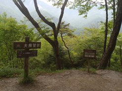
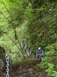
Put-in: Either hike up the creek, or hike the longer but more gradual trail. It is either 2.8 miles or 3.4 miles up.
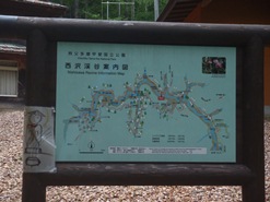
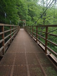
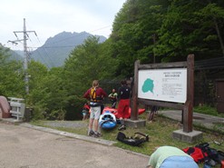
Take-out: The lady that lives near the parking lot doesn't like kayakers going up to run this creek, so either get hiking early, or park on the main road just before the bridge, there are stairs down that bypass the old lady's house... move the car to the parking lot without the kayaks on it and hit the trail up.
HTML Comment Box is loading comments...
