Kamagawa
| Stretch: | Just below the tall dam |
| Difficulty: | Class IV- to IV |
| Distance: | 0.4 miles |
| Flows: | 100 cfs? Low Flow |
| Gradient: | 462 fpm average |
| Put-in: | Base of the Tall dam +36° 58' 11.40", +138° 42' 30.19" |
| Take-out: | Creek on the right, just off the road +36° 58' 31.37", +138° 42' 38.48" |
| Shuttle: | ~0.4 miles |
| Season: | Spring off of Snowmelt |
| Written: | © 2012 |
| Featured in Video Sixty-Eight | |

Japan 2012 Day 10 Evening:
Seemingly every time we went into a village restaurant or grocery store, we had seen tourism posters with several photos of the Kiyotsugawa Canyon and another low volume creeky drop. From the picture, it looked like the top drop was a 80 foot drop followed quickly by a 20 foot drop. We didn't have any expectation of running the top drop, but thought the 20 footer could be worth a look. So, on the third to last day (in our minds, the second to last as we thought the Fuefuki would be too low), we did a morning run on a new section of the Nakatsugawa and went looking for the waterfall in the afternoon.
We found the creek fairly quickly, but were upriver of the falls and due to the impending gorge and a large waterfall, decided to drive back around lower to try to scout the gorge. An hour later, we found a trailhead leading to the Seven Pools of the Kamagawa (Kama is not to be mistaken for Okama, which is the Japanese word for gay). A quick hike down some steps and we get a view of the creek. It turns out that the photographer was quite talented and the falls were instead of being 80/20 were more like 25/5 feet in height. To our delight though, there were in fact 5 additional falls that were slides, boofs, and falls. It also turned out that the top two falls were in fact dams that were designed to mimic the rock walls. Prior to 10 years ago, there were in fact 2 waterfalls there, but a Typhoon caused flooding that collapsed the falls. The top falls would probably go with more water, but then would cause some recirculation. Our day, we seal launched in just below the top falls.
The run is short, the drops all happen in one straight away. If you bypass the last one, you could hike back up to the trailhead without much effort. Once you run the last boof, you might as well continue down another quarter mile of boogie to where the road nears. I wouldn't necessarily go too far out of your way for this run, the on river time is just not there. However, as a Novelty, like Dry Meadow Creek in California, or the Shimagawa in Japan, the scenery and pictures are worth it to visit as a half day while passing through or boating on the nearby Nakatsugawa.
Also, check out Darin McQuoid's photos on his website, www.darinmcquoid.com
Day 11:
Last: Day 10 Morning (Nakatsugawa - Lower)
Next: Day 11 (Kiyotsugawa - Canyon)
Mi 0:
- Tall Dam (?). We seal launched in below... with proper water levels perhaps it is runnable and not hard. At our flows it looked like you would certainly over rotate.
Short Dam (IV). Seal launching in was a team activity to get a good push. Some in our group flipped immediately and began floating towards the uniform pour over immediately below. The dam was not hard, just want to get a good stroke as the hole was uniform.
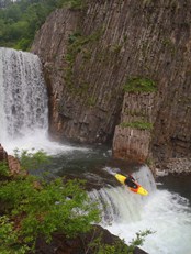
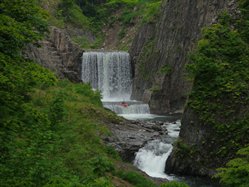
Falls (IV). The only legitimate falls on the 7 Pools or 7 Falls. Run down the left. It is only 6-8 feet tall.
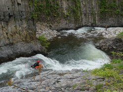
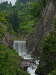
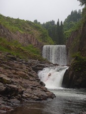
Slide (III+ to IV-). It looks harder than it is. We all thought, wow, it slides you right into the right wall. Some in our group though ended up riding the right wall all the way down and it went fine. I still went for the hard right to left to avoid the wall.
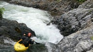
Cool Wall (III+ to IV). A hundred feet downriver, scout on the right or left. The river slides into a good size hole with a pocket on the left. It isn't hard, but you might as well take a look and take some photos of the super cool rock columns that form the wall right here.
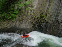
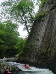
Boogie to take-out.
Directions: Use the GPS locations to get yourself to put-in and take-out... I wasn't driving most days and do not know enough of the directions to be useful.
Put-in: At the trailhead picnic area for the 7 Pools, hike a hundred yards down steps to where you see the falls, then hike up to the top on the trail.
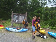
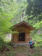
Take-out: You can either take out just below the top set of falls, or kayak another quarter mile and take out at the creek that enters on the right. It is just a hundred yards up to the road from there.
HTML Comment Box is loading comments...
