Whakapapanui Stream (Tawhai Falls)
| Stretch: | Park and Huck |
| Difficulty: | Class IV+ to V- |
| Distance: | 0 miles |
| Flows: | 50 cfs to 400 cfs. Visual Only. Goes very low... even if it hasn't rained lately. |
| Gradient: | 20 ft tall |
| Put-in: | Tawhai Falls access on SH 48 |
| Take-out: | Tawhai Falls access on SH 48 |
| Shuttle: | Short walk |
| Season: | Year round, after rain |
| Written: | © 2017 |
| Featured in A Wet State #122 | |
New Zealand 2016/2017 Day 5 Evening:
This was my last day of boating on the North Island. Rather than do laps on the Kaituna, I had opted to hike the Tongariro Crossing as it had been highly recommended by a number of people. So this morning, before heading out I ran some laps on the Kaituna before saying my goodbyes to all the carpark friends I had made. It was at that time that Allen told me a few valuable pieces of information, one that there was Tawhai falls not far away that I could easily solo as it was a park and huck, as well as the fact that the Crossing was easy to hitch hike on. Thanks for both of those facts Allen!
So I headed out of town not looking forward to the 3 hour drive or so down to where I was hoping to poach some camping. Just out of town a pair of backpackers were hitching so I stopped. They wanted to go to Taupo which was about an hour away and on my route, so I picked them up. Once in the car we began to chat they said their ultimate goal was the Tongariro Crossing, so I gave them a ride all the way there, including a stop at the grocery store so they could buy some food. Once out there, I asked if they would mind coming a few minutes out of the way to hold a rope and a camera for me while I ran the falls... and they obliged. So, mom, I didn't solo a waterfall... ?.
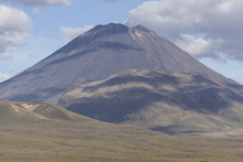
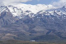
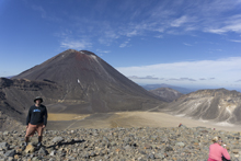
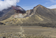
The falls are simple enough, at low flow they are pretty mindless, just try to not let your bow lift nor move too far right into the green water. Just tuck the old paddle and plug away. Apparently this falls is also the inspiration for Gollums waterfall in the Lord of the Rings. After the huck-session of a few laps, I dropped them off at the trail head around 6 pm as they wanted to do some of the hike that night and camp together for a pre-new years. So I dropped them off and found myself the nice little poached camping spot I had hoped for, which great views of the volcanoes that made up the land I would hike through the following day. One of which, Mt Ngauruhoe, was the model for Mt Doom in Lord of the Rings. That was cool... especially as ominous storm clouds rolled in as the sun set, setting the mountains ablaze before quenching all light on them and engulfing them in a haze of dark foreboding. Luckily those are just books, and all I hoped for was clear weather in the morning!
Previous: New Zealand 2016/2017 Day 4 - Waiari Stream
Next: New Zealand 2016/2017 Day 7 - Mitiri
Mi 0.0:
- Tawhai Falls (IV+ to V-). At the low flows I had I would give it a IV+ because it was very low volume, wasn't a super straight forward lip, and had a whole lot of green water to mess up and hurt yourself in. At high flows I have seen that the lip is straight forward but the boils become huge at the base creating additional hazards. The line at the low flow I had was down the only spout of water with enough water to float, far left.
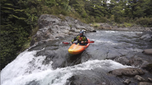
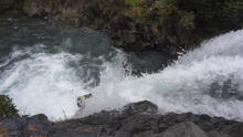
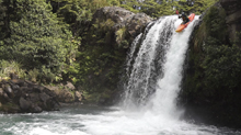
Access: From Taupo take Highway 1 for 43 km to the south end of the lake. Turn right onto State Highway 41 and follow for just 2.7 km before turning left towards Tongiriro onto State Highway 47. Follow it for an additional 37.5 km before turning left onto State Highway 48 towards Whakapapa. In 2.4 km you will see a small parking area on the left for Tawhai Falls. Park here and walk the few hundred yards down to the river. It is not 800 meters as the sign tells you. Maybe round trip it is...
New Zealand 2016/2017 Day 6 Tongariro Crossing:
The next morning I woke up early and headed out to the trailhead at the end of the Crossing. The early start was partially because in this region poaching camping although legal, has the requirement that you are fully self-contained... meaning you need a pooper. As I was in a Subaru I of course did not meet this requirement and was a little afraid of getting a large fine. The other reason for the early departure was because I knew that the first buses began operating at 7:30 to run the shuttle... so I assumed that there would be plenty of people getting a similar start time with their own cars. So I arrived at 7 with my thumb ready to hitch... which was exceedingly easy as the first car by, while I was still walking out to the main road, picked me up. By 7:30 I was hiking.
I first heard of this hike at the Feather Fest this year. A friend of a friend told me it would be very worth taking a day off of kayaking. Once I arrived at the Kaituna, several other people mentioned doing it... one of them even did it out and back in a day... in only 8 hours! It took me 6 hours to do it one way! No wonder they left me in the dust on the portage on the Lower Kaituna!
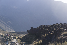
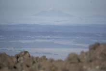
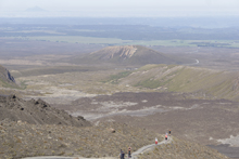
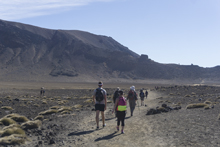
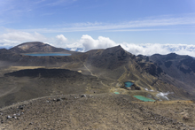
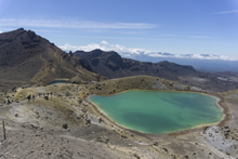
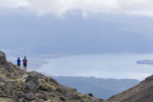
The hike had moments of steep climbing, but throughout offered fantastic views of various lava fields, lakes, thermal pools, and craters. I hiked it the normal way... which has some 985 ft of less elevation gain and goes in the direction from the Mangatepopo carpark to the Ketetahi carpark. That way clocks in with 2,575 ft elevation gain, 3,565 ft elevation drop, and 12 miles in length. I would also agree, if you are given the choice between laps on a river you have done or this, choose this. It sees over 5,000 people a day hike its trail... and is worth it for sure.
HTML Comment Box is loading comments...
