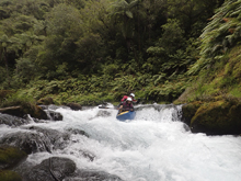
Waiari Stream
| Stretch: | Waiari Gorge |
| Difficulty: | Class III- (V). |
| Distance: | 4.3 miles |
| Flows: | 350 to 300 cfs (estimate). Should be running clear. |
| Gradient: | 79 fpm average |
| Put-in: | Orchard near overhang barn |
| Take-out: | Orchard at 394 Te Matei Rd |
| Shuttle: | 7.2 km plus 15 minutes of hiking |
| Season: | Year round from rain. Holds water really well as you do not need much water. |
| Written: | © 2017 |
| Featured in A Wet State #122 | |
New Zealand 2016/2017 Day 4:
The prior evening after doing the lower gorges of the Kaituna, the overnighter plan that people had been discussing seemed to slip away and everyone began to lose motivation. Luckily Allen Yip suggested this little nearby section of river that though easy was reputed to be super pretty and a group was motivated to check it out. However, come morning motivation waned and I was left struggling. Luckily the Germans whom I had met on my first day were back in town and keen on boating it, as was a kiwi who arrived the day before. So we set off... though we were told we would need to call about the access at put-in and take-out. Seemed easy enough.
This was the first time the guide book disappointed me on the trip... and not the last honestly. The book has phone numbers for put-in and take-out, both of which are outdated. As for directions, it says put-in at the orchard and take-out at another orchard. No mileage and no address nor any description. We went back to camp to see if anyone could point us further, only to find everyone had split for leisure days. We then found luck with a guy who was there who found the write-up online... spelled differently (Wairari... note the extra "r") explaining why we could not locate it, and found that the online there was updated contact info. Calling those people, we got an address for take-out but were unable to get ahold of anyone at put-in. Luckily one person said they recalled that put-in was at an orchard across from a building with an overhang like a gas station... but older and not functional. So we set off... hoping for the best. We found take-out easily using the address. And then backtracking the book's stated shuttle distance found an old bard that had a covered area in the front of it... across from an Orchard. So we assumed that had to be what Bram had talked about and parked outside the orchard on the road and set off with our boats looking for the trail. We quickly found it and found our way down to the river. I hope we did not screw over the local community in anyway by setting off without permission for the put-in!
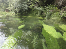
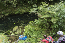
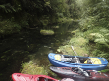
The stream itself was amazingly clear. Some of the clearest water I have ever seen. The downside is that the first half of the run is a boat scrapping piece of crap. It will feel like not nearly enough water and a waste of time. Luckily after a km or so of this, the river gets narrower and the run starts feeling more appropriately filled with water. The rapids are just class II to III with one small waterfall that may need to be walked with ease on the right. This then leads down to the crux drop which is in a walled out section and is a 10 foot falls where the water wants to move you left and a resulting piton into a shelf. Get out and store your boats on the left wall, wade down the water to look at it on the left. With a little more water it would be more tempting, but at the low flow we had the potential for broken legs was too big so we all walked on the left. We did this via passing boats on a small ledge on the left. It was slippery so be careful! Below the river quickly hits take-out. A place that lived in my mind for the next week thanks to the hundreds of sand-fly bites I received in the few minutes I spent loading the boats. It was then that I was told "we don't even really have sand-flies on the North Island, if you are getting it here you are screwed down south..." Words that scared the bejesus about of me... and came to be true too...
This run is pretty, if you have no other options for something this is a worthwhile run to see a new place. The whitewater as I said started off super crappy and not worthwhile before turning into nice enjoyable class III- creeking. The scenery and the water quality is what really makes the float worthwhile though. So if you make it here, look forward to those aspects!
Note that the mileage is approximate on most of the write-up, google earth cannot see into the canyon so I could not pinpoint locations.
Previous: New Zealand 2016/2017 Day 3 - Kaituna River (Lower)
Next: New Zealand 2016/2017 Day 5 - Whakapapanui Stream (Tawhai Falls)
Mi 0.1:
- Junk (II to III-). The first third of the run is a total pile of junk. I was told to look for the river to look low at the start, and it did. But the first rapids are a wide shallow boulder garden nature which needs a lot more water. But, if these feel padded then downstream may get scary! We just suffered through. Some portaged one while others of us just banged down it all. There was one or two boofs in there though made it fun. Luckily. And the water quality of course, crystal clear which some nice grasses on the bottom really were a treat honestly.
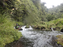
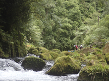
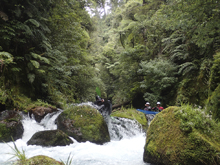
- After about 45 minutes things finally started to improve and the water began to channelize.
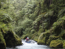
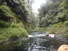
First Falls (IV+). This is called 9 feet in the guidebook. I think it needed a little more water as the left line was a big wall hit and the right line looked scrapable but shallow in the landing zone. We sealed launched from the right wall around it. Things for sure improved downstream and we began having a great time as the rapids and the scenery became first class.
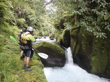
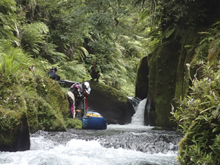
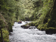
Multi-Step (III+). This rapid would have been easiest on the right, but a tree blocked that route so we worked down the left. It was a few steps of boofs in a tight canyon.
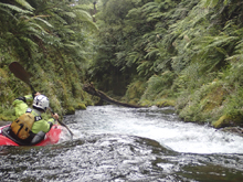
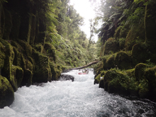
Ledge (III-). A nice small ledge that can be run anywhere.
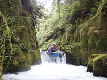
Mellower (II+ to III-). Downstream things got mellower for 20 minutes.
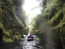
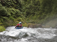
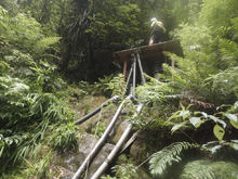
- Big Falls (V). You will see a big horizon line that opens into a very large pool. This is your sign to get out and scout on the left. It is nearly walled out, but luckily the river is shallow and there is a bench just above the river level on the left. Store your boats here (maybe 50 ft upstream of the falls) and then wade down the water to scout the falls. The falls is a tight chute that pushes left where there is a shelf that is waiting to break your ankles. At the low flow Hannes and I did not like our 10% estimation of error and decided to walk. Breaking legs so early in my trip just wasn't an option. Normally you can drive more right which actually also brings into a play a shelf on the right. Portaging is slipper and is best with team work to pass boats through portions but is still safer. We got to this rapid 2 hours after putting on.
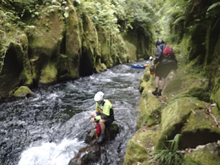
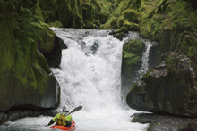
Paddle Out (II). We portaged one rapid due to wood just downstream, and then quickly found ourselves at take-out just a few minutes later.
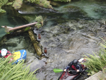
Take-out: Take-out is on private property and you need to call to access the property. Search the rivers.org.nz forum for the Waiari (spelled Wairari) for the latest number. In 2016/2017 it was a man named Sam at 021-210-2252. The address was marked and is 394 Te Matai Rd. To find it head north from Okere Falls on State Highway 33. Follow this for 28.3 km before exiting onto Tauranga East Rd (Te Puke Hwy). Follow this for 3.9 km before turning left just before the town of Te Puke onto Te Matai Rd. Follow this for 3.9 km. Property was marked with an address sign. We went through the gate and along the hedge row to another gate which we also went through. The dirt road then dropped down behind the orchard and forked. We stayed right and went steeply down to the river and parked at the bottom. It was steep enough we did not trust my little rental to get down and up with 2 wheel drive. Also, if it rains the mud would be disastrous here. The walk out would be a painfully steep but short half a km or so if you are questioning your car.
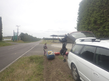
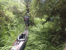
Put-in: go back out to Te Matai Rd and continue south for 6.2 km. There is a large barn structure with an overhang on your left. This parks the orchard to put-in at on the right. We could not locate the correct number as the ones on river.org.nz were out of date. Because of this we parked along the road and walked in. We followed the hedge row straight towards the river. This led to a holding pond. The trail down was behind and to the left of the pond as we faced it. It is a big and obvious trail that quickly gets smaller. The hike took about 15 minutes and was very steep.
HTML Comment Box is loading comments...

