Kaituna River (Lowers)
| Stretch: | Awesome Gorge and Smoky Gorge |
| Difficulty: | Class IV to IV+ |
| Distance: | 13.2 miles |
| Flows: | 200 to 500 gates. Check with Sunspots Kayak Shop (07) 3624222 during business hours for flows, as it is not automated. |
| Gradient: | 78 fpm average until the paddle out |
| Put-in: | Trout Pool |
| Take-out: | Farm off Maungarangi Rd. |
| Shuttle: | 30 km (30 minutes one-way) |
| Season: | Year round! |
| Written: | © 2017 |
| Featured in A Wet State #122 | |
New Zealand 2016/2017 Day 3:
In the guidebook, the Lower section of the Kaituna is broken into two runs Awesome and Gnarly Gorge, followed by Smoky Gorge... I think for the first time ever I will take a route that results in me having LESS write-ups on the site. Most times I feel like a run in a guidebook should be broken up... like in California's where Rock Creek section of the North Feather is one run where in real life it is treated as three separate runs ranging from class III to IV/V. In this case though, Awesome Gorge, Gnarly Gorge, and Smoky Gorge are treated as one run... it is just a matter of whether you portage (like we did) Gnarly Gorge or not.
As you exit Trout Pool Falls, the river opens up into a nice big pool... I would assume this is Trout Pool. This is where you put-in for this run. Though we all just ran through the Okere Falls section as why wouldn't we... it adds a kilometer of fantastic boating to the day. My mood was a bit soured however due to this. As our group approached Trout Pool Falls, I quickly began portaging. I had run laps with the guys the past two days... I knew they would run the falls but I was not feeling it and decided to quickly portage in hopes of not delaying the group. I saw some friends from camp on the shore at the falls and though there was no need to set safety since 1) the friends were there on shore and 2) several of the boaters I was with had waved me off of safety in the past two days, a request I rejected and set safety for anyways those times. I however didn't realize that parts of our group whom I had not met yet were about to run it for the first time. After successfully running it, the group came down and a local boater who was taking out there gave me an earful about not setting safety. I didn't say anything back... part of me still wishes to explain why I did not, and that I didn't even know those others guys were in my group let alone running it for the first time and that there were in fact boaters on shore in street clothes watching us run down. But whatever, it did put me in a less enthusiastic mood moving down towards Awesome Gorge as I pondered it and agreed that I probably should have still set safety regardless of the other points.
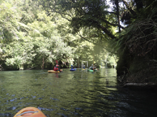
Awesome Gorge starts off with some really nice mellow class III boogie in a shear walled gorge that is only a few boat widths wide. The whitewater is pretty mellow, but the scenery is something else. The one exception to the "whitewater is pretty mellow" statement is near the end of the gorge when you get to the creatively named "Awesome Gorge Falls" which is a big and steep class IV drop that sports a bit of a hole at all flows. At low flow it is a little harder as the rock you boof off of is dryer, but at higher flows the hole on the right is less forgiving. This rapid along with the rapids downstream are tough if not impossible to scout, so don't plan on scouting. Bring a friend who knows the lines or your big boy pants. We went with the first option.
The river then opens up slightly and a creekbed climbs up on the right. This is where you exit to portage Gnarly Gorge. Gnarly Gorge is a class IV/V to V version of Awesome Gorge. It is essentially the same gorge as the "opens up" is just a turn with a creek really, it is just the harder half of it. The river drops over steep sticky holes with large boils and with the ever present threat of wood. In 2015 the community saw the unfortunate consequence of bad luck when a globally known paddler passed away due to getting caught up in some wood. To portage the gorge you climb 50 yards up the creek and then climb up the short but steep left hillside before walking along the ridge out to the road. Then follow the road to the large circle that ends the dirt road. Drop off the right side and follow this crappier road down and at the 90 degree right turn at the bottom, turn left and bushwhack down to the river 150 more yards.
Below this, you enter a wonderful section of whitewater with rapids ranging from III to IV+, and with walls towering above you throughout the length of the miles... which are actually plentiful. This is the longest section of river I did while in NZ, by the end my back was sore from boating... which was a nice change after a few days of short runs to run laps on. The first gorge you come to has 3 bigger rapids, none of which can be scouted. Then there is a lot of boogie. After a long time, you enter the final gorge... the tradition being that veterans tell rookies it is all boogie from there and the rookies boat scout into Smokie Falls. I knew something was up because I knew we hadn't see the last big rapid from the various videos I had seen... but trusted it must be easy enough if they were doing that, and it was straight forward, but still a fun way to experience it! Downstream one more cool rapid awaits before the paddler out begins which does take a fair amount of time... maybe close to 45 minutes or so of paddling flat water.
This section of river is very worth doing. The scenery is fantastic, and the rapids fully worthwhile. The portage took us about an hour, partially because another and myself hiked slow... but not crazy slow, it is a long portage. So get an early start so you aren't doing the hike in the midday heat! And the portage is the one thing I feel that keeps this from getting a lap daily on it. But, it is worth doing more than once for sure if you are around and have the time!
Note: I could not find many distinct indicators on google earth, so most mileages are approximate from my memory and indicated with an "~". I do have timestaps on my gopro so I will add those details as to how much time had passed between points. Also note, wood is plentiful and moves from year to year. Always stay on your toes. Get local beta before dropping in if possible too as wood in the wrong spot could spell disaster.
Previous: New Zealand 2016/2017 Day 2 - Rangitaiki River (Jeff's Joy)
Next: New Zealand 2016/2017 Day 4 - Waiari Stream
Mi 0.25:
- Awesome Gorge (III). After paddling a short flat pool below Trout Pool Falls you will get to the start of the gorge. The walls tighten and class III read and run starts immediately.
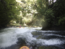
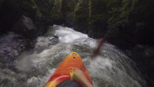
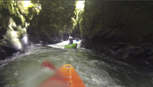
- Awesome Falls (IV). This gorge has one significant standout rapid that comes within 15 minutes of entering the gorge. It is unscoutable and unportageable. Run far left of center and boof the ledge fading back into the main flow. The right has a good size hole at the top. The bottom hole can also stick you if you aren't careful. There is a small pool just above it and it isn't on a blind corner.
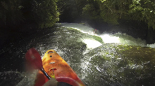
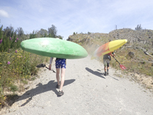
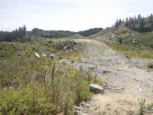
- Gnary Gorge (V). We (and most people) portaged this gorge. The gorge opens slightly and a dry creekbed ascends the right hand bank. We carried up the creekbed for 100 ft before bushwhacking up the left hill side for another 100 ft to the ridge line. We follow that left until it hit the road after 200 yards. From there, follow the road for two thirds of a mile to wide open area where the road ends. Take the dirt "road" down to the right and follow it to another drycreekbed as the road bends right and away from the river. Take the small game trail left and follow it down to the pool at the exit of Gnarly Gorge. For those wanting to paddle Gnarly Gorge, get local beta. It is steep, pushy, and completely walled out. It was also the site of an unfortunate accident a few years ago that took a top tier paddler.
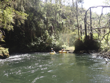
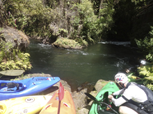
- Smoky Gorge (IV to IV+). After putting back in the walls quickly come back around you and you enter the "Smoky Falls" run as described by the guidebook. Technically I think they count like 3 or 4 gorges in this long section, but honestly I don't remember the walls peeling back super far at any point. Most of the run is just class III read and run with just a few standout exceptions which are class IV to IV+ at low flow, and apparently verge on class V at higher flow due to the walled out nature and the power of the hydraulics.
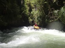
- Number 1 (IV+). This is the biggest of the run in my mind. We started in the far right channel and entered a small chute before eddying out on the left before the main rapid. The main rapid starts with a ramp that we took far right, it looks too tight from above but you want to stay on the shore and go around the midstream rock. Downstream the left side falls into a deep pocket, but the right avoids the pocket and allows you to boof over the shelf around it.
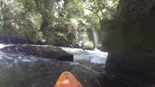
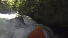
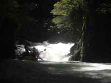
A small amount of boogie...
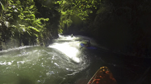
- Number 2 (IV). The second is probably the easiest of the "big ones." We ran down the left and boofed over the exit ledge which was small. Maybe at higher flows it becomes harder. This drop was only 5 minutes downstream of the previous drop.
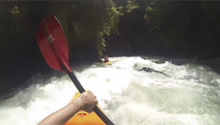
Number 3 (IV). Around the very next corner is this drop. It didn't have a big pool between so trouble in 2 would likely carry through. We ran left with a little right angle. It is a 8 foot tall ramping ledge. At higher flow I imagine the hole is bad.
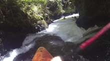
Tree (IV). In 2016/2017 there was a class III rapid just downstream which had an ugly tree across the lip that had just enough room to boof over on the far left.
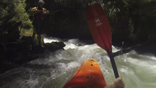
Double Boof (IV- to IV). Not too far downstream was a really fun double drop that we ran down the left on.
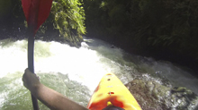
Boogie (III to IV-). There is some really fun boogie in here, it just keeps going and going.
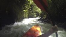
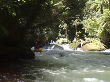
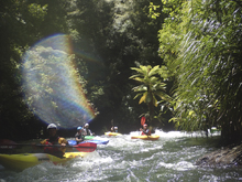
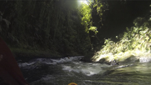
- Slot (IV). One a right corner where the river goes from wide to a constriction, is a rapid that has a solid hole. The line is easy enough, carry left to right and boof the hole, getting stuck here could be tricky to get out of. This rapid is ~40 minutes downstream from Number 3.
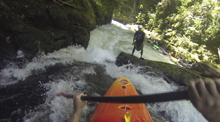
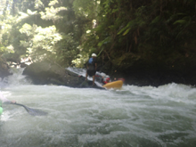
Pre-Smoky Falls (III). Less than 5 minutes downstream the river enters a super cool gorge via a small boof. The gorge is one of the highlights scenery wise, as the walls separated by only 5 or 6 feet rise several hundred feet straight up.
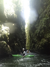
Smoky Falls (IV+). The next rapid you come to is long and blind from above, you can tell that the corridor is class III but you can't see around the corner and there is no way to stop once you are in it, and no way to scout it either. Just run it and stay center or left of center down the ramp that is around the corner. It is a 8 foot tall ramp that goes into a soft hole and empties into a nice pool. It gets easier from here.
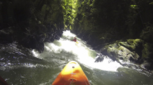
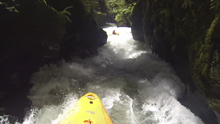
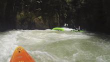
- Exit Rapid (IV to IV+). One last rapid that no one mentions is one of the harder in my mind. We boofed the left wall which then landed in a tumultuous corridor with a few holes. The hazard is apparently the left wall directly below the boof is a bit undercut. This rapid was 25 minutes downstream of Smoky Falls.
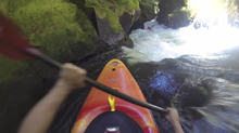
Paddle Out (I). Downstream things get mellow quickly as the walls start to peel away. The paddle out takes another 4 minutes.
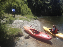
Take-out: From Rotorua, take Highway 33 past Okere Falls for a total of 31.5 km. Before you get to the town of Paengaroa turn left on Maungarangi Rd. There is a bridge in a few hundred yards that the book says to take out at. We took out at a farm (not sure how normal this is). But to find the farm go 5.7 km on Maungarangi Rd from the Highway and turn left on a small dirt road that drops down to a farm. There is a path up from the river on the other side of the field.
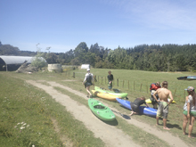
Put-in: Go back to Highway 33 and head south for 23.5 km. Just before the town of Okere Falls, turn left onto Okere Falls Rd and follow it (changes names to Trout Pool Rd) to the end which is less than a km.
HTML Comment Box is loading comments...
