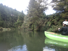
Rangitaiki River (Jeff's Joy)
| Stretch: | Above Murupara |
| Difficulty: | Class III to IV |
| Distance: | 5.9 miles |
| Flows: | Holds well after rain, for a week plus. 5 on the put-in gauge was a medium low and probably about 25 cumecs. 4 is probably low. 6 is fluffy |
| Gradient: | 77 fpm to the flat in the middle, and then 67 fpmafter the flat. |
| Put-in: | Access Road |
| Take-out: | Rafting access road |
| Shuttle: | 10.5 km (all on dirt road, decent shape). 15-20 minutes one way. |
| Season: | Year round, holds well after rain. |
| Written: | © 2017 |
| Featured in A Wet State #122 | |
New Zealand 2016/2017 Day 2:
Waking up after 8 glorious and uninterrupted hours of sleep, I awoke fired up to see what the day would bring. I was up earlier than most, but a few of us went up to the café for some coffee and wifi. While sitting around, we shared our pics and videos from the previous day on Huka Falls... and I began to realize that people may not actually be motivated to do much else. I began to solicit people for boating and got a heap of non-eye-contact answers. People had work, or were worn out after boating the previous few days, or wanted to edit videos from their previous few days. This is when it began to dawn on me that when people are on the travel for several months plan, they are less motivated for the daily routine of driving to a new river and are more content with laps of the local run. It also doesn't help that a lot of them are on shoestring budgets... so the idea of driving to a river they have already done is less appealing.
I was told that the shuttle was fairly long for the river that was closest and had flow, meaning a true solo mission would be tough. I offered one who was on the fence gas money to come with in his car. He feigned. I resorted to offering one-person money to drive my shuttle and he was eager, until his plans changed and errands had to be run. And luckily that is when the previous person, sensing my desperation, came around and decided to boat that day. So off we went... at the crack of 1 pm! Thanks Caleb!
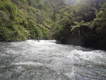
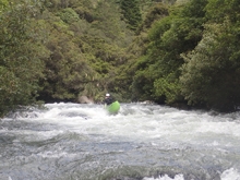
This run is a great little class III run with one stake-up of class IV... even maybe IV+ at higher flows, early on. The harder rapid gets a brief warm up of mellower class IV but that last only maybe 100 yards before the river bends left and enters "Jeff's Joy" which is the sections namesake rapid. This rapid sports a horizon line in the bottom crux move, and looks intimidating, but actually boats rather straight forward. However, the boogie leading up to it is tricky enough I could see people running into trouble before the bottom crux. There is a trail on the right and a few eddies at the top and one at the lip of the crux that you can scout from. Below Jeff's Joy, the river mellows out to continuous class III which does not end until shortly above take-out at which time the river simply peters off to class II.
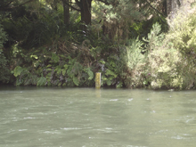
The run is a popular rafting run and holds water well after rains. It hadn't rained in over a week when I was there and it still had plenty of water (5 on the stick gauge at put-in). I can imagine at higher flows it would take a step up and become a rollercoaster ride of hole dodging. Regardless of flow, the scenery was nice and the rapids were entertaining. It was certainly a worthwhile day if you are in Okere Falls and looking for something other than the Kaituna to run.
That night, I headed back to the carpark at the Kaituna. This time, instead fo waiting until the morning to find out that no one planned on boating anything, I began to solicit boating partners early. Some folks were talking about doing an overnighter on the west coast of the North Island... but were thinking that plan may be a day off. One person showed an interest in doing the Lower Gorges of the Kaituna... so I latched on to that plan and a group was soon rallied.
Previous: New Zealand 2016/2017 Day 1 Evening - Huka Falls
Next: New Zealand 2016/2017 Day 3 - Kaituna (Lower)
Mi 0.3:
- Warm-up (IV- to IV). After a short flat water section to warm-up on you get right to the rapids. The first rapid is essentially one long rapid with just a small break (more of a big eddy than a pool) between it and Jeff's Joy. This first rapid I remember running left to right. It is a bit congested but just follow the water.
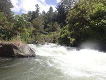
Fantail (IV- to IV). This is essentially the lead-in to Jeff's Joy. You know you are here because there are some cement structures on the left. I ran down the middle and made sure to get my nose over the curler at the bottom coming from the right. Immediately downstream I eddied out right to inspect Jeff's Joy. This eddy is in the middle of the rapid and on the wrong side of the river, so if in doubt, play straight through.
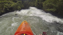
- Jeff's Joy (IV). Run center moving back to the left. This will lead you to a hump and a slide which then drops down into a fluffy hole. You don't want to be too far right at the top or you will drop over a shelf, too far left and you get more of the hole. From the eddy I could easily scout on the right using a trail to the bottom. You can also walk laps easily to this lap. Not sure about getting back up above Fantail though.
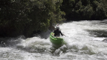
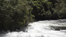
Boogie (III). Boogie continues with a few nice boofs over holes. Then it stops for a bit.
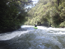
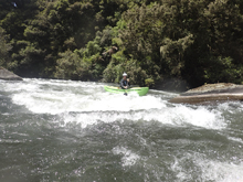
- Boogie (II to III). The rest of the run is filled with non-descript rapids that are still plenty entertaining. Some is light class III, but there is not flat water, it is all class II otherwise.
Take-out: From Rotorua, take State Highway 5 South for 20 kms before turning left onto State Highway 38. Continue on this for 35 km. Just before you enter the town of Murupara (if you cross the river you went to far) turn left on a small unnamed road that looks like a parking lot (just before you get to Kopurki Rd). Take this left and then up to the connector road to Railway Rd. In 100 yards, turn left on Railway Road. In 0.75 km stay left at the Y. In 1.75 km or so the road turns to dirt. 3.85 km from the Y, turn left onto the dirt road that has marked for river access. The marking is not super obvious. Follow this down to the water which is only a few hundred meters.
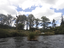
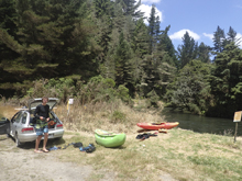
Put-in: Go back out to the dirt road and continue up river. In 7.25 km turn left (sorta a Y) and follow this 3.1 km down to the river. This is a smaller dirt road, but in descent condition.
HTML Comment Box is loading comments...

