Totara River
| Stretch: | Standard |
| Difficulty: | Class III to IV+ |
| Distance: | 4.7 miles |
| Flows: | 500 cfs to ?,000 (visual only, requires very recent rain) |
| Gradient: | 72 fpm average for 2.8 miles then 47 fpm |
| Put-in: | Washout on Totara Valley Rd |
| Take-out: | Woolhouse Rd |
| Shuttle: | 9.6 km (rough dirt road). 20 minutes one-way. |
| Season: | Year round, after very recent and significant rain. |
| Written: | © 2017 |
| Featured in A Wet State #123 | |
New Zealand 2016/2017 Day 9:
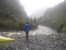
As we awoke in the morning, I felt fairly confident a lot of stuff was going to be too high. The rain had been steady all night, even though it was not super hard. The puddles had formed around camp indicating to me that the ground was more than saturated. Our friends did not however think the rivers were going to respond as much and as this was their third trip to the island I trusted their opinion. The plan was made to drive to the Lower Kakapotahi which is a classic class III to IV run about 45 minutes south from camp. While driving there, we crossed the Totara... which only goes off of significant rain. And to our surprise, looked plenty healthy with a brown tannin color to the frothy water. The guidebook says look for no gravel bars to be seen upstream of the bridge, and there were none... just water and waves. So we headed up the river. The joke with this one is that you can set shuttle and have it stop raining on you and by the time you get to the top it can be too low. For us, the rain just kept falling, and got harder if anything.
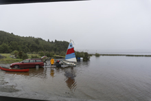
Will H had decided that he didn't want to boat and volunteered to drive shuttle for us. Arriving at the top we put-on at a crossing that looked a little too rough for our little Subaru. I was told it was only a few hundred meters below the normal put-in. We scrambled down to the water and pushed off. And a moment later found ourselves chasing gear and a person as two in our group failed to ferry above a hole. Diane boofed through, but the other wasn't as lucky and had a bit of a rough swim in store for them. We got them to shore after 2 more flooded rapids (oh yea, did I mentioned this thing is non-stop with minimal eddies and some large holes when it is filled with water?) but their boat took another few rapids and the paddle was lost. The paddler themselves were pretty beat up and opted to hike up to the road instead of continuing on. We kept our eyes peeled for the paddle as we continued downstream. Downstream the river opens up for a kilometer before closing back tighter on you a second time, which leads to the busiest and most continuous section of the river. The first lap it felt class IV+ because it was non-stop and the fear of huge holes was present. However, the second lap knowing what was in store it felt like big water class IV, with knowledge of where to be and that there were only a few places to actually need to avoid. It was also on the second lap that we found the paddle that the swimmer had lost... so that was awesome!
The run was super fun and worthwhile. Like I said though, with proper flow it is fast and pushy and scouting is difficult... so plan on bombing into the rapids and bring your roll, because a swim will likely result in a bad experience and some lost gear. This is a small drainage, so put this on the list for while it is raining and the rest of the west coast stuff is too high.
Previous: New Zealand 2016/2017 Day 8 - Toaroha (Lower)
Next: New Zealand 2016/2017 Day 10 - Kakapotahi River (Lower)
Mi 0.0:
- Put-in (IV). From where we put-in, this was directly off of the bat. You want to be on the far left. There is a wall of holes stretching the center of the river that swam one in our group. You can go around them on the left.
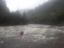
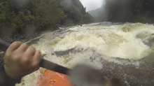
Part 2 (IV). Just downstream you want to be far right to follow the main flow of water. The water is a bit chaotic and leads to a large hole in the middle of the channel. I went to the left and got a piece of it, others went right.
Boogie (III). Downstream it continues for another few hundred yards but is mellower. Then the canyon peels back and you are in a mellower section for a bit.
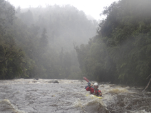
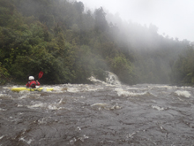
- Mellow (II to III). This section has more recover time and in general is significantly easier than the first stretch. In continues until the walls start to tighten on you.
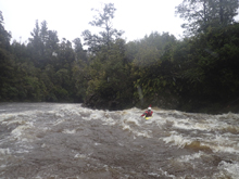
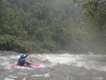
- Gorge Entrance (IV- to IV). On a right turn the river tightens around you.You want to stay off the left wall due to a hole that lurks against it at the end of the turn. The entrance to it is super squirrely.
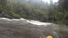
Gorge Middle (IV- to IV). The middle is pretty straightforward, big wave trains that were intimidating on the first lap, but with the knowledge of no sneaking holes the second lap was stress free. This area is non stop so really don't swim as that would suck pretty hard if the flow is up. It begins directly below the entrance, and around one corner you get a cool creek cascading in on the left. Make sure you take a look back upstream as you head down.
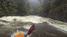
Gorge Exit (IV). The walls open slightly, but the exit of the gorge downstream is the crux of it. The first part was a river wide hole that we boofed left of center before negotiating back center. The second part of the rapid you want to be far right. It is steeper than the rest of the gorge and blind from above. The center drops into rocks and holes. The right ramps out into a fluffy hole. The exit to the valley below had a crashing wave hole that could be skirted right. It crashed on me on the first lap and worked me for a second. The second lap I gave it a wider berth.
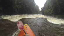
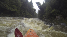
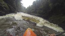
- Winds Down (III). A few more mellower rapids await leading to a nice side creek on the right where the river quickly opens up. Mellower paddling down to take-out.
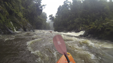
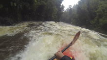
Take-out: From Hokatika, take State Highway 6 South for 23.8 km. After crossing the Totara, stop and take a look to ensure you have enough water. You don't want to see gravel bars. Continue another hundred yards and turn left on Totara Valley Rd. If you get to the town of Ross you went too far. (FYI, there is a great café with awesome pies in Ross). Go up Totara Valley Rd for 2.0 km and turn left at the farm onto Woolhouse Rd. Park near the river.
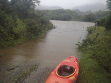 Put-in: Go back to Totara Valley Rd and turn left to continue up the valley. This is a dirt road and my Subaru had just enough clearance for it. It is long and winding. There are a couple of creek crossings that were between 6-8 inches deep. After 15 minutes or so and 9.1 km we got to a landslide and decided to put-in there. Others continue another km or so up the river, but we couldn't cross the landslide. We apparently just missed out on some boogie but none of the big rapids.
HTML Comment Box is loading comments...
