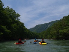
Tonegawa (Momijikyo, Minakamikyo, and Suwakyo)
| Stretch: | Near Minakami |
| Difficulty: | Class III to IV (or class IV+ really high) |
| Distance: | 5.4 miles |
| Flows: | We had maybe 900 cfs. It was medium. Maybe medium low. |
| Gradient: | 58 fpm |
| Put-in: | Just downstream from the small lake +36° 48' 15.70", +139° 0' 25.42" |
| Take-out: | Rafters take out in Konita +36° 45' 8.65", +138° 58' 31.10" |
| Shuttle: | 6 miles (10 minutes one way) |
| Season: | Spring off of Rain/Snowmelt |
| Written: | © 2012 |
| Featured in Video Sixty-Four | |

Japan 2012: Day 2 Morning:
Waking up at first light, the team decided to do the popular Tonegawa which has a dense population of rafters and playboaters. The Tonegawa runs through Minakami, literally... the river is lined with large hotel resorts from a past era when the skiing in the area was more popular. Today, most of the hotels are abandoned as despite the regions resurgence thanks to rafting, it is not enough to support the resort infrastructure. It does however create for a unique experience, kayaking a walled out gorge that is lined with large hotels along the rim, with views of large snow covered mountains in the distance.
The river starts off mellow before going over a runnable dam and entering a class III-IV gorge. We had a medium flow in 2012. In 2011, Cody, Darin and team had a high flow and reported it to be borderline scary big water and class IV+. After the gorge, the river opens up and you enter many boulder gardens. The roads are never far from the river at this point and soon the hotels tighten around it as well.
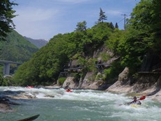
Technically, the Japanese refer to the section of river as three distinct sections (the first gorge is Momijikyo, the section with the hotels is Minakamikyo, and the section with the bungee jumping bridge is called Suwakyo). However, for kayakers coming to visit, there is no reason to do a shorter section. As it were, we got an afternoon run on a creek that was an hour drive away after doing a run down the Tonegawa.
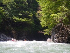
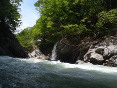
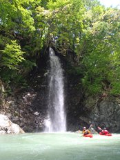
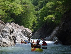
This river was quite nice. The relative ease of the rapids allowed for another warm-up and team bonding run before getting into the harder missions. But mostly, the scenery was just very nice. The first gorge gave us another taste of what the trip would have in store for us. Granite walls with waterfalls falling into the river seemingly every hundred meters. Just spectacular.
Also, check out Darin McQuoid's photos on his website, www.darinmcquoid.com as well as Darin McQuoid's 2011 High Water description.
Last: Day 1 (Agatsumagawa)
Next: Day 2 Afternoon (Yunokoyagawa)
I am not really going to do a rapid by rapid, this was at the beginning of the trip, and I simply don't recall.
Mi 0: Mi 1.1:
- Dam (IV). It looks like a big horizon line, but goes just fine on the far right (don't run the left channel). There is also a culvert on the right in case you want to get out to look at it.
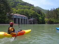
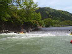
Boulder Gardens (III to IV). Directly below the dam, you get to a boulder garden or two, I vaguely remember running down the far left. This brings you straight to the top of the gorge.
The Gorge (III to IV). The rapids in the gorge were all read and run. Even at our medium to low flow, there were still a few hydraulics, cushions, eddies, and seams that could trip you up a little. In particular, there was one rapid with a good size hole that stuck out. We all just ran straight through it though... the exit of the gorge, is at a bridge, when the river bends left and opens up and you see your first hotel.
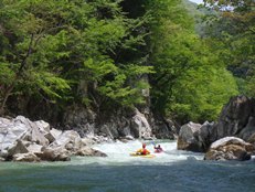
- Out of the Gorge (III to IV). The rapids become more open. The very first one had a wood/metal hazard at the bottom on the left in 2012, make sure to avoid it on the right. Shortly below, the river tightens up in bedrock for another one rapid gorge... it has a good size double hole in the middle.
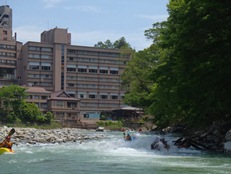
- The Hotels (III to IV). A few cool rapids are in a tight gorge with vertical walls... with hotels lining the top of the walls. Really a strange site, but also really beautiful at the same time. Below, the river opens up into a nice park and river access.
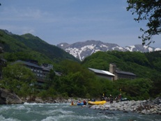
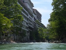
- Last Good Rapids (III to IV). On the other side of the park, the river enters a long boulder garden with some fun waves before entering a few final bedrock rapids. The last few rapids were long and probably among the most difficult simply due to the length. The character also changed to wide slides rather than constricted turbulence. Just below, the river opens up again and you will see the rafting river access.
Directions: Use the GPS locations to get yourself to put-in and take-out... I wasn't driving most days and do not know enough of the directions to be useful.
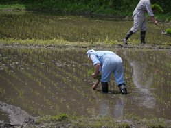
Take-out: Park at the far end of the dirt lot, well out of the way for the rafters so they can turn their buses around. We were asked to leave as we were loading due to being too in the way. There were also some folks planting rice directly next to take out, this was the first time we got to see this. It is funny in hindsight how excited we were... since we would see this hundreds of times in the following two weeks.
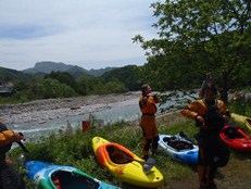
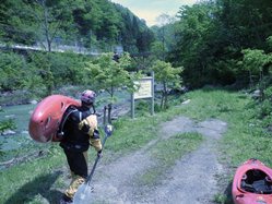
Put-in: If the water is raging high, you may choose to put in lower down, with the numerous bridges, I don't think those access points would be hard to figure out just by searching. We drove up the river past a large fork going up to the left. Before long, we were able to cross the river and a road led steeply and quickly down to the river, steps marked the rafter's put-in location. Apparently, you can also go up higher and there is a larger dam to run up there. But I don't know those details. I think it may have only been a mile further up the road though.
HTML Comment Box is loading comments...

