
Swift River (Lower)
| Stretch: | Lower Falls to Darby Fields |
| Difficulty: | Class III+ to IV |
| Distance: | 5.4 miles |
| Flows: | 0.5' to 4.0' (1.75' = 3,660 cfs = Medium). Visit the American Whitewater flow page |
| Gradient: | 83 fpm average (The best mile is 100 fpm) |
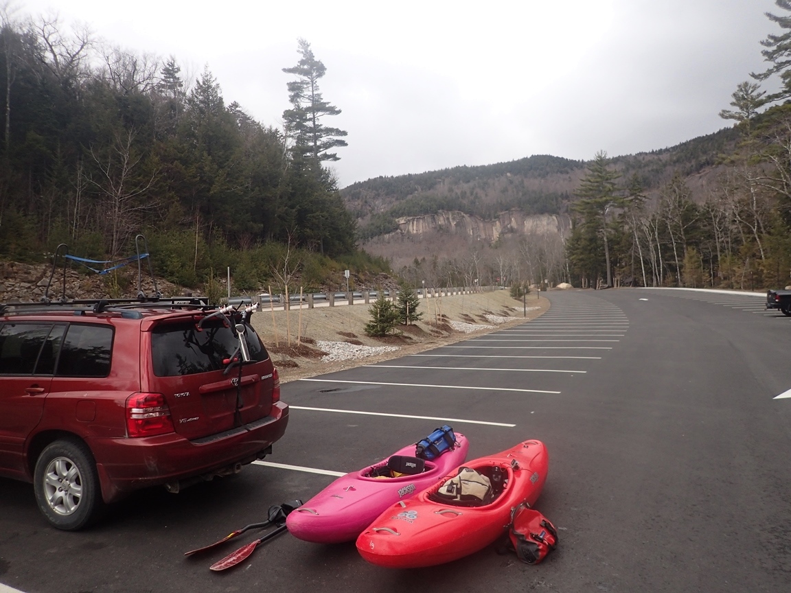
| Put-in: | Parking area at Lower Falls |
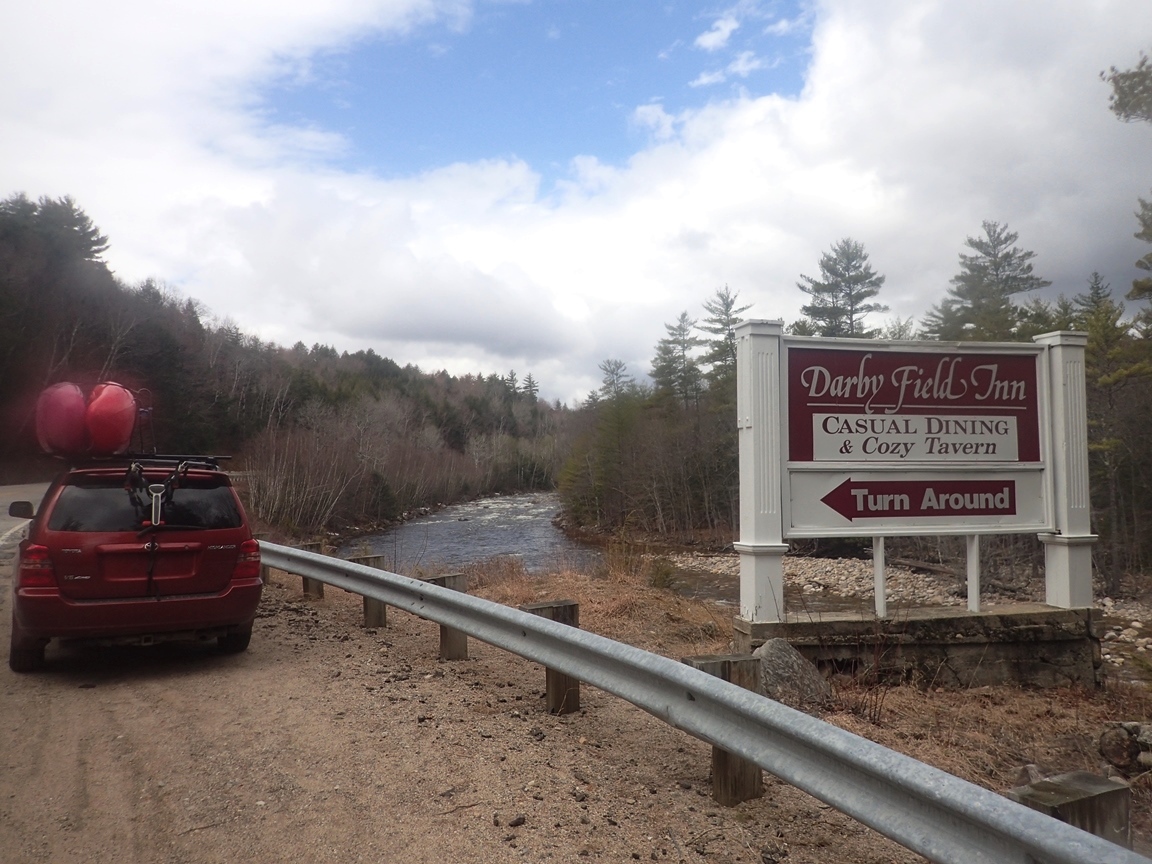
| Take-out: | Turnout for Darby Fields |
| Shuttle: | 5.4 miles (10 minutes one way) |
| Season: | Spring from rain and snow melt. Occasionally off of thunderstorms |
| Written: | © 2015 |
| Featured in A Wet State #99 and in A Wet State's contribution to World Kayak's Video Guide | |
North East Roadtrip 2015 - Day 6 Morning
So as we laid down to sleep in Maine with every intention of doing Small Falls in the morning, I check the Facebook post I had put on the Main Flows group board one last time... and got the bad news that that afternoon a log had swept across the lip of "Biggie" Smalls, blocking it entirely. With the prospect of not getting to run the main sequence of drops we opted to abort the plan to boat in the 6th state of the trip in as many days and choose instead to head back to New Hampshire for the Swift in the morning and the Cold Brook in the afternoon.
Arriving at take-out we quickly set our bike in the woods and just as we were about to pull away a group of boaters showed up who were also going to run the river. We discussed setting shuttle with them before finding out they were also planning on doing the section above the Lower. With our plan for boating in the afternoon we quickly backed out of our own request of them. Then a second boater showed up and 30 minutes later after some confusion in the shuttle setting process, we were at Lower Falls scouting the lip and he was waiting halfway down river...and it was snowing.
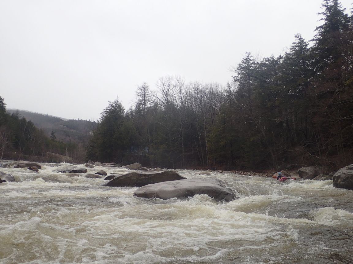
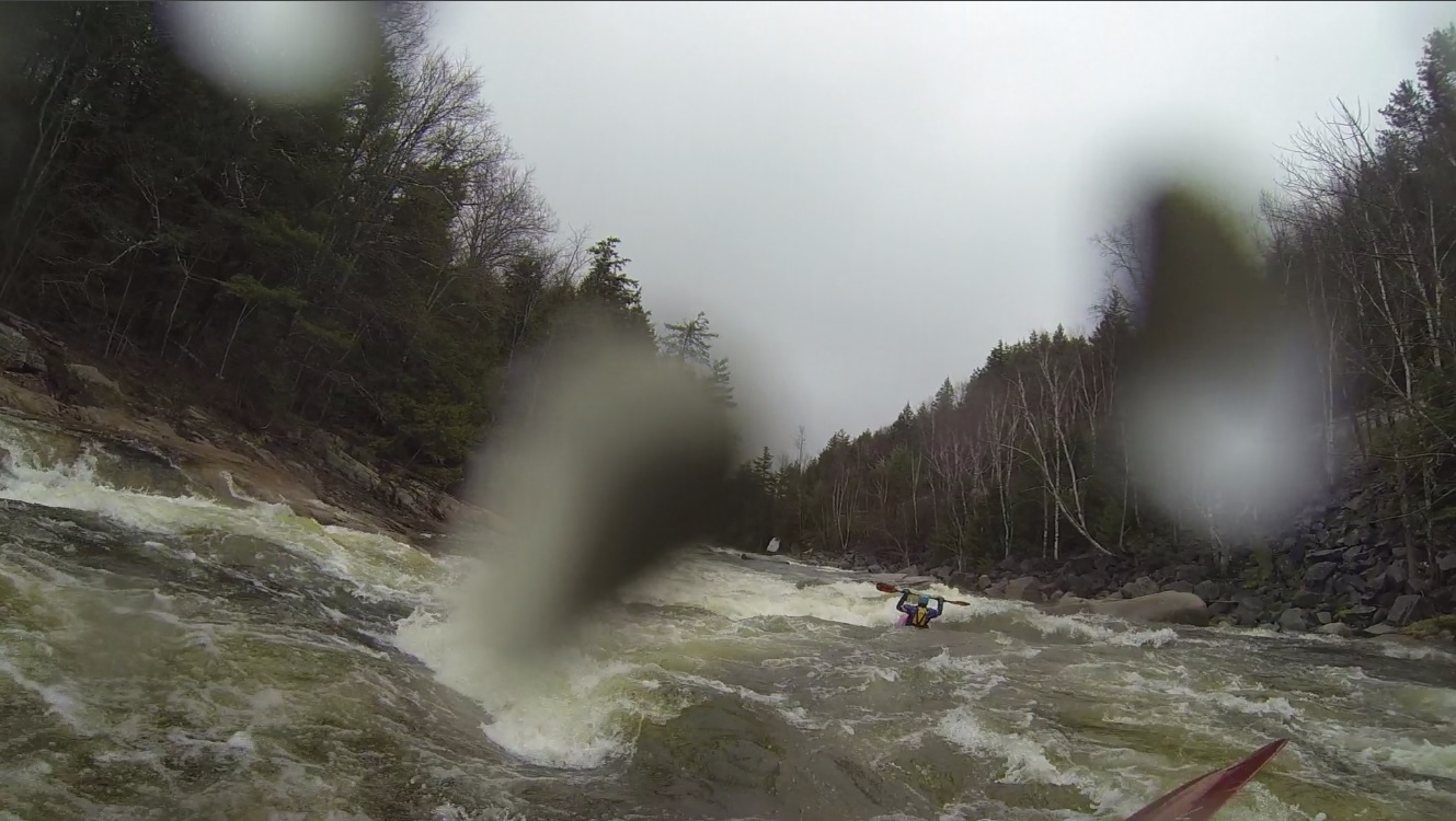
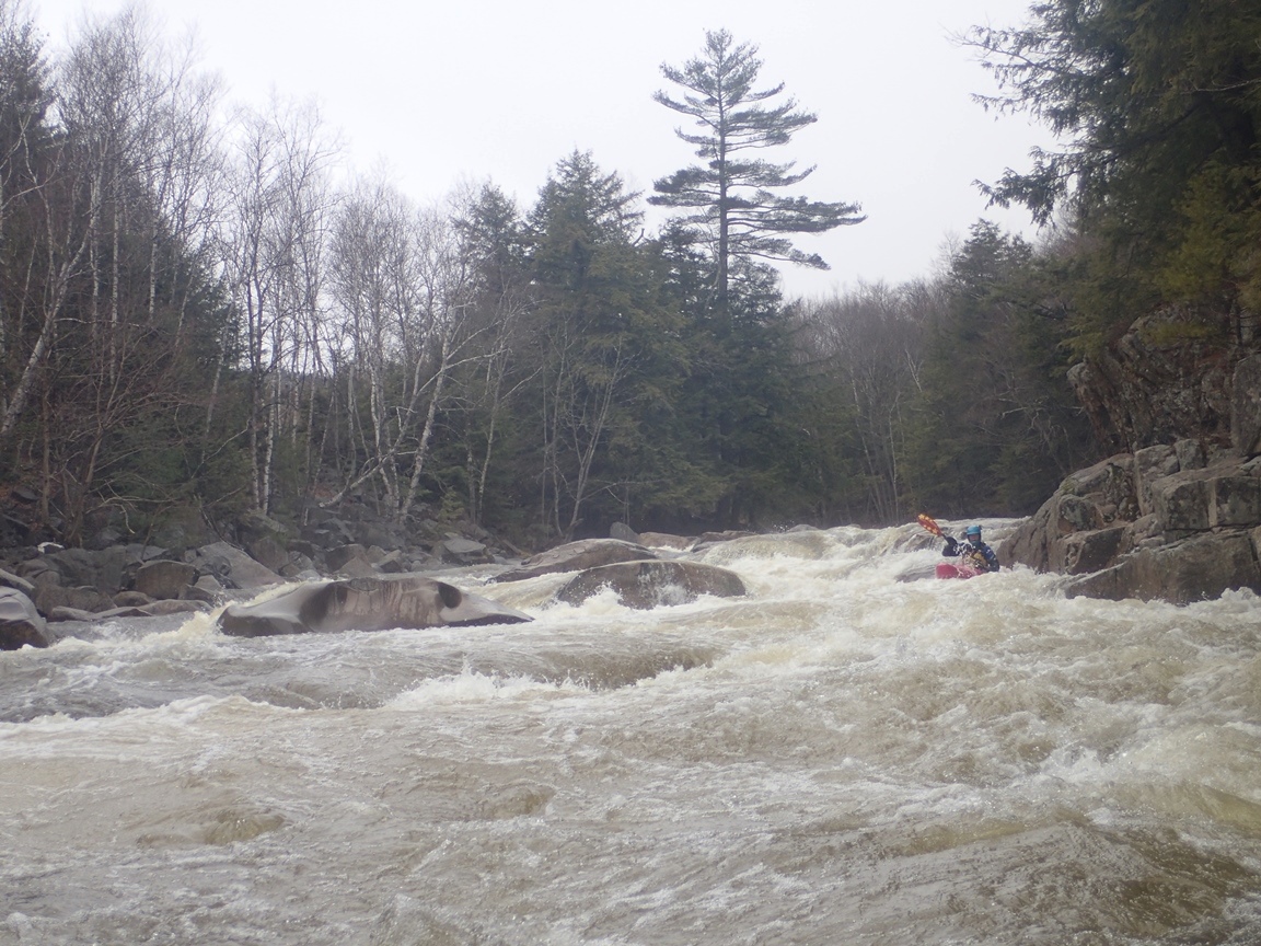
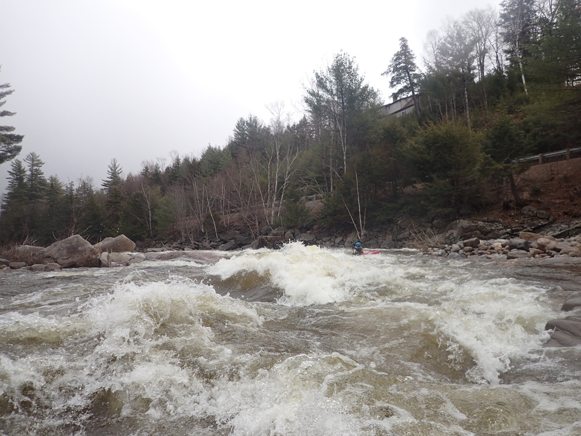
After quickly scouting and running the falls, we headed downstream, trying to make good time as after the delays in setting shuttle we really didn't want to still have to ride our bike if the guy decided to stop waiting for us. We approached the first set of class IV drops and boat scouted through them. Arriving at the point where we had left our new friend, he was gone... continuing downriver we quickly found him eddy hoping down the river, just in time to show us a nice line through the biggest rapid (other than the Lower Falls) of the run. Below the river turns back into boogie with only one or two exceptions.
As we got a ride back to the top to fetch our car we were told that the previous day the Cold Brook was minimum, and that today it would probably be too low. Not sure of what to do, and with my having promised Diane a less busy day of driving... I thought, "hey, why not drive 3.5 hours back (and past) Culley's house for a park and huck on Otter Creek?" Thankfully, about 10 minutes into the drive we got word Culley and a group of friends were planning to run the North Branch of the Winooski. A run that was less than 2.5 hours away and generally on the way back to Culley's. So the afternoon plan was born!
Last: North East Roadtrip: Day 5 Afternoon (South Baker)
Next: North East Roadtrip: Day 6 Afternoon (North Branch Winooski)
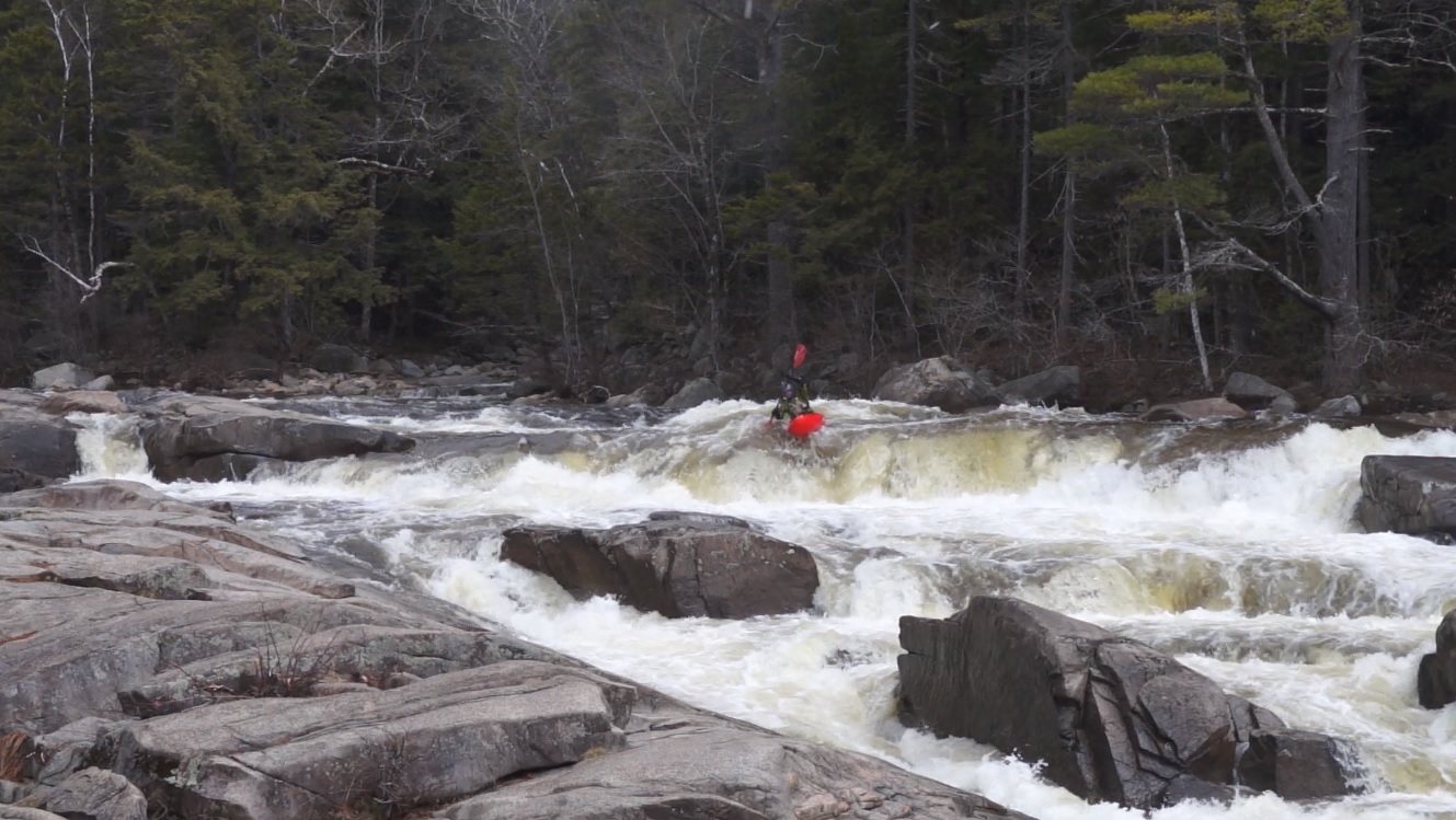
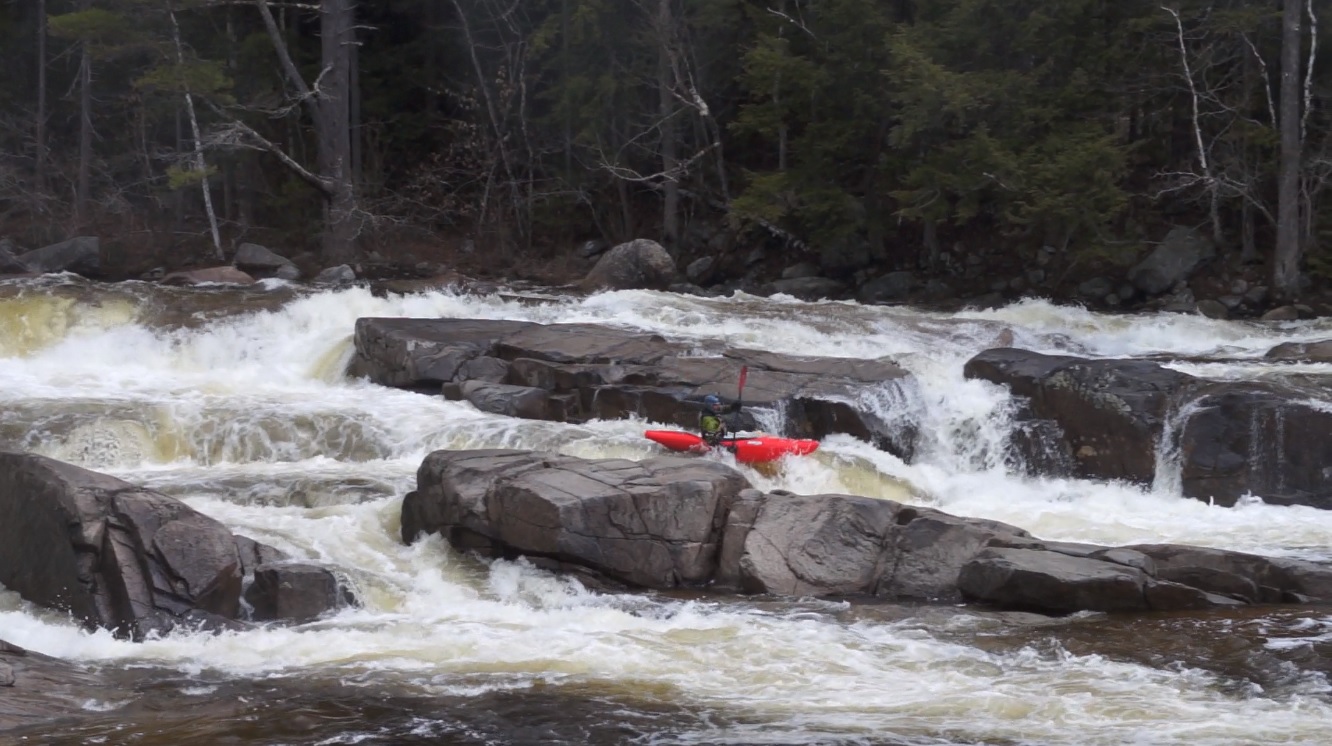
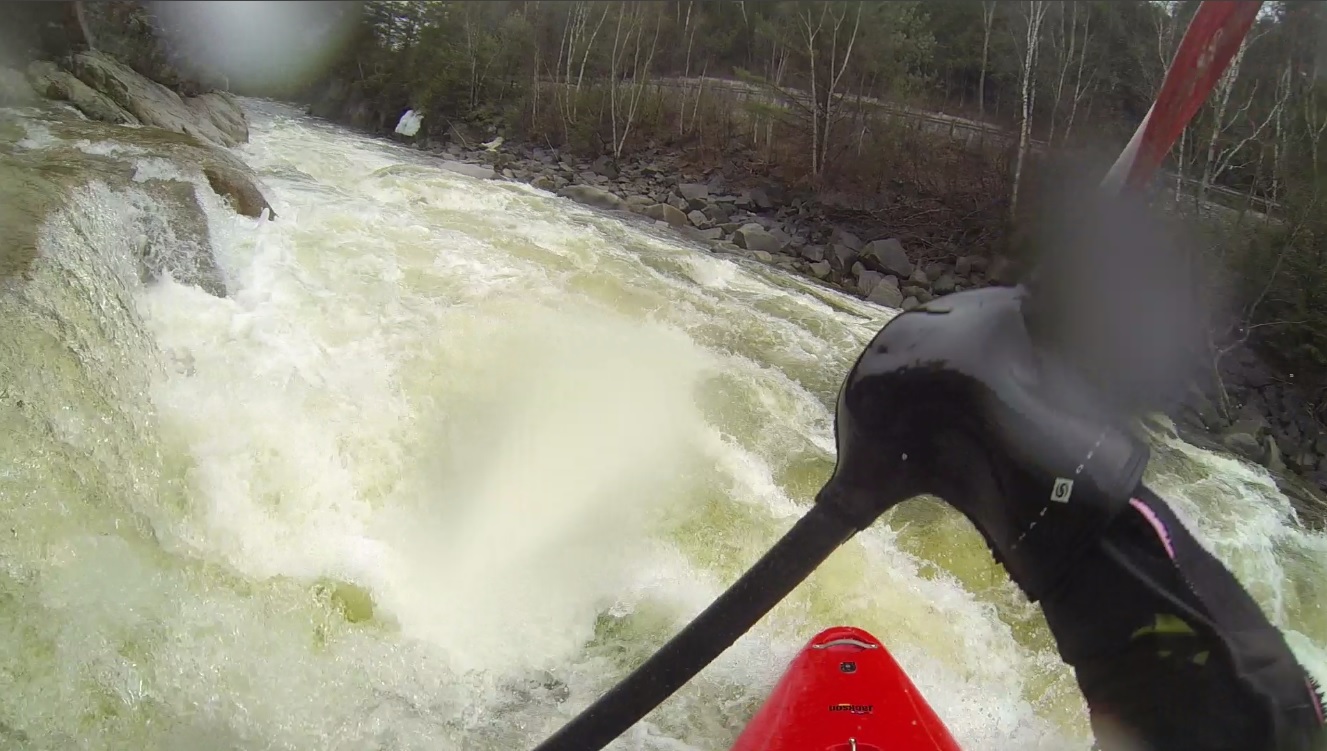
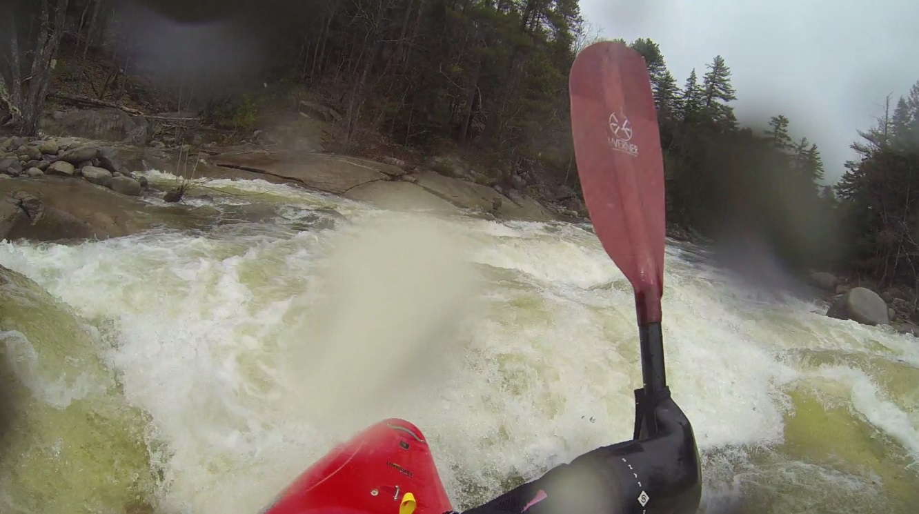
- Lower Falls (IV+ to V). Several lines exist. We ran a middle line boofing the top ledge in the middle and then exiting far left of the middle channel. There was also a fun looking slide line in the far left channel that you wanted to be right of center on.
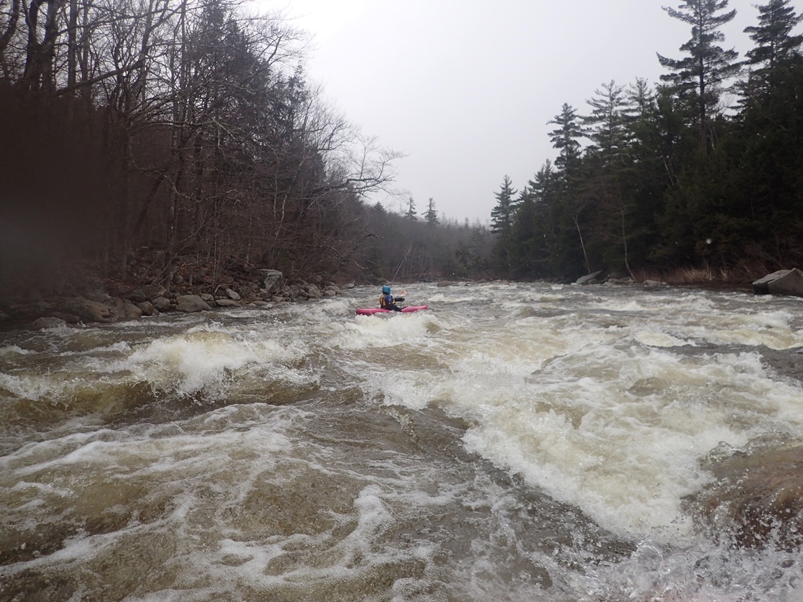
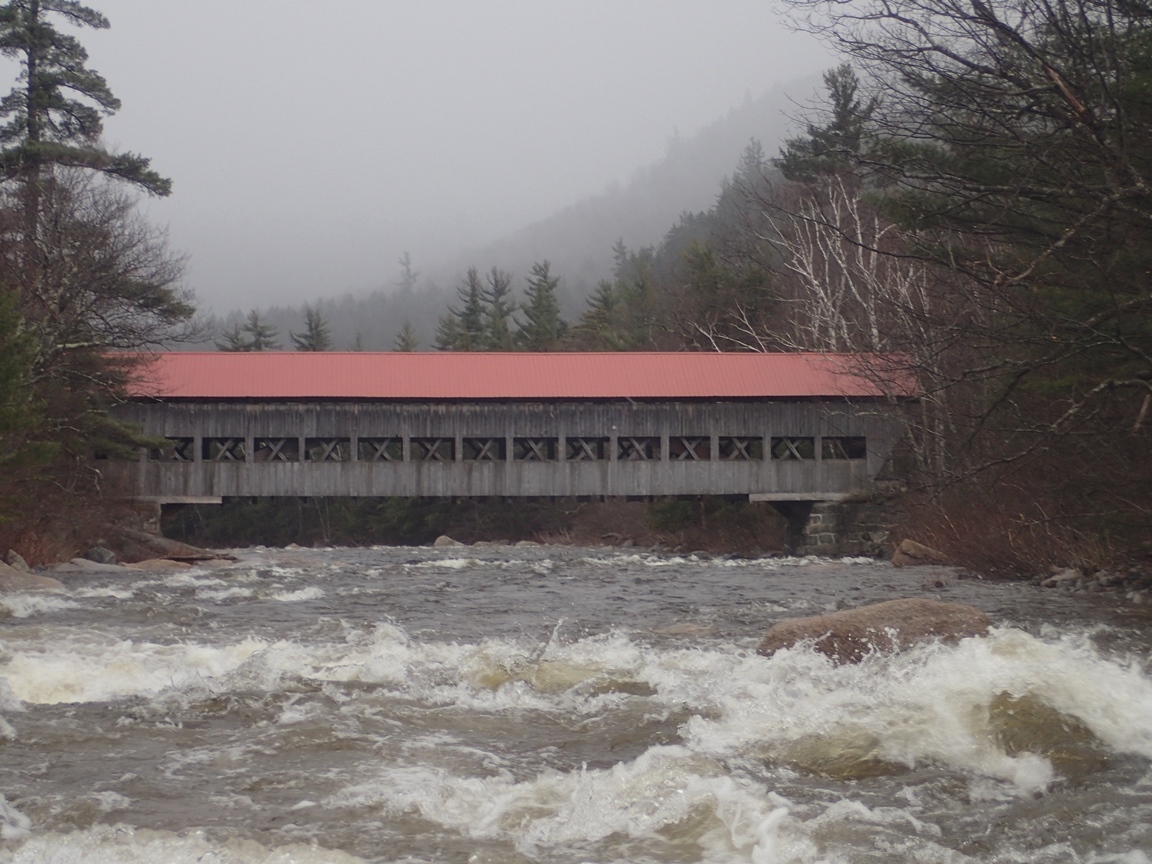
- Boogie (III). There is some boogie at you approach the Albany covered bridge. It was read and run but bigger than the rest of the boogie.
- Cabin Gorge #1 (III). We just followed the main water down the middle of the bend. There were some small holes to dodge.
Cabin Gorge #2 (III+). Immediately below we ferried back out to the middle and ran center moving left just next to the midstream boulders.
Cabin Gorge #3 (IV). The exit had some tricky hydraulics. We ran a line down the left that involved getting your nose over the top seam and letting it move you back to the left before exiting through two more funky streams. I bet at high water this one gets tricky.
- Staircase (IV to IV+). This one has several large holes in it. Like... don't fall in size holes. I was at the lip about to drop in driving hard right to aim for a boof over the ledge that seemed doable at the bottom on the right. But then we got passed by a local who dropped in driving hard left through one good size hole, continuing to move left and avoid the large hole in the middle at the bottom. His line went well so we both followed suite. For the record, the line on the right would have been fluffy but it would have worked!
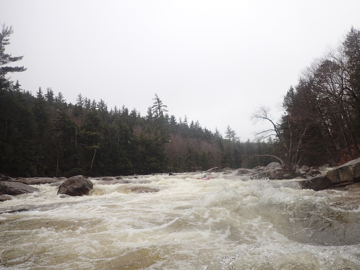
- Bigger Boogie (III+ to IV). The river sweeps over a shoal next to the road and forms a good wave train that then drives you right along some large boulders causing you to have to work off of them.
For more details on the run, see the AW write-up...
Take-out: From Conway, take NH-113 West out of town for less than a mile before turning right on NH-112. Follow this for 1.7 miles to a turn-out at a sign for "Darby Fields" where the river first gets close to the road. This is take-ou.
Put-in: Continue up NH-112 for 5.4 miles to the large parking and picnic area at Lower Falls.
HTML Comment Box is loading comments...