
South Fork of the Baker River
| Stretch: | Bickford Woods Rd to Rowentown Rd |
| Difficulty: | Class IV+ |
| Distance: | 3.0 miles |
| Flows: | ~2.2 to ~4.5. Visit the American Whitewater flow page |
| Gradient: | 132 fpm on Rocky Brook then144 fpm on South Fork Baker |
| Put-in: | Bridge on Bickford Woods Rd |
| Take-out: | Bridge on Rowentown Rd |
| Shuttle: | 2.1 miles (5 minutes one way) |
| Season: | Spring from rain and snow melt. Occasionally off of thunderstorms. |
| Written: | © 2015 |
| Featured in A Wet State #99 | |
North East Roadtrip 2015 - Day 5 Afternoon
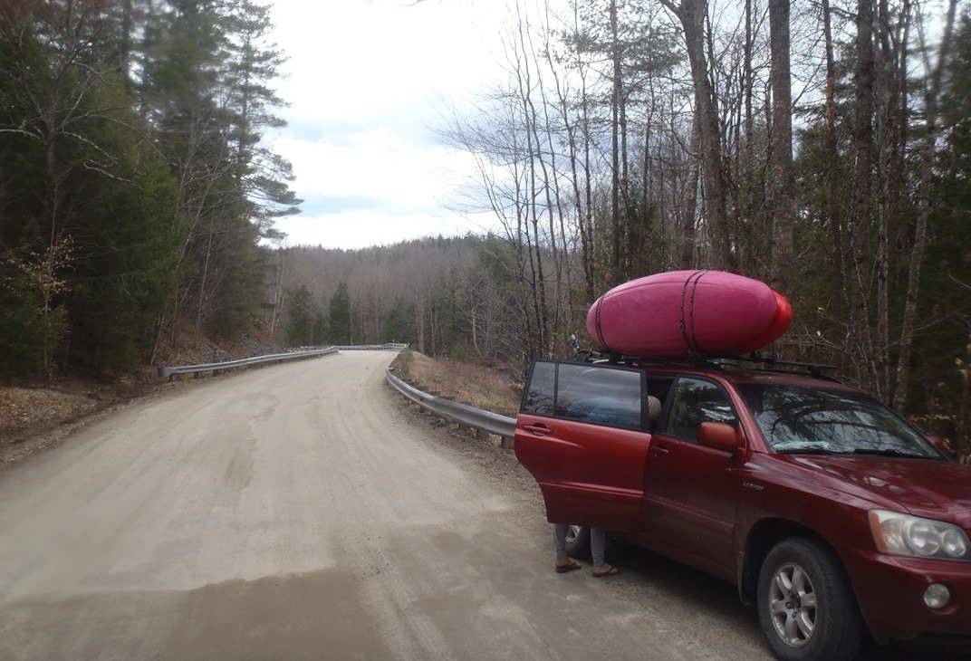
A quick 15 minute drive south from Pond Brook found us lost looking for S. Wentworth Rd. Apparently since the guidebook "Let it Rain" was published, the city of Wentworth and Dorchester got into a disagreement and Dorchester won... and the road is now North Dorchester. Luckily we figured it out fairly quickly and found ourselves setting our bike shuttle and heading to put-in. As Diane had only done one shuttle prior to this day, I called dibs on the "shorter" of the two runs... as we drove to put-in regret filled my heart as we climbed some very steep hills in that "shorter" distance. Dang...
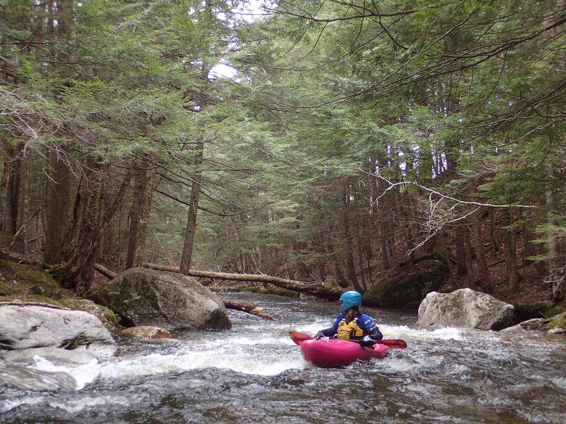
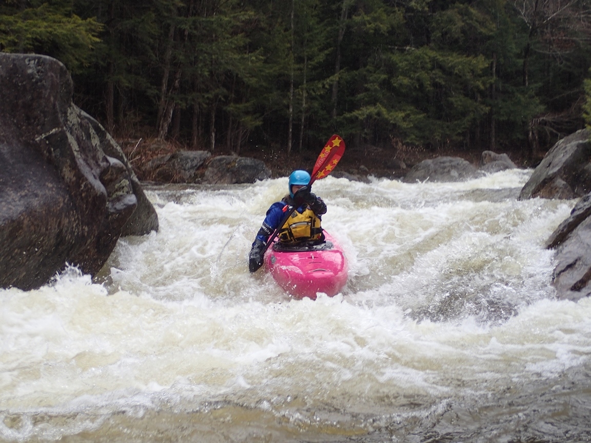
The run was mostly nice. Putting in on Rocky Brook we were experienced some low water, manky, boat bashing with two nice rapids. The first of which could of used twice the water to make it cleaner as Diane reached in and found a piton. Once past the confluence we were on a full sized river and quickly came to Cannibal Falls. The pictures of the falls that I have seen are all much lower water and quickly our hopes of running it faded as we saw the extremely pushy lead in doing everything in its might to move you to the a massive piton at the right side of the base of the falls. Maybe it goes well, but having never seen video of someone running it we opted to portage. Downstream the rivers turns into boulder gardens that climax just before and after the bridge on N. Dorchester Rd. This then leads you to the big slide which is relatively easy, but very picturesque. Downstream it is all boogie to take-out.
We had 3.1' on the Baker River gauge, which is about medium. Though I think only the boulder gardens felt like medium. Rocky Brook felt low, Cannibal seemed high, and the slide felt a little scrappy. So I am sure this run is hard to find a happy medium of everything being good. I also think after seeing a video of the South Baker put-in, if I went back I would put-in on it as it looked to have more fun rapids and less abuse than the Rocky Brook put-in option.
That evening we checked in on the "Maine Flows" Facebook group and got confirmation that Small Falls was in and roads were clear. With that plan set, we set off for 2 hours of driving to get us into Maine with hopes of finding a spot in the White Mountain National Forest to camp for the night. We had already learned that all official camp sites were closed for "Mud Season" which ends between May 1 and May 31, so we were stoked when a road just across the border in Maine ended up not being gated so we were able to find a nice free camp spot right next to Bog Brook for the night.
Last: North East Roadtrip: Day 5 Morning (Pond Brook)
Next: North East Roadtrip: Day 6 Morning (Swift River)
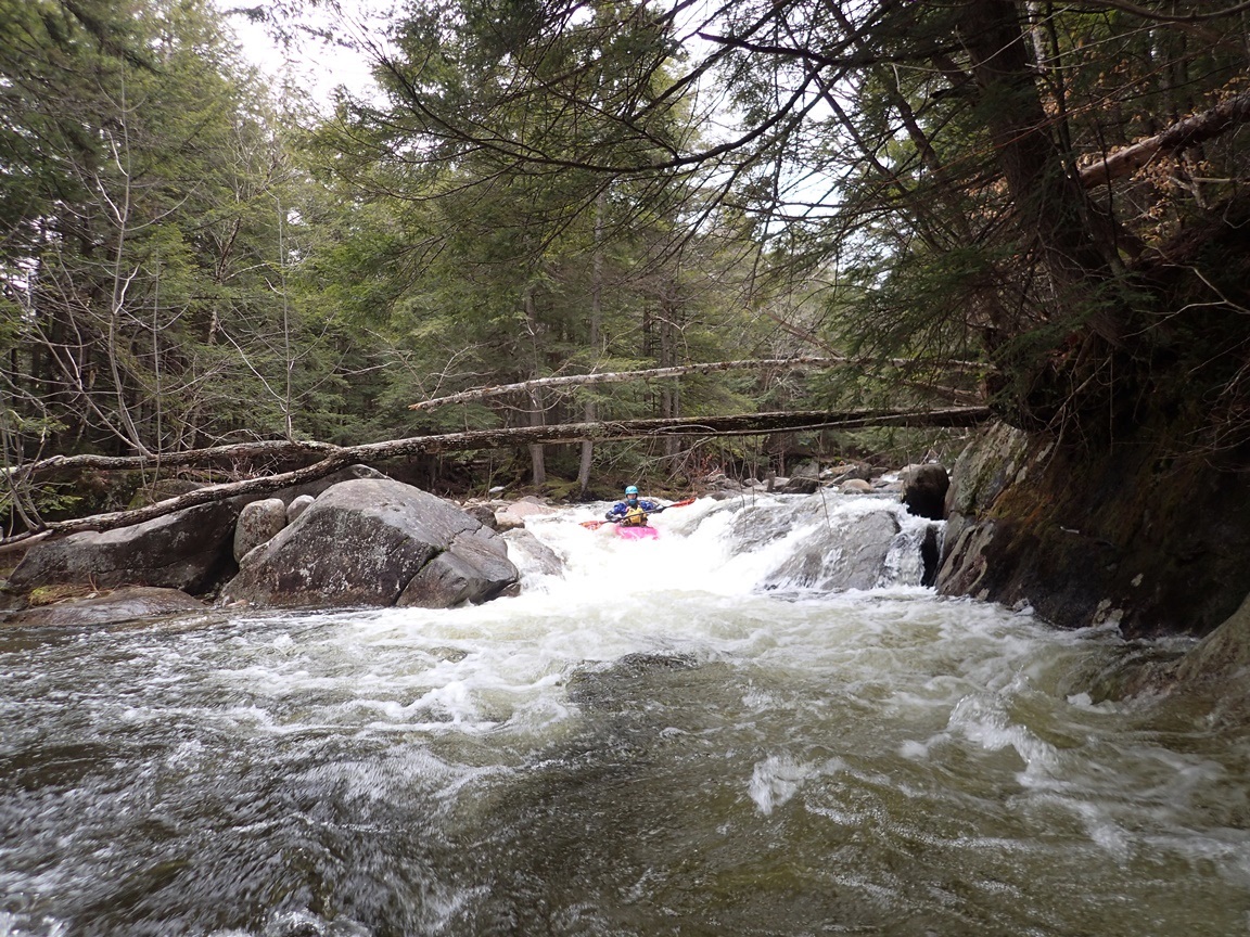
- Falls (IV to IV+). After a big of shallow boogie, you get to the first horizon line. We scouted on the right. You didn't want to be far left in the lead in as it hits a wall. You could be far right and drop into an eddy before pealing out to run the final slot down the middle. There is also a narrow line to run the second direct.
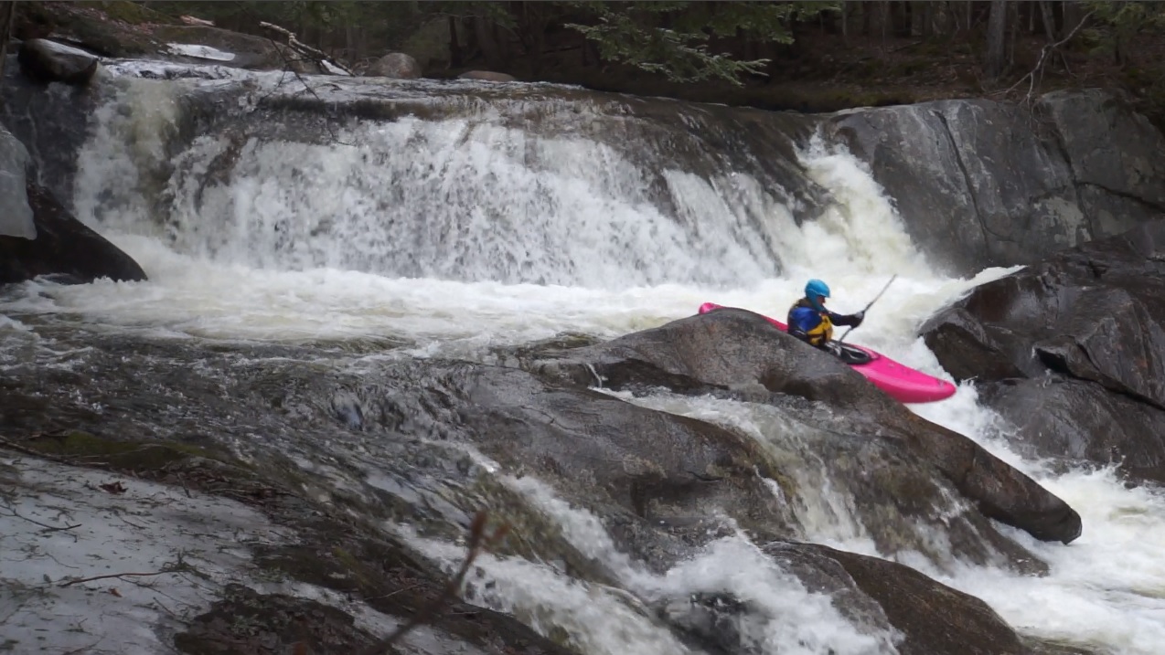
Boof (IV). Just downstream is a very nice boof down the left over a bit of a hole in a walled out area. At high flows this spot could potentially get dicey. But the boof is excellent so I think you would just sail right over. In 2015 it was made a little harder by a sketch log jam just downstream... but I am sure that will wash away.
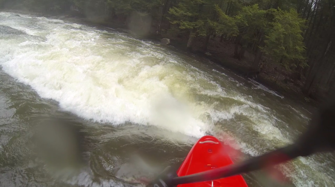
- Confluence Rapid (IV). Immediately after the confluence you hit a nice slidey rapid with a couple of nice curlers and holes to punch down the right. Cannibal is just downstream, so this is not a place for a swim!
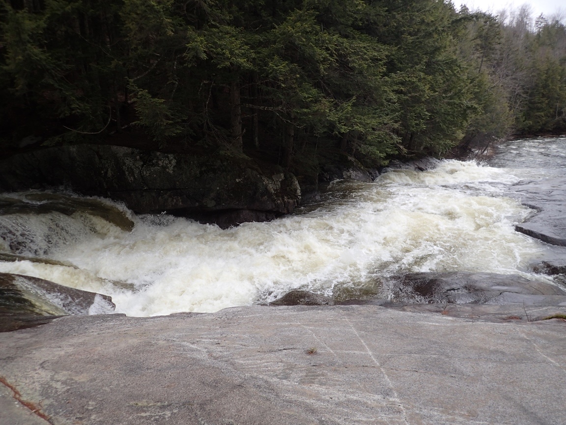
- Cannibal Falls (V to V+). Scout (and most likely portage) on the right. At our flow the lead in was very fluffy through a top hole/ledge before sliding down a long ways into a big curler at the lip that would reject you hard right. The problem is, you really don't want to be far right on the main falls as it lands on rock. You want to be far left. There was a line to catch an eddy on the far right at the lip, and then try to ferry across the lip (literally) and get far enough left to boof or plug the falls. It looked doable. But also looked borderline. You could also put in at said eddy to take the lead in out of it. Either way, a 15 foot falls wasn't worth the unknown for us, so we walked.
- Boogie Rapid (IV to IV+). After a little ways of class II you get a nice boogie rapid. It is an S-turn, we were right for the entry ledge and then moved back left with the main current. The right side at the bottom is a bit undercut.
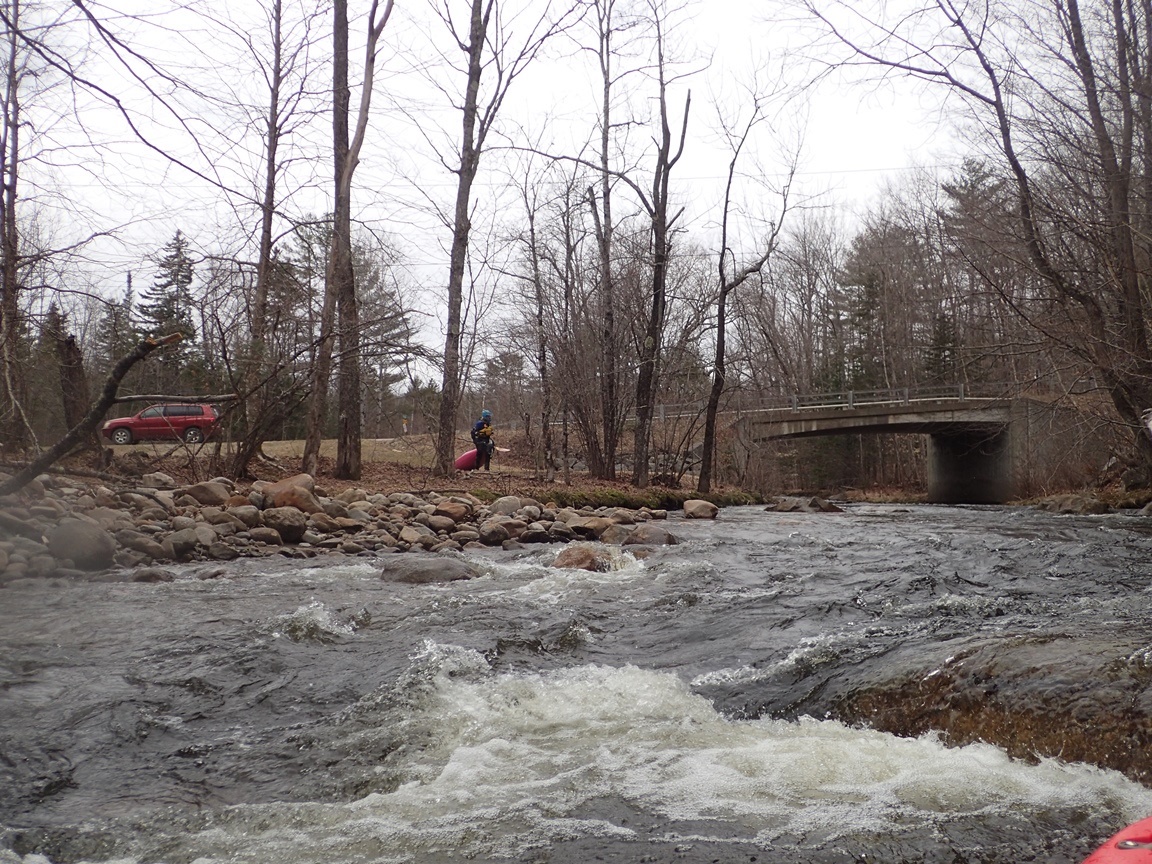
- Bridge Sequence (IV to IV+). As you approach the bridge, things pick up. Continuous class III and IV approaches and passes under the bridge, and leads to a ledge with a sweet boof...
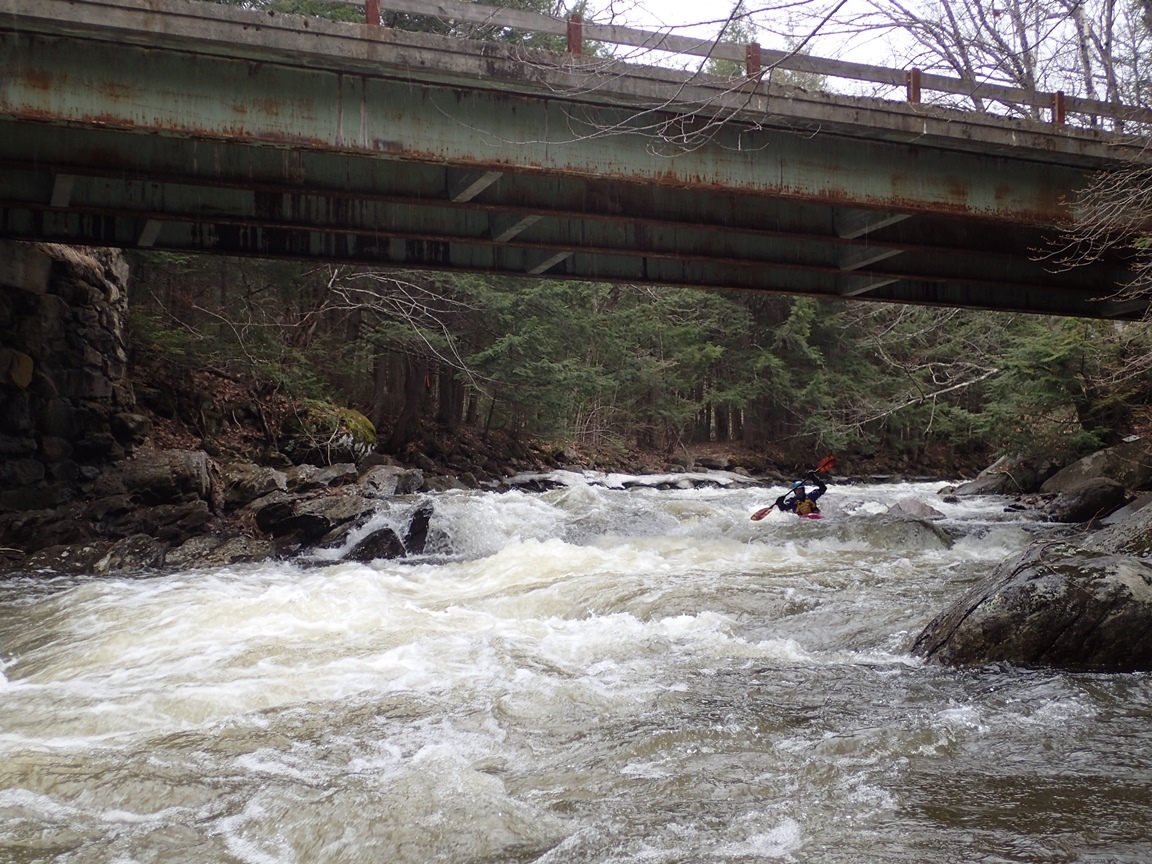
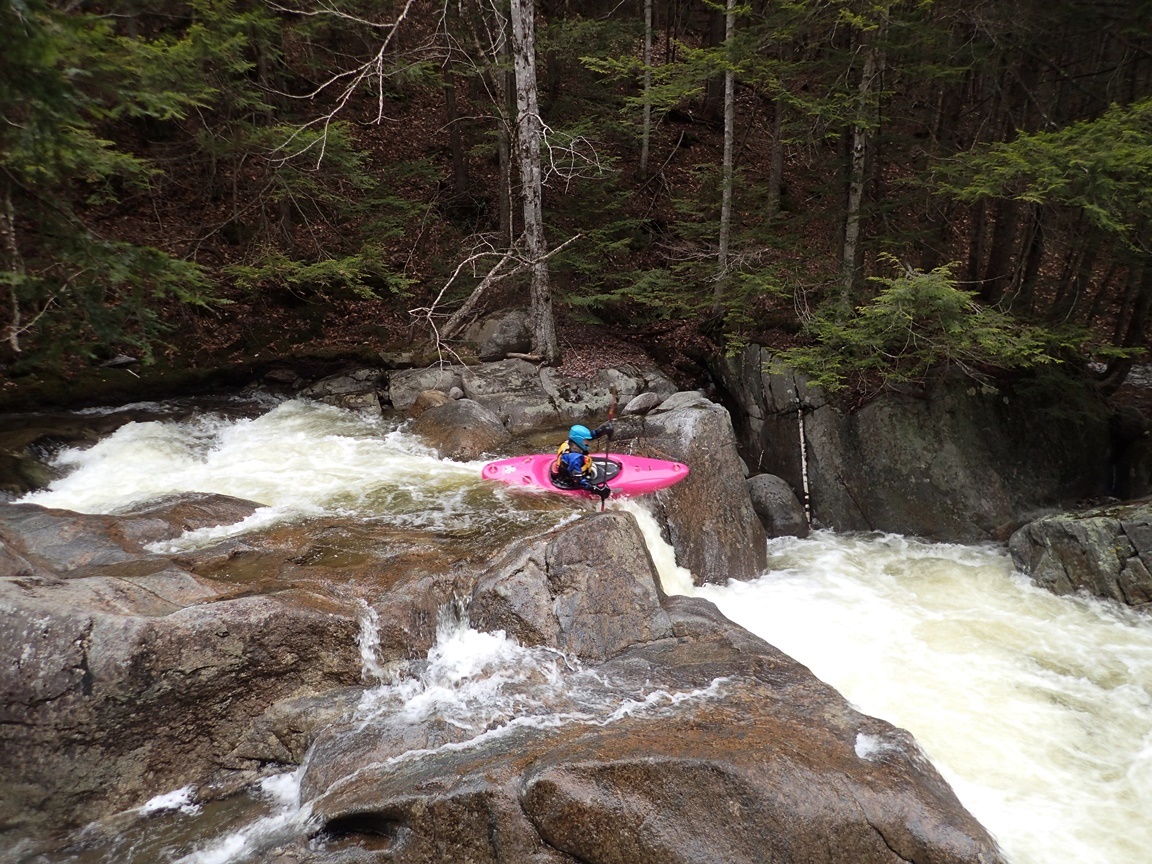
Boof (III). We caught an eddy on the right at the lip to take a quick peak. Both sides of the dividing rock went, but the left had a nice ledge to boof.

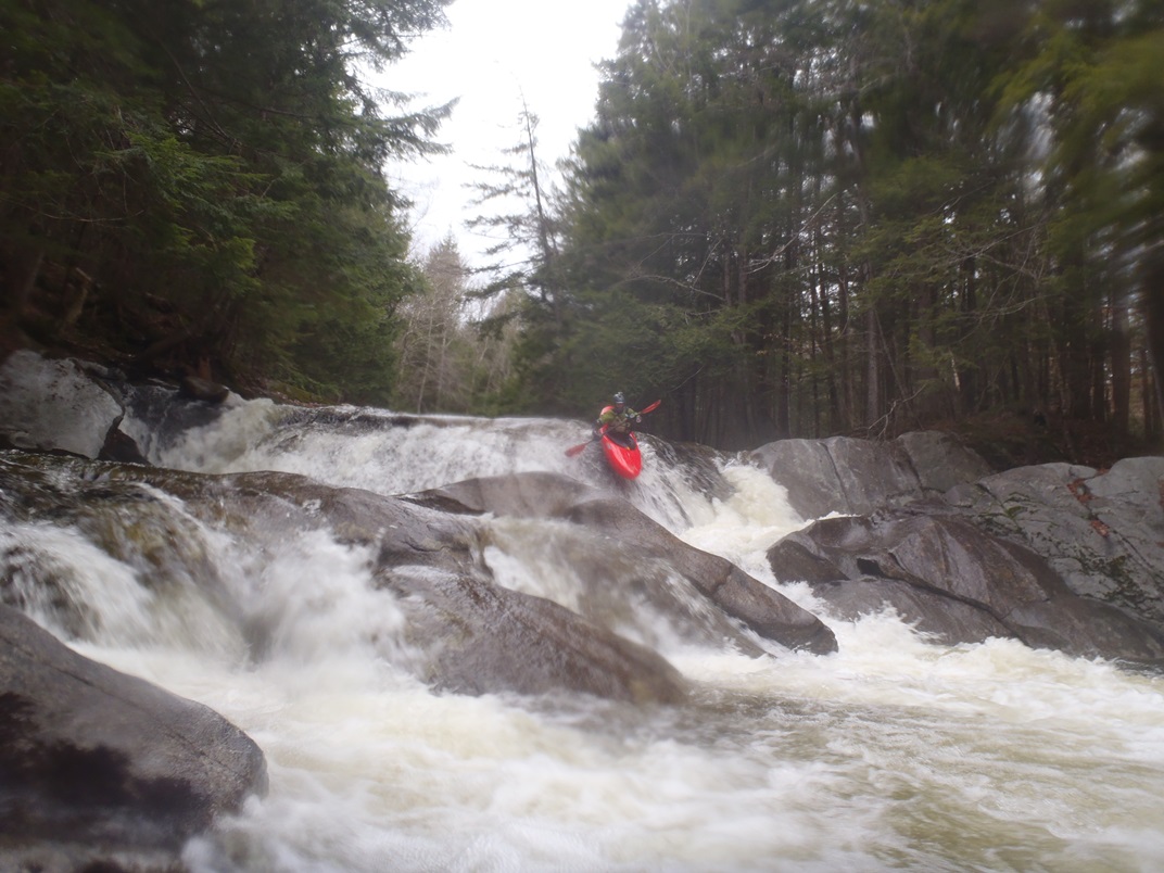
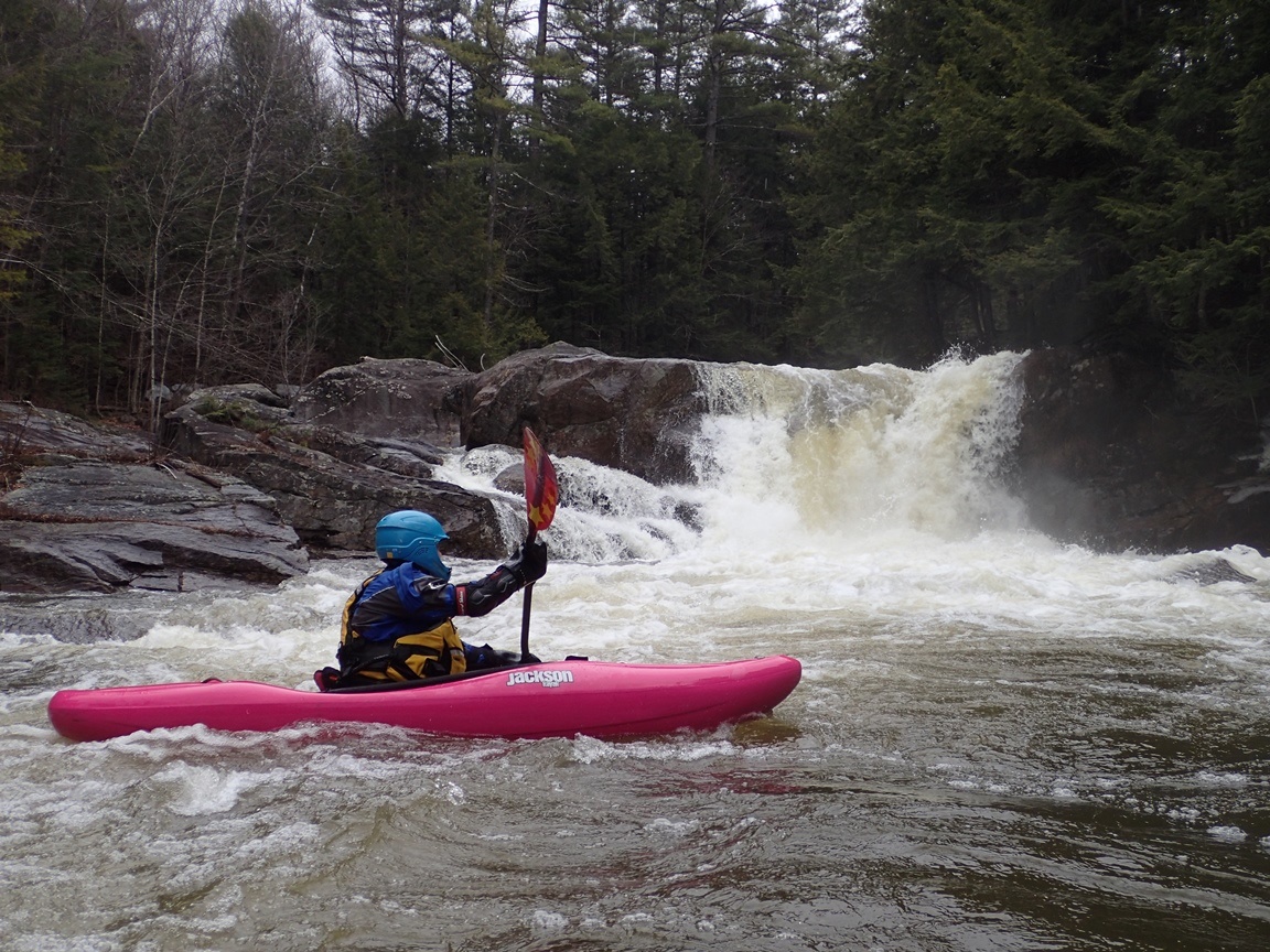
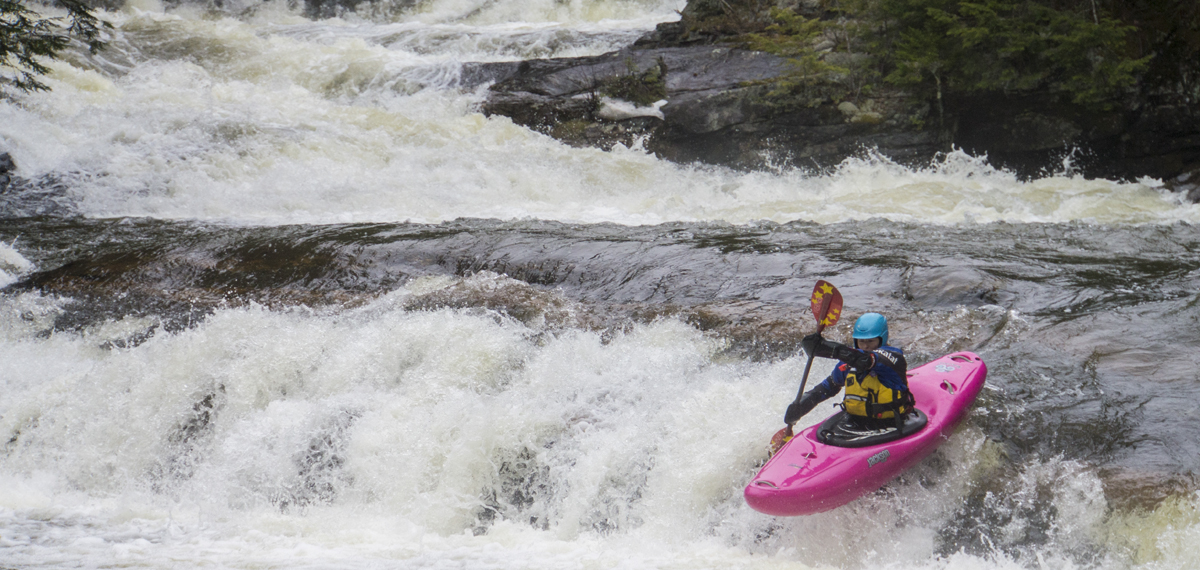
- Slide (IV+). You will get to a very obvious horizon line, it is time to scout on the right. Don't be tempted to follow the main flow down the left as the bottom hole has a very large hole. The main part of the slide is a big two part s-turn, first straight and then a 90 degree turn left into a pool. You want to be right of center at the top to be able to drive far right for the bottom. The exit of the pool is a 5 foot ledge. At medium flows, you could exit anywhere with the only moderately sticky part being far right. At high flows I think you would want to exit far left where the angle of the drop is more gradual and would create less severe of a hole.
For more details on the run, see the AW write-up...
Take-out: 3.8 miles south of Wentworth, NH on NG-118 / NH-25 (or 9.8 miles west from Plymouth) take the North Dorchester Rd to the west (right from Wentworth, left from Plymouth) (the guidebook calls it South Wentworth Rd, but that is no longer correct). It is the first turn South of the river. Continue up N Dorchester for 1.4 miles before turning right on Rowentown Rd. In 100 yards you get to the bridge at take-out. There is a decent turn out on the far side, but easier river access on the near side.
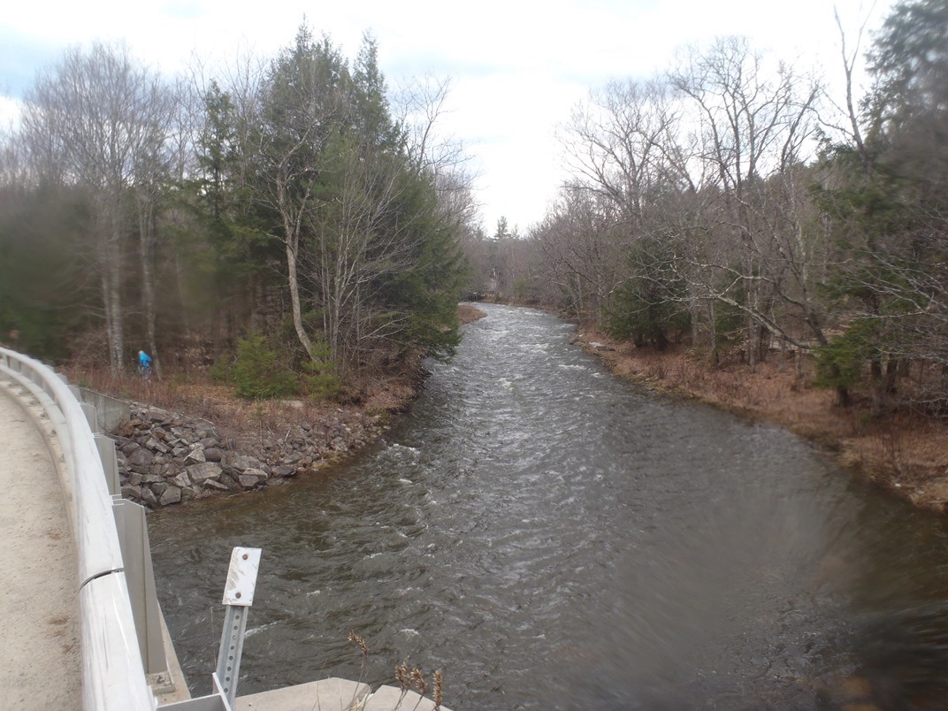
Put-in: Head back the way you can 100 yard, turn right continuing up North Dorchester Rd. Follow this 1.9 miles steeply up a couple of hills (I had to walk my bike finally near the end!) before turning left onto Bickford Woods Rd. Park on the far side of the bridge over Rocky Brook. You can also put-in on the South Baker upstream a mile of the confluence. I know that just above the confluence there was a cool drop, and after our trip I saw a video which actually made several other rapids look pretty good. Look at a map for those directions, it is easy to figure out.
HTML Comment Box is loading comments...