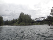
Skykomish River (Classic)
| Stretch: | Mt Index River Rd access to Railroad Bridge |
| Difficulty: | Class III (IV to IV+) |
| Distance: | 3.15 miles |
| Flows: | ~700 cfs to ?0,000 cfs cfs. Check out American Whitewater's current flow gauge. |
| Gradient: | 45 fpm average |
| Put-in: | Access 0.3 miles up Mt Index River Rd |
| Take-out: | Access off of US-2 at Railroad Bridge |
| Shuttle: | 3.1 miles, less than 5 minutes one way, a smidge of nice dirt road |
| Season: | Winter from rain, Spring and early Summer from snowmelt |
| Written: | © 2018 |
| Featured in A Wet State #140 | |
Jobless Summer 2019 Roadtrip - Day 15:
I really wanted to do the Skykomish because 1) it was on the way and 2) the scenery is supposed to be spectacular. Now, you are probably wonder, if I did this run why don't I know for sure that the scenery was nice? Well, this just happened to be our first cloudy day so we couldn't see a dang thing!
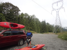
This area is well known for break ins to cars. So, to error on the side of caution this early in our trip, we decided to take turns doing solo laps with the other person watching through the biggest rapid for photo and safety. This worked well as each lap only took 35 minutes or so. I was a little surprised by that actually. I expected more rapids. But instead found that other than the biggest rapid, there were only maybe two others, one right at put-in and one just below the big one. There was nice play, if we had playboats. But we didn't, so we didn't, and instead made fast time.
I thought the run was fun, but not my favorite of the trip. I sorta regretted doing this over the North Saulk which I decided was too far out of the way. I thought it was good and all, but just not much action, and with the scenery hidden behind clouds, the main reason I wanted to do the run was also missing. Oh well. For reference, we had 2,400 cfs which was a nice medium flow I would figure. The big rapid had some bite to it but nothing terrible.
That day after finishing the river we headed into Seattle. Diane's sister lives in Seattle and the plan for the next few days was to go to the North Cascades National Park to hike with her, her husband, their mom Beth, and her friend. Additionally, the next day was Diane's birthday. So we went out to dinner all together and with some friends of ours who live in the area, followed by Diane's favorite, ice cream, knowing that over the next few days we would work off any of those calories.
Previous: Jobless Summer 2019 Roadtrip - Day 14: Cooper Creek
Next: Jobless Summer 2019 Roadtrip - Day 16-20: Cascade River (Marble Creek)
Mi 0.05:
- Cable Drop (III). A fun rapid that we ran right of center. There was a decent hole in the middle at the bottom as I recall.
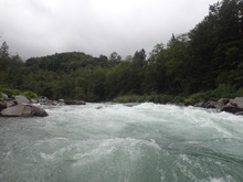
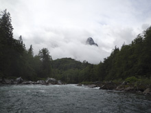
- Island Drop (II+ to III-). Around the next corner is an island. We went to the left, there was some wood but it was mostly mellow rock dodging.
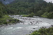
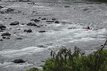
- Boulder Drop (IV to IV+). This is a really nice drop, and has some great scenery if it isn't covered in clouds! We entered right of center and boofed a nice rock ledge. I bet at higher flows you want to error right as that becomes a hole. The next horizon is the classic move of the rapid. A rock fence provides multiple options, which go at various different flows. We ran the main ledge which is called "The Needle." To the left is a smaller slot called "Ned's Needle." To the right shore is a line called JP. To the left of Ned's is a small crack which is ugly and called Chris's Crack. Far left is another line called Airplane Turn. The Needle had a fluffy hole, best run on the left side with a left stroke. Below, there are holes (or rocks at lower flows) to punch through before the exit to the left of the big rock downstream. You can scout this rapid on the right or from the road before hand, though it might take some trial and error to find the correct turn out and the trail down.
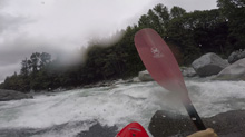
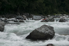
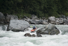
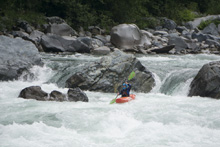
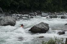
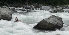
- The Weir (III-). Just below the exit of Boulder Drop is a small weir. I wasn't sure where to be so I went far right to avoid the meat of it. But there was a line through the meat.
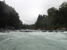
- Lunch Hole (III+). A nice rapid that had some meat on the left side. Since both Diane and I were solo when we ran it, we both errored right to avoid the holes, as we didn't want to do a solo swim and it looked like it had potential on the main left line for that.
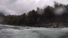
Aguasm (III). I just remember this being boogie.
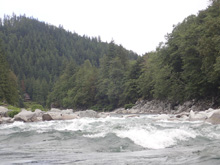
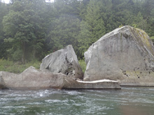
- Split Rock (II+). At some flows there is a nice surf wave at this rock feature which is a large egg shaped rock that is cracked down the middle.
- Railroad (III- to III). The rapid below Split Rock and just above take-out is just fun boogie, but there are some fun lines to take to spice things up. We boofed a few nice little holes down the middle.
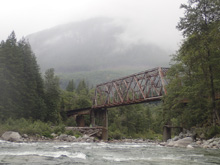
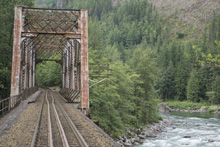
Take-out: From the town of Big Bend, take US-2 east for 1.4 miles. Look for a turn out and dirt road that drops down and goes along the railroad tracks for 100 feet to another small turn out. There is a trail that comes up from the river on the upstream side of the railroad bridge. Note that apparently this area is notorious for break-ins.
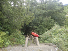
Put-in: Continue east on US-2 for 2.6 miles. Just before you cross over the river, turn right onto Mt Index Rd. Climb up it, following it for 0.2 miles to the turn out on the left and the trail down to the river.
HTML Comment Box is loading comments...

