Cooper Creek (Cle Elum Tributary)
| Stretch: | Falls to Salmon La Sac Trailhead |
| Difficulty: | Class IV to IV+ |
| Distance: | 1.55 miles |
| Flows: | ~200 cfs to 600 cfs. Check out American Whitewater's current flow on the Cle Elum (look for 700-1,700) gauge. |
| Gradient: | 148 fpm average |
| Put-in: | Base of the Cooper River Falls via steep trail |
| Take-out: | Salmon La Sac Trailhead |
| Shuttle: | 5.4 miles, some good dirt, 15 minutes one way |
| Season: | Spring and early Summer from snowmelt |
| Written: | © 2018 |
| Featured in A Wet State #140 and in A Wet State's contribution to World Kayak's Video Guide | |
Jobless Summer 2019 Roadtrip - Day 14:
The day before we got word from Kirk, that although the Cooper was low, it was not out by SE standards. This helped to correct a misunderstanding that we had which was compounded by Diane looking at flows for Copper Creek rather than Cooper Creek. Regardless, Kirk set us on a good path so we made this short but fun creek our destination for the next day.
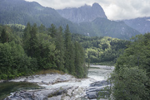
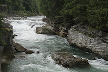
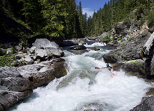
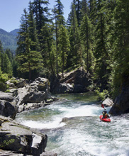
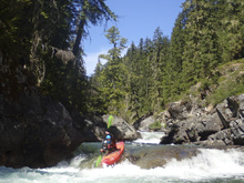
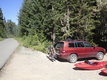
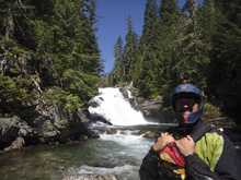
The downside of that plan was that there was a backtrack for some of the drive we had done the previous day on our way from the Ohanapecosh. But so be it. We quickly got to take-out and stashed a bike in the woods at the trail head. Finding put-in quick enough we walked down the trail to the base of the impressive though unrunnable 50 foot tall falls/slide thing. Putting on we could tell we would have low water, but thankfully just 20 yards downriver the river goes off a small falls and lands in tighter walls which channelize everything nicely. Downstream, we had to scout a number of times due to horizon lines, but also ran the worst of it from the boat. There is one hole near the top that at more flow gets super legit apparently and should have safety set on it. Part of why we scouted was also because with only the short run on our to do list this day, we had plenty of time for photos and video. So we used it.
As we approached take-out at 11, we had beat the swimmers to the swimming hole that is take-out. But while Diane road the shuttle back up to get our car, folks started popping up and soon take-out was crowded, so be prepared for an audience if you come.
Even with the low flow, I thought this run was really nice. It was short though. If you have the cars to run multiple laps it is possible and would be fun for sure. I thought this was a great intro to creeking run at this low flow, with really, only the final rapid being more consequential. I bet at higher flow the fun factor goes up, but so does the class III to IV difficulty that we experienced.
That afternoon we drove back up the Wenatchee and continued over the pass into the Skykomish Drainage. We tried and failed to look at the nearby Log Choke Falls as tourists, and then failed to know that Silver Falls on Skykomish was also now closed, as we also hopped to be tourists there too. Oh well. We ended up with a forest service campground and quickly fell asleep.
Previous: Jobless Summer 2019 Roadtrip - Day 13b: Wenatchee (House Run)
Next: Jobless Summer 2019 Roadtrip - Day 15: Skykomish (Confluence to Railroad Bridge)
Mi 0.1:
- Sliding Falls (IV-). This small falls was best run right of center and stood maybe 10 feet tall. Just below was a ledge that we boofed far right.
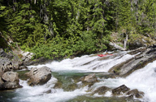
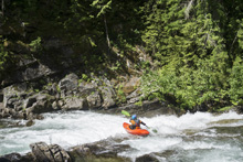
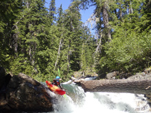
Slides (III to IV-). Immediately downstream are some nice boogie slides that you read and run down the middle.
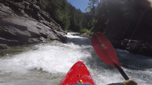
- Norm's Resort (IV to IV+). This is a great long rapid that has some fluffy holes to negotiate and lead to a walled out ledge. You can scout with careful walking on the right. That final ledge is a slopping drop maybe 5 feet tall and lands in a sticky hole (at higher flow) that apparently really sticks you until a rope gets ya. At the lower flow it was fine. You want to run it right.
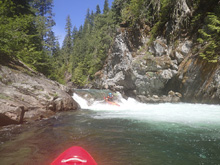
- Canyon Boof (III+ to IV). In a canyon section you will get to a horizon line. A few lines exist. We boofed left of center. We scouted on the left, portaging would be tough.
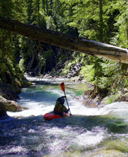
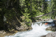
- Slide Boof (III to III+). A straight forward drop, run far right to slide into a boof. There was a rock in the landing to the left so don't drop down the middle. You can scout and portage on the left.
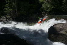
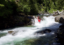
- Canyon Ledge (III+ to IV-). Another canyon section contains this drop, which can be scouted on the right. We ran left of center down the ramp and through the hole.
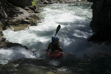
- S-turn (IV). This bedrock rapid had several lines. There was a straight forward line on the left, or a slot on the right which then moved back in an s-turn to the left and exited with the main flow. Scout left.
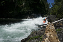
- Corridor Slide (IV to IV+). A nice long slide section with two teirs to it. The first is the harder, you want to be moving left to right to punch the hole while still up on the slide. If you head straight down the slide, the hole is meanest at the exit of the slide and is against the left wall, it could be a sticky spot. Below, is a smaller slide run down the middle.
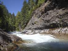
- Shark's Tooth (IV- to IV). This rapid is a junky piece of crap. Scout right. We went generally left and then cut back middle. So many rocks at the low flow. I wonder if it cleans up at all at higher flow.
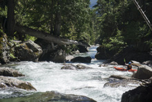
A few boogie rapids and then it mellows out until the last rapid...
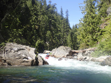
- Voodoo (IV+). The biggest rapid on the run is also the very last and easily scoutable from take-out. It has a few tiers. We entered following the main current and then eddying out above the crux. The crux has a ramp to a submerged rock that splits the flow. You want to end up going off of it to the left. The flow that exits to the right ends up in a big undercut that would suck to be pushed against. But the flow on the left has a nice ramp that is easy to follow down and around the undercut. Immediately downstream is one last small ledge that we ran far right. Then we were at take-out.
Take-out: From the town of Cle Elum, take WA-903 North for 8.5 miles, following the Cle Elum lake North. After the towns of Roslyn and Ronald (there has to be a good story there, old miners who divorced?), it changes names to Salmon La Sac Rd. Continue up the lake. After 10.4 miles, take the left just after the visitor center and cross the Cle Elum river. Continue up the dirt road for 0.9 miles to the trailhead. Park there. There is a fee to park here.
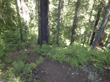
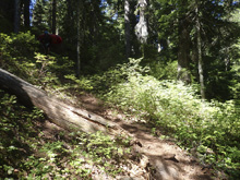
Put-in: Head back down the way you came. After you cross the river, it is 1.2 miles down the river to the next bridge that crosses the Cle Elum. Cross it, this is NF-46. Follow this road up the hill for 3.3 miles and park at the obvious, though only maybe 4 car, turn out. There is a trail that drops steely down and then jogs shortly next to the river downriver, and spits you out below the 50 foot unrunnable falls.
HTML Comment Box is loading comments...
