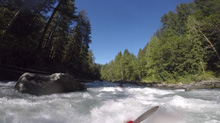
North Fork of the Nooksack River (Horseshoe Bend)
| Stretch: | Above Douglas Fir Campground |
| Difficulty: | Class IV to IV+ |
| Distance: | 2.4 miles |
| Flows: | 500 to ~2,000+ cfs. Check out American Whitewater's current flow gauge. |
| Gradient: | 84 fpm average (125 fpm from the first bigger rapid to take-out) |
| Put-in: | Access below Nooksack Falls |
| Take-out: | Access near Douglas Fir Campground |
| Shuttle: | 2.0 miles, less than 5 minutes one way |
| Season: | Spring to Fall from snowmelt/rain. One of the last runs to drop out. |
| Written: | © 2018 |
| Featured in A Wet State #140 | |
Jobless Summer 2019 Roadtrip - Day 21a:
We arrived at the Douglas Fir take-out spot the night before with a few hours of daylight to spare. In hindsight that was more than enough to run the section, but we wanted a mellow day an if we ran it that night that would also leave only driving the following night. So instead, we sat around camp until I got restless and then went for a walk up the trail that follows the river. The last big rapid is just a short ways up the trail so we thought it would be good to get a feel for the flow level. The rapid is a long boulder garden, which from the trail looked to be pushy. To boot, there was a tree blocking the line just beneath the water half way down. We gave it a good scout and found to our surprise that once we actually dropped down to the river it looked much smaller. We went back to camp, made smores, and went to bed.
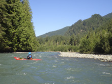
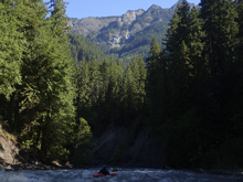
In the morning, we got an early start. The beginning of the run starts mellow and slowly builds up speed before you obviously get to the bigger rapids. We ran one and Diane got spun around weirdly while cautiously boat scouting. The next rapid we had to scout as it was blind and steep, we ended up going down the right. Then, I realized we were at the smaller rapid above the final one that we scouted. We boated through and checked the time... it had only been 30 minutes.
There is another section of river, the class III "Glacier Gorge" immediately downstream. We knew you took out in town (Glacier) but nothing else. We decided 30 minutes of boating wasn't long enough so we decided to continue on... (see that write-up)
For reference, we had 1,000 cfs. I thought this felt like fluffy side of medium flow. I know folks run it really high, but I think you want to know it and have that not be your first time. I think also having someone lead you would make this run easier then how Diane and I sorted it out ourselves. I also know folks run it low, I would think to an extent this is ok but at some point it has to turn manky I assume.
Also note, that this section is not restricted during Salmon spawning like the Glacier Gorge downstream. If you plan to continue on, please read the last paragraph in that write-up.
Previous: Jobless Summer 2019 Roadtrip - Day 16-20: Cascade River (Marble Creek)
Next: Jobless Summer 2019 Roadtrip - Day 21b: North Fork of the Nooksack River (Glacier Gorge)
Mi 0.0: Mi 0.45: Mi 1.7:
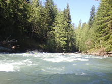
- First Bigger Rapid (III+ to IV). The first bigger rapid (couldn't find a name) is on a right bend. We entered far left through a fun boof that was backed up by a rock. We then headed right for the run out directly below, the runout goes around a couple of corners and has a few small ledges to boof or dodge. It was read and run though.
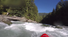
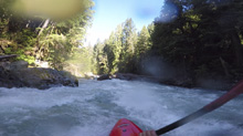
- Bench Drop (IV to IV+). This drop is the biggest , though not longest on the run. Diane went down and scouted from a last minute eddy on the left. We then ran down the right. There is a line on the left though, Diane didn't like the look of it. The line on the right was through a twisting slot with a small hole in it. The runout was mellow but led directly to the next rapid.
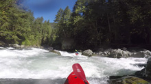
In Between (IV). This rapid was rather blind from the small eddy on the left at the lip. We went for a walk up the trail the night before and I realized we were here, so we were able to run on down left of center moving right between holes/rocks. This then goes directly into the final big rapid.
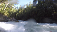
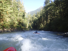
- SAT (IV to IV+). The final rapid is probably good to scout from the trail on the right. It last for 0.15 miles and has a lot of different lines, and multiple moves per line. There was a line down the right at the top, or a smaller channel down the left. In the middle, you wanted to be going to the right to avoid some pin rocks. On our day, the middle line also had a tree just under water. Because of that, I went left as it cleared the tree more easily. The exit was a pinny ramp that was clean on the far right.. Below, was some runout that lasted another 100 yards.
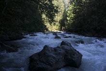
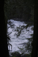
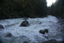
- Island (III). Not a big deal, but just below there was an island in 2018 that was junky and led to wood. Follow the main flow down the left to avoid it all.
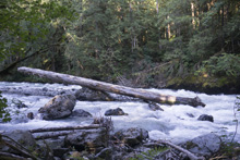
Take-out: From the town of Glacier, along WA-542, head east on WA-542 for 2.1 miles. Immediately after crossing the river, park on the right. There are stairs down to the river on the upstream side. Douglas Fir Campground is on the downstream side of the road.
Put-in: Continue up WA-542 for an additional 2.0 miles. You will get to a large turn out that is well signed as kayak access and has a nice trail down to the river curtesy of AW's efforts.
HTML Comment Box is loading comments...

