North Fork of the Nooksack River (Glacier Gorge)
| Stretch: | Douglas Fir Campground to City of Glacier |
| Difficulty: | Class III- to III |
| Distance: | 2.0 miles (or 4.65 miles down to the highway bridge) |
| Flows: | 500 to ?,000+ cfs (I wouldn't paddle to the highway at 500 cfs). Check out American Whitewater's current flow gauge. |
| Gradient: | 54 fpm average |
| Put-in: | Access near Douglas Fir Campground |
| Take-out: | Vaughn Street in Glacier, WA |
| Shuttle: | 2.1 miles |
| Season: | Spring to Fall from snowmelt/rain. One of the last runs to drop out. |
| Written: | © 2018 |
Jobless Summer 2019 Roadtrip Day 21b:
After doing the up river Horseshoe Bend section, we hadn't had our fill of boating yet, so we decided to continue on downstream with knowledge only that there was a class III gorge and take-out was in the town of Glacier.
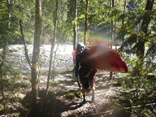
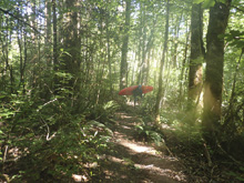
The gorge starts immediately below the Douglas Fir Campground and is one of the nicest pieces of class III- to III around. The scenery in the gorge is nice and the rapids fun. Once the walls open up you get one last rapid where a landslide has dropped in and there are some sharp rocks. Below, the river gains a sizable tributary on the left, look back upstream and see the wonderful views of Baker. Also, look to the left shore as there is some tape on a tree on the left shore not far below the tributary which marks the start of the trail to the town. I was thinking that "take out in the town of Glacier" might not be actually in town, but that a trail might be needed. I remembered that the tributary was very near the town, so on a whim we took the trail with the tape and sure enough popped out smack in the middle of town after a quarter mile walk!
The last little bit of fun was trying to catch a hitch in the small town of Glacier. With the addition of this gorge, we didn't have a bike at take-out and we hoped for the best. I sat out on the road for a good while as tourist went by one after the other. Soon, this Audi comes driving up and I think to myself "no way will this nice car stop." Sure enough though, they did. I run over to them and go to open the door, when I noticed very startled faces. They roll down a window and in broken English ask if I am ok and grow to understand I need a ride. They let me in and I learn they are on vacation from China. I think the concept of hitch hiking was new to them as they seemed relieved when my car came into sight. So anyways, thanks to those folks!
This run was a great add on to the Horseshoe Bend section, or a great standalone section as well. I believe people also continue downriver for several more miles though I believe the river is more mellow below. We had 1,000 cfs and I thought that was a nice low side of medium flow.
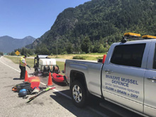
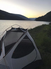
It was 10:30 am and we were done with shuttle so we began our longish drive to Revelstoke where we would meet up with Toby and Erin. On the drive, we learned that there are copious watercraft checkpoints in Canada right now (2018) to try to stop the spread of an invasive muscle. It was our first time through one, and since our boats had been in Colorado and Utah in the past month, they decided to clean our gear. This consisted of soaking all our kayak gear (boats, life jackets, dry tops etc) in heated water (60 deg C) for a few minutes. The process took an hour or so. But after that, at any stop we hit we showed them the paper work showing it had been clean and were allowed on our way quickly. Just be warned, you may get the extra treatment if you are coming from a contaminated state. So anyways, we pulled into Revelstoke around dinner time, met up with Katrina, Toby, and Erin for dinner, and then found a nice spot along the Columbia River to camp for the night.
Also a quick note, this river is not allowed to be kayaked from August 15 to October 15th unless the river is over 1,000 cfs. This is due to the spawning of Chinook Salmon. Also, even after October, until the end of March it is asked that you avoid walking in the river on anything less than grapefruit sized rocks, as you could crush the eggs.
Previous: Jobless Summer 2019 Roadtrip - Day 21a: North Fork of the Nooksack (Horseshoe Bend)
Next: Jobless Summer 2019 Roadtrip - Day 22: Saint Leon Creek
Mi 0.0:
- Boogie (II+ to III-). Directly below put in you run some open river boogie down past the campground.
- Gorge Entrance (III). The entrance to the gorge is a nice rapid that had some large boulders in the river. The line was right to left with the main flow. Just mind the rocks on the left at the top and the right at the bottom as they are a bit sievy looking.
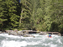
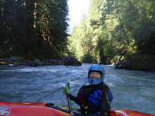
Left to Right (II+ to III-). A smaller rapid in the middle of the gorge with some rocks on the left to avoid. The flow goes left to right into the wall, so just go with the flow and then avoid the wall. Downstream are more big rocks. That could be a bit dangerous for a swimmer perhaps.
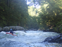
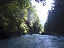
- Landslide Rapid (III-). The exit of the gorge is marked by a landslide rapid on a left bend. It was read and run, we ran down the middle with the bulk of the water. You then get an awesome view of Mt Baker directly ahead of you.
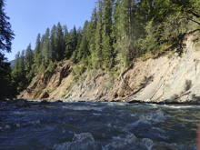
- Glacier Creek enters on the left. As you paddle downstream look back up for awesome views of Mt Baker. And then, look for the small trail (was tapped in 2018) to start hiking to take-out.
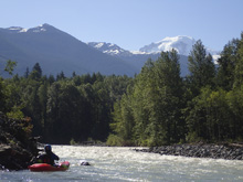
If you continue paddling down to the highway bridge, it is all just shallow gravel bards.
Take-out: We took out smack in the middle of Glacier along WA-542. The trail pops out on Vaughn Ave which is the eastern most street in town before you cross over Glacier Creek. The other optional take-out is 2.4 miles west on WA-542 where the highway crosses the river.
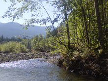
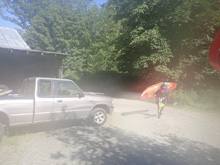
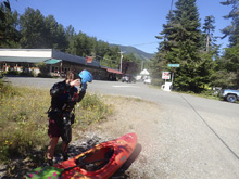
Put-in: From the town of Glacier, along WA-542, head east on WA-542 for 2.1 miles. Immediately after crossing the river, park on the right. There are stairs down to the river on the upstream side. Douglas Fir Campground is on the downstream side of the road.
HTML Comment Box is loading comments...
