Mistassibi (Dolbeau)
| Stretch: | Above Saint Stanislas |
| Difficulty: | Class IV to V |
| Distance: | 2.65 miles |
| Flows: | 150 to 1,500 cumecs (216 felt fine, but the Black Mass is at 1,300). Check out Quebec Whitewater's current gauge |
| Gradient: | 25 fpm average (seems steeper!) |
| Put-in: | Roadside access between Saint Stanislas and Lac Eden |
| Take-out: | Access just outside of Saint Stanislas |
| Shuttle: | 8.6 km (10 minutes one way) |
| Season: | Spring through Fall |
| Written: | © 2016 |
| Featured in A Wet State #119 | |
NY and Quebec 2016 2016: Day 7
Waking up at Evan's house near the Valin, we began to figure out what our options were. The Quebec City area got a bunch of rain and there was our choice of creeks in the area. However, most of the creeks in the area were class V. After a horrible night of sleep as my neck tightened up to maybe 10% of range of motion, I wasn't sure I wanted to bite off that sort of adventure for the day. Discussing with the guys we came to agreement that it probably wouldn't be the best decision. So we diverted our attention back to our original plan A, before the rain came, the big water river, the Mistassibi.
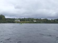
The Mistassibi is known for having water all summer long... and huge water at that. We had some 218 cumecs which is over 6,500 cfs. And that is considered somewhat low for that run! The pictures in the guidebook have it over 700 cumecs! As it was, I would say our flow was still plenty. All of the waves and holes, as is typical in big water, were way bigger at river level than during scouts. And I was the only one in the group that had any real interest in big water. Everyone else was certainly pushing their comfort level!
The run starts with a good size rapid before it mellows down a little. The second to last rapid though is the real deal and a solid class V. We all chickened out on the main line up and over the huge Hawaii 5-0 style curler. And because we scouted on the right, also locked ourselves out of the cleaner entrance lines also on the far left. Oh well, that happens when you don't know the run!
Before too long, we found ourselves at take-out and Steve pulled the straw to bike shuttle. Chad and I hung out along the banks of the huge river, enjoying the last bit of our destination before we began our drive back South towards home. It was Friday afternoon. And we were 23 hours from home. The next 2.5 days were going to be a bit of a grind for sure! That afternoon, we drove through Jacques-Cartier National Park toward the Jacques-Cartier river. The river is best known internationally for its Taureau section. That is an all day, long shuttle, class V affair. We didn't have that sort of time for Saturday morning. So instead we routed to a lower class IV section of the river, Tewkesbury.
Next: NY and Quebec 2016: Day 8 - Jacques-Cartier (Tewkesbury)
Last: NY and Quebec 2016: Day 6 - Valin (Canyon)
Thanks to Chad Christopher for sharing some pictures from the trip!
Mi 0.6:
- H20 (IV to IV+). Scout on the left. There is a far right line that was reasonably mellow it looked like... but that was from a distance. We ran the main left channel. One snuck it on the left shore, the rest of us ran down the left of center. The danger here is the right two thirds of the channel is a huge hole. We ran just to the left of it.
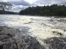
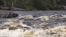
- Moby Dick (IV). We ran the left channel and stayed center down it throughout. There were some large pocket holes if you got near the center rocks, so don't.
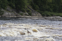
- Adrenaline & Colorado (IV). These are two rapids, but I honestly don't know how they break apart. It is really one long section of continuous action that last about 0.6 miles. We ran the top third down the right but it was clean everywhere. The river then gets wider and fans out. We worked our way left and ended up eddied on the left shore above a small ledge that we boofed. The middle and some holes and some thin lines. The right actually looked like the main flow and the cleanest line. Oh well, lesson learned!
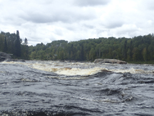
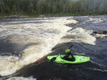
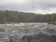
- Hawaii (V). This is the biggest rapid on the run. By far! The main line is on the far left. Enter center in that channel and then drive left to the nice green peak on the left at the top of a huge diagonal hole that runs the middle two thirds of the river. It is huge. We made the mistake of scouting on the right. The right had a thin line that none of us wanted for the lead in so we portaged it. The exit, we didn't want to fail in trying to ferry all the way to the left for the main line, so we exited down the slide on the far right, around the huge diagonal hole.
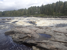
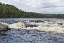
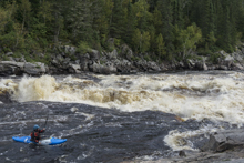
- Black Mass (IV+). Immediately downstream is another sizable drop. When flows are at ~1,300 cumecs the left is the famed "Black Mass" or "Messe Noire" wave. At our flow, the middle was just a pile of holes so we went just 10 feet off the right shore through a seam between a few smaller holes, though they still packed a punch.
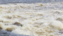
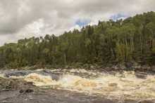
- Runout Rapids (III-). Nothing spectacular, just a few runout rapids.
Take-out: From Saguenay, cross the river and turn left on QC-172. Follow for 45 km until you get to QC-169N, turn right. Follow this for 72.4 km to the town of Dolbeau-Mistassini. As soon as you cross the river, turn right onto Rang St Louis (take a look downriver before you cross the river for a glimpse of a huge rapid!). In 4.6 km turn right to stay on Rang St Louis. Follow this for 1.4 km to where it changes names to Rang Alphonse, and continue for 7.4 km. As you get into the town of Saint-Stanislas, turn right just before the church on a dirt road, follow this down about a kilometer to the river. Apparently you have to pay to access the river, but we couldn't figure out where as we were off season.
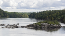
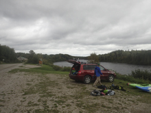
Put-in: Go back out to the road, turn right, and then pass through town and take your first right onto Chemin de l'Eden. Follow this for 5.1 km. Turn right at the obvious blue sign and major turn to stay on the same road. Follow this for 2.0 km to the large parking area directly next to the river.
HTML Comment Box is loading comments...
