Jacques-Cartier (Tewkesbury)
| Stretch: | From above to below Tewkesbury |
| Difficulty: | Class IV |
| Distance: | 3.05 miles |
| Flows: | 20 to +120 cumecs (60 felt like a great medium). Check out Quebec Whitewater's current gauge |
| Gradient: | 41 fpm average (57 fpm from Appetizer to Surprise) |
| Put-in: | Access north of Tewkesbury |
| Take-out: | Access south of Tewkesbury |
| Shuttle: | 6.7 km (5 minutes one way) - Not bike friendly due to numerous hills |
| Season: | Spring through Fall |
| Written: | © 2016 |
| Featured in A Wet State #119 and in A Wet State's contribution to World Kayak's Video Guide | |
NY and Quebec 2016 2016: Day 8
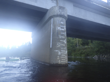
The final Canadian run of the trip is a quick class IV run on the Jacques-Cartier which came well recommended. The flow had been low on it earlier in the week, but the recent rain brought it up to a classic level (66 cumecs on the gauge, 0 meters on the bridge gauge).
The night before, we had come into town around 8 pm, just before dark. Both guidebooks stated there was camping at put-in. However, when we found the put-in bridge we drove up and down the river trying to find the place. We drove up and down on river right, and came in from downriver, river left. Finding nothing, we end up poaching camp just off the road on some private property and set up our tent in the dark with the plan to take it down first thing in the morning. The next morning, we indeed get an early start and quickly set a bike at take-out and drove upriver and found the actual put-in... upstream on river left. No idea why we didn't try that way the night before. I am not certain that camping is actually allowed there, but it is a nice parking area so it does seem likely... or at least less against the rules than what we did on private property!
Soon after we arrived at put-in some canoers showed up and we began to chat with them. They actually had boated in Tennessee several times and agreed when asked to help us quickly set our shuttle so we could have our car at take-out. That was awesome as we were planning on driving to the Yough that evening.
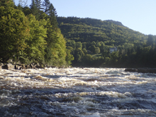
The river was actually a lot of fun, though not too long. Rapids start just downstream from put-in and continue more or less to take-out with only a short easy paddle out. In the middle of the run is a nice long set of rapids that some books rate IV+. The last rapid is rated class III+ in some books, but I actually felt that rapid had more going on than the other. Regardless, the run had some really classic class III and IV rapids. An at 3.5 miles, and all read and runnable for us, we made quick time and found ourselves at take-out at 9:30, only maybe 45 minutes after pushing off. This was great though as we were able to get our drive started. The plan was to do the Ohiopyle Falls on the Lower Youghiogheny first thing Sunday morning and then the Upper Yough later in the morning. As I checked flows though I find that the Ohiopyle Falls section got a little rain overnight and went from 1.81 to 2.0 overnight. That of course means the river is a no go as it has to be below 1.8 to be allowed to run the falls. Scratch that plan. However, as we drove I saw that the Ausable Chasm in fact had just enough water to boat. So we took a slightly longer route to Friendsville which would drive us directly by the Ausable Chasm. However, as we got within a mile of that run, the USGS gauge updated and now displayed low flow. It is really weird actually, as the good flow was erased from their website. I wonder if the gauge had a glitch... or if somehow my phone had some old data stored from a previous time I looked at the gauge. Who knows? But we were skunked. It was around this time I also realized that the Upper Yough does not release on Sunday. It was a bad 20 minutes for me. A week of driving and perfect logistics... all unraveled in that final evening. Oh well. At least we knew we had the Gauley to fall back on. So, we added 3 hours to our drive, driving until 2:30 am to get to the Gauley for a morning lap before finishing the final 4 hours of our drive to Knoxville. Arriving on opening weekend, late Saturday we knew the camping at put-in would be packed. So instead of even bothering to look, we just quickly set up our tent on the grass at the top of the hill knowing that it was questionable at best, but also hoping that with an 8 am wake-up we would beat any authority to the punch and be gone before we got in trouble. A great plan... but the ranger came knocking at 7:30 am. Luckily he was cool, and just asked us to take it down and move on... so we did, and went to get breakfast before setting that shuttle and finishing our trip.
The final tally was approximately 3,300 miles of driving over 56 hours. Not bad for leaving Friday after work and getting home Sunday at 6:30 pm. We ended up getting 11 rivers, 10 of which were new to me. I really enjoyed Quebec, and walked away with an understanding of the boating Mecca that this place is. I really don't know why it isn't more of a destination. Dependable spring flow, and rivers that run well into and through summer. Plus, the rivers are mostly very clean, with a mix of bedrock and boulder gardens. I know I really want to go back. I want to experience more that the area has to offer. Now time to figure out how to make that a reality! So the big take-away... is Quebec worth it? Yes. Very much. Everyone on the East Coast should road trip up there to boat. It is really fun!
Last: NY and Quebec 2016: Day 7 - Mistassibi (Dolbeau)
Thanks to Chad Christopher for sharing some pictures from the trip!
Mi 0.05: Mi 0.55: Mi 1.35:
- The Brothers (IV- to IV). After a bit of mellow you get to where the river tightens and an obvious larger rapid. We ran down the right cutting across to the middle on the ramp. This then quickly to the second part of the rapid where the river funneled into a nice wave hole. We got a little surfing done here as it had nice eddy surface and fun shoulders.
- Bowler Hat (III+ to IV-). The first half is down the right moving back to the center. The second half has a ramp into a wave hole that packs a bit of a punch as two green shoulders converge together. It isn't hard to avoid the meat of it on the left.
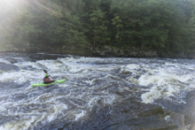
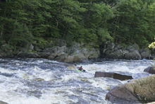
- Meat Grinder (IV to IV+). From above you can tell this rapid is larger than the rest. It is busy and a bit chaotic, but also just a lot of fun. You can see the rapid from above and see down the center there are no major steps in gradient, so we just entered and went center and generally right. There was a ledge that looked to have a nice boof on the far left at the bottom, but it also looked like it could be trouble if you weren't ready for it!
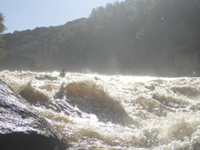
Caldron Gorge (III-). Downstream you immediately run into what just felt like runout of Meat Grinder. It is just a nice fluffy wave train that enters an area where the gorge walls tighten. We were all nervous as the blind right corner in the tightest spot seemed ominous but actually was fine as it was mellow in the corner and immediately opened up.
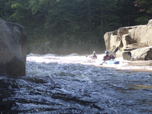
- Gorden's Knots AKA Bag of Knots (III+). This rapid starts out mellow and picks up speed. The crux is the hole at the bottom which takes up the middle 75% of the river. We boofed the hole... at higher flows that is a no go. Or if you don't have a boof. Error left if that is the case and go around the hole.
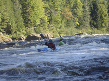
- Surprise (IV). So, I honestly felt that this was the biggest rapid of the run, at least from a boat scouting standpoint. It was long, multiple moves to make, an island to choose an approach to, and some ledges if you guessed less than optimally. We entered right of the island but hugged the island. There were some smaller holes to boof over there. We then worked left and exited down that side through a wave train. It was a fun rapid for sure... I really wish I had gotten out for some nice pictures of this one. But as the name might suggest, it surprises more than just us apparently!
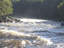
- Rock Garden (III-). The river splits around a very large wooded island. We went down the left and negotiated a boulder garden. More islands await downstream but no worries as they all converge together right at take-out.
Take-out: The town of Tewkesbury is just off of Autoroute 73. Take QC-371 to get from the freeway to the town. Passing through Tewkesbury, continue down the river on QC-371. 4.7 km from town, you will descend down a hill. Near the bottom there is a parking area on your right. It is half a kilometer to walk up from the water. You can exit the water immediately downstream of the house at the base of the hill. Most people will load up using the side of the road though parking here is obviously a no-go. There is also a rafting take-out another 100 yards down the rd. I am not sure how frowned it is to tak-out there. We did, as did many others, but I think that may have been because we were out of season.
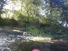
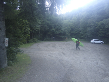
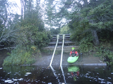
Put-in: Continue back up to Tewkesbury. As you enter town after 4.7 km, turn left onto Rue Jacques Cartier S. Follow this for 1.9 km and you will see the bridge over the river, the gauge is on the bridge. Another 100 meters upstream you will see a parking area on the right. This is put-in
HTML Comment Box is loading comments...

