Beaver (Eagle)
| Stretch: | Beaver Lake to Soft Maple Reservoir |
| Difficulty: | Class IV+ to V- |
| Distance: | 0.4 miles |
| Flows: | 200 cfs. Check out North East Paddlers Message Board for the scheduled released |
| Gradient: | 445 fpm (for the main section) |
| Put-in: | Access off of Soft Maple Rd near Beaver Lake |
| Take-out: | Access off of Soft Maple Rd near Soft Maple Reservoir |
| Shuttle: | 0.4 miles. Just walk it... |
| Season: | September releases |
| Written: | © 2016 |
| Featured in A Wet State #118 and in A Wet State's contribution to World Kayak's Video Guide | |
NY and Quebec 2016 2016: Day 2 Afternoon
The Eagle section of the Beaver is the first one that got my attention. I remember seeing pictures of the middle split falls some time ago and always thought it looked fun. What I didn't realize is that this is a glorified park and huck. The run is four drops long, and you hike your laps back to the top in just a few minutes. The slides are fun for sure, they provide a nice steep creeking feel but are also surprisingly friendly. There is a hole at the base of the split falls that back enders some but the pool is big to roll up in. Downstream is the hole that gives some trouble. It is a little lead in to a slide with a hole against the left wall which then recirculates on the right shore. If you carry momentum through it and keep your nose downstream you will punch right through. Downstream, one more nice ledge awaits for a boof.
The river was great fun. We ran three or four laps in an hour before the race began. During the race, we opted to not boat. All the boaters from the Moshier showed up and were on the water, while the race was simultaneously trying to race through, needless to say, it was a full blown cluster.
I thought the run was easier than the Nantahalla Cascades at 400 which I felt had a similar nature. The hike at the Cascades is a little longer, but the drops there have more punch and more moves. I felt like Eagle most of them were intimidating but in the end, you just needed to line it up, negotiate a class III lead in and then hold on and keep it straight. Fun certainly, but also a little bit of a novelty.
That afternoon, we watched the race for a bit before heading downstream and loading our gear for a 1:45 drive north to the Raquette. I had heard you could camp at take-out. Arriving we were on the river left and found a house and a small lot near the powerhouse. We really need to read beta better. We searched google maps for promising places to pouch, but with each place were foiled by clearly marked "No Trespassing" signs. NY, come on! We googled camping nearby and found a state park 10 minutes away and drove that way. Of course, the next morning as we drive into town we find that put-in is in fact on river right and the Volunteer Fire Department allows camping on the lawn behind their station... where we find 10 tents set up. Damn it. Oh well.
Next: NY and Quebec 2016: Day 3 - Raquette (Stone Valley)
Last: NY and Quebec 2016: Day 2 Morning - Beaver (Moshier)
Thanks to Chad Christopher for sharing some pictures from the trip!
Mi 0.0:
- Put-in Seal Launch (IV-). Putting in on your first lap, most choose to seal launch in directly to the spillway on the far left of it. Just be mindful that the small ledge immediately downstream has some metal sticking up. I decided to eddy out between and exit far right, away from the metal.
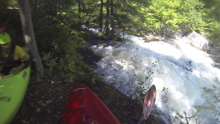
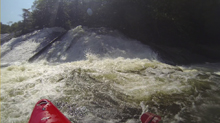
- First Slide (IV-). After a 100 feet of boogie, you get to the start. No stopping once you enter this until below the Split Slide. This one is straight forward, the water hits the right wall, I entered far left and slide down into the second cushion. Others went more direct. Downstream get ready for the next slide.
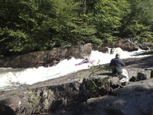
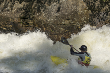
Split Slide (IV+). Enter and drive left through the entry holes. I think one thing people error on is starting too far left and then unable to carry left momentum as they get walled out over there. Or worse yet, roll due to lack of edge control. I just entered center and drove left. I was then set up well to move back right as the slide started to drop through the fan of water straight and punch the hole below. A nice but short recovery pool exists below.
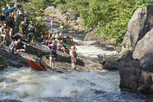
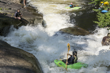
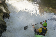
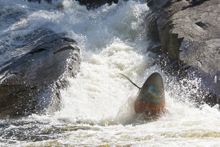
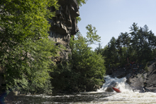
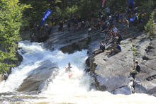
Big Hole (IV+). We scouted at low water and this looked like nothing. Was surprising to drop over without scouting it with water to find a big hole. We ran center driving straight perhaps a smidge to the left to punch the hole. To the right is a recirculating eddy. Downstream, the water flushes out and goes to rocks on the right downstream. Those ruin race times. If you are upright they are no problem. In all honesty, this is the hardest rapid of the run.
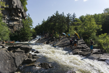
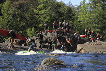
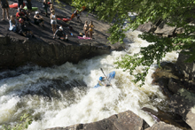
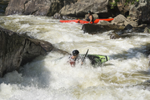
- Exit Boof (IV to IV+). Downstream of the Big Hole, you enter a nice straight away with some tricky off angle and offset holes. I just ran down right of center. This then rounds the corner and goes off a ledge, I liked to drive to the right and boof the flake just off of the right shore. Nice fun. Now, get out on the left and carry back up for another lap!
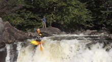
Take-out / Put-in: I am going to do directions from Belfort and the Taylorsville section as most people will be coming from there the one weekend that this runs a year. I enjoyed the dirt road drive which followed the lakes, bonds, and river up. This lets you scout Eagle if you are nervous for the afternoon following Moshier as well. There is a slightly faster way that is out on paved roads rather than dirt. Just map it. The way we went, from Belfort, on the south side of the river, take the first left. Follow this for 4.3 miles to a T, turn left on Soft Maple Rd. After 1.6 miles turn left to stay on Soft Maple Rd. Continue for 6.4 miles (note, you will cross the river after a little over a mile, there is a pay campsite to the left). After 3.3 miles you will see signs for the Portage Route which indicates you are passing the Eagle Section. There is a side road which parallels the main road, and is the access road. Either enter from the top or bottom. Top seemed to be better from a car flow perspective. The whole thing is walkable so there is really no reason to set shuttle... either park near the top (the gate on the trail is unlocked for releases) or the bottom where the wood stairs come up from under the pipe half a mile downstream.
HTML Comment Box is loading comments...
