Raquette (Stone Valley)
| Stretch: | Colton to Brown Bridge Rd |
| Difficulty: | Class IV+ to V |
| Distance: | 2.95 miles |
| Flows: | 500 to 1,500? cfs. Check out American Whitewater's current flows and North East Paddlers Message Board for the scheduled released |
| Gradient: | 213 fpm average (through Particle Accelerator) |
| Put-in: | Base of the dam in Colton |
| Take-out: | Lenny Road roadside/riverside pull-out |
| Shuttle: | 3 miles (10 minutes one-way) |
| Season: | Releases in July, August, and September. Runs occasionally due to natural rain |
| Written: | © 2016 |
| Featured in A Wet State #118 and in A Wet State's contribution to World Kayak's Video Guide | |
NY and Quebec 2016 2016: Day 3
So, finding the put in in the morning as well as the camping that we had hoped for... we decided to not bother setting a bike as there were enough boaters out. I am actually not sure this was a great decision in hindsight. It worked out, but it turned out it was all basically two groups out there. If we had dropped behind them we would have been hosed!
The river was actually much better than I expected. After the pond drop nature of the first four runs of the trip, as well as the fact that the only rapids on the runs were the ones we had seen in pics we began to not expect much. What we found was nice drops surrounding the two drops I had seen pictures of. From put-in to take-out was great fun. A nice warm up drop was the prelude to the biggest of the run, Colton Falls. Downstream two nice boogie rapids then led to one that completely surprised us, the Narrows. What a hoot. I wish we got some pics of it! Downstream was the next one I expected, The Tubs. Then another nice surprise, Particle Accelerator. All so much fun!
Throughout the day, I had chatted a few times with a nice guy from Montreal. As Chad began laying out all of his camera gear on the warm rocks due to the fact it was all soaking after an unfortunate splash wetted it all, the guy, Louis, offered to give us a ride to our car. I agree to paddle on and get the car while they dry the stuff. One important thing we forgot to think through though was that they (nor really me) had a firm grasp on what take out was. We were told a hike out, one is 20 minutes and one is 10 minutes after an additional 20 minutes of class II paddle. I knew we were going to the latter. But as I paddle away, Steve and Chad realize they know nothing about it... not even what side of the river it is on. And within minutes, the crowds of boaters and spectators on the shore had disappeared and they found themselves alone... and a little lost. I paddled down and find that the 10 minute walk is actually a 10 yard walk... car easily visible from the river. I think... "Well that would have been good info to know." Steve and Chad had it in their mind that the hike out was on river left. Which given the 50/50 nature of the guess was close... but wrong. While they paddled down they found beer bottles which they thought might have been left over from the race a few days prior and began hiking. After about a mile Chad opted to run ahead and scout... from another mile in he saw across the river, the cars... and went back to give Steve the good... and bad news. Time to hike back the way they came and paddle out. I on the other hand had gotten our car and came back expecting them to be there as they said they would be only 5 minutes behind. With them not at take-out, I drive up the river right side of the river to the other hike out spot... still nothing. So I try put-in again. Nothing. Returning to take-out I wait for a few minutes at which time Steve and Chad come paddling up with their story and we agree we need to execute better next time!
Next: NY and Quebec 2016: Day 4 - Ottawa (Main Channel)
Last: NY and Quebec 2016: Day 2 Afternoon - Beaver (Eagle)
Thanks to Chad Christopher for sharing some pictures from the trip!
Mi 0.0:
- Put-in Rapid (IV). The put-in rapid starts with some finesse moves. Most start far right to avoid peeling out directly into a pretty good size hole. This then either sets you up to push through the next hole and ride the boil behind it back to the left, or just surf the hole to the left to then exit with more water. Nice fun. One small rapid is downstream that we ran far left... and then you are at the big show.
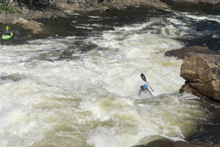
- Colton Falls (V). The horizon line is big. Bigger than anticipated for sure. Most will enter left of center over a shallow ledge, this lands you in a small slack water shelf that you can set angle and begin driving right across with the goal of boof the right edge of the ledge below. You don't want to melt off super early as there is pin potential. From there, you are between the two drops. The exit is a big slide that you want to be far right on, there is a boof flake at the top, some went over, I went directly to the left of it driving right. Slide down and around the huge hole that is the left 9/10s of the river. At higher flow the hole is even bigger! A small ledge is downstream and gaurds the exit. Run anywhere. I have also see lines of the top being run down the middle right. It is a big line for sure. Doable though apparently.
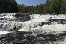
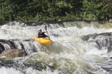
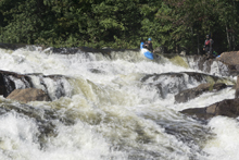
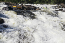
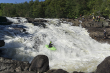
- Tannery Ledges (IV to IV+). Immediately downstream is a tricky rapid with some sticky holes. We entered left of center and then boofed center and right of center. It kinda just took us there as we didn't scout. But it worked!
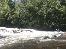
- Mushroom Ledges (III+ to IV-). A short ways downstream is another horizon line. The common line is the far left of the middle ledge. The middle part is pretty burly so don't error too far right. The far far right channel and the left channel also appeared runnable.
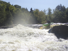
- The Narrows (IV+). This one surprised us. We could tell it had gradient. But there were some boaters in front of us that appeared to know the lines so we just followed their heads. The line, definitely be in the left half of the river as it splits around the island. The right gets ugly quick. However, within the left channel, be far right against the island. The left side drops into a large and ugly hole. The right side is a short slide that then makes a 90 degree left turn and boofs 8 feet down into the main flow. Just below is a sticky hole to punch before you get out to scout The Tubs
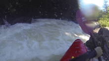
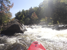
- The Tub (IV+ to V). Scout left. Several different lines. Some people eddied at the lip on the right. Then ferried back over. Others like me just ran it direct. The drop has two ledges. The first one you want to be maybe 5 feet off of the right shore and boof straight. The right half of the drop is a large whirlpool eddy. Some guys were dropping in on purpose at 720 cfs. They were all getting beat before getting spit out. The bottom ledge is best run to the far left of the main flow.
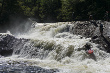
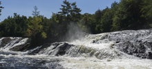
- Particle Accelerator (IV to V-). Just downstream is another island, scout from it. The right side is the main drop while the left side apparently has a class IV falls. The Particle Accelerator though is the right side. A slide should be negotiated to move you back to the right, the way the curlers are moving you, so that you drop off the broken ledge somewhere to the right of the center split in the ledge. The left side is ugly... but would take a lot of work to get over there.
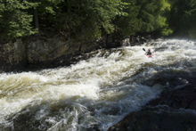
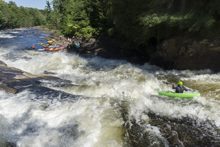
- 200 Proof (IV to IV+). 100 yards downstream you enter a boulder garden which then picks up. We ran down left of center with the main flow. This then ramps out into a nice slide with a nice fluff wave hole at the bottom. Totally caught me by surprise (didn't read a detailed description beforehand) so I was smiling big.
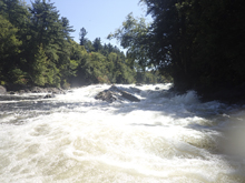
- Optional Hike-out take-out. Hike out for 10-20 minutes (I was told) or paddle to your car in 20 minutes. It is probably a crap shoot as to which is quicker.
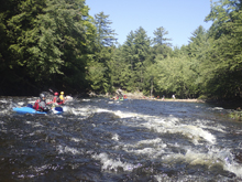
Take-out: From Colton, take NY-56 North for 2.4 miles. At a larger four way intersection, turn right onto Brown Bridge Rd. Cross the river and turn right on Lenny Rd. In 0.4 miles the river is directly next to the road and there is a trail that leads up. See the put-in directions for the hike-out take-out directions
Put-in: You can either go back the way you came and cross the river at the top and turn left and park for put-in... or continue up Lenny Rd which immediately turns to dirt. After about a mile you pass a large area with a road to the right, this is the hike-out take-out spot. Continue up the road for a total of 2.4 miles before joining the pavement and keeping right. At the intersection in town, turn right and turn right just before crossing the river. This is at the Fire Station that you park at for put-in
HTML Comment Box is loading comments...
