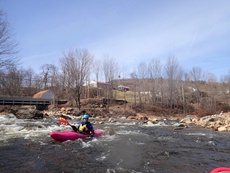
West Branch of the Deerfield River
| Stretch: | Heartwellville to Readsboro Village |
| Difficulty: | Class IV to V |
| Distance: | 3.5 miles |
| Flows: | Correlation to the Walloomsac River. 2.0 is low and 4.0 is high (3.25 seemed medium). Visit the flow page |
| Gradient: | 188 fpm from First Bridge at The Wall to the Bridge at Low Chair (154 fpm average total) |
| Put-in: | Bridge at Howe Pond Rd |
| Take-out: | Downstream of Reedsboro, VT |
| Shuttle: | 3.5 miles (10 minutes one way) |
| Season: | Spring from rain and snow melt. Occasionally off of thunderstorms. |
| Written: | © 2015 |
| Featured in A Wet State #99, in A Wet State's contribution to World Kayak's Video Guide, and John Moore's rapid-by-rapid video | |
North East Roadtrip 2015 - Day 2
Waking up in the morning in Pennsylvania, we knew that we were only going to target one run for this day. So waking up leisurely in what would be the last warm morning of our trip, we hit the road to complete our last 3 hours of driving to get to Vermont. As Diane had never been to Massachusetts we took a slightly different route in order to cut east early so we could have lunch and she could check of the state for her list. Back on the road we got to Readsboro around 1 and quickly set our bike at take-out and headed to put on.
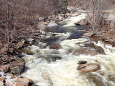
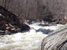
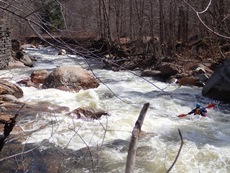
The run starts off with a few fun warm-up rapids before mellowing out which quickly eats away the mileage to the first hard section, just below the first bridge. This section has a very large and in play sieve in the first rapid, followed by a great boof and a boulder garden before it lets back up again. More mellow takes you to Tunnel Falls which marks the crux section. Downstream at this flow, only a few small eddies allow you egress from the river to the safety of the road above before the river drops into Breather... which at this flow had no eddies to egress below before Tunnel Vision... a stout, steep, constricted and dangerous drop that is certainly runnable... but that we had no desire to prove. Downstream the river keeps going with boulder gardens that get less defined as you get closer into town. A few scouts will likely be warranted before reaching the confluence with the Deerfield where the river has one class III waiting below before a quick paddle out.
We had 3.25' on the gauge which I felt was perfect. There were plenty of eddies, the rapids felt padded but not pushy. Although a friend told me 4' is high and 2' is low. I would have guess that it would be more like 2.5-4.5' just from some of the in between boney boogie at 3.25 and the fact that nothing felt like it was approaching being too high.
That afternoon, we continued driving north hoping to get on New Haven. After about an hour we passed Danby and I noted that Big Branch was in that town. An hour later we got a hold of our friend who lives near the New Haven who suggested that we hit Big Branch which was just getting low enough to run, and allow the coming raid to bump the New Haven up over the next day or two for a more optimum flow. So, backtracking an hour (what's 2 hours of extra driving after doing ~12 in 2 days) we went back to Danby and found the National Forest land at the top of the road where the Appalachian trail crosses to set up camp for the night.
Last: North East Roadtrip: Day 1 Afternoon (Lower Big Sandy)
Next: North East Roadtrip: Day 3 (Big Branch Brook)
- Readsboro Falls (V to P). Just at put-in, this rapid is a double drop that has a deep powerful seam. It looked very runnable, but also like high potential for a wipe out. We walked as it would be the first strokes of the day.
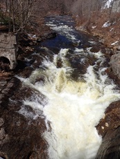
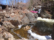
Holey Holey Holey (IV). Just downstream from put-in is a set of fun rapids, starting with a great boof off the left shoulder of the bank.
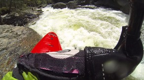
- The Wall (IV+). Just after you cross under the bridge you enter one of the hard stretches of whitewater. The first drop is a ramp that drops you down into a small chute that you HAVE to be right on as 75% of the water deflects left and into a sieve.
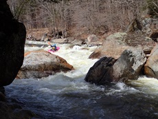
Cauldron (IV to V). Immediately below is a fun drop involving a big shoulder boof off the right wall. This then goes immediately into the next rapid with only one small eddy on the right between the two.
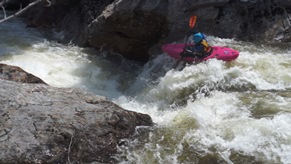
Faceplant (IV to IV+). One of us blew the eddy and ran this blind. Luckily it went both down the middle and down the right, splitting a double drop with the second drop on either side of a rock. This then feeds directly into the exit Ledge
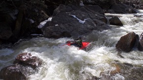
- Ledge (IV). The right had a nice boof we found from below, but was too hard to boat scout. So we went down the far left which we could boat scout and was straight forward.
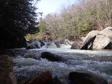
- Tunnel Falls (IV+). After a section of class II, the walls tighten and you get to Tunnel Falls. A 10-12 foot tall near vertical slide that ramps out into two holes. A straight forward rapid if you run right of center, but you definitely want to be in control as only a few small eddies are between you and Breather. We scouted from the road prior to putting on but we were also able to hop out on the left to video from the lip.
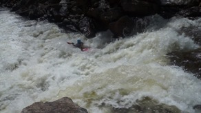
Breather (IV+ to P). Honestly, we didn't look at this that much. From our road scout we didn't see any eddies or way to climb out of the river before you drop into Tunnel Vision. Because of that, we portaged this at the same time as Tunnel Vision. The line looked to be to either side of a pillow rock at the top. Then generally middle through some splashy fun stuff.
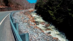
Tunnel Vision (V to P). This rapid is tall and nasty and changes regularly with high water. There was a line that we saw down the middle, then moving left, then dropping into the tunnel generally left. But with only two of us, and being day two of our trip... we figured we didn't need to bite this one off. We portaged using the road on the right.
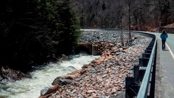
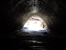
- Howe Pond Brook Rapid (IV+). Just after putting back on at the base of the tunnel you are greeted with this nice long rapid. It started with some read and run down the far right. I think lines were also open in the middle, but there were some boulders there and the boat scout showed us down the right. The second part was straight forward down the left punching a few small holes. The exit was in a constriction. We caught an eddy at the lip and scouted on the left. It turned out to be mellow down the left. There was a sneaky piton rock dead center that I could see folks finding if they bomb in.
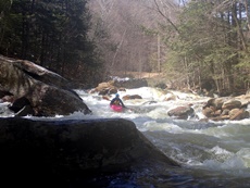
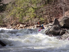
- High Chair (IV to IV+). Once you pass the lumber yard, the river braids out. We went with the main flow down the middle moving left and punched left through a decent hole at the bottom. Diane flipped and ran the exit blind as I yelled the beta I could see from my eddy. Straight forward enough thankfully though, the river s-turns and pillows up on a large boulder on the left shore. Just ride the pillow.
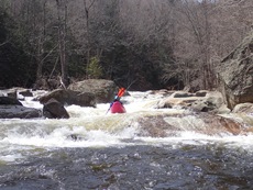
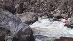
- Low Chair (IV+). This is kinda two part rapid that starts just below High Chair. The first part was a fun wave train that was fast and directly under the bridge. We then eddied out left though scouting from the right would have been better. The exit is a steep boulder drop. Due to wood on the left, it was obvious to start right and then exit in the middle. It is rocky and congested. So keep it hairy side up in this one!
For more details on the run, see the AW write-up...
Take-out: Get to the town of Readsboro Vt in southern VT, just across from the Massachusetts border. On VT-100, take the first road north-west of the bridge over the Deerfield. This is Tunnel St, follow it downriver for 0.7 miles. Park across from the last house on the right.
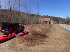
Put-in: Go back to VT-100 and turn left. Follow it for 2.8 miles to a a pull out just before a road between an old barn and a house. Park at the pull-out and walk down the road to the bridge to put-in. The walk is only 100 feet or so.
HTML Comment Box is loading comments...

