
Big Branch Brook
| Stretch: | Picnic Area to Mt Tabor Rd |
| Difficulty: | Class IV to V |
| Distance: | 1.35 miles (+1.4 for the Upper section) |
| Flows: | Look at the West River at Londonderry for a correlation. 1,600 cfs is optimum for a medium/good flow. I think ~800 is bare minimum. I would guess around 2,000 is getting big. We had 1,500 cfs and felt it was a great flow. Visit the flow page |
| Gradient: | 327 fpm |
| Put-in: | Picnic Area at the Landslide |
| Take-out: | Mt. Tabor Road |
| Shuttle: | 1.7 miles (5 minutes one way) |
| Season: | Spring from rain and snow melt. Occasionally off of thunderstorms. |
| Written: | © 2015 |
| Featured in A Wet State #99 and in A Wet State's contribution to World Kayak's Video Guide | |
North East Roadtrip 2015 - Day 3 Morning
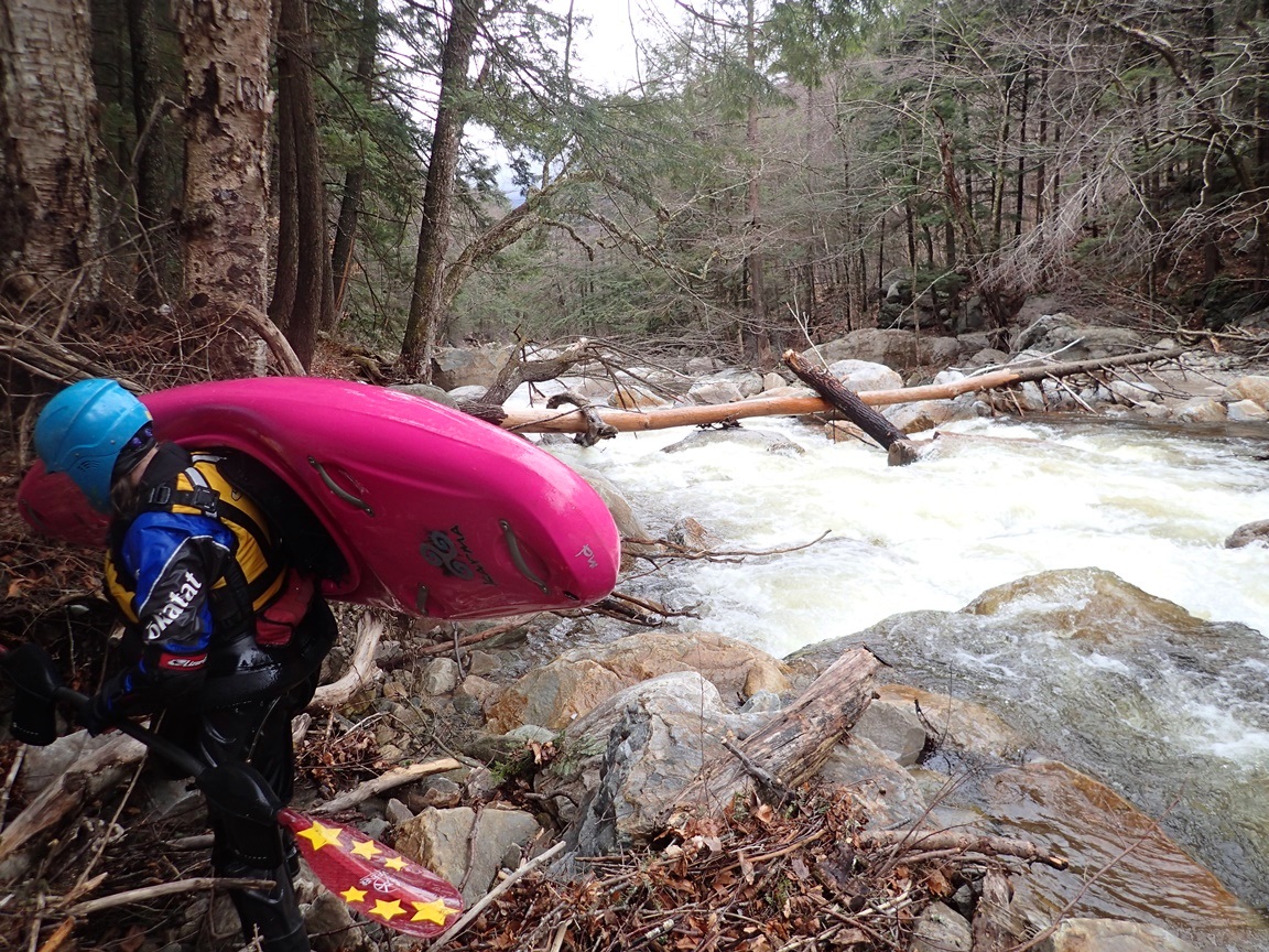
We had hoped for the best the previous night when we set up our tent. Arriving after dark, we couldn't really search the woods for a nice spot so instead we chose to just set it up behind the car in the Appalachian Trail / Long Trail Parking lot. And regretfully, hoping for the best does little when it rains all night when you are set up on pavement. Thus, awaking to tent walls soaked through due to a fly not being staked out and a ground tarp that had soaked through I knew it would be a long day. Going out to the car to get the guidebook, I return to tell Diane some other bad news... the rain that had been falling was actually freezing rain. She was unamused.
The plan was obvious now... lets go find a café in Danby to get some hot coffee and warm up some before putting on. We found said café on the other side of Danby, in the General Store at the take-out of Mill Brook. Warming up we found out that the area had experience 40 mph winds. I guess we were sound asleep and that the car had protected us from the wind. An hour of chit-chatting later we headed up river, setting our bike at take-out and heading to put-in.
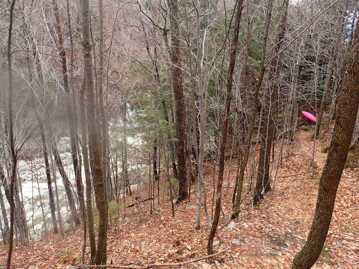
For folks who might so desire, you can hike up from the trails using the Long Trail to hike a mile upriver adding ~1.4 miles of river. I have read that this section is good, some fun boofs etc but the crux is certainly the lower. We put on at the lower spot as we were hoping to do Mill Brook that afternoon before driving North to our friend's house where we intended to dry out and warm up for a night or two!
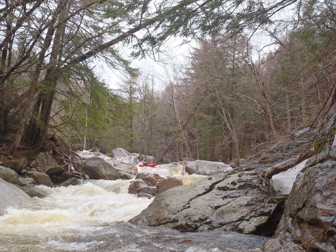
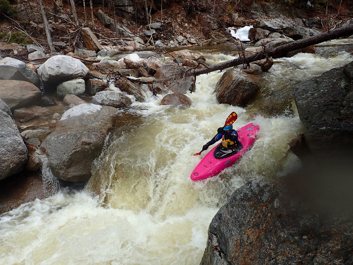
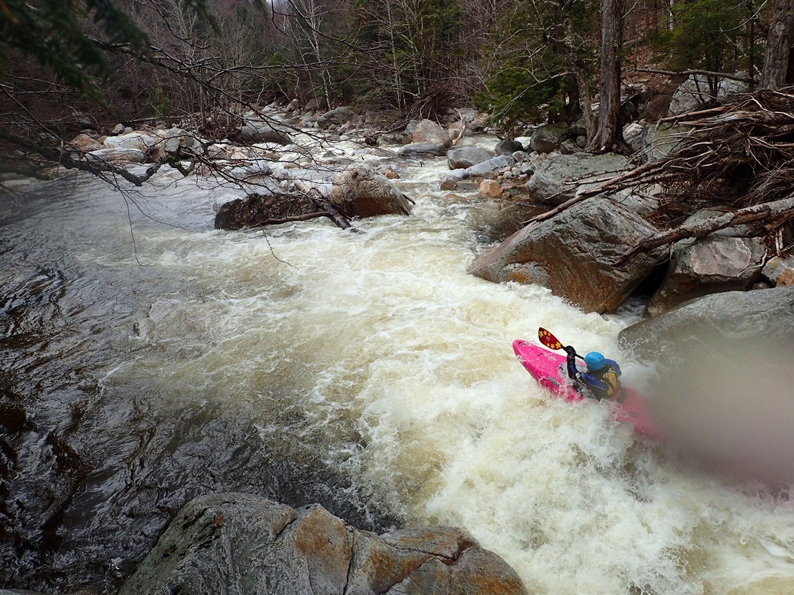
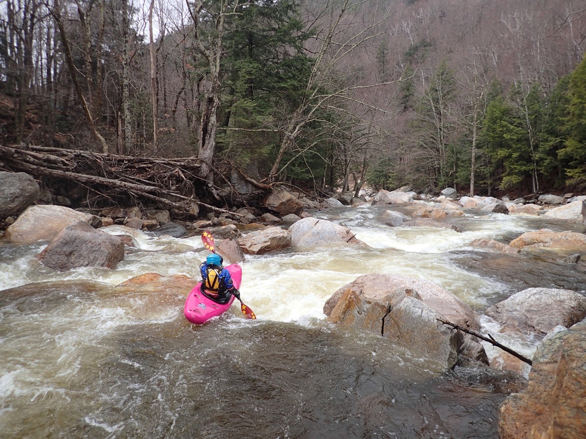
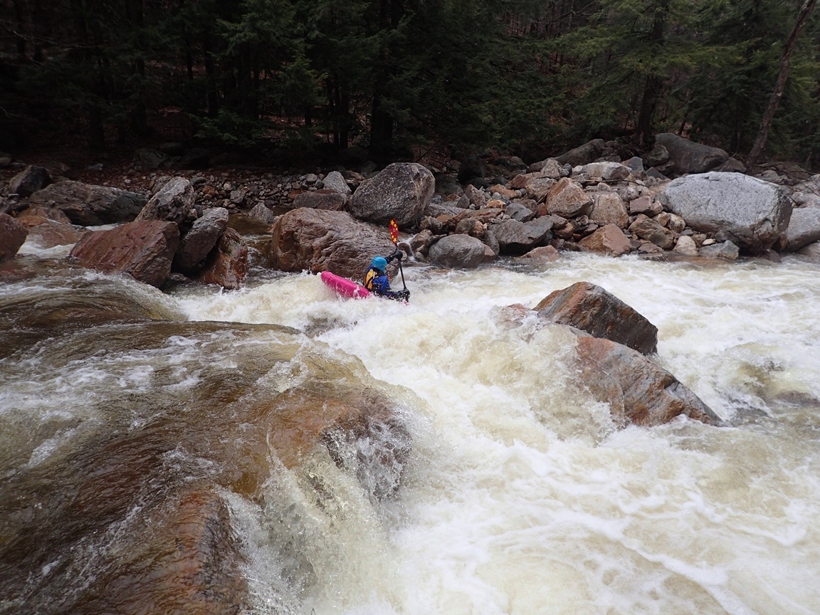
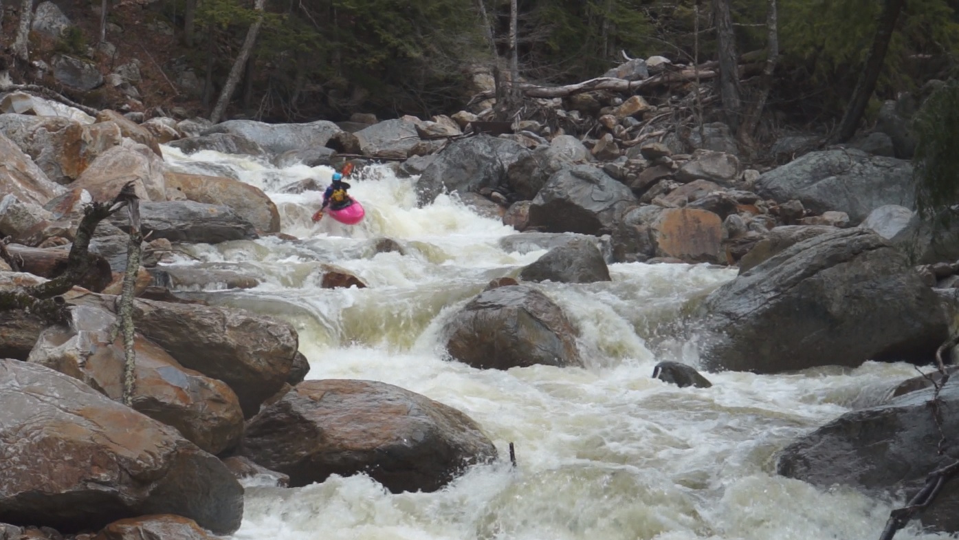
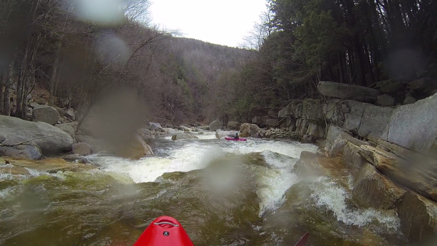
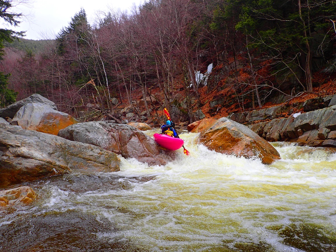
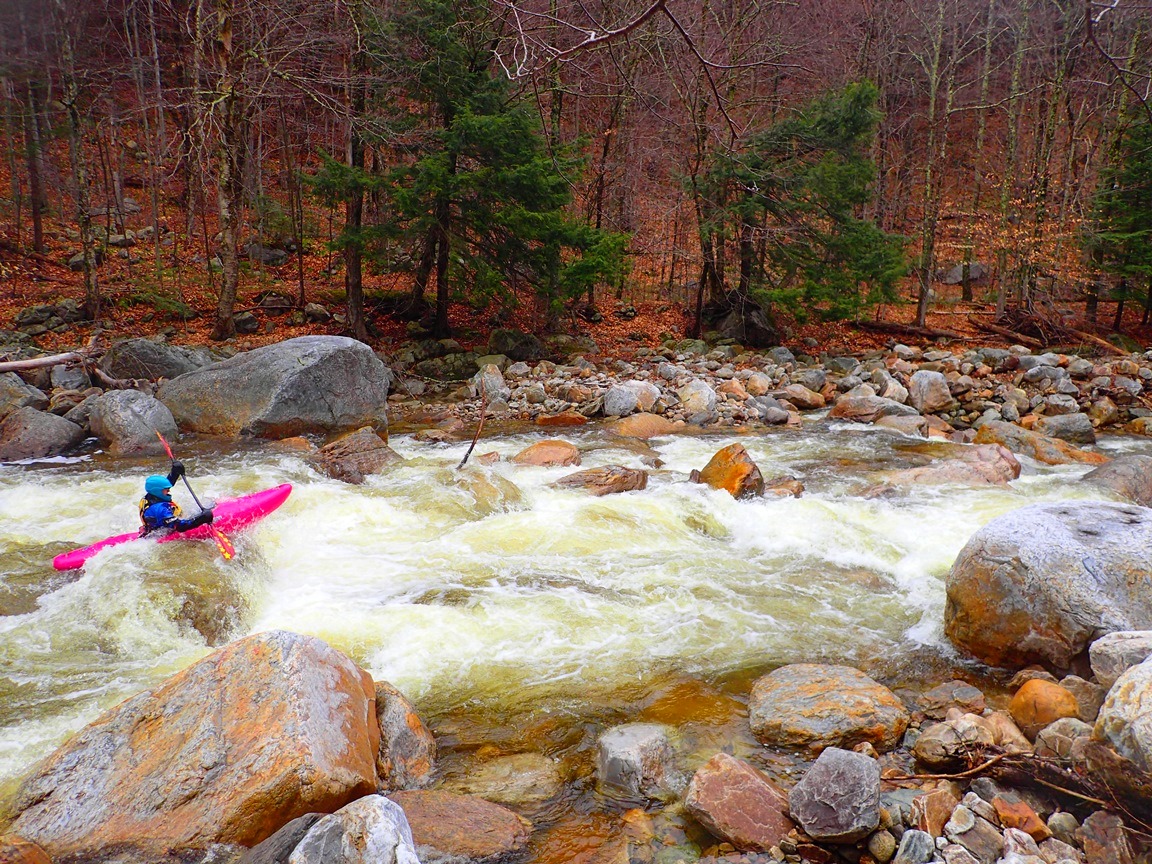
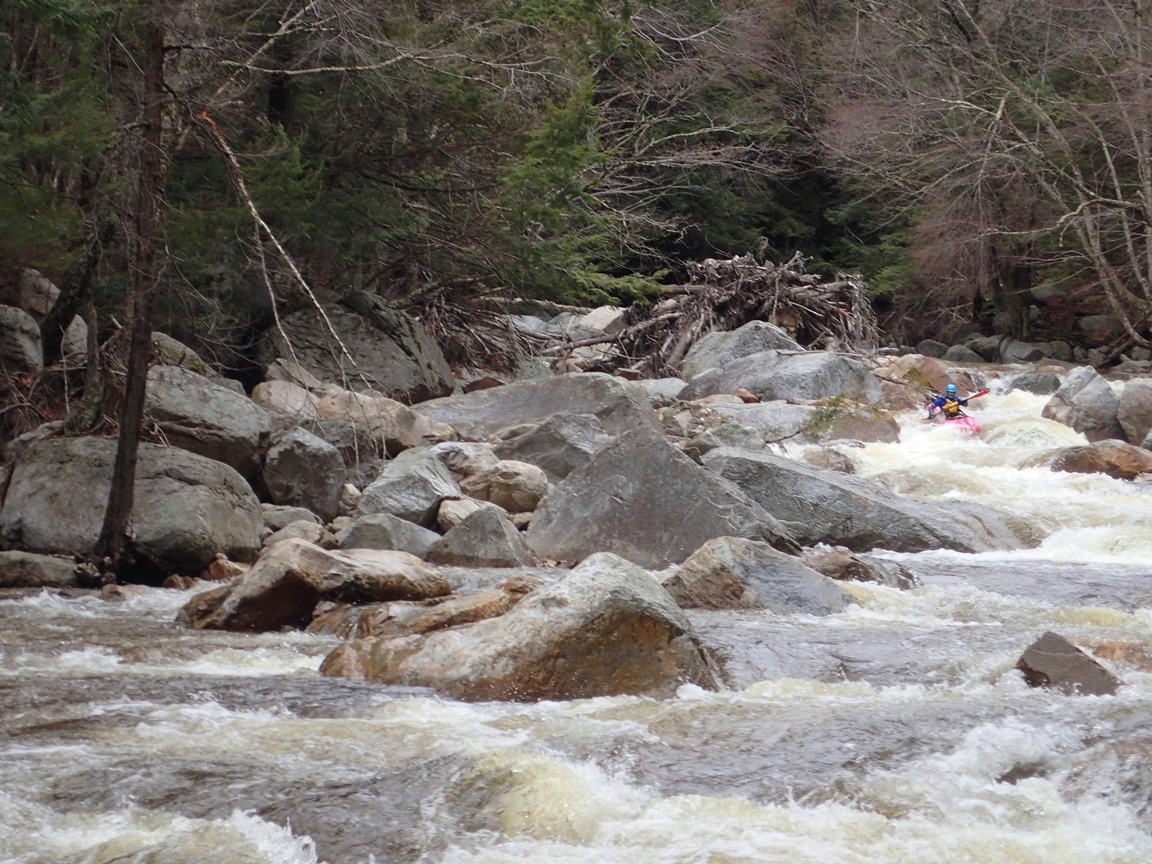
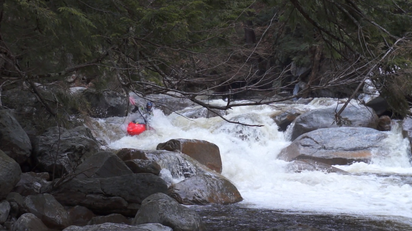
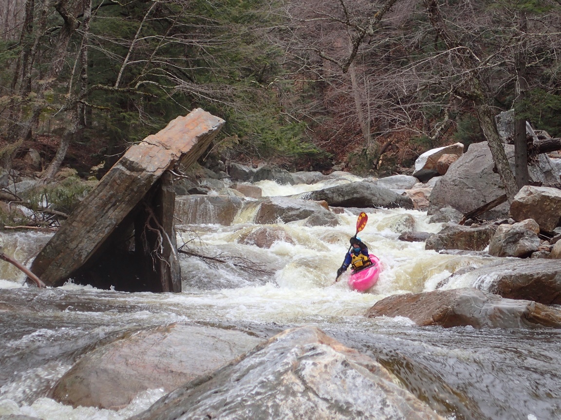
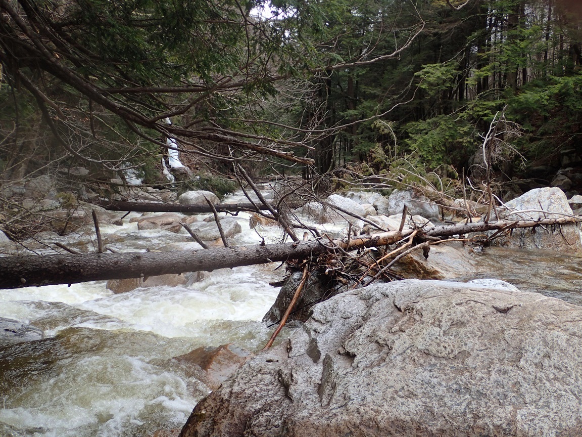
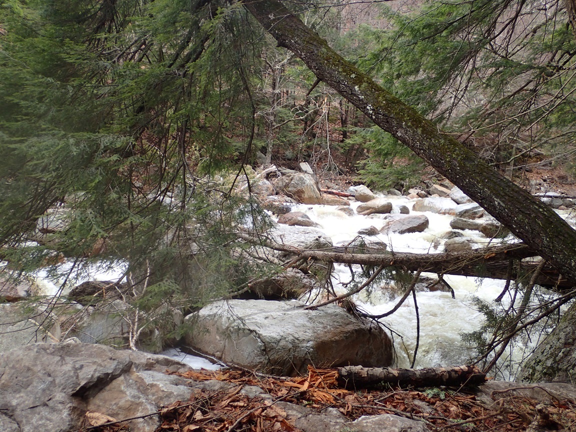
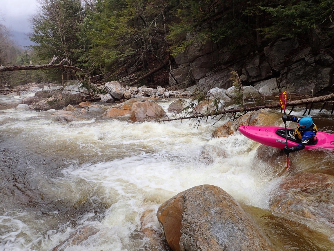
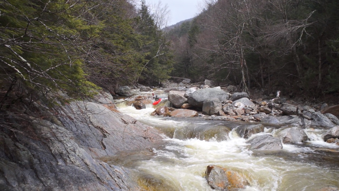
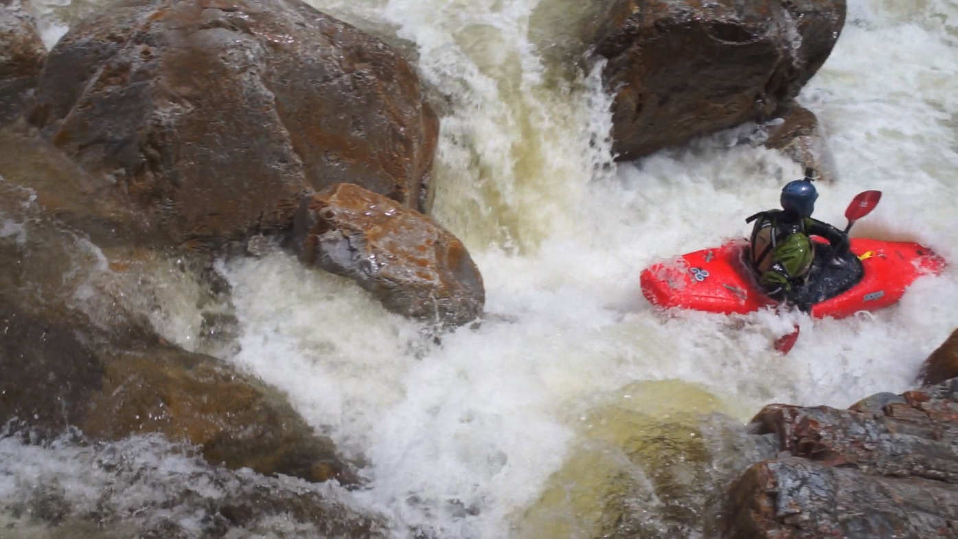
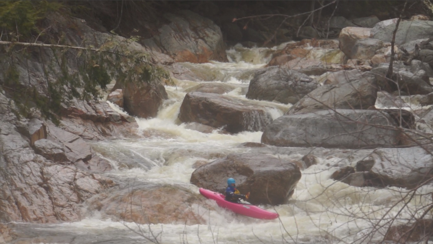
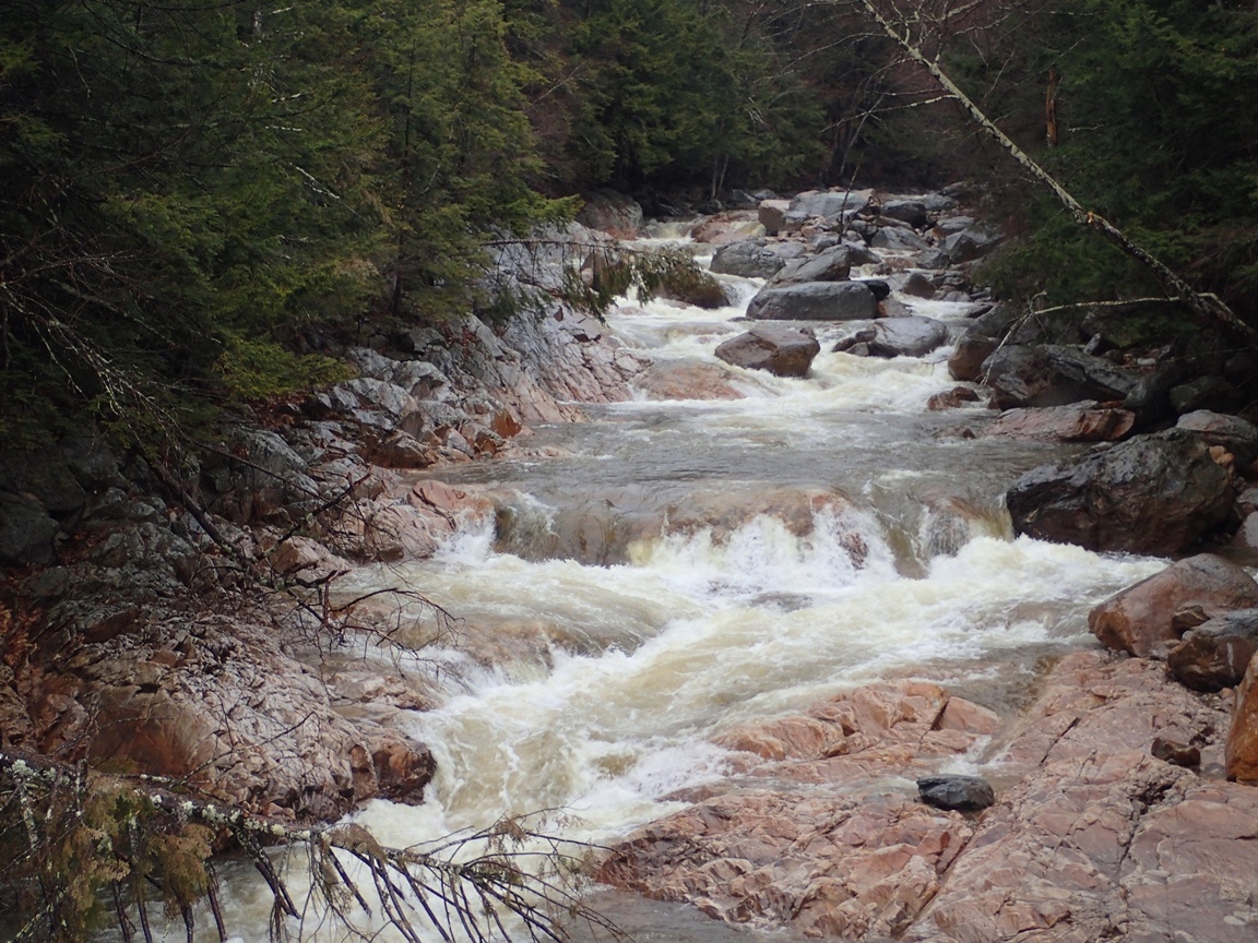
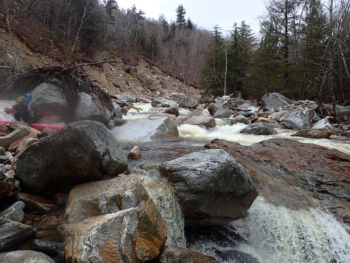
The river starts off fast with your first strokes being for a great boof and does not relent until the take-out. 250 boofs per mile is an accurate description. The nature of the river meant that Diane and I made slow progress though, as said boofs were often blind, and eddies were infrequent enough, while wood was frequent enough to make us ensure the safety of each 100 yards as we approached it. We quickly ran Caveman which post-2011 is mellower than it used to be, made a quick portage around a jumble whose sneak was blocked by a tree, and then progressed downriver. The highlight for me was BLT whose long boulder garden lead in was great fun and dropped a solid distance in an unrelenting pace. Downstream things got a little mellower before we then began hitting downed trees. Not just a tree here or there. But rapids with 4 or 5 river wide trees. Sometimes forcing us to start portaging on one side, ferry across and complete the portage on the other side. Quickly though we came around the corner and saw the bridge signifying the final rapid. This rapid is a great finale full of fun boofs over holes and with some consequence in the middle.
Arriving at take-out, the wind was still roaring... literally, the sound of it cresting the ridge above was as loud as a jet taking off. As we unlocked the bike, Diane (whose turn it was to ride shuttle) decided the bike was silly and decided to walk it. Returning she proclaimed the foresight she showed stating that the wind was blowing her off the road while walking the shuttle and the bike would have been worse. With that, we headed back to Danby and the General Store to get going on a quick novelty of a run, Mill Brook.
As a note, we had ~1,500 cfs on the correlation. I thought this was a great first time flow. Felt maybe just a touch low of medium. Higher would work great but be harder to boat scout and catch eddies throughout the run. If you know it is clean of wood though and know the lines, higher would be great. Folks also run it very low... crazy low. In California the limit would be ~1,200 or so I think. Whereas I am told folks run it down to 800 here. I guess you take what you can get!
Last: North East Roadtrip: Day 2 (West Deerfield)
Next: North East Roadtrip: Day 3 Afternoon (Mill Brook)
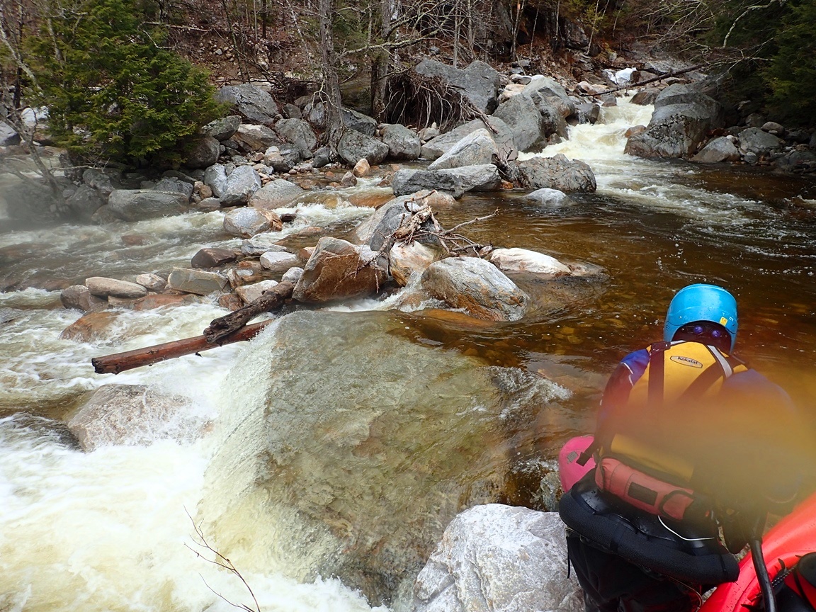
- Landslide Put-in (IV). From put-in, the rapids start immediately. Peal out for a sweet boof. This then leads down a straight away with a few holes. We hoped out to scout once. Then you are quickly at Caveman.
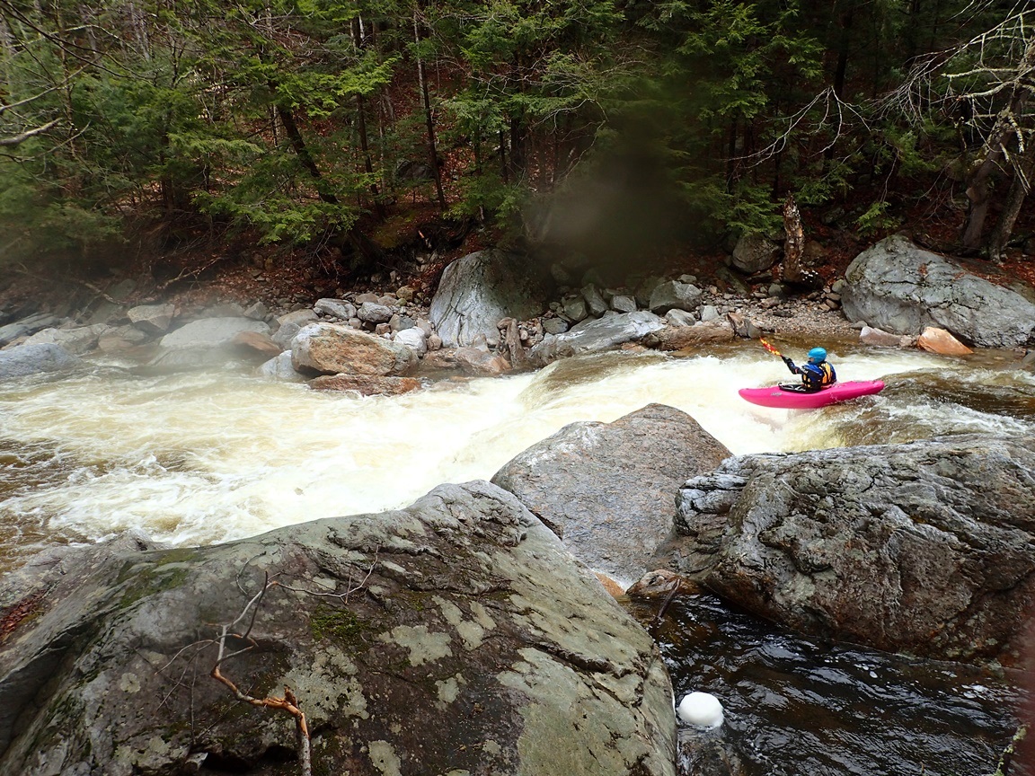
- Caveman (IV to V). As the river bends slightly left, the river splits into channels. We scouted from the left and saw a double drop that was not sticky on the left. It turns out this is Caveman. Apparently prior to 2011 the cave was more in play. As long as you are straight it all goes fine now. Just downstream the rapid enters a boulder clog. We scouted from the left and right islands and could not see a line that was worth running, so we walked down the left island. Apparently there is a sneak on the right... but our day there was also wood blocking the one somewhat clean line we saw over there.
Boogie (IV to IV+). Downstream lays some nice boogie. We hopped out a few times to scout due to the blind nature of the river. After a small slide and some boogie down the right, the river bends gradually left signaling one of the bigger rapids of the run.
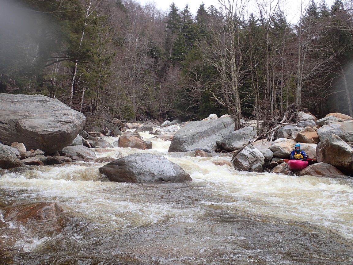
- BLT (V). I am not 100% sure that this is BLT (Boof Left Twice). But I think it is. We scouted the lead in on the left and found a nice line boofing down the right. This is one of the steeper boulder gardens you will run. I think BLT is the exit just downstream of this. At that point, we scouted on the right and could not see what was going on on the left, so we ran a shallow line on the right. But I believe the left ledge is the BLT rapid proper.
Boogie (IV to IV+). Lots more boogie. We hoped out several times to make sure rapids went and were clear of wood.
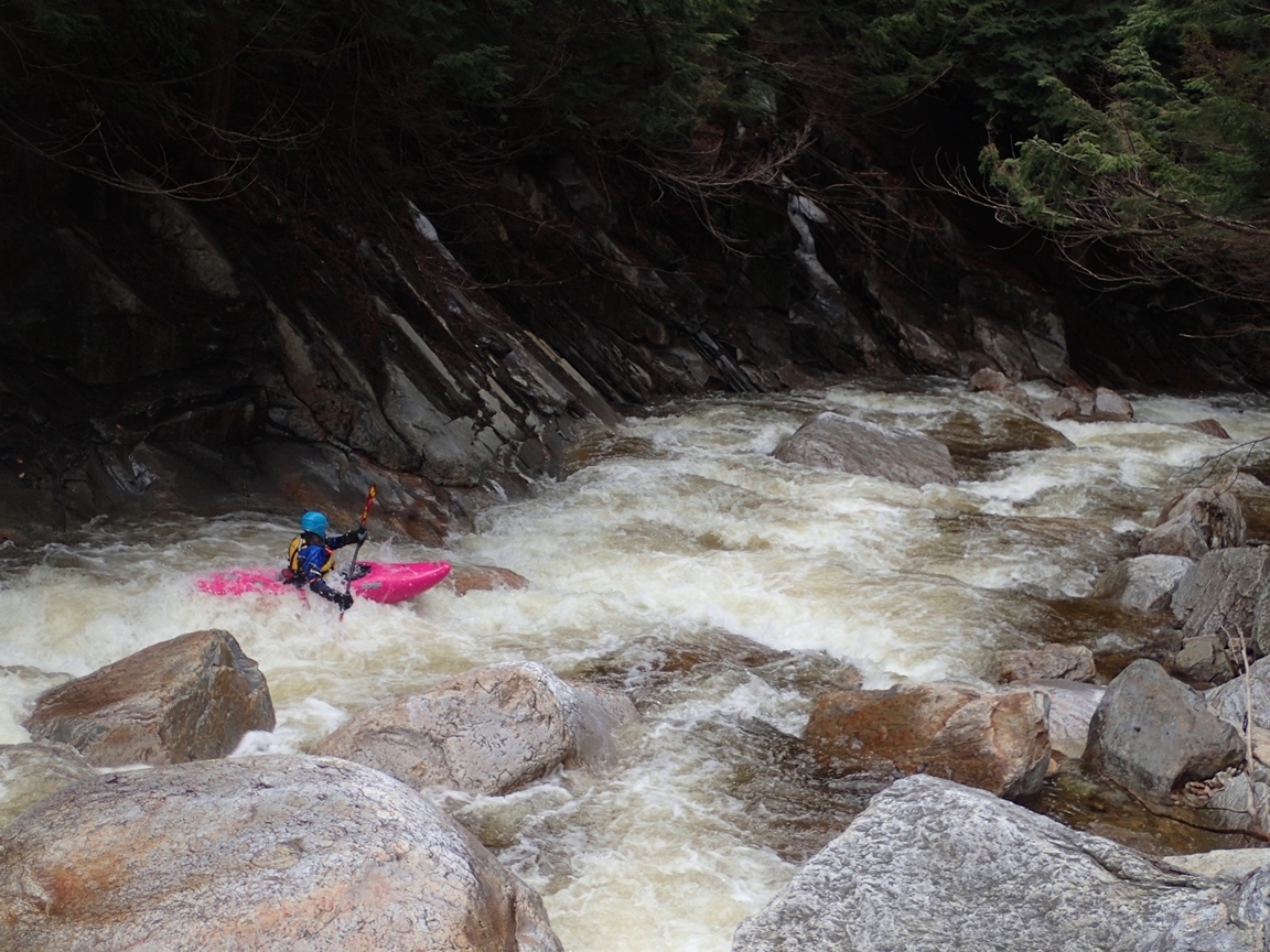
- S-Turn (IV+). This rapid stood out to me as it was a bit junky and totally blind. We scouted on the left. The line involved s-turning to the right and then back left. There was some big piton potential if you ended up left too early. And it was a little junky if you stayed right too long.
Boogie (IV to IV+). Below here we only got to run a few in between rapids while portaging several log filled rapid. It is going to take the local kayakers some time I think to clean this section out.
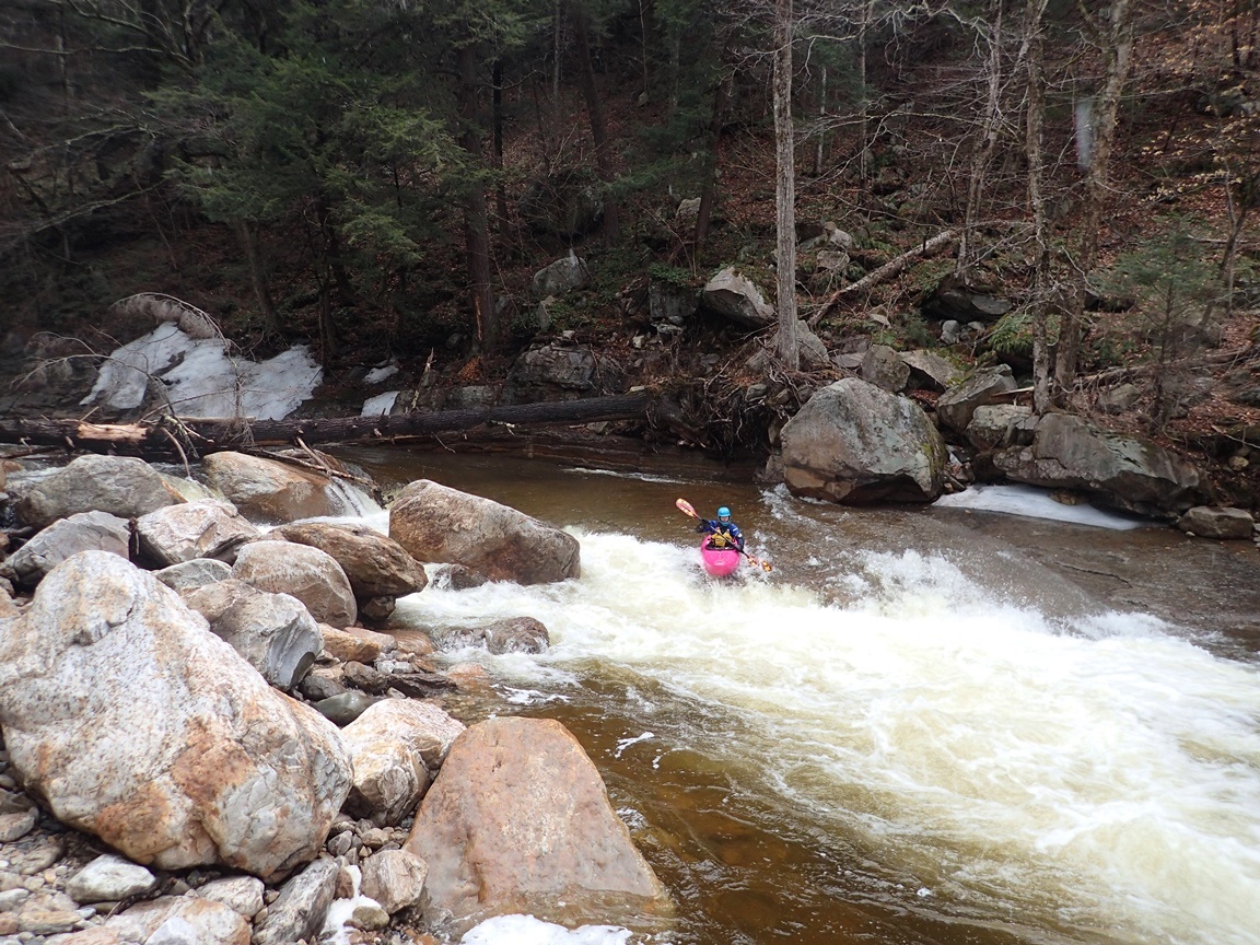
- Last Rapid (IV+ to V). What a great way to finish the day. Scout from the right so you can see the middle slot move. We ran the first left over the main hole, you could also enter right I think. We then stayed right over a small hole that fed back left into a boulder clog, easy move though. The exit of that move is a small slot on the right bank that you want to take straight, avoiding left angle as you could breach if you let your bow drift too far left. Downstream you exit through one more ledge that can be run anywhere. You then take out on the left.
For more details on the run, see the AW write-up...
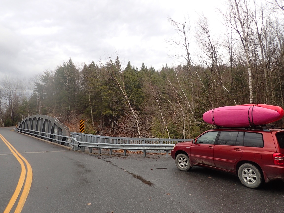
Take-out: Super easy, as you come into the small town of Danby on route 7, look for Mt Tabor Ave. Go East on it for 1.0 miles to the bridge over the brook. This is take-out.
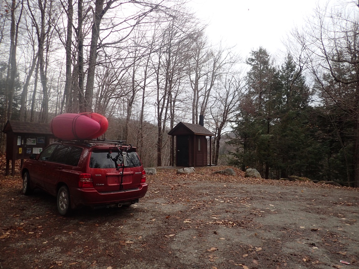
Put-in: Continue 1.7 miles to the parking and picnic area that will be on your right. There is a trail that leads down to the water. If you want to do some hiking for extra miles, continue 0.4 miles further to the parking at the Long Trail / Appalachian Trail. Hike the Long Trail to where it crosses the river in about 1 mile.
HTML Comment Box is loading comments...