Untertalbach
| Stretch: | Above the Obertalbach Confluence |
| Difficulty: | Class V- to V |
| Distance: | 1.85 miles |
| Flows: | No Gauge. ~200-400 cfs |
| Gradient: | 264 fpm for the 1.1 miles of rapids |
| Put-in: | First bridge over the Untertalbach on Untertalstraße |
| Take-out: | Confluence of the Untertalbach and Obertalbach |
| Shuttle: | 2.8 km (5 minutes one-way) |
| Season: | May to early July, snowmelt. Sometimes rains off of rain |
| Written: | © 2016 |
| Featured in A Wet State #113 and in A Wet State's contribution to World Kayak's Video Guide | |
Austria & More 2016: Day 2 Morning:
Untertalbach is one of the reasons I wanted to come to Austria in the first place. Harry had told me about it nearly every time we kayaked together. And to his credit it did sounds rather nice so naturally I wanted to do it. We were lucky that the rain brought it just high enough to get it though as it isn't a gimmie to catch with water. To that point though, arriving at take-out we found low flow. Harry mused if it was too low, Reiner assured it would be ok. It turned out we had more than minimum flow once we were on the water though so that was nice. And it lived up to my expectations and is a classic.
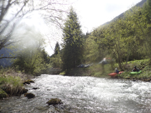
This run starts off with just a little boogie before dropping right down and into it. It has highlights which are bedrock interspersed with some boulder gardens. It is worth scouting a little from the road on the way in to ensure the wood situation is ok. The run starts with a nice sluice down the middle before you enter a nice boulder garden which leads to a ledge. You then get to a split drop where we ran left. This one is worth bringing your elbow-guards for sure. Downstream a little more boogie brings you to the main events. First you have the falls followed by a small slide and some short boogie. This leads to another big slide, a little more boogie, and then one of the best crescendos on any river, the final big slide. Our first run took us maybe 1.5 hours or more. The second run took 20 minutes. Jim and Reiner on their third, only 16 minutes.
The most memorable thing for me about this creek though will be the first time running the 6m drop. After having a good line and expecting hooting and hollering upon landing I instead hear someone yelling in German. It is Reiner screaming his head off at someone. I make eye contact with Jim asking what is going on to which he shrugs with "I don't speak German" in his eyes. It turns out this landowner decided to throw sticks at Reiner, eventually throwing something large enough that it knocked his new camera out of his hand and towards the river. As he scrambled to save the camera something large then hit him in the head. To which.... Reiner did not respond well. We were able to laugh about it later in the trip, but it does highlight that landowners are not overly friendly to kayakers in Austria. And as a rule of thumb, you can walk through the woods along the river, but do not ever walk through a meadow of grass. That is illegal. We were following these rules and were well within the woods. But it highlights the issue. Additionally, there has been a struggle over this river as the local city wants to 1) make it illegal to kayak because kayaking is dangerous and 2) dam the river for whatever reason.
One final German lesson for everyone to finish. Untertalbach can be broken into three words Unter-tal-bach meaning lower-valley-creek as opposed to the Obertal which is the creek in the upper valley. Not a creative name, but there you go!
OK, one more tip from Harry to share: It gets much more serious when the level is high... The drops don't get much harder, but the whole run gets very fast with big holes to avoid in many places. High water makes this one change its face a bit. It's gets better, but also much harder.
2021 Update regarding access and the ongoing interactions with the local community:
Because after many years of conflicts in Untertalbach -valley we finally got together with the landowners and the City Schladming.
We are trying to find a solution that everyone involved can live with, we will have several rules at Untertalbach - valley that we have to respect in future!
Please respect these rules, even if some things are a little more complex than before!
Although it is officially allowed to paddle the Untertalbach, as it is a public water property, all surrounding areas are private property. Please respect this !!
The rules about a possibly permitted preliminary inspection of the 1st rapid + gorge to the left on the hiking trail are still being discussed, and are currently still prohibited!
Now to the current rules!
1. The old hiking trail is no longer allowed to accsess (PRIVATE Property) therefore it will no longer be possible for photographers and viewers to scout in advance and walk with them
2. Visiting (scouting) + setting saftey, only in the immediate riverbed (do not enter meadows)
3. Scouting and stop of the"Mill-rapid) ONLY !!! from the LEFT BANK !!! Right = private property + company premises
4. If possible, only 1 person per group get out and check for blockages/trees
5. No "illegal" overnight stays in parking lots in the valley
6. Don't leave any trash (according to the property owner it happened again and again)
7. Put in and Take out only at the public parking lots!
8. The Community chairmen wants to set up warning signs(in DE / EN / CZ language) that indicate the difficulty of the section in order to keep away paddlers who are at the limit with the difficulty of the section. Due to the problems and regulations, this is no longer a WW 5 stream to test its limits. If so, please only at low water where it is not necessary to leave the riverbed and someone is there who knows the river well, in order to avoid unnecessary boat mountain situations as best as possible According to the property owner, the reason for this are some incidents of people who have carried out across the meadows or paths to the street, because they had to break off because of the rivers too high difficulties!
9. Be friendly to the property owners, even if paddling on the UTB is allowed, we are all guests in the valley!
10. Do not cut trees yourself!
11. In an emergency / injury, every bank may of course be stepped on! But everything that can be prevented from entering the bank is good. However, you can be held liable for any damage (agricultural areas / fences).
Recommendation on our part,
• 1st rapid: Get off directly in front of it and scout right
• 2nd rapid: Gorge/ slot) either scout to the right in front of it (difficult to see) or get out to the left directly in front of the gorge and proceed directly to the edge of the gorge in the forest (do not enter the meadow)
• Waterfall: visit on the right at riverlevel
• Mill-Rapid !! VISIT ONLY LEFT! Get off on the left too! We know the eddy on the right invites you to get out, but the biggest problems were in this area.
• Silver cataract: river-right at the water level is a small path, please use it and do not leave it !!
We will inform you as soon as we have new updates!
Please pass on / share and address paddlers who do not adhere to it!
We want to create a more relaxed atmosphere in the future and not constantly discussing, being reported and annoying property owners.
Additional request / recommendation:
Use the gastronomy in the valley for a visit after the trip.
The people in the valley should see that the paddlers also have a use for the valley, and we are not just the people that nobody wants, sleep in parking lots and trample through meadows 🙂 (I know this only applies to a few, but still)
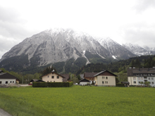
Thanks to Harald and Reiner Glanz as well as Jim Janney and Robert Machacek for sharing photos and for making the trip possible!
Last: Austria & More 2016: Day 1 Evening - Koppentraun
Next: Austria & More 2016: Day 2 Afternoon - Lammer (LammerÖfen)
Mi 0.3:
- Slot Slide (IV+). The first drop comes pretty quick, it is worth looking at if it is your first time. On the first left bend, scout from the right before the class II picks up steam and drops you into this drop. The idea is to go down the center with a little left angle to avoid getting a bunch of the right wall at the bottom.

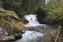
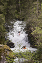
Gorge Drop (IV+). This then immediately goes into the next rapid. First, go right of the large truck size rock, the left is occasionally full of wood. Below, starts a busy boulder garden set of rapids that leads to a boof over a stout little hole. This then leads to a bedrock drop where you want to be right of center, but really don't want to be far left. This section can be scouted while driving up as it is directly next to the road. Eddy out right below for the next slide. This one apparently gets the most chaged with higher water, much more linked and serious.
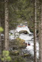
- Island Slide (V-). For a few years the left side had a log forcing you to run the stouter right line which boofs over a pothole. The left side of the island is a slide where you drive left of the island and then ricochet down a narrow slide before turning 90 degrees right and boofing a small hole. This rapid alone is good reason to where elbow guards and even pogies. You take some shots sometimes in there! This is also the site of the fatality that took place on this river. Apparently someone swam in the Gorge rapid above and ended up with the rope tangled on them which then caught in this rapid causing them to drown.
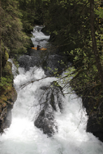
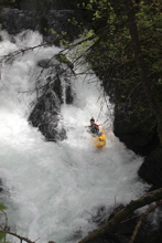
- 6m Falls (V). There is a short section of boogie. Scout on the right before going around the bend to the right as the boogie leads directly over this falls. The line on the falls is to get to the left launch pad. To get there you need to carry left momentum and boof two small ledges both moving left. The right has some rocks in the landing.
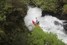
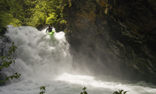
Exit Slide (IV+). Downstream is a fast slide that we ran down the middle through the holes.
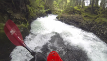
- Mill (IV+ to V-). When you see a footbridge overhead, it is time to scout. Get out above the bridge, and then walk under it in the water to scout. The landowners here are unfriendly and really do not want anyone walking on their property. The drop has a choice of lines. Down the far left which is bouncier or down the right of center off the big flake into a set of decent holes. An added level of complexity is also present at higher flows, as downstream 50 feet is a hole that you want to avoid to the left.
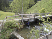
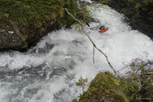
Boogie (III to IV-). Downstream is some boogie and some small slides that will quickly close the distance between you and the last big drop. Be on your toes for wood.
- Big Slide (V). This drop is 3 tiers and is long and a real classic. Additionally, there are multiple lines to run so that also makes this rapid that much better. The entry is a ledge that you want to run right. The first tier is then run left of center moving left. The right drops into a badly shaped hole. Overachieving left though will put you in the wall. The second tier has two choices. Either go left over the island hugging the right side of the channel to stay on the slide and not fade off into a pothole. The right side of the channel is a fluffy flume that then leads to a 90 degree turn to the left. Keep it upright here as the bottom tier is approaching fast. The bottom tier is a river wide hole. The easiest line is far left though anywhere goes. Just know that the right wall just below is called the "wall of shame" because the right side of the hole moves hard right against the wall which is slightly undercut and causes some swims. The exit which is just below is a set of soft holes to run down the left.
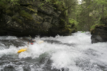
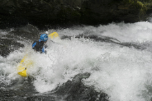
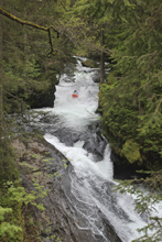
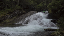
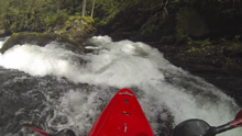
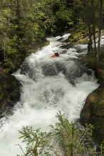
- One Last Drop (IV to IV+). After some boogie (and potentially wood to avoid) we got to the final drop of the run. This one is a fun boof down the center which then lands into a 90 degree turn and chute which deposits you in the pool below. Not hard, but surprisingly fun and sorta tricky to repeat good lines off of.
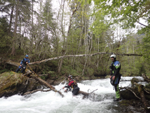
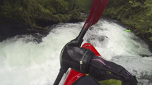
Take-out: Taking B320 (Ennstal Str), get to the town of Schladming. Once there, take Ramsauerstraße. Follow this up the valley, climbing for 3 km before finally getting to a roundabout. Take the left onto Tälerstraße and follow for 1.9 km. Just after you cross the river, park on the right at the parking area.
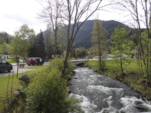
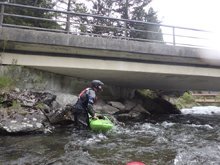
Put-in: Continue heading up the valley on what is now called Untertalstraße for 2.8 km. Park on the left just before crossing the river.
HTML Comment Box is loading comments...
