Lammer (Lammeröfen)
| Stretch: | Lammer Gorge |
| Difficulty: | Class IV |
| Distance: | 1.15 miles |
| Flows: | ~45 cm to 90 cm (71 cms felt medium-high) for normal flows. Check "The River App" |
| Gradient: | 36 fpm average for the rapids |
| Put-in: | Pull out above the gorge |
| Take-out: | Lammertal Str Bridge |
| Shuttle: | 1.8 km (5 minutes one way) |
| Season: | Spring is best because of snowmelt. Runnable year round... though that is because it is runnable very low |
| Written: | © 2016 |
| Featured in A Wet State #113 and in A Wet State's contribution to World Kayak's Video Guide | |
Austria & More 2016: Day 2 Afternoon
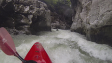
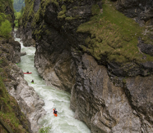
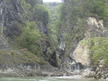
After doing some laps on the Untertalbach, we headed over to the Lammer. Although I had not heard of this river before the trip, and despite the fact that it wasn't the hardest rapids of the trip, I have to say it is one of my favorite rivers we did. The scenery in the gorge is out of this world and similar to only a few other rivers I have experienced. As you enter the first larger rapid, you come around a bend to find the walls have tightened, nearly touching at the top, and boiling, swelling water filling the void left between. I wouldn't want to be in this canyon at very high flow as the consequence of a swim would be legit. Even at our flow you might find yourself swimming for longer than you would prefer as often there were no spots to get out of the river to resituate. However with that said, the run itself was only class IV at our flow. I would say the first rapid and the rapid immediately below the first canyon are the two standouts and I could see both approaching class IV+ with the right flow. If you are unsure, lucky for you there is a trail down the whole canyon so you can hike it (I believe it was 3 Euro in 2016) and scout it before you enter. This also means that if you want to get some really nice pics, someone can take the lap off and hike the trail to document the run some which is what we did to get our photos (thanks Reiner!).
After doing two laps we headed over to camp near the Saalach river. Camp itself was muddy and kinda bleh, but it was raining, it was getting dark, and we were hungry so it fit the bill nicely.
For reference, we had 71 cms or 21 cumecs and this flow was considered medium/high.
Thanks to Harald and Reiner Glanz for sharing photos and for making the trip possible!
Last: Austria & More 2016: Day 2 Morning - Untertalbach
Next: Austria & More 2016: Day 3 Morning - Saalach (Lofer Gorge)
Mi 0.1:
- Boogie (III). Just below put-in, you get one warm up rapid. We boofed over the hole on the right, but you could have gone around it as well.
- First Gorge (IV). One of the tougher rapids of the run is right here at the start. It is an intimidating place, dropping into a walled out canyon. But know that if something goes wrong, there are no other rapids in this canyon. The crux of this one is to get to the far left as you enter as the right two thirds of the river is a rather large hole. The challenge with the water level we had was just that it was pushy and boils were coming off the walls. Would be a challenge if it is your first time paddling pushy water. At lower flows though I bet it is not a problem at all. Below, enjoy the amazing little gorge. There is just one or two little things as you exit into a pool.
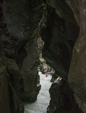
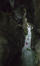
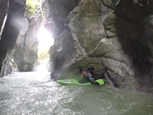
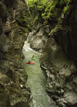
- Second Gorge Starts (IV). If you have had second thoughts, walk up to the trail in the brief break between gorges. The second gorge starts similar to the first, with the other "big" rapid of the run. We ran down the left until the turn to the right, where we booked it off the left wall and to the right as there is a large hole waiting for you at the bottom on the left
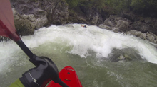
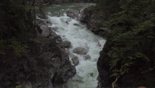
Boogie (III). There was a nice class III rapid with a fun boof on the right.
Hole (IV-). Not hard, but it is worth nothing it is sticky if you find the wrong place. It is a very obvious horizon line, we ran the left channel on the right side of it. Just get the nose up!
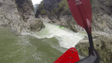
Fluffy (III to IV). A straight forward rapid with some weird currents, boils and eddies. Just stay off the walls which means starting a little left as a large current will push you right half way down.
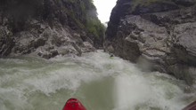
Run-out (III). The final section has some pretty mellow constrictions. Again, keep the boat straight and off the walls.
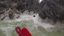
Exit (III). The final exit rapid pinches down to just a few feet across. If you are nervous, you can catch the eddy just before the pinch so you can line it up and ferry through it.
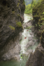
- Paddle Out Begins (I). The canyon opens up and you have a brief paddle down to take-out. Time for laps!
Take-out: Head south out of Salzburg on the A10 before exiting for Golling. Continue on Anschlusstelle Golling for 1.3 km. This then joins Salzachtalstraße (B159) which you only stay on for a few hundred feet before going left at the roundabout and joining B162, Lammertal Str. If you cross the river, it means you missed the last turn. Continue up B162 for 7.4 km until you now cross the river. Cross, and park on the right.
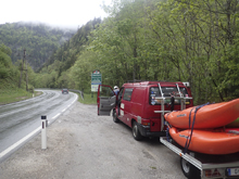
Put-in: Continue up B162 for 1.7 km. There is a parking area at like km 1.5, but that would require you to hike up the road a little ways. Instead we used a turnout with a trail down to the water.
HTML Comment Box is loading comments...
