Snake River (Murtaugh Canyon)
| Stretch: | Murtaugh Rd to Twin Falls Reservoir |
| Difficulty: | Class IV |
| Distance: | 11.6 miles plus 1.4 miles of lake paddle out |
| Flows: | ~1,500 to ~35,000 cfs. Check out American Whitewater's current flow gauge. |
| Gradient: | 27.5 fpm average |
| Put-in: | River access at the Murtaugh Rd bridge |
| Take-out: | River access at the dam on Twin Falls Reservoir |
| Shuttle: | 17.9 miles (30 minutes one way) |
| Season: | Dam Release. Sometimes it is rare, sometimes it is plentiful |
| Written: | © 2018 |
| Featured in A Wet State #140 | |
Jobless Summer 2019 Roadtrip Day 9:
The plan was originally to bike the shuttle, freeing Amanda to hang out with Penelope at camp or wherever. But after driving to Shoshone Falls the night before, we realized that the bike was going to be very long, and a hitch not likely as it was on small, gridded, farm roads. So, with her normal helpful demeanor, Amanda said that she could pick us up at the bottom. The other part of "the plan" was to get an early start. After the run, Diane and I intended to drive 9 hours to Portland where my family was all gathering for a wedding of a cousin the following day. So, the earlier start on the drive the better as it would allow me to actually socialize that evening with the aunts/uncles/cousins/siblings/nieces etc. So, with an alarm at 5 am, we were leaving camp by 5:30 and putting on by 6:15 am. We anticipated the rather long run taking us at least 3 hours, if not 4. We also weren't sure what the flow was going to be, the gauge had been crapping out, and we thought we would have somewhere in the 1-2000 range, which is not really a full flow for the river. Upon putting on, we found that we had 4,000 cfs which is a nice flow for the river for sure, and also made for much faster time down the run. We realized that we would make faster time as we pealed out and ran the first rapid or two, both of which were fluffy, fast, and surprisingly powerful. Thankfully the water was warm as the morning was still early and the sun far from cresting over the canyon walls.
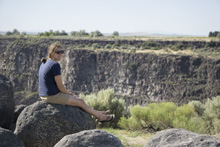
The canyon walls really are the main reason to do this river. As you drive in you will notice that all you see is a flat field. That is until you get near the cliff that suddenly drops into the crack that is this canyon. At the bottom, you are greeted with vertical walls rising out of the canyon, occasionally with springs or waterfalls that tumble in, and of course the fun rapids pinched between. The wildlife was abundant, with all sorts of birds doing their morning feeding. In all, the wilderness aspect felt legit. Which is fitting, because even though there are farms just on the other side of the canyon lip, getting to those farms would be dang near impossible at times. Once in the canyon, fully plan on paddling your way to the end. That means bring breakdowns etc and a mentality that you are in it to win it on this one.
The whitewater starts big and then calms down for a bit though stays moving the whole way. A few bigger rapids did surprise us as we went, one is a ledge that I have seen photos of people boofing far right, we instead ran a meaty line through some holes on the left as the boat scouting failed us on this one. Soon, you will see the highway bridge overhead and get to Pair of Dice which is a spicy rapid which should be scouted before running, whatever you do, avoid the river right side of the island which is a huge poorover hole. Downstream you get some ponds for the first time before the river spreads out into numerous channels. Downstream of that is the next big rapid, Lets Make a Deal. We ran far right which is door #5 which had a sporty line but went fine. Other lines look easier though I think each is a bit flow dependent. Downstream a few more fun rapids await before you soon hit the lake and a one mile paddle to the access before the dam.
To our surprise, it was only 9:00. We were on the water for less than 2.5 hours. So we called Amanda and she headed our way. We were then leaving take-out to get the put-in car and begin our long drive to Portland. By 10:45 we were on the road to Portland for the wedding festivities. It was July 4th, so thankfully we got there in time for the fireworks with the family!
On a side note, this run was my 500th Personal First Descent. I can't believe that I have gotten to see so many sections of river. And I was stoked to have it be such a cool, unique river, and to be with Diane and Paul on the run. Diane for obvious reasons. Paul because we actually learned how to boat together, as kids at age 11 or so. So, he has been there since the beginning of my boating career. So, all around, a special day for sure.
Previous: Jobless Summer 2019 Roadtrip - Day 4-8: Weber River (Henefer to Taggarts)
Next: Jobless Summer 2019 Roadtrip - Day 10-11a: White Salmon River (Middle)
Mi 0.05:
- Put-in Rapid (IV- to IV). Directly below put-in is a sizable boogie rapid. We ran right of center under the bridge and down the middle for the second tier of it.
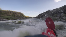
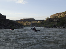
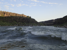
- 2nd Horizon (III to IV-). The mileage goes really quick in this section. The next horizon line was run down the right of center.
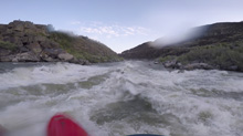
Boogie (III). The boogie in here is plentiful but I felt like it was just class III, at least at 4,000 cfs that is what it was.
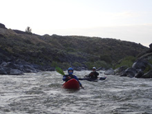
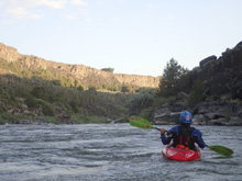
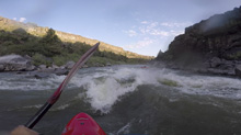
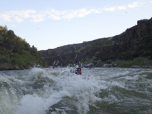
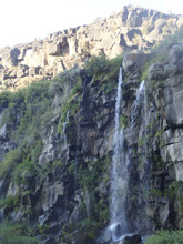
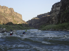
- First Chute (III). There was one rapid that at 4,000 cfs was a chute that we ran down the right. There was a couple feet of wall sticking out on the left that was undercut, stay away from that. At 10,000 cfs it would be underwater.
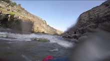
- Surprise (IV). There was a rapid that I think is sometimes boofed far right. But we just ran down the left and found large offset holes that surprised us. It was threading the needle but also totally good to go.
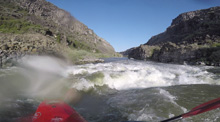
More Boogie...
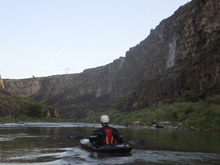
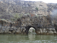
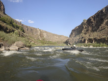
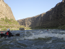
- Second Chute (III). Another rapid that felt like a chute. This one started fanned out, we stayed middle which was good because the right and left had ledgy holes.
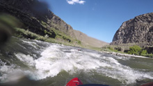
- Pair of Dice (IV to IV+). The biggest rapid on the run, we scouted it from the left. At 4,000 there was an eddy at the lip. At higher flows you might have to get out earlier as the channel had flow through it that we hoped out onto the big island to scout from. There were a few lines. The river left channel makes a 90 degree turn with some water dropping over a ledge into the turn. We ferried out below that drop and went straight down the far right side of the turned water. The left side was a junky pour over at this flow. The river right channel is a huge pour over so don't venture into that unless you know what you are doing. Apparently at really high flows, you have to run the right side ledge hole (called Paradise)
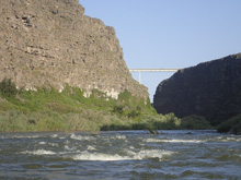
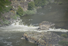
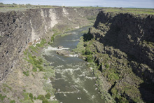
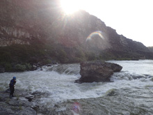
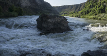
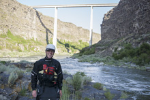
- Highway Bridge. The river passes under the highway bridge high above. There is a good view of the Pair of Dice from the bridge too... though it looks small. You then quickly hit a poind/lake to paddle across
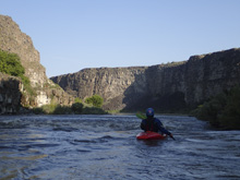
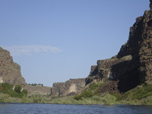
- Not Lets Make a Deal (III+ to IV-). The river enters a number of small channels amongst rock and vegetation islands. We went far right and hugged the far right. There was a hard move if you cut left at the end of that channel, we all cautioned to the right not knowing what was down there. Other channels looked mostly easier. But at high flows who knows if some ledge holes would appear.
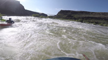
- Lets Make a Deal (III to IV+). Depending on your flow and appetite there are 5 channels to choose from, each one formed by pillars that rise out of the river. We went far right down the hardest normal channel, door #5. That channel was against the shore, into a big curler which drops into a fast moving corridor which then ends in a large hole/curler that flushed out to the left. Not sure what the other lines are like, but far left (door #1 and #2) looked very shallow and chill at 4,000 cfs. To me, the line that looked the rowdiest was the door 4.5 which starts left like for door 4, but then takes an offshoot back towards door 5.
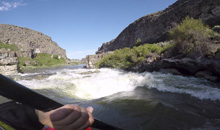
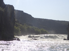
Redshanks (III). A small ledge is downstream and super blind. We ended up pretty far right of center. It ended up being fine, though maybe a little junky. There was also lines on the far left but there were also exploding waves there that had rocks in them, so we stayed far away from that side.
- Duckblind (III to IV). We ran left of center moving to the center between good sized holes. The scenery here is spectacular looking back upstream.
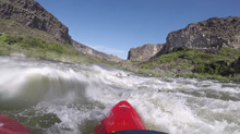
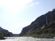
- Top of the Lake (III). The river bends right, a nice little waterfall drops in, and you get one more rapid that we ran down the right moving a smidge to the left on that right side to avoid a hole. Below, the lake paddle out starts.
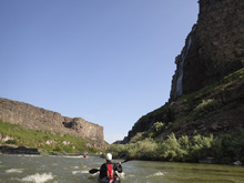
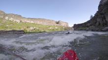
- Take-out finally after a 1.4 mile lake paddle.
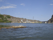
Take-out: Depends on which way you come in from... but you will almost certainly be on I-84. So, coming from the east, in the town of Tipperary take the ID-50 exit and turn left onto ID-50. Follow this across the bridge (take a look at Pair of Dice if you want just upstream of the bridge) and then take the first tight onto Addison Ave. Follow this for 3.1 miles before running onto 3500E. Follow this for 1.5 miles and turn right onto 4050 North Rd. After just 0.3 miles turn left onto Twin Falls Grade which will drop down to the boat ramp at the dam.
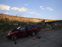
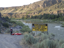
Put-in: Numerous ways through the grid of farm land. This is the most direct (fewest turns) route. Go back up the grade and get back onto 3500 E. Follow this for 4.3 miles to US-30-E. Hope onto US-30 E and follow this for 7.4 miles. When you come to a y, take the left off of US-30 and onto E 3700 N. Follow this for 1.8 miles and then turn right before falling off the cliff into the river onto N 4500 E. Follow this along the river for 3.0 miles and into the town of Murtaugh. As you enter town, turn left onto Archer St and follow for 0.5 miles before turning left awkwardly to cross the train tracks and then take the first right onto Murtaugh Rd which drops down to the river in 0.9 miles. Put in is on the far side of the bridge. Parking for put-in as at the top of the hill, in a big gravel lot, on the same side as the river access.
HTML Comment Box is loading comments...
