Sanna (Lower)
| Stretch: | Rossanna/Trisanna to the Inn River |
| Difficulty: | Class IV |
| Distance: | 4.1 miles |
| Flows: | 190 cms to 250+ cms. Check "The River App" |
| Gradient: | 80 fpm average |
| Put-in: | Downstream of the Rosanna and Trisanna confluence |
| Take-out: | Confluence of the Sanna and the Inn |
| Shuttle: | 6.4 km (10 minutes one-way) |
| Season: | Spring and Summer |
| Written: | © 2016 |
Austria & More 2016: Day 13 Afternoon
After ditching our Pitzebach idea while looking at the continuous, wood containing, no eddy wild ride that was the Pitzebach, Thomas suggested that we head to the Sanna, with hopes of all catching a quick run on the Landeck Gorge on the Inn River. The latter is a dam release that apparently typically (but unpredictably) goes at around 6 pm on weeknights. As this was a weeknight, and by the time we got off the Sanna, it would be after 6... and they share a take-out, it seemed like a solid plan.
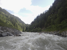
Arriving at take-out, we find the Sanna has a good flow but so far the Inn is bone dry. Reiner chose to run shuttle for us while we do a quick lap on the Sanna. The run actually didn't look all that impressive from the road as we caught glimpses on the shuttle. It looked like continuous class II to III. Once on the water however, I quickly realized that the river was larger volume that it appeared and that the class II to III was actually closer to III to IV. Because of the fact that it was seriously continuous, I would put it in the class IV category. I feel like to be class III you need to be able to swim, and this was not a place to swim. I know of one accident that occurred on this river due to just that.
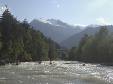
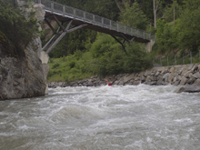
As we float, we all end up smiling much more than anticipated. I think we had all just wanted to get some more time in our boats, but instead ended up getting a real gem of a run, though it isn't all that long. As we enter town, you go through a pinch that is spanned by a bridge. People were on their balconey's enjoying the warm evening, drinking wine, and waving at us. As we rounded the corner we were created with a 200 yard long rapid that was a fluffy experience, certainly the crux of the run. More fun boogie continued downstream to where the artificial slide lead us to the confluence and our take-out.
For me, I found this run more enjoyable than Upper or Lower Ötz. Not that those were bad... but I thought this was better. We had 240 cms (30 cumecs) which The River App says is high... but I am certain people run it higher as it only felt like a healthy medium, not flooded. I think at low it is likely a lot of gravel bars. Also, there are runs upstream of it that also look fun on both tributaries, the Rosanna and the Trisanna. Both are class III to IV, and both have gauges.
Thanks to Harald and Reiner Glanz and Jim Janney for sharing photos and for making the trip possible!
Last: Austria & More 2016: Day 13 Morning - Ötz (Lower)
Next: Austria & More 2016: Day 14 Morning - Loisach (Gorge)
Update 2021: A large rainstorm rolled through earlier this year which flooded and drastically changing the river channel. Time will tell where things settle.
Mi 0.0: Mi 0.6:
- Roofed Corner (IV). As you approach a hard right turn, you cross under two small bridges. Beneath them is a large rapid. I remember a few holes that we skirted around, though I also vaguely remember many lines being possible. Just don't drop into a hole side ways. The rapid is a long one and the crux is a solid 100 meters below the entrance as you make the turn.
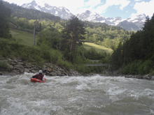
Boogie (III). As I recall the boogie continues but gets a little easier.
- Pinch (III). As you approach town, there is a pinch between bedrock. It goes just fine down the middle.
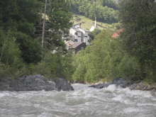
- Town Pinch (II). As you get into town, the walls pinch together and an old bridge spans above you. There isn't a rapid here, but it is a cool spot.
Pians Cataract (IV). The crux of the run begins immediately after exiting the town pinch. It starts mellow enough but half way down it ratchets up and has some steep waves with a few holes that commits you and then takes you down a blind corner where you want to stay off the right, outside, wall. The rapid is a quarter of a mile long.
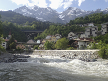
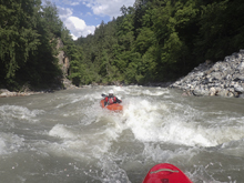
- Ledge (III). Not far below the highways crisscrossing the river you will get to a ledge that you want to boof right of center. It has a sticky hole if you hit the wrong spot.
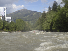
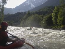
- Slide (III). Scout from take-out prior as once you are on the river, the city walls line the river which make stopping difficult and the drops appears as a horizon line until you are going over it. The line was fine, just right of center worked well. Just don't flip as you can tell it isn't super deep!
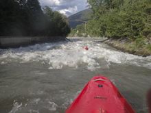
Take-out: From Innsbruck, take A12 West for 70 km (past the Oetz Valley). As you approach Landeck the road name changes to S16, stay on this for 5.3 km. As soon as you cross the river in Landeck, exit right towards Landeck West. Turn right onto B171 and follow this east towards town for 2.2km. You will cross the river again, as you enter torn, the road begins to veer right, turn left into the parking area which is at the confluence of the Sanna and Inn. You do have to pay to park here.
Put-in: Get back on B171 and turn right back the way you came. Travel upriver for 4.7 km before turning left onto B188 (Silvretta Straße). Continue on B188 for 850 meters. Just before you cross the river, turn right onto the dirt road that goes up the river left side of the river. Continue up the dirt road for 500 meters to the turnout and river access.
HTML Comment Box is loading comments...

