Ötztaler Ache (Upper)
| Stretch: | "Upper Ötz," Kaisers to Winkle |
| Difficulty: | Class III to IV |
| Distance: | 2.65 miles |
| Flows: | 180 cms to 250+ cms. Check "The River App" |
| Gradient: | 112 fpm average |
| Put-in: | Bridge in Kaisers |
| Take-out: | Bridge between Winkle and Aschbarch |
| Shuttle: | 4.3 km (5 minutes one-way) |
| Season: | Spring to Fall |
| Written: | © 2016 |
Austria & More 2016: Day 12 Afternoon
Waking up in Tirol, we had a leisurely morning while we waited for the sun to crest the hills and for Reiner to find us. The previous night we had been told to cross a bridge, take the first left and go into the woods. That first left found us in a parking lot... and Harry was there too, so we just slept instead of looking further. Turns out there was a dirt road on the far side of the building whose lot we were in. Reiner found us and the sun came out and we all enjoyed a warm morning for only the second time of the trip.
The plan was to start over on the Venter, checking out the locked in gorge called Heiligenkreuz (Holy Cross) named after the nearby town. The gorge is known for being locked in, having a mandatory rapid early on, and for a fatality that occurred some years ago a day before the Sickline Race was to occur on the nearby Ötz Wellerbrücke section, which resulted in the race being canceled that year. As my back was still not healed from the Reinbach debacle. So along with another member of the team who didn't feel up to it, we ran shuttle. I will add some details for that run to the Lower Venter write-up which we did that evening... so fast forward a few if you want to see those.
The original plan was for us to continue down from the Heiligenkreuz section to the lower. However, as they exited the river they reported the water perfect for that section, which translates to too low for the lower. So we packed up our gear and went to the Upper Ötz so I could try out my back.
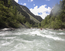
The Upper Ötz proved to be a fun although straight forward section of river. It is road side through its length, and offers a non-stop cascade of class III which occasionally builds to slightly harder whitewater. More than those crescendos, I think it develops into class Iv because of the continuous nature of it. I also imagine that the run is done pretty high, when a swim would turn serious just due to an inability to get to shore at higher flows.
As it was, we had 205 cms which was a medium-low for this section. There were plenty of eddies to catch and a swim wouldn't have been disastrous if your mates were on their game. I thought the run was fun, though as typical, fairly short. I was pleased with how my back was feeling as we arrived at take-out (as it should have the pain killers and muscle relaxants I took), so I suggested to everyone's surprise that we head down to run the Middle Ötz which is a harder section downstream. So, we packed our stuff, and headed to scout a bit before putting on.
2023 Floods Update: Massive floods ripped through the valley in August of 2023 and changed every section of this river. Use this guide as only a general skill required, distance, and gradient and not for detailed beta as it is all from before the floods and should be treated as highly suspect.
Thanks to Harald and Reiner Glanz and Jim Janney for sharing photos and for making the trip possible!
Last: Austria & More 2016: Day 11 Afternoon - Rienz (Lower Gorge)
Next: Austria & More 2016: Day 12 Evening - Ötz (Middle)
Mi 0.4:
- Rapids Start (III to IV). The rapids start and don't stop for the length of the run. They are continuous, and as such I don't recall any specific individual rapids. At our flow I would say the rapids were all in the class III range, but if the flow is higher I could see them approaching class IV.
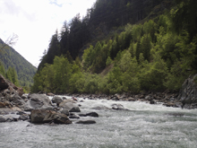
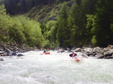
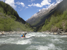
- Pinch (III). You enter a tighter spot in the canyon with a fun rapid.
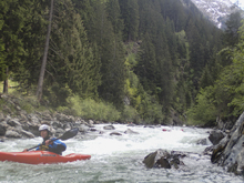
Exit (III to IV). As you exit the pinch, you enter one of the harder sections of continuous boulder gardens. This continues down under the highway bridge and then begins to get easier as you approach take-out.
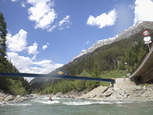
Take-out: From Innsbruke, take A12 West for 47 km to the junction with B186. Take B126 South towards Oetz. Follow this for 30.7 km to the town of Winkle. On the south side of town there is a bridge on an offshoot road (Brugen), this is the take-out. Just park on the side of the road prior to that bridge.
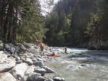
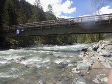
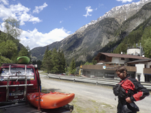
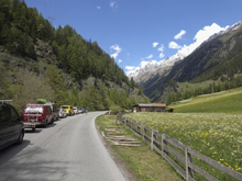
Put-in: Continue south on B186 for 4.1 km. Before you get to the village of Schmiedhof turn left onto GehÖrdestraße and follow this down to the bridge. Turn right just after the bridge and park along the road.
HTML Comment Box is loading comments...
