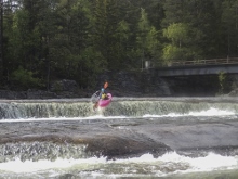
Mår (Home Run)
| Stretch: | Wooden Bridge on the Road to Åsberg to the main road bridge |
| Difficulty: | Class IV+ to V |
| Distance: | 1.0 miles |
| Flows: | 15-30 cms (no gauge) |
| Gradient: | 210 fpm average (the waterfall section is significantly steeper) |
| Put-in: | Wooden Bridge on the Road to Åsberg |
| Take-out: | Either at the bridge where the road that travels up the Mår crosses the river or at the end of the dirt road on the upstream, river left side of the bridge. |
| Shuttle: | 1.5 miles (5 minutes one-way) |
| Season: | May and June |
| Written: | © 2015 |
| Featured in A Wet State #101 and in A Wet State's contribution to World Kayak's Video Guide | |
Norway 2015 - Day 1
Honestly, I had never really put Norway on my list of places to visit. Not because I didn't think it wasn't going to be spectacularly pretty or because I thought it didn't have worthwhile whitewater. Quite the contrary, I was terrified that the only whitewater there was the gnar that you see in the A-teamer's videos. I grew up in kayaking watching Valhalla and Twitch IV, featuring some of the biggest boating I had ever seen... and it was all filmed in Norway. It wasn't until last year while I was in Italy boating with the Glanz brothers that they suggested instead of me going to the Pyrenees the following year like I had planned, instead to go to Norway. They assured me that there is a lot of class IV to V rivers there to boat and that even if you aren't on the "go huge" agenda you can have a great time and enjoy the amazing place. For one reason or another, I believed them and the plans were formed.
Joining me on the trip were Diane (who we had to pull the "honeymoon" card to get all the time off of work for), North Carolina boys Daniel Steward, Will Rudisill, and Harald Glanz from Austria. Daniel S flew in a few days early into Frankfurt Germany using some standby tickets and got the car situation nailed down and started the 16 hour drive north to pick Diane and I up at the airport a day and a half later. Diane and I flew into Oslo Sunday morning. We quickly met up with Harry near the airport and soon were caravanning out to the Telemark region for some less commonly paddled classics.
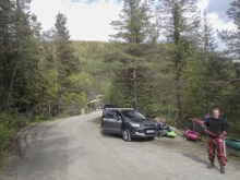
Telemark is the first region to run in Norway each year. Because of that it is typically dry by the time that the hordes descend on Voss looking to throw themselves off of big waterfalls and slides. In 2015 however there was a very large snow pack (~200% normal) and with the record coldest May on the books, snow was not in limited supply... and therefore neither was water for the rivers across Norway. Our plan was to start our trip on this short section of river that is only 1 mile long and boats a back to back combo of 5 waterfalls. Putting on around 5 pm our plan was also to camp at take-out. A pleasant dirt turn around area right on the water and only a 5 minute walk from the lower falls.
The river itself we found to have an optimum flow. I had seen videos of it at high flow and the last falls made me nervous for sure. I was relieved to find a much more manageable flow. I have also seen some very low flow videos online... it looks equally less appealing at the low end as the high end. In our medium flow, I thought the falls had clean lips, the landings were padded, but there was also time between the first and second, as well as fourth and fifth falls. The last of which is by far the most serious as they are very linked together and there is a mean hole where the water wants to push you. But if you are in Norway to boat, this will likely become the norm for your trip.
That night, as the exhaustion from our travel's into the country set in, our last team member Will arrived via bus (bus stop was ~1 hr away from the Mår) and we all set in for a great night of sleep, stoked on the adventure we were about to partake in!
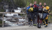
Thanks to Harald Glanz for sharing photos.
Next: Norway 2015: Day 2 - Austbygdåi (California Section)
Mi 0.0: Mi 0.4:
- First Falls (IV+). The first falls feeds directly into the second one, but you can catch an eddy on the right below. Scout from the left above. The line is just right of center off a ramp to a boof. Make sure you boof back to the right otherwise you run the risk of catching your elbow on the way down. Also, folks seem to lose track of which small channel is the right one from the small eddy above, so look carefully. This falls is ~18 ft tall.
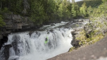
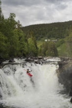
Second Falls (IV to IV+). It is straight forward, but still boosts a sticky hole. We went down the far right and boofed with right angle. I think you could go numerous places but be careful as the water comes up. This then emptied into a pool. This falls is taller than it looks from above while scouting, probably about 10 ft.
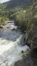
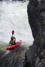
Third Falls (IV). This is really just a boof. We boof far right off the shoulder. There were rocks in the middle to avoid. You can scout from either side.
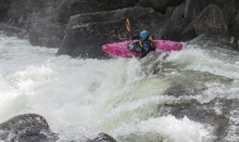
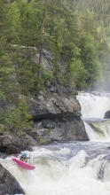
Fourth Falls (V- to V). The fourth and fifth falls are linked together and form a class V drop at all but the lowest flows. At high flows they look super legit! The first falls has a slide that you run far right before turning and delay boofing off of a 20 foot falls. At high flows there is a lateral hole that rejects you left but into a safe zone. Whatever you do, do not fall of the left super early though as the water lands in a walled out slot that looks like it might be more than a little dire. Even at our lower flow, this falls pushed directly into the next fall.
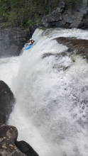
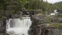
- Fifth Falls (V- to V). This one looks shorter from the scout as well, but from below you can tell it is about 15 feet tall in total. You will want to scout it for sure as the whole middle of the drop where the water is pushing is a big and gnarly hole. A rope would be needed if you get caught in there. The line at lower flows is to drive hard right to left to get on the rock slab and boof the exit. As water comes up a line can open up on the far right as well. Safety is hard to set on this one. This exits into a nice big pool. Though the right wall does look a little undercut FYI.
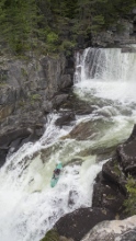
- You can either take-out at the dirt parking area next to the river just below the exit pool, or you can continue to the bridge 0.4 miles further to paddle some extra class II to III.
Take-out: From Atra, continue on 364 for an additional 1.2 km before turning left just before crossing the Mår river. Follow this road up for 4.4 km, just after you cross the bridge (optional take-out), turn left on a small dirt road and follow it up half a km to a dirt parking area. We also camped here a few nights.
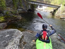
Put-in: Go back out to the road and continue another 1.1 km. Turn left on a small dirt road that drops to the left, follow this 350 m to the bridge over the Mår. Park on the far side of the river.
HTML Comment Box is loading comments...

