Kawarau River (Citreon)
| Stretch: | Below Victoria Bridge to above Retrospect |
| Difficulty: | Class IV+ |
| Distance: | 3.25 miles |
| Flows: | ~100 to ?00 cumecs |
| Gradient: | 29 ft, nearly all in the single rapid |
| Put-in: | Victoria Bridge |
| Take-out: | Dirt Road access shortly below the rapid |
| Shuttle: | 3.25 miles (5 minutes one-way) |
| Season: | Year round |
| Written: | © 2017 |
| Featured in A Wet State #125 | |
New Zealand 2016/2017 Day 19 Afternoon:
This river is probably best known for the rapids called Nevis Bluffs. Those are located downstream of Dogleg, and upstream of this section. Diane and I scouted the rapids from the road, and due to juicy flow, they looked huge... well, they always look huge because they are. With just the two of us in our group at this stage, we opted to forego this section and look downstream at the Citreon instead for our afternoon plans.
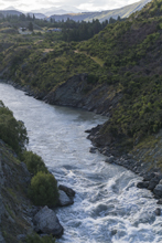
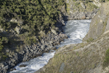
Citreon is considered a class IV+ run great for class IV boaters to step up on. I am honestly not sold on the latter point. The "run" consists of paddling down to the one rapid and running it. The one rapid although not super hard, class IV+ in nature in mind, is however a very long rapid and could see a long swim if you don't hit your roll. Or worse yet, find one of the many pockets or holes to park yourself into. Because of that I think it is class IV+.
Diane and I found take-out easily, it is just off the highway just as the river bends right. Easy. Finding put-in we measured milage back upstream to a gated farm road. We found a few that seemed to match but upon walking around on foot, just didn't quite seem to foot the bill. The rapids were supposed to be just downstream 500 meters but we could not locate the rapids to scout on foot prior to setting off as we were told the left line is hard to scout once on the water. After maybe an hour of walking around amongst overhead thorn bushes, we opted instead to put in at the Nevis Bluff take-out, adding 2 km of paddling mellow water, but ensuring that we didn't accidentally put in below the Citreon rapid.
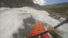
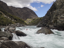
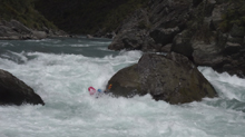
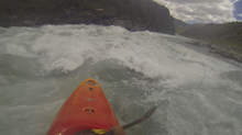
After 20 minutes of floating we found ourselves at the top of the obviously large rapid. We hoped out on the right to scout and walked down. The left was indeed hard to scout, from above it for sure looked good to go though. The right was easy to scout, and actually looked a little more complicated and a little more fun, so both Diane and I decided instead to run that line. Diane went first and styled it. I went second and carried too much momentum through the boof over the hole and found myself on the seam of the boil coming off of the center rock, flipping quickly through the main hole. Downstream, huge waves and a few sizable holes carry you the next quarter mile to the flat water below. Note, that the flat water is not a pool, so actively chase a swimmer as they could easily swim quite a ways downstream!
This section is certainly worth doing, and if you are not quite up to Nevis Bluff, offers a nice consolation. Or warm up, whichever you may view it as.
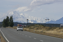
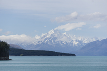
That afternoon we began to drive towards the Rangitata some 4.5 hours away. The plan was to boat that in the morning prior to driving to Christchurch. The drive saw us drive up the interior of the South Island. Googlemaps showed us that we would be driving along a lake that looked impossibly blue. We thought it must be a photo error. However as we rounded the corner to Lake Pukaki, at the foot of New Zealand's highest peak, Mt Cook, we realized the images were 100% accurate. How can an entire lake shine the same sapphire blue as the Perth River? Otherworldly pretty. It was as if I was looking into Zooey Deschanel's eyes. Anyways, I get distracted... so, we made it to the Rangitata and find that there is no place to pouch camping so we opt to stay at a DOC campground near the river. This one is a fancy one with a place to shower so we indulge and take hot showers and talk about the trip, as we tuck ourselves into our sleeping bags for one last night of camping in New Zealand.
Previous: New Zealand 2016/2017 Day 19 Afternoon - Kawarau (Dogleg)
Next: New Zealand 2016/2017 Day 20 - Rangitata (Gorge)
Mi 0.0:
- Flat but moving water starts you off.
- Nevis River: Enters on the right. You know you are getting close now.
- Alternate put-in. Though this screams private property to me and was also kinda a pain. I would just use the access at the bridge upstream.
- Citreon (IV+). This rapid is obviously big. We scouted from the right. Scouting the "normal" left line is not really possible from the right shore and very hard to do from the road prior as well. We ran down right of center boofing a ledge hole and then going right around the large midstream boulder. The other line is down the left, however you want to drive into the cushion coming off the midstream boulder in order to avoid getting stuffed in the pocket on the left wall, which is a dangerous spot. Downstream, the channels immediately converge. There are large holes on the left wall and some medium sized holes on the right shore. Stay down the center. The river then bends left, you can run anywhere though there are a few sneaky holes throughout to avoid.
Put-in: From Gibbston Valley Winery, continue another 10.4 km east on Highway 6. You will come to a bridge (Victoria Bridge) over the Kawarau, the access is just before the bridge. Alternatively, you can continue another 1.9 km downstream and look for a very small dirt road with a gate just off the highway. You can go through the gate and access the river here.
Take-out: From the bridge, continue downstream for 4.8 km. Just before the road does a sweeping right turn, there is a small dirt road that cuts back up steeply and drops quickly (100 ft) down to the river.
HTML Comment Box is loading comments...
