Jonathans Creek
| Stretch: | Joe Carver Rd (or Cove Creek Rd) to Riverwind Rd. |
| Difficulty: | Class II to III |
| Distance: | 5.1 miles (or 3.05 miles) |
| Flows: | 250 to 750 cfs. USGS's Cataloochee Creek gauge should be a close to 1:1 correlation |
| Gradient: | 39 fpm average below Cove Creek Rd, 30 fpm above it. |
| Put-in: | Fire Station on Joe Carver Rd (or turnout on Cove Creek Rd near US-276) |
| Take-out: | Riverwind Rd, before the Pigeon Confluence |
| Shuttle: | 5.0 miles, 10 minutes one-way (or 3.1 miles and 7 minutes one way) |
| Season: | Fall, Winter, and Spring from rain |
| Written: | © 2019 |
The day before, Jim Janney and I were talking about doing Cataloochee Creek into Waterville Lake, portaging the dam, and then continuing down through the dries. By the time after work came around however, the dries were raging 3,000 cfs and I had no desire for that. So I bailed. However, this did remind me of a run that Kirk and Justin ran last year on nearby Jonathans Creek which runs into the Upper Pigeon River , above Waterville Lake. So, like that, a seed was set for the next morning.
In the morning, Jim went off for some class V gnar adventuring, but I really wanted to get a new run after the skunking the prior night. I called up a friend at 8 am and a plan was set, then the plan was delayed, then it was delayed some more, I sent out some other notes to find more people, the friend then canceled, I load up the bike for a self shuttle day, and then a different friend calls me back and is game. Phew. After 2 hours of getting strung along, I was at wits end and ready to just go get my fun on for the day! Thank you Jeff for coming through for me, its always better boating with other folks!
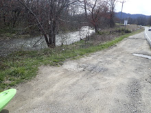
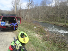
So, there are two put-ins for this creek, AW says to add a few miles of flat water to the top, putting in at the fire station. Kirk's book says to use Cove Road, which is also what I had google scouted on the map. So we did the Cove Rd option which cuts off the paddle in. Also, there is a perfectly nice turn out and access to the river here, so it seems totally ok too. I think maybe if you are only running Jonathans Creek, and not continuing onto the Upper Pigeon River , adding the extra miles above makes it feel like a more complete day. Do note, that the Upper Pigeon River is a few steps harder, so only continue down if you are up to it.
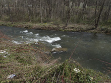
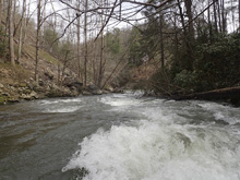
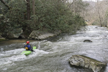
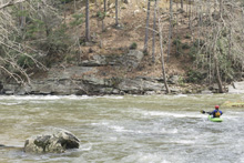
This creek is honestly a bit meh. You are in field at the start, and then in backyards through the reminder. As the houses start, they are very nice, manicured houses and turn into more standard affairs along with some trailers. Regardless of the house, the point is the wilderness is not present. Road is ever present, as are the houses, and occasionally the highway. But, the road being present does make for a great escape if you are pushing yourself here. There are a few small but nice rapids sprinkled throughout, but then one bend where the river tightens and steepens up and is class III for sure, with four back to back rapids. At high flow, this section would be game on. There was a log in the second rapid our day, which necessitated a portage.
Anyways, for us, the highlight of the day was the downstream Upper Pigeon River . See that description for that. I know some folks in the nearby college run this often, for me, I would go back... but only as the access to the Pigeon. You see, that is the tough part... take-out. This whole creek is private property on the banks. I did not notice any super obvious spots to leave a car etc. So, you may have to get a little creative for the take-out... unless you continue on down.
For reference, Cataloochee Creek can be used as an indicator, it was 360 cfs and leveling off on its way down from 1" of rain 24 hrs earlier. The Pigeon above the lake was running 1,680 cfs also on its way down from the same rain. Those two data points should be sufficient. Also, we felt that this was a medium-ish flow for the creek. I am sure it goes WAY higher, but if you are looking for the class II-III experience, I think this was medium.
Mi 0.0:
- Flat (I). We didn't actually put in at the top, but apparently it is just flat stuff. It is in fields, so that makes sense to me.
- Small Ledge (II). A small river wide ledge gets the pace started. Downstream is more boogie in the class II range.
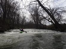
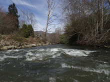
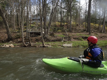
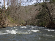
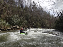
- Tight Ledge (II+). The river constricts and goes over a few foot tall ledge. The hole was not bad at all, but I could see this making a class II to III boater nervosa. We went left of center.
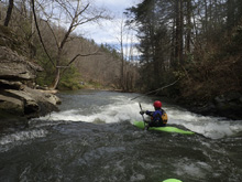
- Highway 40 crosses high overhead. This is your signal you are getting to the crux of the run.
- #1 (III). This was a cool double drop. We ran down the top ramp in the center and caught an eddy on the right above the bottom ledge. We then boofed the final 3 foot ledge on the right.
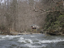
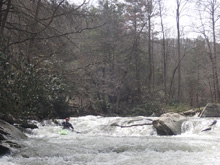
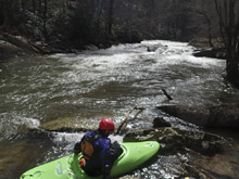
#2 (III). Well, for us it was a log portage. But there was a nice line if not for the wood, on the right, a tight constricted drop. There was a small channel on the left, but note that after seal launching in I noticed that it is super undercut on the left, so I would avoid that.
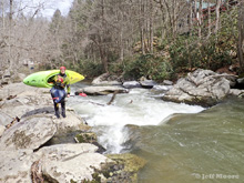
#3 (III-). A nice boogie rapid is directly below. It was just some rock and hole dodging.
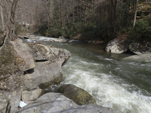
- #4 (III-). Another nice boogie rapid leads you to the end of the gorge. This one had a few small holes to punch, you could sneak the bottom move on the right, or just aim for the meat, it was all good.
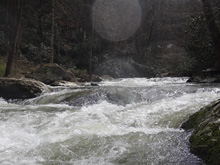
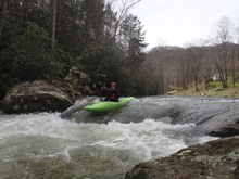
- Surf Wave (II). Another tight constriction ledge, this one is fine down the middle but also had a nice play hole to it with eddy service on the left. Downstream, boogie leads to the confluence. Get out where ever makes sense. Likely 100-200 yards before the confluence. Or continue on to the Upper Pigeon River .
Take-out: From Hartford TN, take US-40 East towards Asheville. Follow this for 19 miles, through the gorge, and along Waterville Lake. Just past the rest areas, take exit 15 for Fines Creek Rd. Turn right, cross the river continue on Fines Creek Rd for 0.8 miles. At the 4 way intersection, continue across it onto White Oak Rd. Follow White Oak Rd for 3.7 miles. You will cross under Highway 40. Look for a place to park just past it where Riverwind Dr goes off to the left. Jonathans Cree is just below you.
Put-in: Continue upstream on White Oak Rd for 2.2 miles. Turn left onto Cove Creek Rd. In 0.5 miles you will pass a shoulder on the river side of the road, that is the put-in that is called "Gravel Pit" or "Cove Creek Rd." To get to the upper put-in, in 100 yards, turn right onto US-276 and follow for 1.7 miles. Turn right onto Joe Carver Rd. in 100 yards, just before you cross the river is a Fire and Rescue station. Apparently, they are friendly to kayakers parking near there, so ask them for permission and access the river there.
HTML Comment Box is loading comments...

