Housatonic (Bull's Bridge)
| Stretch: | Bulls Bridge to Power Plant |
| Difficulty: | Class IV |
| Distance: | 2.2 miles |
| Flows: | 1,800 to 1?,000 cfs. Visit the American Whitewater flow page |
| Gradient: | 32 fpm |
| Put-in: | Bulls Bridge |
| Take-out: | Power Plant |
| Shuttle: | 1.6 miles (5 minutes one-way) |
| Season: | Dam Release |
| Written: | © 2015 |
| Featured in A Wet State #99 and in A Wet State's contribution to World Kayak's Video Guide | |
North East Roadtrip 2015 - Day 8
Waking up just a few miles from the Housatonic, we quickly woke up, packed up the car, and went to put-in to check out the flow. This was going to be a long day. Nine hours of driving to do and I hoped to talk Diane into stopping at Gettysburg for a few hours to sight see. With this in mind, we quickly made up our minds to ignore the cold morning and get started. To postpone the pain of the cold water, Diane decided she wanted to bike the shuttle to start the day rather than end it. So off she went, retuning with very cold hands!
The river starts with its best (in my mind). In fact, there are literally only 4 rapids on the run so I almost think this run wouldn't be worth it unless you live in Kent, unless you are thinking about running this rapid. The rapid went great, and we had tourist spectators so that is always fun. Downstream you quickly get to the Flume and then S-turn/Pencil Sharpener... and then just like that the run is basically done. Flat water to take-out. Sigh. Oh well, it was perfect for our day... we were back on the road by 10:30. And 4 wrong turns later, we were actually leaving.
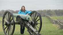
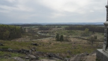
That day we did get to go to Gettysburg. We just went into the visitor center to get a map, and began driving around the circuit. Gazing across the field, and walking in the steps of Picketts Charge, standing atop Little Round Top, straining our eyes to see the sharpshooters nest at Devil's Den in the distance. Although we only brushed the surface of the history at that field, I feel that it was a very worthwhile 1.5 hours. But at about 6:30 we decided to push on as we had 4.5 more hours to drive and had plans to boat in Fayetteville the next day. But the question loomed, will Lower Meadow be too high? We will run Mill Creek instead? What about Manns? Arriving at 11:30 in a downpour we opted for our first hotel room of trip and quickly fell asleep. With the alarm set for 6:45 am...
The flow we had was 3,660 cfs. I thought this was a great flow for the run. Staircase was fun and not too bad. The flume had a big seam. And S-turn and Pencil Sharpener although already combined into one rapid, weren't overly pushy and had just the right amount of splash to make them fun. I have heard in the 10's of thousands that this run is a hoot. But I imagine Staircase is gnarly. And the run would only last a few minutes.
Last: North East Roadtrip: Day 7 (Joe's Brook)
Next: North East Roadtrip: Day 9 (Lower Meadow)
- Staircase (IV+ to V). What a fun way to start the day, at 3,660 cfs this rapid looked worse from below than at river level. If we had a bigger group, I would have gone for a hero line too. But alas... The most straight forward line was to cut left to right across the entrance drop. The top did not have a hole, just a wave. This dropped us in an eddy on the right next to the middle hole. We then ferried out below the middle hole to run right to left across the bottom ramp. The one hazard over here was a slot with some pin potential due to a crack between two rocks situated just off shore on the right. It was easy enough to get left though. And you could straight it up and just run far right next to the pair of rocks. The hero line looked to be to drive hard left across the entry and punch through a curler off the shore, staying left to avoid dropping into the middle hole. Then, straighten it out and boof the ledge below far left. The hazard here was that the hole at the base of the ledge was bad, and due to the water coming in from the spill channel there was hard left current into a bad and backed up pocket in the middle of the river. I would want more safety to run that line... I know how poorly Diane throws a bag!
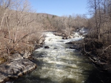
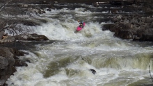
- Flume (IV). Just downstream of the bridge we entered a wave train, we errored right to catch an eddy above the next horizon and were grateful. The next horizon is an 8 foot tall ramp into a big hole. You want to hit it left of center, at the seam. There was also a sneak far left. Apparently just one day before we were there some locals worked to get a nasty log unwedged from the main channel. We didn't even know about it until we got home.
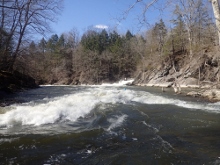
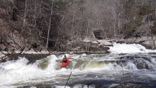
- S-turn (III+ to IV-). After a bit of flat water, you get to another horizon. I hoped out to scout on the left and saw an obvious and clean line down the left. The middle was a bad ledge hole. Not sure about the right as the river is really wide. We went down the left.
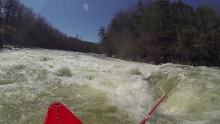
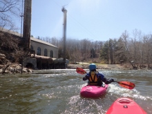
Pencil Sharpener (III+ to IV). Immediately downstream, at our flow it seemed like one rapid, you enter Pencil Sharpener. We caught eddies at the "lip" on the right and saw a clean line left of center so we ferried out to run down the straight forward rapid. Just dodge the holes and rocks! Below, it is flat water for 1.4 miles.
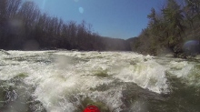
- Georgia's (II+ to III-). With the powerhouse in site you get to the last rapid which had an ok surf wave at the top on the left.
Take-out: From Kent CT, head south on US-7 for 5.5 miles. Just after you cross the water pipes feeding Cedar Hill Pond into the Power house below, turn right and park down at the water.
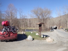
Put-in: Head back North on US-7 for 1.5 miles. Turn left onto Bulls Bridge Rd and park on the left. The trail is on the far side of the river. Also FYI, the New York border is just a minute or two further on this road.
HTML Comment Box is loading comments...
