Gimbach (Cascades)
| Stretch: | Above Rd153 |
| Difficulty: | Class IV+ (V) |
| Distance: | 1.2 miles |
| Flows: | ~100-200 cfs (look for the water to be +/- 2 inches from the top of the pipe near take-out) |
| Gradient: | 236 fpm average (for the rapids) |
| Put-in: | 1.25 mile upriver from the rd bridge |
| Take-out: | At the Rd 153 Bridge |
| Shuttle: | Hike your kayak up the hill a little over a mile! |
| Season: | Spring from Rain |
| Written: | © 2016 |
| Featured in A Wet State #113 and in A Wet State's contribution to World Kayak's Video Guide | |
Austria & More 2016: Day 1 Morning
Man this is daunting... 29 new write-ups to do. But I guess that is the price to pay for a great trip. This trip came out of a few seasons of boating with the Glanz brothers in Europe, California, and the East Coast. I have enjoyed boating in Europe because of the ease of access to the rivers, the spectacular scenery, wonderful food, and quality whitewater. So it was natural for me to want to see more of the Alps, and Austria and its surrounding area fit the bill nicely.
Wanting to keep the group small to reduce the number of cars required, Jim Janney was the sole person joining me from the states as Diane couldn't get off of work. As the trip dates got closer, the snow in the Alps never appeared. The weather forecast also didn't look promising. Harry would update me that the trip might not be as classic as we had hoped. Sure I was a little disappointed, but there is always stuff to boat... and it may just require additional driving. As of course, Austria always has the plan B of Piemonte and Ticino if we really got stuck in a bind. But, fortuitously, as the trip neared, the weather came with it. First cold rain, then heat which melted the snow, then warm rain to bring in more rivers, and then as we headed to the glacier fed rivers, more heat to bring in more rivers. What luck... the two weeks ended up being just about as good as can be hoped for! But lets start at the beginning...
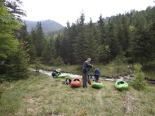
The plan was we would fly to Munich, Reiner would pick us up and we would "try" to get a river that day. As it turns out, we got three rivers that first day and got skunked due to high flow on another steep creek. Good thing I brought some 5-hour Energy with me just for this day! The Gimbach was our first stop and was ~2.5 hours from the airport. The time in the car flew by as we caught up with Reiner. Arriving at the river, we had a few minutes while we waited on Harry, Robert, and Jurgen to show up. Jim and I took the opportunity to hike a little ways up the creek. It surprised me just how small it was. Apparently we had "healthy" water, but that must have only been 150 cfs at the most. I can't believe that people run this a foot lower! I thought the flow we had was idea for forgiveness, though more water would have lubricated some of the drops better. But I could see a few rapids (like the mandatory) being more stout with more water. As it was, I thought it was a great first run for us. It was Jim's first time in a Flying Squirrel, I was sleep deprived etc. I would say it is fair to call it IV+. Maybe at lower flows it is more class IV. I understand it is a lot of peoples first waterfall run, and I imagine that is at lower flows. The only downside to this run I would say, is that you have to schlep your kayak from the bottom to the top. The start of the hike is really steep but then it meets a road and calms down for the rest of the way. There are a few drops that are worth scouting on your way up so keep an eye for those on the hike.
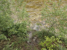
For reference, at take out there is a pipe in the river, our flow was about an inch over the pipe and is considered a healthy flow. Two inches below the top of the pipe is considered getting low. The pipe was just barely covered for us, I thought this was medium-low flow actually for all but the mandatory rapid.
Thanks to Harald and Reiner Glanz for sharing photos and for making the trip possible!
Next: Austria & More 2016: Day 1 Afternoon - Rettenbach (Upper)
Mi 0.0:
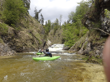
- Put-in Slide (IV+). Immediately below put-in starts the first slide. We started on the far right and worked back middle. The bottom part actually can piton you if you are left, best to finish far right.
Hole (IV). At our flow the rapid was no problem. It was just a slopper into a small hole that was easy to get your nose over. It did push hard into the right wall which had a minor undercut. But it wasn't bad. At high flow it apparently becomes much worse.
Junky (IV+). As the river steepens scout on the right. The river slides into a boof that is best far left in an unassuming small offshoot channel. Then most will drive back to the right and boof over a junky pile of rocks over there. The far left side can be done but is a crack line with some knuckle damage potential if you mess it up.
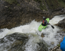
- Cross under the bridge you hiked over.
- Under the Bridge (IV+). One of the harder drops of the run, this one is worth scouting on your hike up. It is below an old stone bridge just downstream from the bridge you hike over on your way up. You want to enter far right and then drive to the left and carry left momentum. The hazard is the right wall which has a nasty pocket.
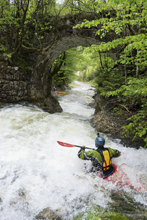
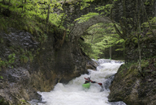
- Slides (IV). When you come to a horizon line you are at these slides. The first one we ran far right and clapped a little down some rocks. There is also a line far left. Downstream is a small ledge that you want to be far right on.
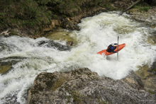
- Mandatory (V). The hardest rapid on the run is also the one that is hardest to portage. It is called mandatory but in fact you can get out and then lower boats back in just below the crux of the rapid. The crux starts with a slide into a 90 degree turn to the left. It wouldn't be bad if it weren't for the move just below. Because of the move, some choose to seal launch in below the two parts. The bottom move is to boof the middle of the 8 foot ledge with left angle. Do not error too far left though as the water reflects and shoots straight across the base of the drop and into the right wall which is badly undercut. Downstream is a small ledge to boof anywhere followed by a nice 8 foot left to autoboof far right.
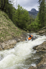
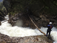
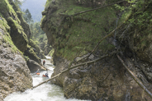
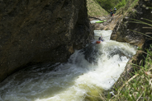
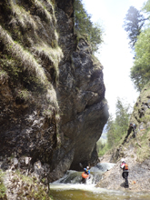
- Cascades (IV to IV+). The exit was great fun, several smaller slides led to the final set which you can see as you start hiking up. With that, the run is done! At our flow the final gorge was just class IV, but at higher flows I can imagine the holes get meaty.
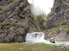
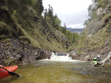
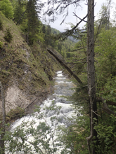
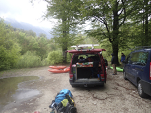
Take-out: Find your way to Lake Attersee. The take-out is where Rd 153 (Weissenbacher Straße) crosses the creek 4.6 miles South-East of the lake. There is a turnout. The "gauge" is a pipe that is just at the back of the parking area along the river.
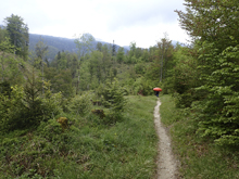
Put-in: From the parking, find the trail that goes up the creek. It quickly climbs steeply for a short ways to a dirt road. Follow the dirt road to the left. You will cross the river, 100 yards later it is worth looking at a hole that can be munchy at higher flows. Continue up just past the put-in slide.
HTML Comment Box is loading comments...
