Defereggenbach (Waterfalls)
| Stretch: | Erlsbach to Rinderschinken |
| Difficulty: | Class III to V |
| Distance: | 2.1 miles |
| Flows: | 45 cm to 65 cm. Check "The River App" (Listed as Schwarzach) |
| Gradient: | 198 fpm average |
| Put-in: | Bridge in Erlsbach |
| Take-out: | Covered bridge in Rinderschinken |
| Shuttle: | 3.6 km (5 minutes one-way) |
| Season: | Spring to Summer |
| Written: | © 2016 |
| Featured in A Wet State #115, in A Wet State's contribution to World Kayak's Video Guideand the Coaster in A Wet State #114 | |
Austria & More 2016: Day 7 Afternoon
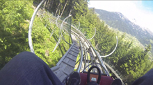
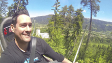
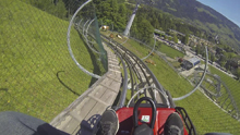
Waking up at our campsite, we decided to have a leisure morning. Reiner went with Ali to go for a bike ride. Jim opted to run their shuttle and go for a hike. I opted to go site see in Lienz and then hang out with Harry and his family at the Alpine Coaster. The latter of which was surprisingly fun. A bit pricey for the ride to the top of the mountain and one coaster ride down. But still, very fun. Though it was a shock that Moritz and Harry managed to catch up to me. I guess Moritz has a higher fear tolerance than I do despite the fact that he is only 4 years old!
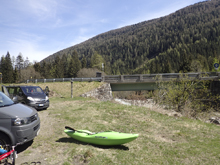
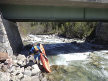
That afternoon we headed up to the Defereggenbach. This river is also commonly called the Schwarzach. It is the latter that shows up on the maps actually and that is also what kayakers from out of town commonly call it. However, the locals call it the Defereggenbach so that is what I am calling it here. Arriving at put in, we see that the water is low. Plenty for the falls, but the paddle in and out may be a bit boney as it is mostly class II gravel bars. We plan to hike out below the falls as there is a gorge below that typically has wood and once locked in can take hours to portage the one rapid with the wood. However, as we passed take out we noticed some kayakers taking off at the full takeout below that gorge. As we suited up, the Italians told us they just went in and found the rapid clear of wood. Additionally, they gave us a German guidebook (little pamphlet) to Southern Tirol, which was the next location on our tour. So thank you to those Italians!
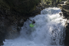
The run indeed did start off rather boney and meh. But that all quickly changed when we got to the first falls. The first falls has a lead in hole that is commonly portaged as flows rise. Downstream is the second falls which has a pocket on the right to avoid. Below, fun rapids continue before the gorge walls tighten and you approach the class IV gorge that can ruin days when there is wood. But it was clear and we quickly found ourselves floating in the valley down to our take out.
After the run, we decided we would run the Isel Cataracts. But on the way, we decided to try to get a view into the exit gorge of the Defereggenbach which has been run only twice, and with significant effort. Getting a few sights in, we saw runnable falls, some 30 feet tall, but much too high of water for being locked in. But Reiner promised that at some point in the future he would go explore and let us know how it looks. I can't wait to see those photos and video! See a few pics from the 2nd decent here.
For reference, we had 49 cms which was low but ok for the falls. It is also worth noting, the elevation for this one starts over 5,000 ft.
Thanks to Harald and Reiner Glanz and Jim Janney for sharing photos and for making the trip possible!
Last: Austria & More 2016: Day 6 Afternoon - Drau (Race Course)
Next: Austria & More 2016: Day 7 Evening - Isel (Cataracts)
Mi 0.0:
- Boogie (II to III). Some scrappy boogie files the mile to the first waterfall. It was VERY scrappy at the low water. I think however if it didn't feel scrappy at all, I would get concerned for what lays below!
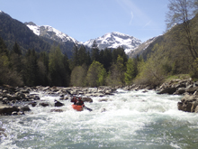
- Waterfall #1 (V). Get out and scout on the left before going to far as the lead in picks up steam quickly. The first hole actually messes people up more than they expect so give it a look. The second hole is the real consequence of the rapid, it is a ledge hole with an undercut on the right and a pocket on the left. At higher flows a lot of people seal launch in just below it. If you get stuck in it even at low flow, you are not getting out without a rope. The exit is the fun drop, it is a ramp to kicker that you run straight off of the peak. Great fun!
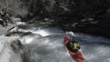
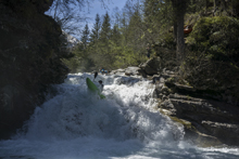
Waterfall #2 (V). A few different lines are available. Harry went first and did the line he had done before, down the far right and then pealing back out in the center. I didn't quite like the look of it, so I opted to run down the center and drive left. Jim opted for a completely different line and eddied out after the lead in at the lip on the right, and then peeled back out to boof the center. The key to this drop is that you really don't want to be caught in the far right at the base as it is a pocket tucked back up against the wall. The hole drop is also not super clean, so upright is idea!
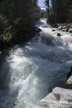
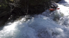
Boogie (III). Downstream you get some mellow boogie for a little ways
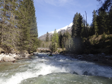
- Sieve Rapid (IV to IV+). When you get to another steeper drop you know you are here. The entry is a sweet boof on the left when then leads to a bunch of waves and an s-turn that leads to the exit. The hazard is that at the exit the left side of the river goes into a sieve. So make sure you are far right when exiting.
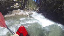
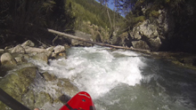
- Ledge (IV). Just downstream is another ledge that was straight forward down the middle. By the log choke on shore next to it, I be this one occasionally chokes up.
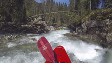
- Exit Gorge (IV+ to U). The exit gorge occasionally gets choked full of wood and is unrunnable. There are stories of people spending hours in the canyon trying to egress upriver or climb out of the vertical walls. It is worth asking around before going into this canyon. The first part of the rapid is a river wide ramping hole that you can run anywhere. The river then pinches around the corner blindly to the left, where the log jam normally is, and pinches over a small ledge. Reiner was up front, hoped out to scout from the eddy at the top, then ran down to catch the eddy just before the blind corner, getting out he gave me the ok sign and I went through.
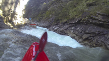
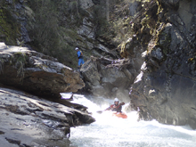
Boogie (II). Downstream the boogie turns to class II and you quickly get to take-out.
Take-out: From Lienz, take B108 (Iseltaler Str) North West along the river. Follow this for 19 km to the town of Huben, where you will turn left onto Defereggental Landesstraße. Follow this for ~24 km up the river. As you enter the town of Mariahilf, turn right onto Oberrotte and park at the bridge in ~100m.
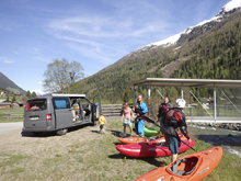
Put-in: Go back out to Defreggental Landesstraße and turn left, continuing up the canyon. Continue for 3.6 km to the bridge over the river. This is put-in.
HTML Comment Box is loading comments...
