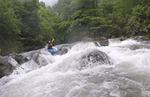
Chakvistskali (Mitrala National Park)
| Stretch: | Sachokhia confluence to Access above Khala |
| Difficulty: | Class III to IV (IV+) |
| Distance: | 4.4 miles |
| Flows: | No Gauge. Estimate at confluence put-in: 750 cfs |
| Gradient: | 130 fpm average |
| Put-in: | Either at the confluence with the Sachokhia or at the Mitrala National Park Visitor Center |
| Take-out: | At the access just upstream of the town of Khala, downstream of a tributary |
| Shuttle: | 6.5 km (25 minutes one-way) |
| Season: | Spring and ? (Needs rain) |
| Written: | © 2017 |
| Featured in A Wet State #130 | |
Our thanks to our trip leads at Two Blade Adventures.
Republic of Georgia 2017 Day 4 Morning:
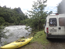
With rain having hit the area the prior night, Egor used our "flex" day to hit a rain-needed run an hour north of Batumi. This run is up a rough dirt road that follows the river. You can see the crux of the run from the road, but once on the river the road is never really noticed. On our first lap of this upper section, we put-in at the National Park's visitor center. They had nice displays with English translations and were happy to have us and let us put in behind their center. This resulted in us having an extra km or so of somewhat manky boating down to a confluence where the flow doubled and the river channelized. It was worth doing once to put in from the top for sure.
Once on the water, we were greeted by our first somewhat pool and drop river. A nice break from the relentless gradient that we had seen so far on the trip. Instead, this river was mostly class III with a few IV- and one bigger drop that was IV+ and could approach V- with more water. Downstream a quick portage around a dam brings you back in civilization and a quick paddle to a boat ramp of sorts on the right.
I thought this run was a great class III to IV run, with the one spicier rapid to keep you entertained and I would highly recommend it if you find it with water. Note that you can't judge flow from the high bridge as there is a sizable tributary that comes in about 2 km upstream. I feel our flow was on the low side of medium, maybe even low. But it was plenty for the spicier rapids. The paddle in from the visitor center was definitely on the low side and looked ELF from the road before putting on.
Previous: Republic of Georgia 2017 Day 3 Afternoon - Adjaristskali (Lower Gorge)
Next: Republic of Georgia 2017 Day 4 Afternoon - Chakvistskali (Lower)
Mi 0.0:
- Visitor Center (II+). Putting in at the visitor center for the national park gives you a warm up on some shallow rapids.
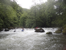
- Normal Put-in (III-). The normal put-in is above one last kinda steep and junky rapid that was best run far left. This is under the road bridge that you drive up on. Immediately below, there is a confluence with a sizable tributary (Sachokhia) which doubled our flow. Below, rapids continue.
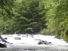
- Island #1 (III). The river splits, the left side had some nice rapids that were the first ones that felt fully filled in. If I recall, there were two rapids. We ran a nice boof center on the first. And exited right on the second.
- Island #2 (III+ to IV-). The second island was even smaller than the first, the left side again was the side we ran. This looks to be no good from above, but was a fun creek line in a tight spot. Follow the water.
- Shouldn't Be That Hard (IV). On a left turn, the sizable tributary Bezonistskali enters on the right, and marks the spot for this rapid. The rapid is two tiered. The first one is a slide that should be run center to right, there is an eddy on the right between the two. The second teir should be run far far left. There looks to be an appealing boof left of center, but it lands on rocks, as does anywhere other than far far left. This then ramps off and drops through a small hole. Both laps, I had ugly lines here clobbering rocks by not getting far enough left.

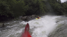
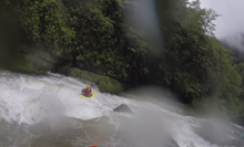
- Long and Busy (III to IV). This one had several trees in it. We ran a center moving right line through a tight slot to get right as the left was blocked off by trees. Then we ran the runout in the center or left generally.
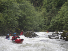

- First Ledge (III). This ledge is totally straight forward but should be run left of center as there is a blind flake in the middle that you don't want to hit.

Pinch (III). Immediately below is a pinch rapid where the river is constricted to two small pinches, either go, we always ran the left narrower one. I bet at high flow you might not want to hit this one as it lands in a small walled out hole.
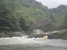
- Boogie (III+). A nice long boogie rapid wraps around the corner and picks up some steam as it ramps off into a splashy hole at the end. Run down the middle. Downstream there is another small ledge that can be run anywhere. This leads to the Second Ledge.
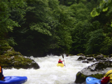
- Second Ledge (IV). This ledge is straight forward, but, it does have a decent size hole if for some reason you don't boof and it is immediately above the biggest rapid of the run. Just go left of center off the peak of the boof and boof straight.

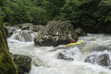
Big One (IV+). This rapid has some hazards in it, so it should be scouted on the right. Note that the rocks are super slick! The line at the top is off of the left wall, boofing over a folding seam. Then, get to the right and hug the inside of the large house size boulder. The left side of the channel drops into some nasty pin rocks. As long as you are on the right tongue you are good. Then, turn left and exit with the water.

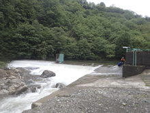
- Dam (P). A dam appears, the water at the lip is shallow so you just float up to the lip and get out. Walk down it and then put back in below on the left near a picnic table.
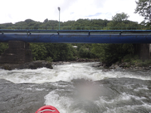
Boogie (III). Below the damn, boogie continues but is easier, and within the city, and continues to take-out.
Put-in / Take-out: Use the GPS coordinates in the map and a mapping program on your phone. The street names will not be legible anyways...
Put-in: Either put in at the visitor center at the national park, though you may need to ask permission for that, or just downstream, before the bridge over the river there is an easy access on river right.

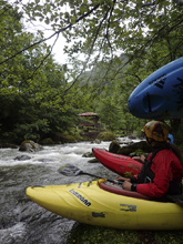
Take-out: After the dam and the resulting boogie, a tributary enters on the right. Get out just below the tributary at the low water dirt road.
HTML Comment Box is loading comments...

