Cache la Poudre River (Bridges)
| Stretch: | Pineview Falls to Boyd Gulch |
| Difficulty: | Class III |
| Distance: | 1.9 miles |
| Flows: | 300 to ?,000 cfs (well downstream). Check out American Whitewater's current flow gauge. |
| Gradient: | 49 fpm average |
| Put-in: | Below Pineview Falls |
| Take-out: | Roadside access near Boyd Gulch |
| Shuttle: | 1.8 miles, less than 5 minutes on way |
| Season: | Spring and Summer from snowmelt |
| Written: | © 2018 |
Jobless Summer 2019 Roadtrip Day 2e:
After boating the Narrows we continued on through the subsequent sections and finally down into this section. This section is a short section, but certainly fun with some nice class IIIish rapids. The scenery, is probably the least nice of the sections below the Narrows, mainly due to being well inside the residential areas so plentiful houses line the river and numerous bridges are passed under.
Honestly, this section with the three above it seem like they should all just be one class III to IV section. But, I think because of the rafting industry in the area, which utilizes different put-ins and charges different rates for different lengths and difficulties the split out into four runs has stuck. Realistically, I don't know how many boaters do just one short section. I can see raft guides perhaps doing this as an after work kayak run, but for boaters looking for a full run it seems they will likely do multiple of these sections each time. Anyways, I am following American Whitewater's lead on this one and breaking them up accordingly.
Finally, after finishing our run we headed towards Denver to meet up with a friend of ours for drinks at Call to Arms. After catching up we again hit the road with a 2 hr drive towards Buena Vista, where the river for the following day was, the Arkansas. Using Leland's guide to North America, we found some camping on the ridge above Buena Vista, across the river, so we set up our tent and quickly fell asleep.
Previous: Jobless Summer 2019 Roadtrip - Day 2d: Cache la Poudre River (Poudre Park)
Next: Jobless Summer 2019 Roadtrip - Day 3a: Arkansas River (Pine Creek)
Mi 0:
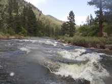
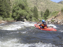
- Boogie (II to III). This section had a lot of non-descript rapids. I do not recall the details honestly.
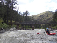
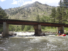
- Bridge (III). There is one bridge that is spicier. Avoid the pillars and the holes. Left or right.
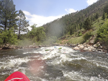
Boogie continues...
Take-out: From Fort Collins take CO-287 North for 9.8 miles before turning left onto CO-14. Follow this up the river valley for 7.1 miles to a riverside turnout. You will know you are here as there is a left turn for Kings Canyon Rd, just pass that there is a small bridge on the right, and then the nice turn out on the right.
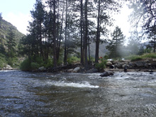
Put-in: Continue up CO-14 for an additional 1.8 miles to the pull out downstream of Pine View Falls. Or use the pull out above the rapid if you want to add that rapid. The gauge is just above the rapid too.
HTML Comment Box is loading comments...
