Bow River (Upper)
| Stretch: | Above Trans-Canada Highway |
| Difficulty: | Class III (IV) |
| Distance: | 4.25 miles (optional additional 2.2 miles) |
| Flows: | 7 cumecs to 30+ cumecs. Check out the PaddlingMaps gauge |
| Gradient: | 80 fpm average |
| Put-in: | Small trail from shoulder of AB-93 |
| Take-out: | Access at Trans-Canada Highway crossing |
| Shuttle: | ~10 km. 10-15 minutes one way |
| Season: | Spring and Summer from snowmelt |
| Written: | © 2018 |
| Featured in A Wet State #142 and in A Wet State's contribution to World Kayak's Video Guide | |
Jobless Summer 2019 Roadtrip - Day 34a:
Diane had bought tickets to fly out of Calgary, and we were beginning to run low on things to kayak. It was almost August now, and with the low snow pack everywhere out west, the creeks had been dry for a few weeks and the rivers in the Banff and Jasper areas were mostly easy affairs. We had hoped to find a group for the Yoho Canyon which is class IV to V, but failed due to the Toby Creek race which was also going on at this time just a few hours away. So, we decide to run the Upper Bow, which was reported to be class III with some class IV.
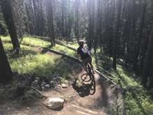
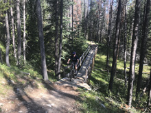
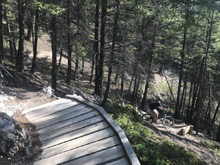
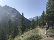
We decided to start the day with a bike ride in near the town of Banff. The new trail came highly recommended so we gave it a go. We found the trail, "Topp Notch," to be quite challenging and resulted in a lot of bike walking for us. There were some really technical parts that we just weren't good enough for. But we climbed back up and road the Star Wars loop next before taking the Bow Falls trail up to the famous falls in the middle of town. Sadly, the falls was much too low to run, a fact which we already knew, but was confirmed on site. We then road the road back to the car, hit up the Banff Ave Brewery for some drinks while overlooking the town while we waited for Gerard to finish his morning activities to join for the Bow later that day.
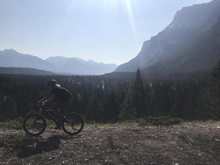
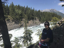
In my experience, Banff and Jasper boating and biking were both significantly easier than basically everywhere else we have been in BC. We road blue in Revelstoke and were scared. We kayaked IV in Revelstoke and thought it was spicy. In Jasper and Canmore we road blue and it was pretty chill. And this run is an example of where class III was perhaps III- and the IV was much more in line with what I would normally call IV, but certainly not what Revelstoke or Whistler call IV.
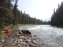
That said, you do the run for the Canyon which is a nice long section of moves to make and the scenery which is essentially the mountains that surround Lake Louise. The scenery was the main pull for us since a few class IV rapids is nothing for us to write home about. And the scenery did not disappoint.
This would be a good run to couple with Pipestone River. They are just a few minutes from each other and both are short. For us, we had spent the morning doing a bike ride in Banff before meeting up with Gerard for this run. Then after this run, Gerard mentioned we could go back and get the Mistaya. I was sorta feeling the same thing, so we decided it was a good idea. With his information from his previous run we felt moderately confident we could find put in. That, and then we just happened to meet another set of boaters who were about to put in on the Bow when we undid our shuttle that had more information, so we set off!
Note, one of the limitations of this run is the parking at put-in is just a slightly wider spot on the shoulder of the highway, so there is not a lot of room for multiple cars.
Previous: Jobless Summer 2019 Roadtrip - Day 33b: Maligne (5th to 6th Bridge)
Next: Jobless Summer 2019 Roadtrip - Day 34b: Mistaya (Canyon)
Mi 0.0:
- Boogie (II to II+). The first good bit is just boogie read and run.
- Canyon (IV- to IV). You will get to an obvious tightening of the river on a right bend. If it is your first time, it is worth scouting on either the right or left, right being more common as you can see the whole rapid. We entered far left to boof the entrance ledge. From there, we worked to a right eddy through the top section. The bottom section had a descent hole on the right so we then worked back to the left for the exit.
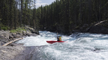
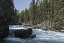
Canyon Exit (III). The exit of the canyon we ran right of center moving left of center. It comes on the left corner just below the above rapid. At high flow I bet it all merges together.
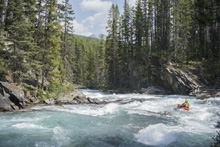
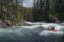
Boogie (II to II+). More boogie, but now with occasionally epic scenery looking down at the mountains that surround Lake Louise.
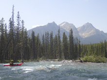
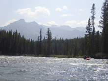
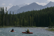
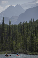
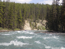
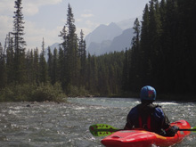
- Pre-Bridge (III- to III). This rapid was a nice s-turn down the left. Super rocky in the middle and right, so just avoid that and go with the s-turn.
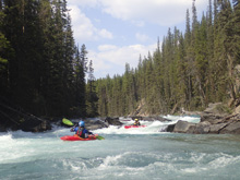
- Rail Bridge (III). Under the railroad bridge there is a nice class III rapid with a few lines, all of which are down the left. There are some rocks at lower flow to zig zag around, or holes at higher flow. I bet hugging the left shore is a good line at high flows.
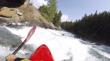
- Take-out just before you cross under the Trans Canada Highway. Though, some people continue down to Lake Louise Village. But apparently there is a lot of flat water in those 2.2 miles and only a few smaller rapids so our friend suggested not doing that optional section.
Take-out: On the Trans-Canada Highway, from Lake Louis, head North for 3 km. Just after AB-93 goes off to the North, be ready to pull into a shoulder turn out on the right just before you cross the river. Don't miss it as turning around is a pain.
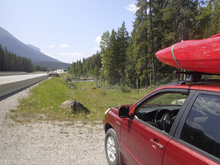
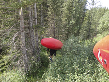
Put-in: So, this is a center divided highway, so you have to continue on the Trans Canada until you find a turn around. We were able to use a construction area which had a break in the divide. I am sure that won't always be the case. So lets assume you go, find a place to turn around, and come back to the opposite way on the Trans Canada. We will start mileage from the Bow River crossing when you come back. After crossing the Bow, in 600 meters take the exit to head North on AB-93. Follow this North for 6.3 km. There is a small spot (nothing more than a slightly wider shoulder) that can fit 1 to 1.5 cars on the river's side of the highway. Park there. There is a trail to the water 50 feet up the road further. The trail is only like 100 yards. The GPS coordinates will help tremendously with this put-in parking for sure.
HTML Comment Box is loading comments...
