Yellow Creek (Daddy's Creek Tributary)
| Stretch: | Into Daddy's Creek |
| Difficulty: | Class III to IV |
| Distance: | 1.4 miles on Yellow Creek, then 3.1 miles on Daddy's Creek |
| Flows: | No gauge, look for USGS Daddy's at Hebbertsburg to be +1000 cfs (+4.4') and rain in drainage. If it looks runnable at put-in, it will at least be minimum. Check out USGS's current flow gauge. |
| Gradient: | 140 fpm for 0.75 miles then 90 fpm to confluence. 71 fpm through Daddy's Creek Canyon paddle out |
| Put-in: | Hebbertsburg Rd |
| Take-out: | Devil's Breakfast Table |
| Shuttle: | 5.2 miles, half on dirt road (10 minutes one way) |
| Season: | Winter and Spring, rain |
| Written: | © 2024 |
I have done Daddy's many times, but not many times on the higher end. When it is running high, there are usually plentiful options. The one exception to that was a post hard freeze when we ran Daddy's with huge ice chunks as ice broke up, at 3'. That was the only time that Yellow would have also been running that I was there. But, Yellow was also frozen, so it was completely a no go.
This weekend though, Daddy's was running at 4.4' (on the online gauge, 2.7' on the bridge gauge) which is the minimum flow you can have and hope that Yellow is in. Additionally, the rain fell in the Daddy's headwaters, so we really didn't expect any luck, but as we crossed over it it looked like a minimum flow and Natalie and Anna were game to explore it as well. So we decided to put on.
It was for sure low, as low as I would say was entertaining, any lower would require wheel-chairing. But as it was, it was a fairly low stress class III to IV run. I would imagine at higher flows it gets more into a class IV feel as it all would move faster and logs could be more dangerous.
As it was, it was a fun alternative to the flat paddle in to Daddy's Canyon, Yellow enters Daddy's just a half mile above the start of the canyon. But Yellow is not so good that you should be adding it to your list for its own merits. However, it is good enough that if it is running, you should put in on it for a Daddy's lap every time.
Mi 0-0.75:
- Ledge (III-). The first horizon line you approach is a ledge that is non-vertical. Just run straight down the middle.
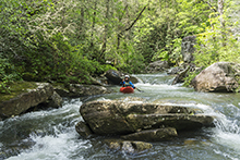
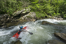
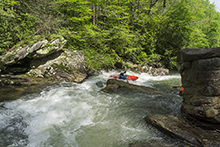
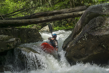
Problematic Rapid (III to IV-). Kirk mentions this early right turn as it often collects wood. We were able to avoid the wood without much ado. After that it goes off a small ledge before splitting around a rock. I hoped quickly out for a scout on the right. We went to the right for a two-part slide where you just follow the water. Probably wise to heed Kirk's more experienced perspective about wood and approach cautiously. The pictures show the middle and exit of the rapid, just out of view above is the undercut corner with wood.


Slot Boof (IV). The marquee drop on the run. The river hits a large rock in the stream and careens to the right through a quick airplane turn into a boof. Boof right. Note the left of the slot kinda dips under the large midstream rock, so try to exit boofing right.

Slidey Boof (III). One rapid that I remember entered via a low angle slide before ramping to a small boof into a pool. It was straight forward but fun.
Hallway (III+ to IV-). The river narrows and you can see it all pillows as it hits a rock just over the horizon. I eddied out at the lip on the right and could see the bulk of the current made a 90 degree turn to the left. From the eddy just peel out and go left hard. Do be aware that the left shore after this is a bit undercut, though not too hard to avoid assuming you are in control.
- Paddle out (II). Avoid wood. A few times the river splits into two channels and one will be overgrown. So, eddy hop cautiously.
- Daddy's Creek Canyon (IV to IV+). You will now have to run Daddy's Creek Canyon with a fair bit of water. Just be aware, Daddy's is harder at the flows that Yellow runs, so make sure you are good with that. Check the beta for that canyon on the Daddy Creek write-up.
Take-out: Note google will lead you astray on this and have you take a road you can't actually drive as it is deep mud and overgrown usually. On 40, take exit 340 for Airport rd. Go North for 1.4 miles before turning left on Golliher Road. After 0.8 miles go right at the Y to turn on Smith Mountain Rd. Follow this for 7.3 miles, IGNORE GOOGLEMAPS which will tell you to turn right on Tom Davidson Rd, instead, continue straight for another 0.5 miles before turning right on Hedgecoth Rd. Go 1.2 miles and turn left on the dirt road Hamby Rd. Follow this for 1.8 miles to Hebbertsburg Rd, turn right at the T and immediately enter Catoosa Wilderness. Go 1.1 miles on dirt road before turning left at a 4 way intersection. Follow this for 2.5 miles down to the parking area before the broken bridge.
Put-in: Drive back out the dirt road the way you came, taking the right onto Hebbertsburg road at the 4 way stop. Continue on it for 2.5 miles to the bridge over Yellow Creek. We parked 100 feet past the bridge.
HTML Comment Box is loading comments...
