Wilson Creek (Gorge)
| Stretch: | Above Adako |
| Difficulty: | Class IV (Class V above 12") |
| Distance: | 1.75 miles |
| Flows: | -6" to 24" at the Adako Rd Bridge Gauge. (<-2" is low, >12" is high). Check out American Whitewater's current correlation to Johns River. |
| Gradient: | 120 fpm average |
| Put-in: | Access downstream of Brown Mountain Beach Rd Bridge |
| Take-out: | River Access above Brown Mountain Beach Resort |
| Shuttle: | 1.7 miles, good dirt road. Less than 5 minutes each way |
| Season: | Fall to Spring, runs A LOT from rain. All it needs is 1 inch in 24 hours |
| Written: | © 2018 |
| Featured in Video A Wet State #144 | |
Lets flash back a week... last week, after boating Gragg Prong thanks to Hurricane Florence (2018) I met some local folks who were game to boat it the next day. One of the reasons I was excited is because I have heard it is a great run with more water in it than the semi-normal lower flows that make it such a nice training river for those learning how to creek. Upon arrival the river looked like I expected, full and fairly brown. I didn't stop to look at the gauge, but the folks I met up with did and reported it to be +16". This run is run down to -8" give or take, with the 0" range being a standard flow. +16" is decidedly "high" for a lot of the normal Wilson Creek boaters.
I could tell the guys I was meeting with were nervous. They both waffled but decided in the end to put on. I was stoked, as it did look high and looked to have some ledges that I wouldn't want to go figure out solo. We made our way down the first few hundred yards and got ourselves to the top of Ten Foot Falls. From the road (and the high water picture in Kirk's book) I knew the line was far left at the bottom. As we ran down, both of my paddling partners went center, like the normal flow line, and found their way into the large hole at the base. One swam, one fought his way out. The swimmer's soon discovered his back band broke during the fight and so his day was over. Then the last remaining person wavered, not feeling confident about continuing on. So, like that, the day was done. Sometimes the stars just don't align!
It was a midweek work day. We hung out for a little over an hour, but I really didn't want to sit there all day hoping that some other boaters may show up to boat with, so I drove home. A little disappointed.
So now flash forward a week. This weekend Jim, Steve and I drove out from Knoxville to get Linville Gorge with the last little bit of water from the Hurricane. After doing the run, we were at our car with shuttle undone at 6 pm and thought, hey, why not head over to Wilson for a lap tonight. So we did. Nevermind the fact that I was puking thanks to the hike out of Linville, and ended up puking again at the put-in for Wilson. This lap was fast, we just boat scouted our way down at the nice, and relatively mellow flow of -2". The entire run with this group took less than 30 minutes. Jim jogged shuttle and returned with the car as darkness set in. 6 days apart, but two totally different experiences.
This run is really quite fun. Bedrock and ledges for the length of the run keep you entertained. The scenery, despite the road being nearby, is actually very nice as well with the gorge walls rising from the river at times, makes me feel like I am on the South Yuba out in California! The downside in my mind is the length. It is short. And once you know it is it is even shorter. The shuttle is easy and quick, but I still wish the run was more like 5-6 miles of the run rather than 2 miles as I tend to lose motivation between laps. But it is a classic, and runs at a large flow range, and therefore can cater to a wide range of skill levels. And the thing that seals the deal... it actually runs a lot, like more than any other natural fed river in the area.
For reference, at 16" I wouldn't call it class IV. It was IV+ and had many sticky features. You want to be confident in that. At -2" I thought the big rapids were IV, with the in-between being class III, but overall would still call it IV- to IV overall. I can see at lower flow it probably gets more into III to IV range.
Mi 0.1:
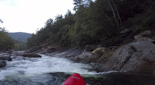
- Initial Ledges (III). At put-in, you have one smaller rapid that you run center moving right which then brings you to the top of several ledges. We ran the first few on the far right. Then, the river turns into a more boulder garden affair, we moved to the left and ran a set of ledges over there. Note, that these ledges can get big holes at higher flows, scout when needed.
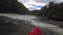
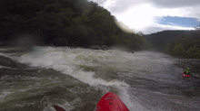
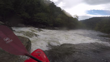
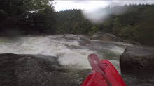
- 10 Foot Falls (IV to V-). There is a bunch of mank just above this rapid, we ran down the right. This then leads to a small poor over that we ran down the right which commits you to downstream progress towards the main falls. The main falls has different lines at different flows, at low flow, run center and slide down into the convergence of the right and center flows. At high flow, you want to head far left, using the small eddy/slack water on the left just above the lip to move left behind. Be careful though, as it will want to spin you out. Also, at high flows, the center line is a big hole. It is worth scouting a bit from the road on the drive up.
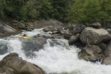
- No Name Ledge (III). After a few small rapids you will get to a river wide ledge. At low flow we were able to run the meat of the drop and boof the hole. At higher flow I think you want to error far left or far right.
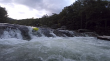
- Boatbuster & Thunderhole(IV- to V-). The walls tighten and you enter a gorge section. A large rock sits on the horizon line. At most flows you can go left of center down the ramp which is shallow. At really low flow, you want to start boofing to the right as the shallow ramp ends up being a boatbuster. Immediately below, after maybe 50 feet of quickly moving water is this funky hole called "Thunderhole". It is held where the river pinches, the current folding under itself. Being right gets you the worst of it. You want to be left of center and moving left with left angle and you will fly through and not notice a thing. This section from Boatbuster and down through the runout holes below Thunderhole is full on at higher flows. You should scout from the road on the way up at higher flows.
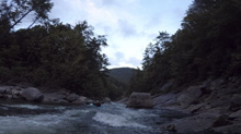
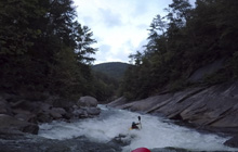
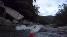
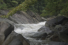
- Bedrock (III). Some nice bedrock awaits downstream once the walls peal away. Again, stay on your toes for a sticky hole if the flows are up.
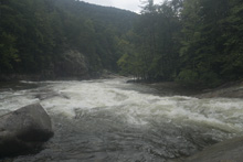
Dental Work (III to III+). In here, there is a bedrock ledge that we ran with the current, right of center and into a tight s-turn with a hidden rock as it cut back left. You can go to either side of it, but the first lap it surprised me and broached me for a second.
- Triple Drop (IV- to IV). A steep boulder pile that is channelized down the far left. We just ran far left the hole way, the middle hole packs a small punch, and you want to be moving off the left wall through that move as the left at the bottom is a little junkier.
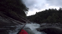
Bitch Slap (III). This is just a pile of crap directly below Triple Drop. We ran far right at the entrance and then one channel to the left through the bottom. You hit rocks. But it was the only clean looking place.
- Maytag (III to III+). A spicey little cauldron hole. At -2 you could just barely grind the left of the slide and get an autokick over the hole. It was a little abusive at that flow, so on the next lap we just ran down the middle and used a delayed boof which was fun. At high flow, I am not sure of the line, maybe far left as there is a channel over there, and I think the right might get mean.
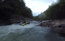
- Razorback (IV- to IV). The last bigger rapid on the run. This is a riverwide bedrock shelf with a shear drop on the left. The line is to slide down far right into a cushion forming off a bedrock jut on the right wall. Hit it with a little left angle to kickout to the left.
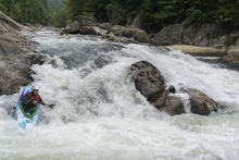
- Railslide (III+). A minor rapid with a fun move. The river forms a river wide ledge, but there is a nice slot that ramps down on the far left, that you can rail slide, and then ferry behind the riverwide ledge. It is a fun move.
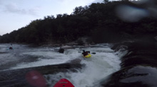
Take-out: Get yourself to the town of Adako, NC. Head west out of town on Adako Rd, less than a mile out of town, turn right just before you cross Wilson Creek (the gauge is on this bridge), onto Brown Mountain Road. Continue for 1.5 miles. There is a bathroom on the left, and a parking area with stairs just before and after it. They use the same beach for take-out.
Put-in: Continue up the dirt road for an additional 1.7 miles. There will be a large pull out parking area on the left with access path down to the river.
HTML Comment Box is loading comments...
