Willow Creek (Carhood Section)
| Stretch: | First Bridge to Forbidden Section |
| Difficulty: | Class V |
| Distance: | 1.0 miles |
| Flows: | 150-500? cfs (Redwood Creek "Highway 299 Gauge" Analogy: 300/400 is low, 700 is optimal, 1,000 cfs is high... so I am told. Dreamflows Gauge) |
| Gradient: | 206 fpm |
| Put-in: | Turnout Upstream on Highway 299 of the first bridge up from the Trinity |
| Take-out: | Turnout 1.0 miles down the road. |
| Shuttle: | 1.0 miles. Highway. |
| Season: | Winter and Spring from Rain |
| Written: | © 2013 |
| Featured in Videos by Dan Menten and Leif Anderson linked here | |
Well, it is 3 AM, 2 days after I did my first run down Willow Creek. I can't sleep due to the poison oak that is found every nook and cranny on my face and is now spreading up both my arms and down my neck. So despite my overwhelming discomfort and frustrating on two nights in a row of not being able to sleep... I am going to try to keep this positive.
Willow Creek as described in the Stanley/Holbek is an unappealing place, both for the quality of rapids and the quality of scenery. These days, the run is split into three sections, with the bottom two (Forbidden Section and Lower Section) being run far less frequently than the top section (Carhood Section). Easy access, easy shuttle, steep continuous class IV-V, and a close proximity to Humboldt State have made this a go-to run of sorts for the locals, much like the Green is in Ashville. Of course, Willow Creek is all natural and needs some rain to get going. Unlike the green, there is no big clean bed rock drops, just tight, technical, and steep bolder gardens with hazards waiting for you if you end up off line.
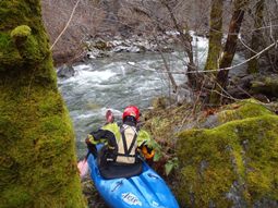
We met up with an Arcata local, Justin Teague, who was nice enough to show us the lines down the run. The nature of the river requires either someone to show you down your first time, or lots of scouting. Many small drops commit you to bigger drops or end in bad areas and the rapids are too steep, too congested, and too full of hazards (wood and sieves) to be bombed down hoping for the best. Scouting each and every rapid seemed like an option from the little I looked around. We scouted a few ourselves to ensure the wood situation was clear even though Justin had run it just a few days before.
The run is worth doing though if you are in the area, though probably not worth driving from Sacramento for. However, if you are driving on Highway 299 to go up for a weekend on the Trinity, Smith or the Salmon, this would be a quick, not out of the way section to add to your plans. The highway is above the creek at all times, the shuttle is hitchable or hikable (only one mile) so you don't even need a second car.
The day we ran the creek, the flow was estimated to be 180 cfs or so. The analogy folks use to determine if it is likely in is the Redwood Creek gauge at Highway 299 which is just on the other side of the ridge, a few miles away. Our day the gauge read 370 cfs which was the" high side of low" to quote Justin. Groups run it lower, though I think that was as low as I would like. My next time down the creek I will want more water by 50 cfs or so. That would help to clean up some of the channels, fill in the landings, create some cushions, and hide some sieves. As it was, I had one fairly sticky pin at the top of Eraserface (right line).
For more info, see Dan Menten's write-up as he has many laps on it along with some nice photos of the run. North Coast Paddling's Write-up. He also notified me that there is a good warm up section upriver from where we put in that offers folks a good feel for the creek and the level before getting into the hard stuff.
Mi 0:
- There is one small warm up rapid before the first big rapid. In 2012 there was a log in the warm-up rapid that required staying far right.
Pyrimid Rock (IV to V). We entered far left and worked back to the right to boof the ledge at the bottom. There was a small run out rapid that we ran down the middle and then immediately eddied out right for a quick scout/portage around Carhood.
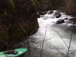
Carhood (V). Better with a little more water I think. Now that the carhood itself is gone, you can run middle charging right in front of the carhood rock. Or more commonly, you boof the left edge of the center, landing in an immediate right turn to pick your way through a boulder manky pile. We portaged easily on the right. Things ease up for a little bit below with a few class IV drops.
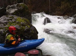
Eraserface (IV to V). Apparently the line is usually down the left, but there is some wood over there this year so we were told so we ran down the right. The right consisted of a 90 turn into a double boof. Justin and I got pushed into the outside corner of the turn and melted off the drops. Justin cleared through, I pinned in the top drop and had my boat begin to cave in on my ankle before I managed to wiggle off the spot and drop the runout backwards. Diane managed to catch a micro eddy just above me and hoped out of her boat. Close call for sure. Easy to scout on the right for the right line.
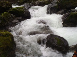
Lambada (IV to V). Precision is the name of the game in this rapid. No hard moves, just precise slots need to be chosen to ensure no dead ends. Enter on the right and stay far right when the river splits. Hug the left side of the far right channel. In the week between Justin's runs, a new log appeared in the run out requiring a left move into a small micro channel at this point where as normally you can run down the right. Scout/portage this part on the right down to here. Below here, the river drops over a ledge that you want to drive left across and boof the exit on the left.
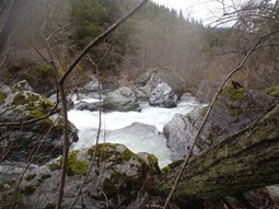
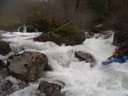
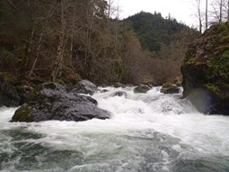
White Trash (IV). A junky rapid that we ran the far left moving back far right. It is junky, there are no great lines. It ends in a small eddy in the middle or the right, just above the final boof (set safety on that one).
Take-out Boof (V). So by no means is this drop actually class V, other than it feeds directly into a very sieved out rapid that should be considered unrunnable (though it has been by a few after lots of scouting and at the ideal flows). Boof the left channel and then catch the eddy on the right. Set safety at the bottom eddy to pull people in that don't make it. Justin went first and barely made it in, Diane went second and I had to pull her into shore when she didn't quick make it, as she was entering the sieved out rapid. I decided to walk after seeing the close calls. The fun to f@#* just wasn't there for me. Take-out is this eddy. Apparently at high water, take-out above White Trash as the eddies disappear.
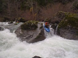
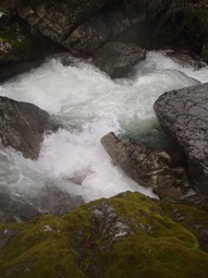
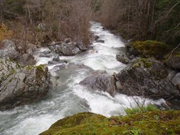
Take-out: From the Highway 299/96 Junction, drive 2.3 miles on Highway 299 towards the coast. Park at the big turn out on the right. The back of the turnout has some rocks blocking a section of it, the "trail" pops up back there. The hike is short, 100 feet up in about 200 feet of walking. Takes just a few minutes though it is steep.
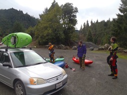
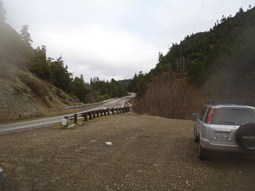
Put-in: Drive 1.0 miles further up Highway 299 and use the turnout on the left just after the first bridge you cross. There is a trail quickly down to the water here.
HTML Comment Box is loading comments...
