Weber Creek (South American Tributary)
| Stretch: | Green Valley Rd. to Cold Springs Rd. |
| Difficulty: | Class IV+ to V |
| Distance: | 2.2 miles |
| Flows: | 1' to 3' on the bridge gauge. ~150-500 cfs... Or Estimate off N. Weber inflow. If between 100-200, I might be in. Current Dreamflows N. Weber gauge |
| Gradient: | 141 fpm average (The goods are 162 fpm for 1.5 miles) |
| Put-in: | Bridge on Green Valley Rd. |
| Take-out: | Bridge near Cold Springs Market on Browns Rd |
| Shuttle: | 3.5 miles, 10 minutes one way |
| Season: | Winter from Rain |
| Written: | © 2011 |
| Featured in Video A Wet State #41 | |
I have been trying to get on this run for a few years. It shouldn't be as hard as it was for me. I live 30 minutes from the run, I work 30 minutes from the run. The hard part is that it tends to only run off of substantial rain and furthermore only on the day of the rain, occasionally the day after. It seems during the past few winters, the only rains substantial enough to bring flows in came while I was sitting in my office, a world away from the river. With that in mind, I even brought my boat to work several days with plans to ditch the second I got word flows came in... only the word never came. Until last Friday. It was 12:30, almost jokingly I sent Darin an email asking if he would be interested in getting on Weber on Saturday. I knew flows wouldn't be in. It was hardly raining now, and it was a freaking cold storm that had kept every other river low. But it went (albeit low) the prior weekend out of nowhere and a man can dream. Then, an hour later I get a phone call. Darin: "You busy at work today?" Daniel: "No." Darin: "Weber is in and I am just leaving Davis." Daniel: "Meet you at my house in 30 minutes." And so it was...
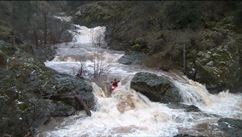
The rhyme goes 2 is "goo," and 3 "let it be." We arrived to flows of 2.7' on the gauge and Taylor proclaiming that he has never run it this high. I reassure myself that besides the two big rapids, the rest of the run is boogie. And we push off. 100 yards downriver I find that the boogie is anything but and we are scrambling for eddies and missing the same eddies. Folks are upside down, Will: "You done this before?" Me: "No." Will peels out and I am left thinking, "should I follow? He hasn't done this either." Crap, another eddy missed, folks are stuck in holes below me, Cody: "Go left! I mean Right!" Phew. But eventually we all recollect in eddies down below with grins on our faces and stories to tell. Darin: "I forgot about that section, it is mellower from here out besides the big ones."
In all seriousness, if it is your first time down and don't have someone to show you the way, I would stay at flows around 2' or less. That would slow down the first section. At this flow, if anyone swam it would have been a rough pill to swallow. After that first section of class V, the river mellowed out all the way to first big rapid. It was then mellow again (with plenty of wood hazards) to the last big rapid which is quickly followed by a portage (for almost everyone) followed by more runout. So why do this run? Why not? It is convenient, and it was fun. I will be back... sometime hopefully sooner than 4 years from now.
Thanks to Darin McQuoid for sharing photos.
The three main sets were all class V at high water, though I have seen video of low water and they look more like big class IV+. Be aware of ever present wood hazards as it changes from year to year.
Mi 0.12:
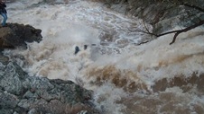
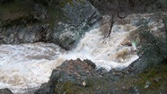
- First Set (IV+ to V). 0.12 miles below put-in you bend left and it is on. The first move was a 5 foot boof into a large hole. Run it center or boof the left edge of the center channel. There was an eddy below on the right. Come around the next corner and drive right, hole at the bottom. The river then bent left again and there was another hole that we went center through. Below here, it was easier but there was another hole or two in the run out that had bite, so keep your eyes open until it flattens out. It last about 0.15 miles.
- Mad Dog (V). At the high flow, the largest concern in my mind was not rolling up before going over the rocky ledge just downstream which was immediately followed by a large quantity of strainers. I gave it 50/50 odds at getting through the funky hydraulics in the landing zone upright, but I knew I could get to the landing zone ok. So off we went. Basically, we all ran the right edge of the main chute, just catching the edge of the reactionary off the left wall. Good times. Scout or portage on the left.
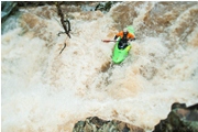
- Double Drop (IV+ to V). The hazard is the pocket on the left at the top and the shelf in the middle at the bottom. Some folks run down the junky right side at the top and finish right. Others run left and left. At our flows, we ran center/left followed by a left finish over the nice 6-8 foot boof. Scout on the left.
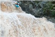


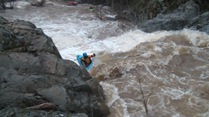
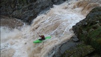
Portage (V+ to U). On the other end of the pool, the river plummets down a quadruple drop that is huge. It has been run, but only once or twice I believe. We portaged on the right.
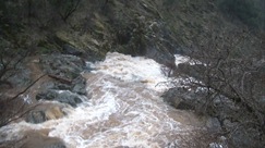
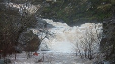
The End (IV). 100 yards downstream of the Portage, is a double ledge. The exit had a good size, though runnable hole on the left and a rocky but straight forward line down the right.
Take-out: The easiest way (direction wise, but not most direct, look at a map) is to take Forni Rd off of Highway 50 as you enter Placerville. Cross over the freeway and get on Placerville Rd. Drive 1.1 miles and turn on Pierroz Rd. In 100 feet turn left on Cold Spring Rd. Continue for 1.8 miles. You will see Cold Spring Market (closed as of 2011), park here. Browns Road has no parking on it, but it is a simple 200 yard walk down to the bridge over the creek.
Put-in: Get back to Placerville Rd and head back towards the Freeway. Before you pass the shopping center, at the light, turn right on Green Valley Road. In 0.6 miles you will cross the creek. There is a turnout with space for 2 cars just before you cross the bridge. The painted gauge is on the near side of the bridge and needs to be viewed from the far side.

HTML Comment Box is loading comments...
