Watauga (Gorge)
| Stretch: | Guys Ford Bridge to Tester Road |
| Difficulty: | Class IV to IV+ |
| Distance: | 4.9 miles |
| Flows: | ~180 to 650 cfs. Check out American Whitewater's current flow gauge. |
| Gradient: | 89 fpm |
| Put-in: | Guy Ford Bridge access |
| Take-out: | AW Access off of Tester Road |
| Shuttle: | 6.2 miles (10 minutes one way) |
| Season: | Winter/Spring from rain (with occasional runs in Summer and Fall when storms permit) |
| Featured in Video A Wet State #97 | |
| Written: | © 2014 |
When Diane and I moved out to Knoxville, all our friends who had ever lived in the area told us their list of runs that we must do. In each of their lists, there was the Watauga. And adding reinforcement to that sentiment, with every new friendship formed on a river since we moved, with each person who asked us what rivers we had done came the inevitable, "Oh you haven't done the Watauga? Oh you have to do that one." So as it was, the first day that it was running that I was able to make the 2.5 hour drive from Knoxville to Boone I did.
None of the Knoxville folks I reached out to could make the drive the day after Thanksgiving, so I reached out to some other folks looking for a group to join and found a group in town from New York. Arriving at put in we were surprised to find out the groups other plus 1 was actually a plus 15 and had a large group of their own. For whatever reason we did not break off on our own, so instead we headed down river at a slow pace in frigid 25 degree weather. Most of the run was boat scoutable, although we had some folks who had done the run before, they were busy helping some other first timers down. I decided to avoid the crowd by staying in front, only a few times deferring for beta rather than probing something I could not see the bottom of. The style of rapids although most boat scoutable did sometimes get congested and steep. A few scouts would be needed for all but the boldest boat scouters.
The highlight of the run of course is Stateline Falls. This is one that if you were boat scouting, you would want to scout if you could figure out ahead of time that you were at. The river goes through a short lead in before pushing you towards several channels, only the middle of which is runnable. Following someone that knows the line is not difficult, but you really want to make sure you are in the right channel if you don't want to land on rock. And even in the correct channel, proper angle is required... make sure you are far right aiming right else you land on rocks. Below, the river quickly gives you its last few rapids and a short paddle out gets you to take-out.
We had 220 cfs which I thought felt low. Locals were saying ~350 is a great flow. I would have loved to see it with that flow. I imagine rapids like Hydro get beefier but I also imagine many others clean up some. The run is short enough that with a group paddling downriver it would be easy to get two laps in the day. But as it was, with a few pins and a few swims it took our group over 4 hours to complete the run. So keep that in mind when dressing for this canyon as it is notoriously cold.
And as an unrelated note, this run was extra cool for me personally as it was my 50th personal first descent of the 2014 season. The second time I have managed to get that many new runs in a year so far. The other was 2011.
Mi 0.0:
- You start with some mellow warm-up stuff that leads to a right had turn at a house that is a sorta junky rapid with a cleanish line down the middle.
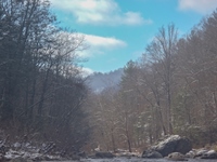
- Bump and Grind (III+ to IV). Just below that sorta junky rapid the river drops through two channels. I scouted a left line that went great (though it looks horrible from above). We entered to the sharp right in the left channel and eddied out. From there, there was a channel that went back to the left towards the wall that was clean and avoided all the rocks in the pile. There is another line down the far right (avoid just left of the far right at the top as there is a pin spot). Head down the ramp but avoid the undercut on the left at the bottom as well.
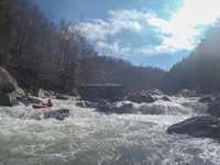
- Shitkicker (IV). The moves on this rapid aren't hard, but it is rocky and therefore pinny and sievy which results in some calling it class IV+. I would actually give the moves class IV- difficulty, though the consequence is there. You can either start far far left and avoid the first hard move but it is rocky and that could cause problems. Or enter far right and move all the way left across the river. The tricky part is below the middle move you want to keep moving left (or back far right), but a lot of water pushes into a bouldery middle part that you want to avoid.
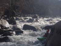
Hydro (IV+ to V-). Hydro is the biggest rapid on the run other than Stateline. At the low flows it was forgiving. You start with a boof off the right side of the middle rock. A fun move in and of itself. You then can catch an eddy on the left behind the rock. Next you can run down the right or left of the ramp around some rocks and holes, this leads to the final hole which can get quite sticky when the flow is up, and it is unavoidable. You can scout and set safety easily on the left.

- Split Decision(III). The river split amongst large bolders with the correct line being down the far left.
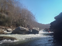
Vernon's Follow (III+ to IV-). Not far below was a fun rapid that was bedrock. We started left and ferried to the far right across the entry. Then ran down the far right into a small eddy on the right. And then ferried back left in front of a slightly undercut rock. Good fun and ferry practice.
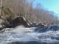
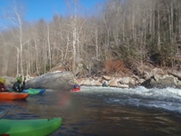
- Edge of the World (III+ to IV-). The rapid started with either a tight slot on the right or some junky crap on the left. Then you boofed a ledge and ran down some fun boogie.
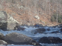
- Below, the river went into a fun section that had some tight slots and fun little boofs. Blow Job is in here which is where you suddenly feel like you are in a pool with no good exists as they are all tight slots. The two on the right go.
- Heavy Water (IV). This is one of the better rapids on the run. Starting heading right into a small eddy, then you can head left into another small eddy. Then you run an s-turn anywhere other than left of center through some friendly holes. Left of center there is a good size hole at the top. There are also some great eddies to catch in here.
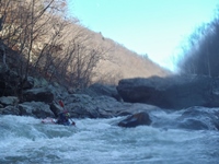
- Knuckles (IV-). This is one rapid that from the boat we just weren't sure of. You could see from the eddy at the lip on the right that there was some water fanning up in the middle. The left looked good but the landing was over a horizon. The line turned out to be on the left. Go cross current to the left boofing a hole that would feed you back right, and then exit on the left side of the ledge. Keep your nose up as apparently there is a pin spot on the right side of this ledge if you pencil off of it.
- Diane's Ledge (III). I boat scouted down to an eddy above the ledge on the far right. Found a nice launch pad and boofed the ledge. I was later told that someone died there from a drowning (but was revived) and that the normal lines are the ramp around the hole on the left or the sneak to the far left. At the low flow the ledge was fun, but I guess it can get really mean at higher flows.
- Stateline (IV+ to V-). Great rapid. Below Diane's ledge, don't enter the rapid that starts with a few ledges prior to making a sharp right hand bend. Scout if you don't know the line. The line was down the middle chute with right momentum and right angle in order to avoid landing on some rocks. It is an easy walk on the left if you are so inclined.
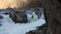
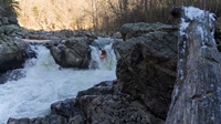
- Rewind (III-). Just below the river fans out over shallow rocks, go down the right. This then leads to a 8 foot tall ledge, the left most slot (on the right half of the river which is split by a large rock) is a slide to autoboof. Tradition says your first time down you have to run it backwards which proves to be good fun.
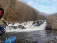
- Last Hair (III to III+). The main flow goes down the left into a pile of ugly looking rocks. You can go with the flow right to the far right side of the river and a large eddy. From there peal out and head down the right channel moving back left away from the wall. There was also a small channel far right at the top to sneak the initial move.
- Boof Falls (III). Around a corner you see the river split into two slots with the left looking like a ledge that turns out to be friendly. There was also a fun little kicker into a cushion move on the far right. Mostly flat water below here.
- Watson Island: A large island splits the river, make sure you stay left as the takeout is before the river comes back together.
For more details on the run, see the AW write-up...
Take-out: From Knoxville, find your way to Hampton, TN and go another 19.9 miles on Highway 321. Look for Tester Road which is a small dirt road off to the left. Follow this down and follow the signs to the AW access half a mile down. Drive slow to keep the neighborhood folks happy.
Put-in: Continue up Highway 321 for an additional 5.3 miles, look for Guy Ford Rd dropping off to the left at a market. This quickly drops down to the water, there is parking before the bridge.
HTML Comment Box is loading comments...
