West Fork of the Tuckasegee River (Thorpe Dam to Thorpe Powerhouse)
| Stretch: | Thorpe Dam to Thorpe Powerhouse |
| Difficulty: | Class IV |
| Distance: | 5.55 miles |
| Flows: | 250-~750 cfs. (250 felt rather boney). AW's flow page |
| Gradient: | 107 fpm (129 fpm for the first 3 miles) |
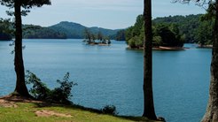
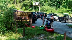
| Put-in: | The Pines Recreation Area at Lake Glenville |
| Take-out: | Thorpe Powerhouse on Highway 107 |
| Shuttle: | 7 miles (plus 15 minute hike) |
| Season: | April through August dam releases |
| Written: | © 2014 |
| Featured in Video A Wet State #94 | |
The second new run as a resident of the great state of Tennessee was yet another run located in North Carolina. Damn it. Oh well. The run was interesting... AW calls it class III to IV+. I think I agree with that... but at the same time the first two rapids are steep and junky and push the class IV+ rating. Then there is the miles of mellow whitewater... that of course is plentiful with wood. Then there is the must run, that although is only class IV has broken backs in the past. It is sort of perverse. Hoping for a class IV run, it was certainly easier than I expected... except when it wasn't... and then it was harder than I expected. So it is hard to tell how it should be rated. But I think aside from the first two rapids a class IV boater, taking their time could get down it.
American Whitewater negotiated a release of 250 cfs... which in my opinion is probably about 150 cfs too low. I think even 500 cfs would probably be a great flow in it... though certainly continuous. As it was there was a lot of boat abuse, and the slides weren't so much slidy as they were grinding the plastic down as you nearly slid to a stop each time.
I thought this run was a great run to do, but with all of that I just am not sure I am going to rush back without more water. Oh, and in addition to the flow, there is a hike in which is down a steep hill and will leave your legs sore for a few days. And while hiking you hike past some sweet looking slides and falls that disappointingly lead directly over the High Falls which is unrunnable. Just all around a lot of work and effort for a sub optimal flow. (But I do appreciate the fact that any flow is better than no flow!).
Mi 0.0:
- Put in (III+). The first rapid is directly at the base of the falls. The line is to the right of the boof, too far left and you land on rock, but too far right and you elbow a rock.
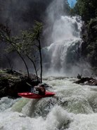
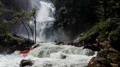
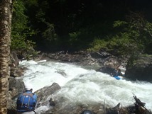
First Boulder Garden (IV+). Directly below is a complex and somewhat crappy little rapid. There was a line on the left, but we entered middle over a small boof before driving left through a slot and around a large rock through some more holes. Below there were two more steps which we read and ran down to the right.
Second Boulder Garden (IV to IV+). Just below is another junky rapid that is steeper than the rest. We ran down the middle and boofed the ledge. Over the middle seemed to work best as there was a rock in the landing on the left. The photos AW have of it without water makes you almost not want to boat this run in general!
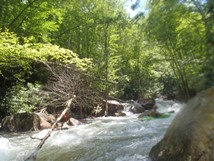
Things then got much easier for over a mile with some cool small slides and surf spots
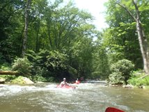
- Pre Falls Slide (III+). A fun slide just above the falls, we entered right and slide middle. The rapid was really straight forward, but the water in the outflow quickly heads down and off of the Big Slide below.
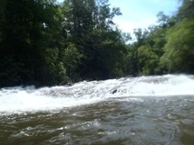
Flight Simulator (IV or V). The easier line is on the left, go straight through the small roster tail at the lip. Too far left and you will hit a rock and have to keep your balance as you bounce off of it and back onto the slide. Too far right and you drop over a ledge onto the transition slab below. Two folks have broken their backs in the past year since they began doing releases apparently.
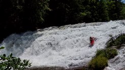
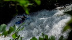
- Kornegay's Cascade (III). We didn't know this rapid was there, caught us by surprise. It looks like a big horizon line but turns out to be a mellow slide with lines left, middle or right. We went the middle for maximum fun which included two small ledges with small holes.
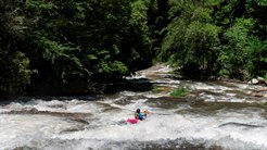
Cullowhee Bridge (III-). Around the corner was another long slide that appeared to be runnable anywhere.
There is some wood in the sections below this...
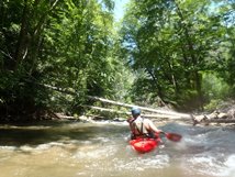
- Mini Gorge's "The Crux" (IV). Scout on the right if you want, or eddy hope down the right which breaks it apart nicely. The first move was a small lead in to a ramp into a hole that went deep into the eddy line. There was a big eddy here on the right to boat scout the exit. The exit was again down the left, down a large ramp into a splashy hole. This then leads to one more small boof over a hole and you are in the pool below.
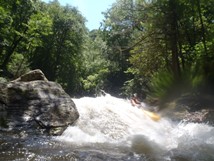
Mini Gorge's Second Rapid (III+). A junky rapid has the deepest water on the right, but you don't want to exit on the right, work back to the middle and boof. The right ends in a pile of crappy rocks.
- Mini Gorge's Crevice Ledge (IV). The only reason I give this a class IV rating is because the Second Rapid, this and the next rapid are all one rapid for all intents and purposes, and in total it was a class IV rapid. This was just a single move within the rapid. Stay right on the slide and don't melt into the middle crevice. Or you can, your call.
Mini Gorge's Little Amphitheater (IV-). The river slopes off of a bedrock shelf into the left wall creating a large pillow. You can slide right around or plug through the feature. Below is some fun splashy run out.
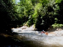
The next 2.5 miles were full of non-de-script rapids though a couple were a bit junky if I recall.
For more details on the run, see the AW write-up...
Take-out: From Knoxville take 40 towards Ashville, 20 miles or so before Ashville take Highway 23/74 towards Waynesville/Bryson City. In Silva take Highway 107 South for 15 miles to the Thorpe Powerhouse, large parking area exists on left.
Put-in: Continue on 107 for 5.2 more miles and turn right on Pine Creek road which rises quickly away from the Highway. Follow this to the parking area a quarter mile past the dam.
HTML Comment Box is loading comments...
