
West Branch of the Pleasant River (Gulf Hagas)
| Stretch: | Katahdin Iron Works Rd to Appalachian Trail Access |
| Difficulty: | Class V |
| Distance: | 4.65 miles |
| Flows: | 0" to 8" for normal levels. Down to -3" for ELF and up to +19" for high. Gauged based on water height relatively to the concrete step at the base of the put-in bridge. |
| Gradient: | 104 fpm average (185 fpm from mile 1.35 to mile 2.9) |
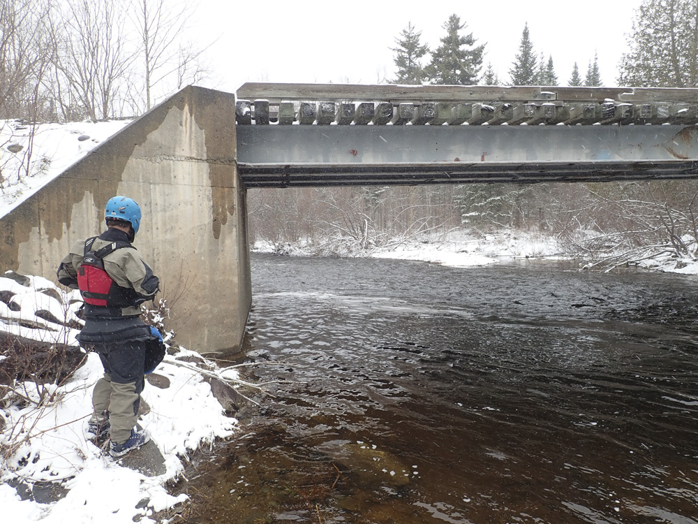
| Put-in: | Katahdin Iron Works Rd |
| Take-out: | Appalachian Trail Access |
| Shuttle: | 5.4 miles +0.4 miles walking, (10 minutes one-way, some muddy and rutted, a highlander would be enough, a minivan may not be in spring) |
| Season: | Spring off snowmelt, summer and fall off of rain. Holds well due to marshy headwaters. |
| Written: | © 2021 |
| Featured in Video A Wet State #158 and Mike Mcvay's High water video | |
-
North East Road Trip 2021: Day 3
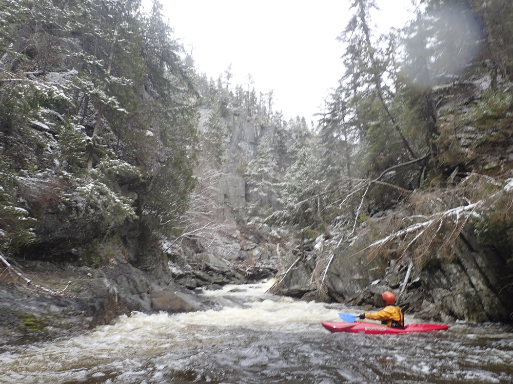
What a classic run. It is right there in the name, the Pleasant River! This run stands up to the East Coast Classics, though it is perhaps much less known just because its location at the far tip of the country, well away from large boating populations. In Maine, it has a reputation as being mean and dishing out epics. This is partially because it is the goal of many of boaters, which means some boaters step up too soon and are unable to navigate the mandatory class V rapids encased within its inescapable walls. Or perhaps it is just the unforgiving nature of the walls that form the inner canyon, making any hope at egress and adventure and risky endeavor. Whatever it is, this is an unforgiving canyon that should not be taken lightly, but for those who are up to it, it is an unforgettable and rewarding canyon to experience.
I first heard of this canyon five years ago when we road tripped to the North East. A friend of mine who lived in New York for a few years highly recommended this canyon. That trip did not take us far into Maine, so while it was added to "the list" I did not know when or if I would ever get to experience it. Thankfully, on day three of our 2021 trip, we got some rain on the freshly fallen snow which gave the region the much needed shot of water in the rivers, and brought the Gulf Hagas up from -3" up to +4" the morning of our run. Super! For reference, most people consider low to be 0" with it having been run by a few down to -7". I think that must have been absurd bone zone. I was told -3" wasn't worth it even if it was the only opportunity I may ever get to see the place. +4" was a nice medium(ish) flow, perhaps a tad on the low side. It has been run as high as +19" but that is a locals connoisseur level that I would think is terrifying, even if you know exactly where to go and what to expect.
The run is fed from a marshland so it typically holds out better than just about any other river in Maine. It is usually runnable through most of May at least at a low level. Only in drought years (this year) will it drop out in mid April.
I would look at your favorite hiking app before going in to familiarize yourself with the trails. They run on river left and include a Gulf Hagas loop as well the Appalachian Trail. If you have issues, it is not a given you will easily find one of these trails to walk back to the put-in on.
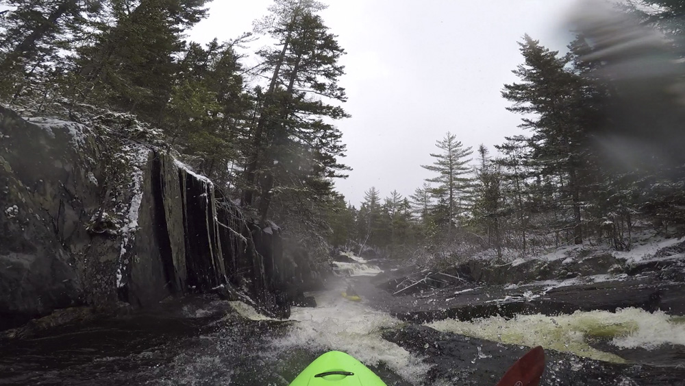
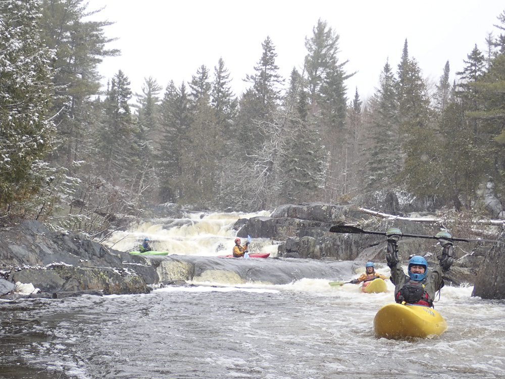
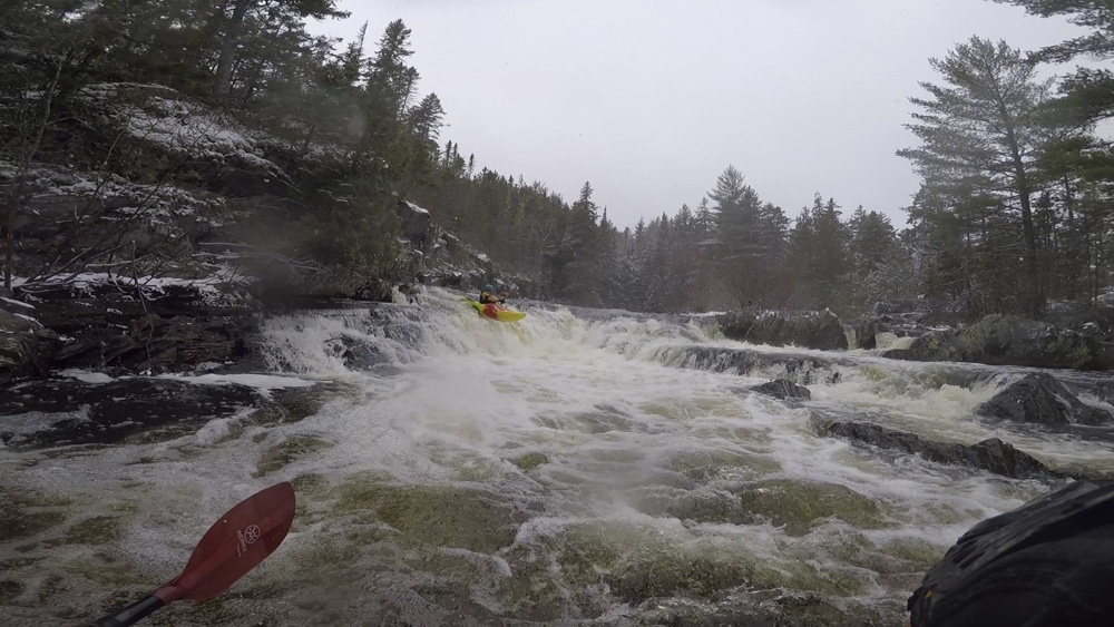
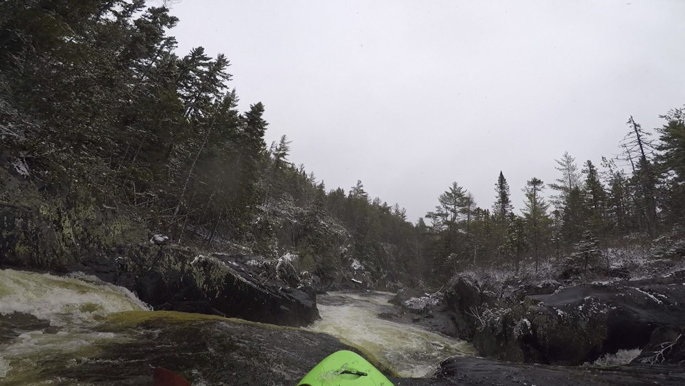
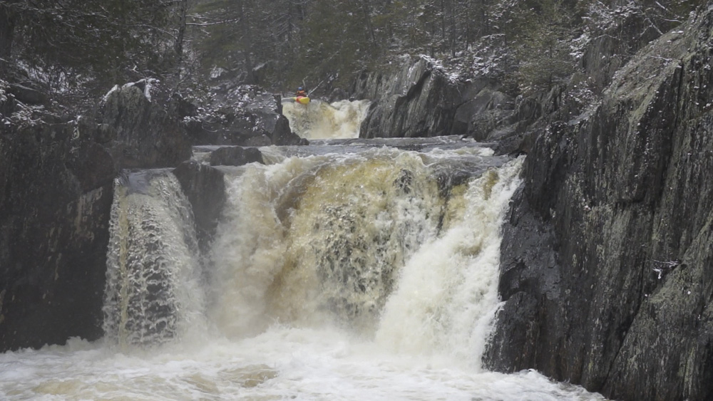
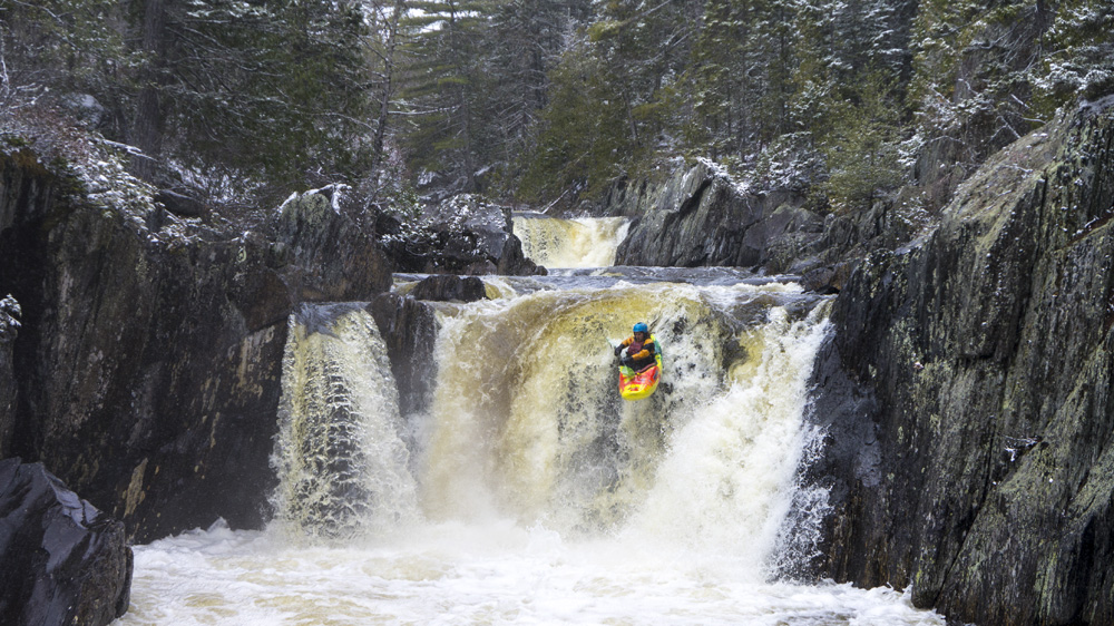
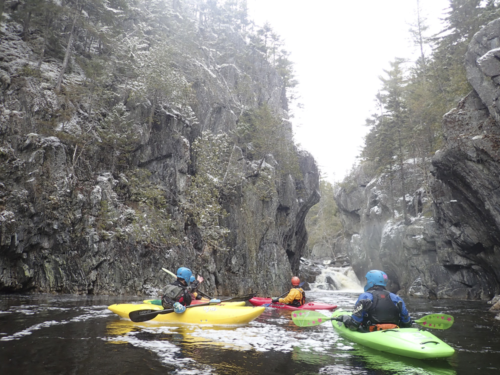
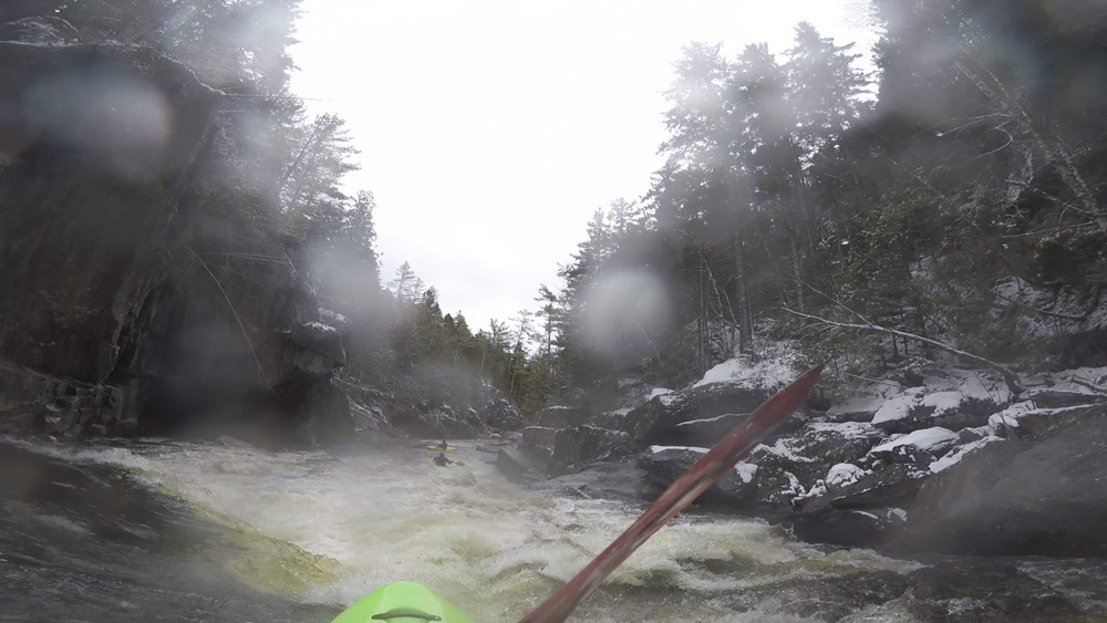
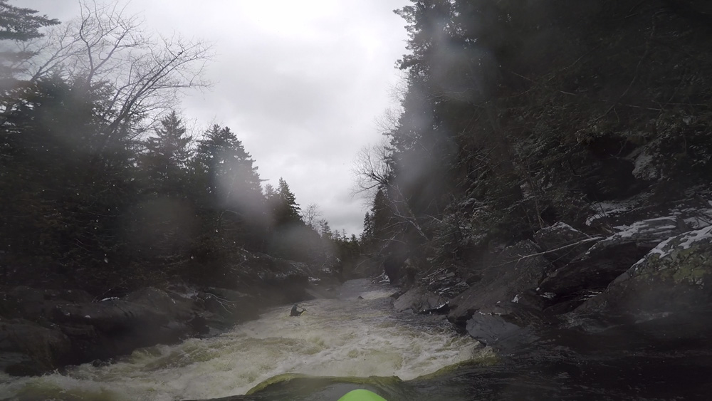
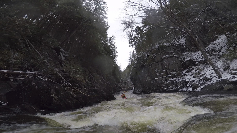
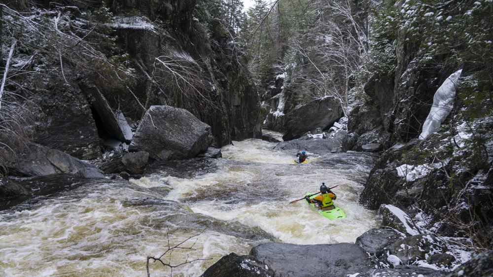
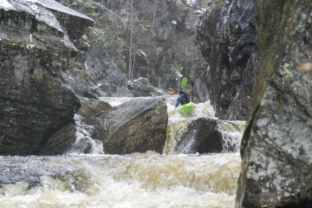
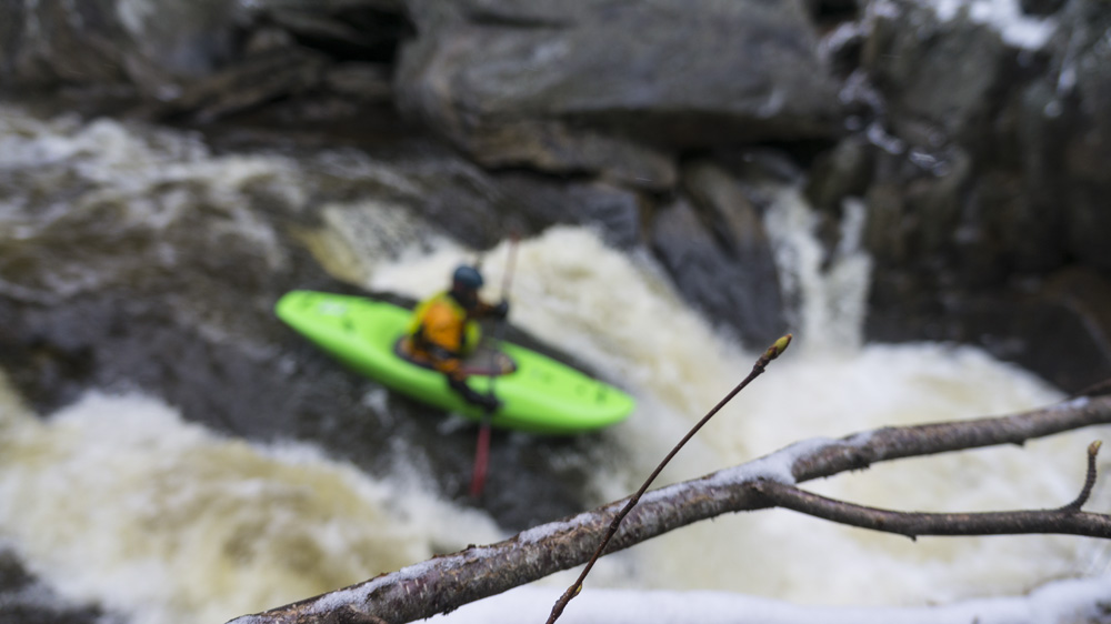
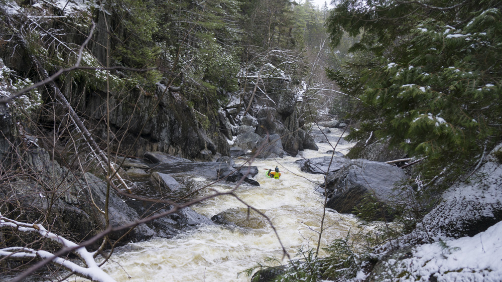
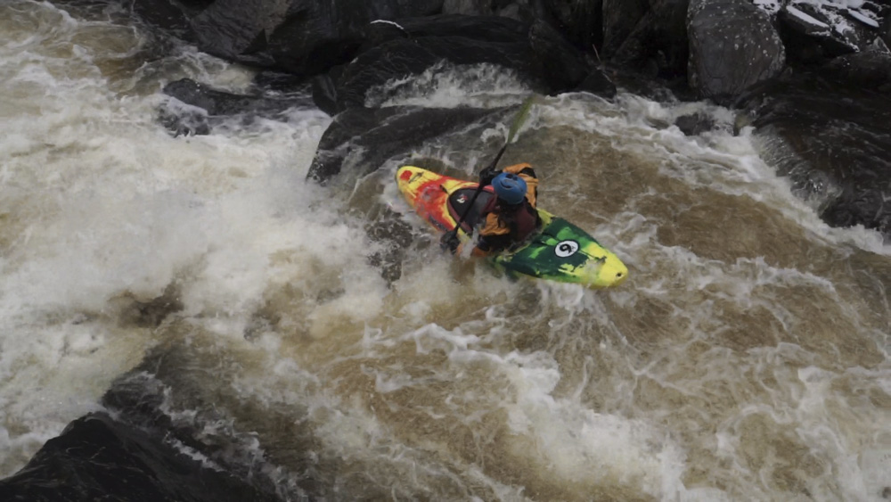
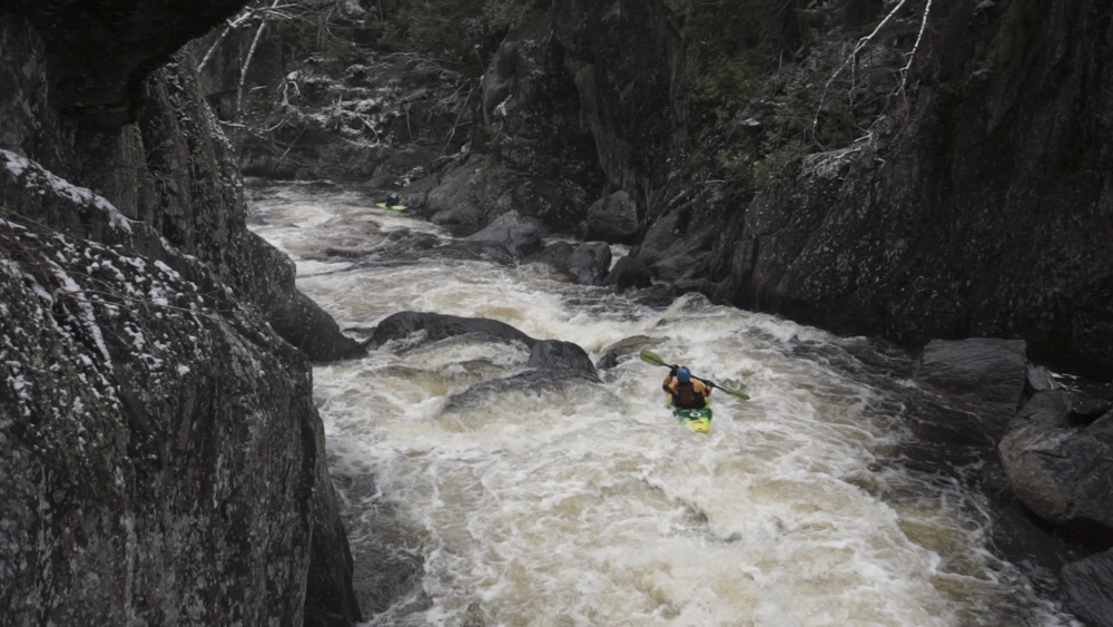
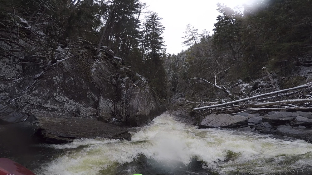
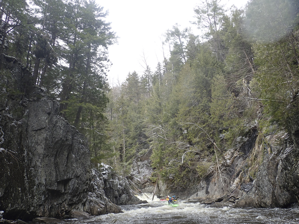
The run starts off as a meandering stream before falling off Stair Falls. Below, the river quickly enters a section of falls that leads to the biggest falls, at 18', Billings Falls. Downstream you begin to descend into the canyon and are quickly met with Wedge Amok which is portaged by most, and is a terrible sieve feature that needs +5" or above to begin to be considered to be run. Downstream you quickly drop into the canyon and at Buttermilk Falls (a mindless 15 foot ramping falls) you are committed. Just below, Turnstile is your first unportagable drop that you also can't scout in its entirety from above. In fact, you can only see the top moves clearly and have to go on beta through the bottom. Classy boogie fills the river until you then reach Jaws, the crux of the run as it is another hard to scout and even harder to portage rapid that can only be described as not super clean. Downstream, things step down to be reasonable class IV for a short distance before the mellow off to class II to III. Make sure to look back upstream as it mellows out as some of the best views of the canyon are in this section, once the inner walls peel back and give you a glimpse at what awaited anyone hiking out.
So, yea, I think that sums up all there is to say. It is worth the drive to Maine. If the snowpack works out well, this will be the crown jewel of a fantastic paddling trip. If the snowpack doesn't work out well, this run will make you walk away from Maine still feeling like the week was well spent, all because of the few hours you got to spend in the spectacular canyon.
Oh, and thanks to Chris Howe. I posted on the Maine Flows facebook group at the beginning of the trip just inquiring generally about what was running etc and he sent me a private note that led to the Gulf Hagas plans. It was great to have someone familiar with the run as Turnstile and Jaws are not full scoutable, so having the first hand beta was really nice. Also, with the windy snowy weather, I think Diane and I would have been too intimidated to put on our day by ourselves. As it was, our gear would freeze while scouting, the shore was snow and ice covered which made the scouts and the portage of Wedge scary so it was nice to know generally where to go on those too. Anyways, thanks so much, we appreciate it!
Mi 0:
- Flat water paddle in fills the start of this run. Get warmed up as when the action starts it doesn't let up.
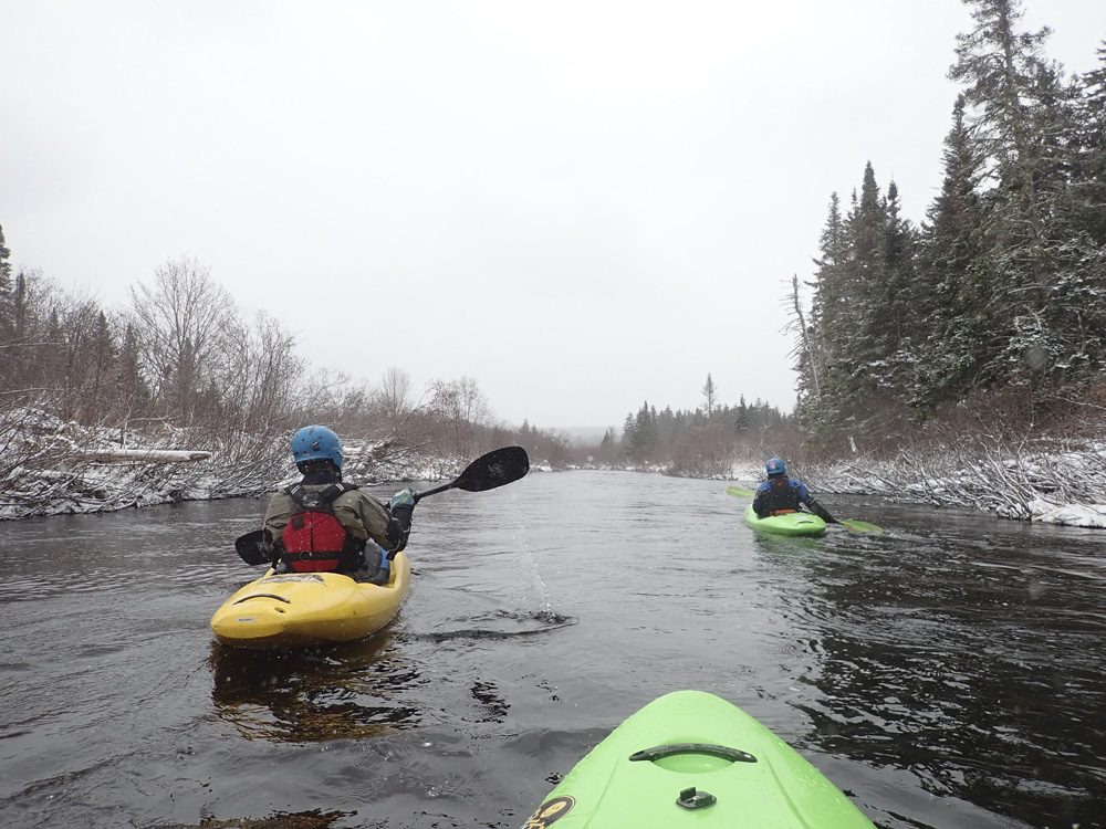
- Pre-Stair Falls (III-). I am only adding this because it is the first rapid and signals you to take the very small right channel immediately after (it seems more like a narrow eddy that pulls back to the right) to bring you to the more commonly run line through Stair Falls.
Dead Moose Falls (III+ to IV-). A nice 6 foot ledge best run on the right side of the main left channel. As you drop over you get a wonderful view of Stair Falls re-entering coming in on the left just below.
Stair Falls (IV). Needs more than 4" to be run. It is a stair step drop that is shallow and wide at most flows.
Ledges (IV). A small exit ledge was run anwyehre, and a larger broken ledge is run right of center. And that brings you to the goods. Hold on to your hat...
- Faceplant (IV). An autoboof 12 foot drop. Sick. Run right down the middle and sail it!
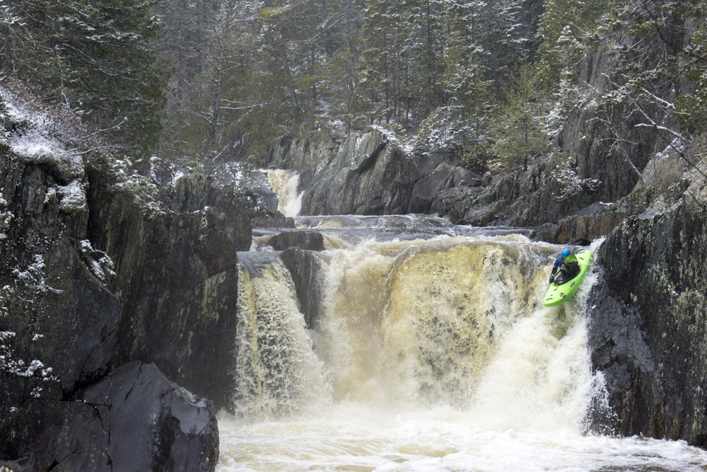
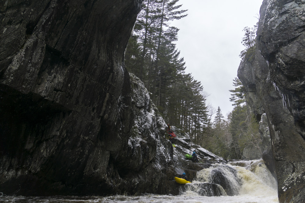
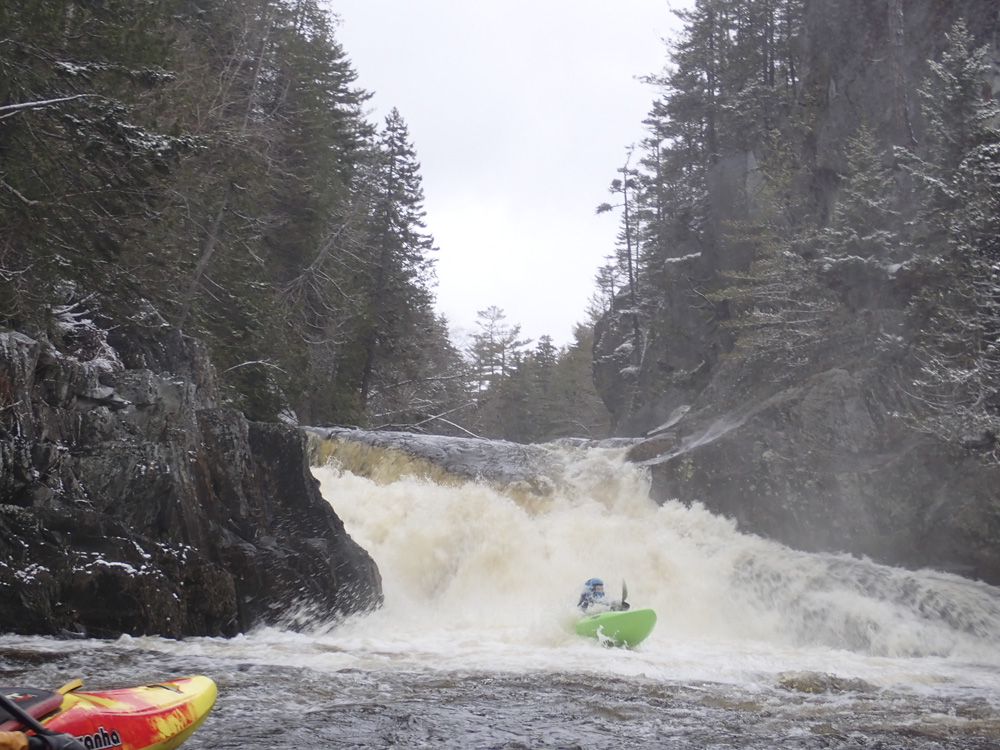
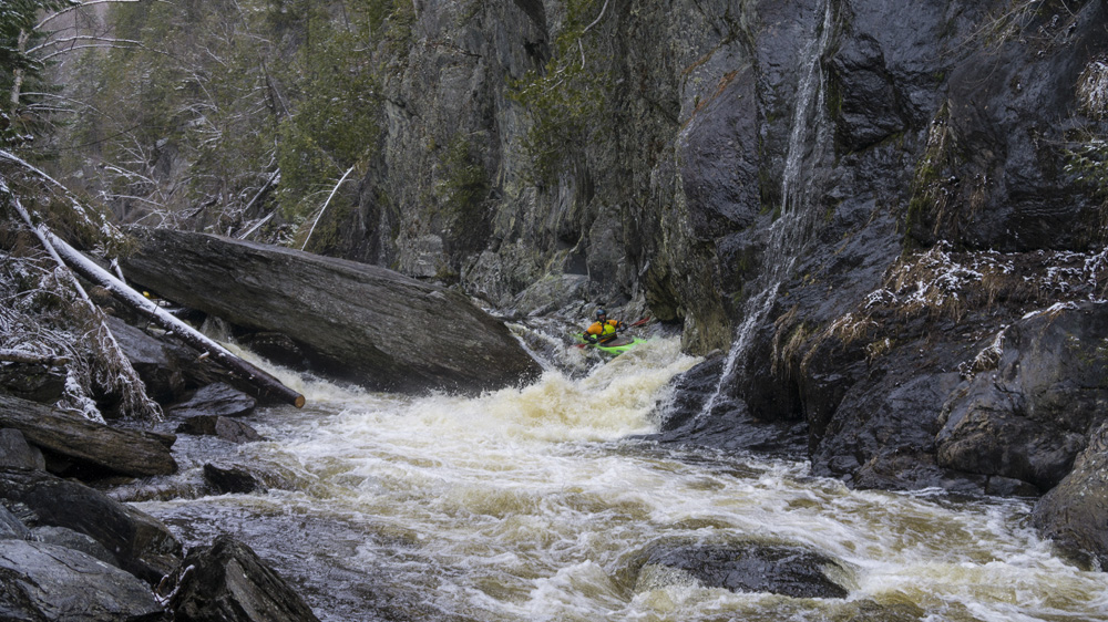
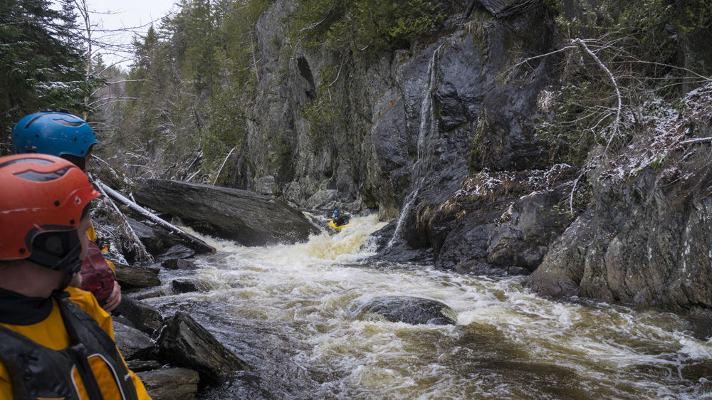
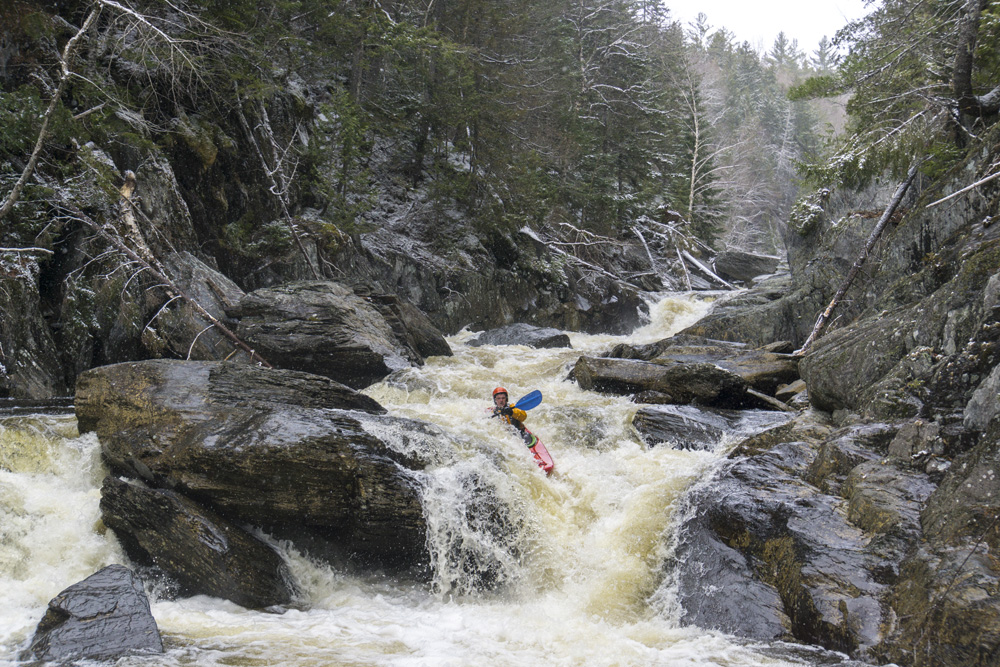
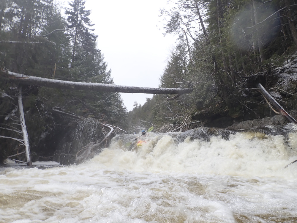
Billings (IV+ to V-). The biggest vertical drop on the run at 18 feet. The normal line is down the middle. Though depending on flow you can error more left. Or you can sneak it down the far left which is more of a slide. Diane and I couldn't scout well due to the snow and ice, but I knew I wanted to get below for photos, so I snuck it first to get out below. Then Chris and Joe ran main line after us. Just be aware there is a cave on the right and apparently a cave behind the falls.
Boogie (III to IV-). This boogie was all straight forward and not too tough at all. If you are having issues, get out above Buttermilk while you can as this is all much easier than what awaits downstream.
- Wedge (V to P). Nasty nasty nasty. Get out on the right and scout. Most portage. Almost everyone portages below 5" as too much water goes into the sieve you need to boof directly over and slide down the backside of. The lead in is long, but is obviously a bigger rapid so get out before dropping in at all as you portage the whole thing. The portage requires downclimbing directly at the sieve, when it was icy it was scary as a slip would send you right into it. We then climbed down onto the ledge on the right below the drop and seal launched in there.
Boogie (III to IV). More good boogie.
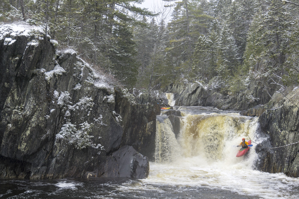
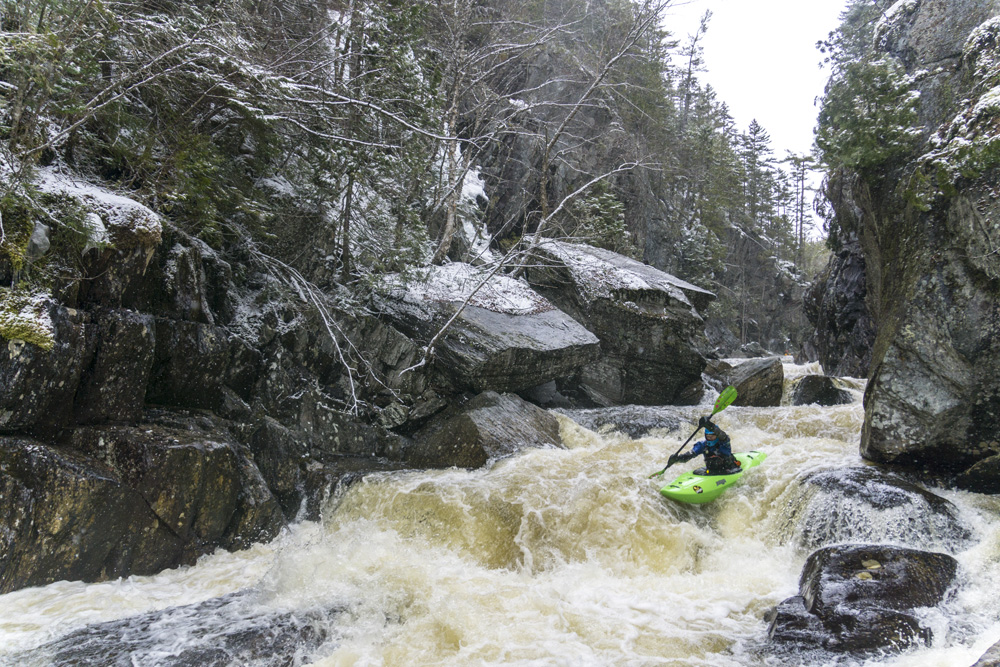
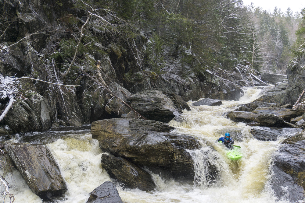
- Buttermilk Falls (IV to IV+). A straight forward drop that is 15' tall or so. Its basically right down the middle to a reconnect which then sales you over the final ledge. Great fun. Send your friends down blind.
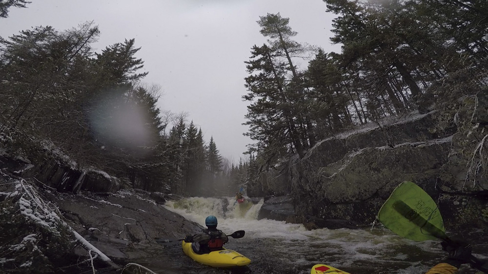
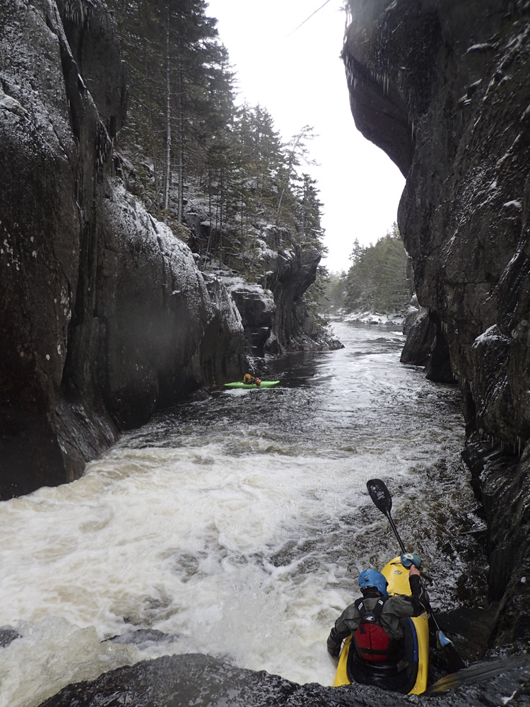
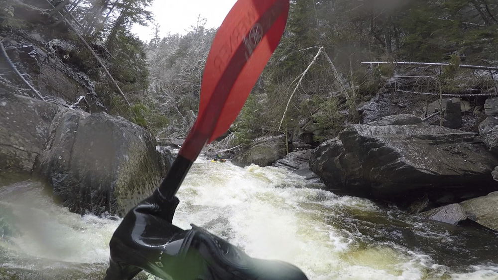
- Turnstile (V). The river enters a gorge and has a few small eddies. Catch the two boat eddy on the right at the lip to scout. There are 5 ledges in the rapid. The first two are run far right and are spread out. But then the river constricts and you boof against the left wall. This is the ledge that gives people the most trouble. There is an eddy that people sometimes catch on the right below, but I honestly think that is a tougher move than just running it direct. Maybe different flows change that. The next ledge is directly below and is also run far left. This then leads to the exit ledge which you want to run left as the right lands 3 ft in front of a rock. It is a tough drop as the middle hole is impossible to scout and is squirrely. Add in the ledges above and below, the sieves below the eddy move, and the rock in the exit, all coupled with the lack of a scout, safety, or portage makes this one earn a class V rating for sure.
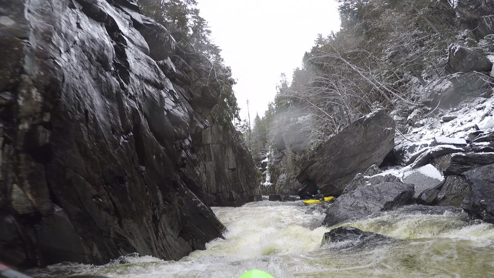
Boogie (IV to IV+). The boogie steps up its came now. Tight gorge. Tight rapids.
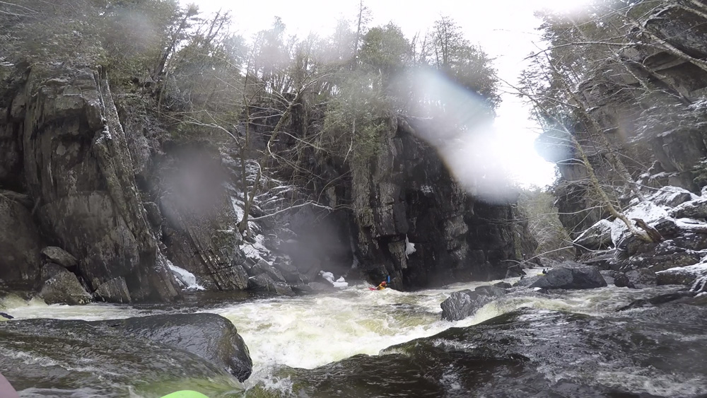
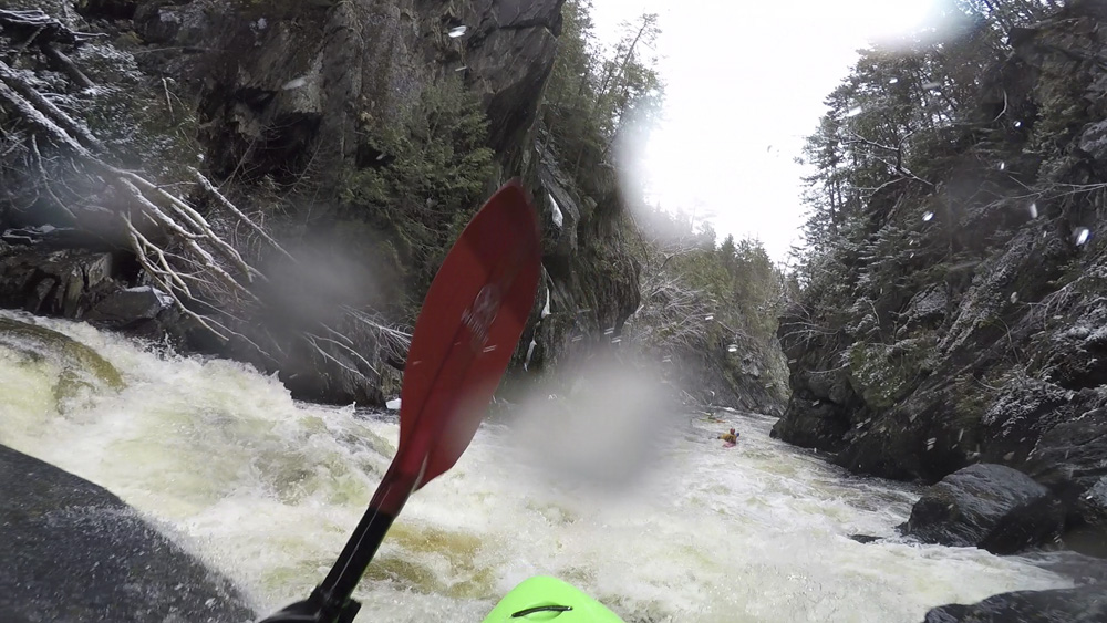
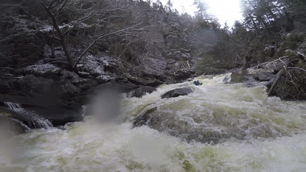
- Jaws (V). Another big rapid that is very tough to scout or portage. You can scout the top from the right shore. But this does nothing for the people who run first and have no safety below, and the exit rapid which people get pushed into blindly. The entrance drop is a narrow slot on the left, drive left and boof over the curler. Then, line up the center flake for an autoboof into the crux part of the rapid. Landing, you drop through a constricted channel of diagonals, mind the right side as you approach the main drop as a small but powerful little hole exists there. Then, go left with the flow and melt down into the pool below. Thank goodness this one doesn't generally have a hole, as the seam is hard to avoid and we all went deep. There is a small eddy that can be caught and safety set from it immediately on the left here. Below, is a junky exit. A weird ledge is run center moving right and ideally you exit int the right through some boulder mank. Alternatively if it pushes you left, it is tight slots that go, but won't be super pleasant for your elbows as it is very tight.
- Double Drop (IV to IV+). A sharp right hand bend and a ramp against the wall leads you to the last of the bigger boogie rapids. This double drop was run center and then right. The middle had a weird curler to melt you. I think you could also sail a boof left at the exit. Mind the right wall at the bottom as it was undercut.
Last Bigger One (IV). One last bigger drop. We boofed the top ledge left of center and then landed driving left to avoid the sorta chunky exit in the middle and right.
- Backwards (III to IV). Normally you send first timers down backwards down the right. But our day had trees on either side so it required a finely tuned line and a bit more of a rock check in the final ledge.
- Opens up and turns into class I.
Take-out: 8 miles north of Brownville ME on NE-11 turn left onto the dirt Katahdin Iron Works Rd. Follow this for 6.5 miles to the bridge crossing over the river. Turn right to stay on Katahdin. In another 3.4 miles go left at the fork and quickly cross the river again. Continue for 3.0 more miles and look for the parking area at the trailhead.
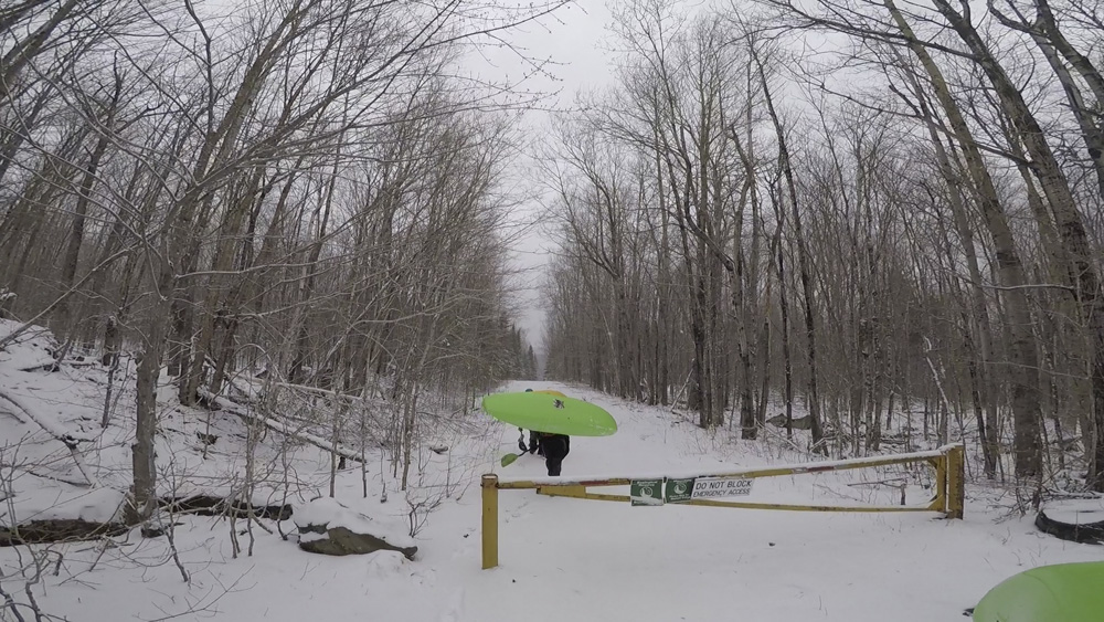
Put-in: Continue on Katahdin Iron Works Rd for 5.4 miles. This dirt road can be muddy and rutted during the spring, or even snow covered. So bring something better than a minivan for the shuttle. Park at the gate at the junction of Frenchtown Rd and walk 0.4 miles down Katahdin (past the gate) to access the put-in.
HTML Comment Box is loading comments...