West Prong of the Little Pigeon River (Lower)
| Stretch: | Chimney Picnic Area to Campbell Overlook |
| Difficulty: | Class V |
| Distance: | 2.2 miles |
| Flows: | 1.2 to 2.0? on the bridge gauge (1.4 felt a smidge low but great for the first time). |
| Gradient: | 335 fpm |
| Put-in: | Chimney Picnic Area |
| Take-out: | Campbell Overlook |
| Shuttle: | 2.2 miles (5 minutes one way) |
| Season: | Fall and Spring, Rain (with an occasional Summer storm) |
| Featured in Video A Wet State #94 and McFloats video | |
| Written: | © 2014 |
Yeah, finally a run in Tennessee as a local! I have done a few runs on previous business trips... the Ocoee and Cain/North Chick. But this was my first as a local to Knoxville. And man what a way to start my stay here! When I first found out I would be moving to Knoxville, all my friends who currently live in the area or have in the past all were quick to say that the West Prong had to be at the top of my list. Now I am sure that the Upper section is more what they intended... but that day will come, I hope, along with some more rain ;).
The trip was made possible by enough first of my stay, or life for that matter... a Tennessee afternoon thunderstorm. Good lord. The sky went dark (literally) and rain and lightning shook the apartment, tornados swarmed not too far away from town, and rivers filled. Over 3 inches of rain from the brief storm... crazy. So the next morning the facebook boards and text messages began to light up and a plan to catch my new friend Mike Reber on an evening lap was formed. The additional perk of this plan was that David Maurier just happened to be driving through Knoxville this day on his way from Palo Alto, CA to Winston Salem, NC where he is taking up residence for medical school... so I had a best friend so carpool with. Though disappointingly it turns out he doesn't fit in all of Diane's gear as well as would be hoped so his session on the river was a bit shorter than ideal.
Anyways, this section is a steep 335 fpm and essentially one long rapid. Literally, no pool... just a couple of bigger eddies. Near the end of the run as you get into the harder rapids, the pace picks up, the boulders get bigger, and the rapids tougher. It really blows my mind that they stay runnable the whole way! And I can't wait to see what the upper section look like as it peaks at 550 fpm! Stay on your toes throughout as wood apparently moves around with each storm.
In total, this run was a challenge. Just so different than anything we have in California. The only thing I can compare it to is Shirtail Creek... though I have never even run that. It is not the place to be out of control... I was off by six inches in the first hundred yards and ended up broached between two rocks in a class III. As my head slipped under I pulled and climbed onto the rocks. 15 minutes later we were able to dislodge the boat. And that was in the easy section... I can't imagine getting into trouble downriver as that would be painful. Well, I can't wait to get back and start to learn the lines. We had 1.4 on the gauge at put-in. I thought it was a good first time flow, though I may look for a smidge more water next time to clean up some of the trip rocks... at my weight there were a lot of them!
There is seriously no way to do a mile by mile... and it will be a lap or two before I even get the rapids listed here correct. So bear with the process...
Mi 0.0:
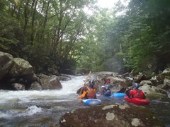
- Easy rapids start immediately. And by easy I mean one caused a few of us to surf and another pinned me and forced me to pull my skirt. This gradually get harder and busier.
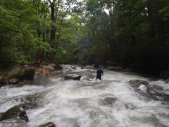
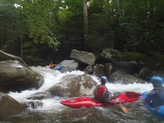
- Cave Man (V). The first of the bigger rapids as I recall. This rapid had a boof at the top that we ran on the left and then a folding falls that we boofed far right into a jut of water. The danger here is a cave just downstream that the water races towards. Apparently there is an exit in the back though in case you do end up in it.
- Skywalker (V). OK, so we snuck this on the left. There was wood just off the line down the middle.
- West Prong Falls (IV+). Sometimes there is a cool boof on the far right, but at this time there was wood. So we went down the middle over the ledge. Error a little right as the left side of center landed in a piton.
- Amtrak (IV+). Fun and low stress! We entered right and boofed the ledge into the jut of water and road out several fun curlers and through the hole at the bottom.
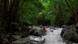
- Room without a View (V). The biggest and hardest rapid on the run, this one is just chalked full of rocks. We started far left and then followed the water back to the right into a narrowing of the river. The river then splits, at 1.4 you could exit either side, most of the water went right and that way was cleaner.
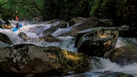
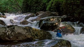
- Bitch (V-). The last rapid, we entered right and boofed the right edge which plugged into a hole that was backed up. At 1.4 it was ok but I can imagine as flows go up this spot may become dicey. We took out immediately below on the left. Climb up 15 feet and you will find the trail.
For more details on the run, see the AW write-up...
Take-out: From Gatlinburg continue south on Highway 71/441. Continue 4.7 miles to the Campbell overlook which is an obvious overlook/parking area over the value below. The hike out looks miserable but in fact is not bad. The trail is on the upriver side of the parking area. If this is your very first time and no one knows it, it is worth hiking down to the river to spot the take-out.
Put-in: Continue up the hill another 2.3 miles. Just before the bridge that crosses the river turn right into the Chimneys Picnic area. Park there. Be warned they lock it down after dark. There is also a small turnout just past the bridge on the left.
HTML Comment Box is loading comments...
