Van Duzen (Goat Rock)
| Stretch: | Bridgeville to Golden Gate Drive |
| Difficulty: | Class V |
| Distance: | 3.1 miles |
| Flows: | 500?-1,500 cfs (500 may be too low, we don't know how low it has been run, it may be a lot of fun, or cause more portaging. 1,500 would be scary in my opinion. 800-1,000 is optimum. Dreamflows Gauge) |
| Gradient: | 56 fpm (101 fpm for 0.8 miles of the good rapids, the crux is more like 140 fpm for 0.15 miles) |
| Put-in: | Turn-out 0.4 miles upriver from the Bridgeville Bridge on Highway 36 |
| Take-out: | Golden Gate Drive Bridge 2.5 miles downriver from the Bridgeville Bridge. |
| Shuttle: | 3.0 miles. Highway. |
| Season: | Winter and Spring from Rain |
| Written: | © 2013 |
| Featured in Explore Six Rivers' video | |
The Van Duzen may be a candidate for the most obscure river in California. I think it is safe to say that most Californians have no clue that this exists... let alone that it is one of the rivers that comprise the Six Rivers National Forest nor that it is protected under the Wild and Scenic river. But alas, it is both. The river is just south of Arcata, home of Humboldt State and drains the South-Western corner of the Trinity Alps, originating a new miles from the South Fork of the Trinity before then running parallel to the Mad River and emptying into the Eel River a few miles from the Pacific Coast.
There are four main sections to the river. The Upper most section is class III before the river leads to civilized world and drops out of sight into a section only run once, the Bloody Section. As part of the Six Rivers Expedition, Paul Gamache, Dan Menten and team went in for the two day exploration and portage fest in their attempt to paddle the entirety of each of the six rivers in the Six Rivers National Forest. The Goat Rock section is immediately below the Bloody Section, which is then followed by the Grizzly Creek section, the easiest of the four.
This river is by no means a classic... but at the same time, it is amazing that it is not done more often. Perhaps as Paul postulates, most often Goat Rock is viewed on the same day folks run the Grizzle Creek section... a section which you want 3,000+ on and as such, Goat Rock looks like death. In reality... the run still looks pretty scary even with proper flow. Sieves await anyone off line, and unlike some rivers where the flow wants to keep you in the safe lines of water, the Van Duzen seems to try to pull and push you off line towards sieves. So much so, that of the four rapids in the crux section, I only ran the exit. None in our group ran the first. And the third wasn't that bad, but the second wanted to move you to the part of the third you really didn't want to be in. Despite this those, I still had a good time. The handful of rapids before the crux were fun, ranging from class III to IV+. And the scenery was quite nice, despite the short length of the run and road lingering not far up the hill side.
We had 900 cfs at Bridgeville the day we did it. Apparently, with 1,100 cfs the first rapid looks a lot better. Though I am sure at higher flows the consequence of the crux section is amplified. I bet this run also goes down to 500 and turns into a boof playground... but there is also a small chance the water goes underground from time to time, but I would be willing to go and find out because I think it will be good.
As a side note, there are some nice trails nearby amongst the Redwood Groves. We stopped and enjoyed one that is at the take-out for the Grizzly Creek section some 10-11 miles below the Goat Rock take out. And how about this for a random Redwood Forest fact... Did you know that in 1900 all the Redwood Groves existed on land that had been sold to private owners. Over the next 70 years groups raised money to buy the groves back culminating in the 1968 passing of the Redwood Forest National Park. But fewer than 8% of the original forest groves were saved.
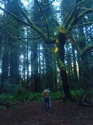
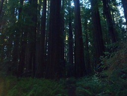
For more info, see Explore Six River's write-up as well as Dan Menten's on North Coast Paddling
Mi 0.5:
- Warm-up (IV). The first rapid is below the Bridgeville bridge. It is a slopping ledge into a hole, best boofed left of center.
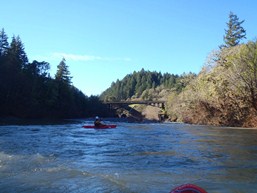
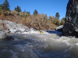
- Goods (III-IV+). After a few read and run rapids, you will get to a larger horizon line. Paul said, "I don't remember having to scout anything" and fired up center with Diane and I not far behind. It turns out he went right the prior time down and the center was a steep drop into a decent hydraulic. We all popped straight through though and reflected on it as one of the more fun rapids. The rapid below this had a tree in play that we moved far right around.
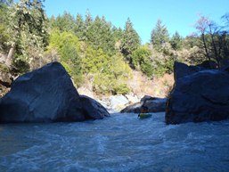
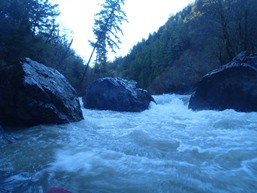
- Headwall: When you see the shear wall drop down on the river left, run the rapid at the base of it and immediately eddy out on the right, as you have arrived at the crux.
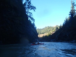
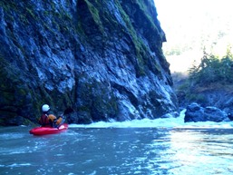
Goat Rock Falls (V). Drive center to the left, and boof the ledge. At our flow, a big curler protected the boof instead depositing you in the big hole below. We portaged carefully at river level around the top, then up and over a large bolder for the bottom.
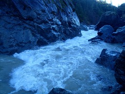
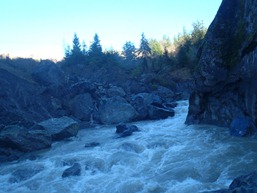
The Pinch (IV). Ferry across the river to get a good scout at The Pinch and the Goldenbeard boof. The Pinch is a double hole, though the holes aren't bad but the cross current right to left push is. The water pushes you as you exit extremely hard towards the sieve pile in Goldenbeard Boof. Paul and Diane both had to catch last minute eddies on the left before ferrying back to the right. I walked easily on the left.
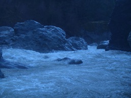
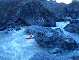
Goldenbeard Boof (IV+ to V-). Scoutable from either side, boof the right most channel. The whole left side is a sieve pile, don't end up over there as you exit The Pinch.
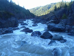
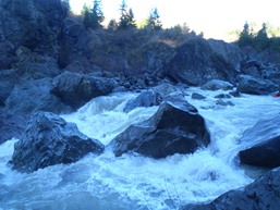
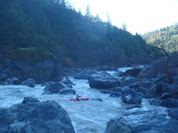
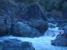
Deathtrap Boof (IV+). Mellow class III-IV boogie leads to the final boof of the run and the exit of the crux section. Right of center, a big pile melts off a rock and is a wonderful boof over a good size hydraulic. The hazard is that if you end up stalling on the pillow and sliding to the right, the water drops into a Deathtrap of a crack in the rock. So... don't over achieve on this one.
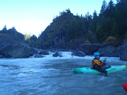
- The rapids immediately taper off to class III and down to class II for a one mile paddle the bridge below.
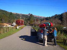
Take-out: From Highway 101 just south of Arcata, take Highway 36 East for 21.3 miles. Turn right on Golden Gate Drive and drop down quickly to the river. Take out is at the bridge. Be polite to the neighbors as this is in a residential area.
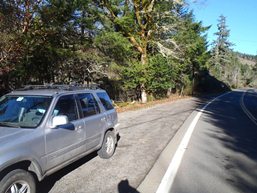
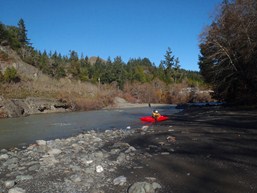
Put-in: Continue up highway 36 for another 2.5 miles and cross over the river and continue another half mile to a turn out on the left. There is a trail on the far side of the turnout that leads down to a large river bar. We put-in here. Upriver is mellow for a while...
HTML Comment Box is loading comments...
