Thompson River
| Stretch: | Musterground Rd Culvert to Lake Jocassee |
| Difficulty: | Class V to V+ |
| Distance: | 0.7 miles |
| Flows: | No gauge (visual inspection at put-in). The middle colvert should not be scrappy. But you should be able to easily pass through it. |
| Gradient: | 378 feet drop (540 fpm gradient) |
| Put-in: | Culvert cross ing on Musterground Rd |
| Take-out: | Lake Jocassee |
| Shuttle: | 1 mile, 4x4 dirt (Highlander barely made it) |
| Season: | Winter and Spring, rain (and off of thunderstorms)... however the road is often closed |
| Written: | © 2016 |
| Featured in A Wet State #110 and in A Wet State's contribution to World Kayak's Video Guide | |
Wow, what a creek. Short but oh so sweet. I would say it reminded me a lot of South Silver back in California. Less than a mile long, and non-stop action. Instead of falls like the South Silver though, this river boasts some sweet slides... that are steep! I honestly haven't ever done slides of this length that are tilted on such steep angles. Just an absolute wild ride. And I am sure by the doubt going through my mind, many people will be standing at the lip and begin looking for portage routes.
The creek starts off mellow with some boogie that leads directly to the lip of the first huge falls. From there, the action comes quickly. The second rapid is probably the most consequential. People sometimes end up on the left side of the bottom tier which slams you into a small crack... I am sure injuries have (or will) occur there. Below, the action continues straight down to the lake though the rapids are much more sane in size!
I learned about this run from Kirk's books last year. I of course had heard of the Jocassee area prior to moving to the South East, but that was limited to the Toxaway and Horsepasture, with only limited knowledge of even the Whitewater. However Kirk's books didn't spawn my interest all that much... rereading it he is super fired up for it, but I think the very short length of the run lowered my interest. But this year lots of folks were heading that way and some photos and video popped up. With those my interest was peaked. So when Zach Dean suggested it I was eager to jump on the trip.
After starting the day with a few laps on NFFB we headed that way... as winter had finally hit (2015) the cold temperatures and a week of boating was taking its toll. One in our group opted to run shuttle, so Zach and I were on our own... luckily at put-in was John Moore who was about to solo a second lap. He offered to show us the lines. Something we didn't know how much to appreciate until after. I think Zach and I may still be at the top of the second drop now, 4 days later, still wondering who will go first. With John's lines we were able to make quick time down the run, only quickly hopping out to see a line before plopping off.
This run is seriously at the top of my list of favorites. Top 5 for sure. Just so steep, and so fun. And no portages! I can't wait to get back there. The only issue is that the road is gated more often than not. The regulations for the Jim Timmerman Natureal Resources Area at Jocassee Gorges is open only September 15 through January 1, and March 20 through May 10. Give or take. This year (2016) the gate is open through January 15. This aligns with hunting seasons.
You wouldn't want high flow in this run, lower is fine. The pace would become dangerous if the flow is high, certainly don't go in high if you intend on scouting. Our flow is considered low but I thought it was a great first time flow.
Oh, and random fact... I thought it was cool that Overflow Creek started 650 ft from a different state... well, the put-in here is less than 450 feet from North Carolina. Hence this is in my South Carolina section!
The run is only 0.7 miles... so...
Mi 0.0:
- The first quarter mile is boogie... but there are two things to note.
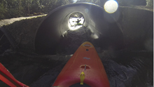
Get Right (IV). A fun rapid starts off the "need to know" rapids. This one is a horizon line, boof the main flow on the left before landing and immediately moving right. Once right just plop over the slide. You don't want to follow the current left as it drops into an undercut.
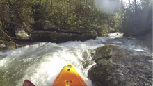
Small Double Drop (IV). Two small double drop comes, the first is a mindless set of slides, the second is as well other than the fact the bottom one has some piton potential on the bottom left. Just stay right.
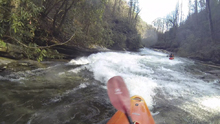
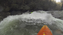
- First Slide (V). A small eddy on the right allows you to exit the river when the river obviously drops out from under you. It is one boat but there is also room on river left to wait. The drop is a huge slide maybe 60 feet tall. Stay right at the top... as far right as you can. The left slides into a sieve and some metal that thumps loudly against the pressure of the water. Once you start right though it seems the best lines are had by working back left as much as you can while sliding at Mach 2. This lines you up to slide through the slot between the two ribs of rock. Some hit either rib of rock which works out fine but they fly and spin in the air.
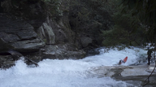
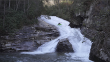
Small Rapid (III). One small rapid that you read and run and you will want to scout again, we scouted left. We saw some folks portaging in the woods on the right, so I guess that is an option as well. Though it doesn't look easy.
Skatepark (V).
-
Skatepark Part 1. The lead-in of the rapid had three boofs. The first two were just follow the water, at lower flows don't bother trying to hit the shoulder as the landings aren't super deep. The bottom was maybe 6-7 feet tall and moved back left into a small sliding hole with a tree in it. The tree makes it harder. Just go left around it and if you want, catch an eddy immediately below on the right to break it up.
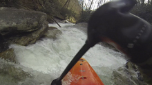
Skatepark Part 2. The second part isn't hard if it goes well. The first part is a small hole that is stickier than it appears. Just power through. You then hit a slide which banks left. Some people choose to slide down and aim left to eddy out. This plays with fire and makes the exit drop much harder. Instead we aimed right and plopped into the whirlepool eddy. At high flow this may not be ok to do, but at the lower flows it was much safer!
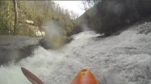
Skatepark Part 3. The final part is the crux. If you slide down Part 2 and went right of the midstream boulder it is super easy. Go around the rock and drive right and you are in a fast moving slot that accelerates and accelerates but is straight forward. If you eddied out left you need to drive right across shallow bedrock and not drop off to the left. That side slides into a very small crack and I have seen video of people eating all sorts of shit in that crack. It is ugly... don't do it.
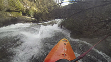
- Double Drop (V). One small slide leads to another drop worth scouting. This one has a tight s-turning lead in to a 10 foot ledge that you want to boof right. Though our day there was a tree so you had to boof more in the middle... and I found a piton or pin spot in there when I landed. I ended up pirouetting out of it and dropping the small exit ledge backwards.
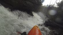
Plop Falls (IV+). If wood isn't present, you can main channel and just head right of the kicker. This time there was wood, so we plopped into an eddy on the right by wheelchairing the rock. We then slide out and worked left. Just don't work too far left or go left of the kicker as there is a outcropping of bedrock at the bottom awaiting you if you do!
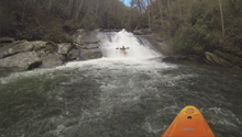
Right Turn (IV+). The next drop starts by making a 90 degree right turn. Scout before catching the eddy on the left at the lip. From the eddy though, just ferry out and right down right of center. It whites out at the top but just hang on. Also, keep it straight as there is a bit of a hole against the wall at the bottom. This then goes directly into the next rapid.
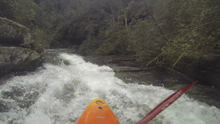
Exit Falls (V-). Catch the eddy at the lip on the right. Ferry across the main flow and run it moving left with left angle. Use the hole at the base of the top small slide to move further left. Left of center (not either of the two "center" channels) there is a channel that is a main flow channel. Take that and slide down into a turn and over a step down into the sliding hole below. Below, a small rapid awaits and you are free... in the lake water. Mission complete!
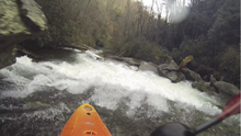
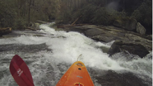
Take-out: From Hendersonville, take US-64 for 38.8 miles. Shortly after passing Lake Toxaway turn left on NC-281. Follow this for 11.5 miles... crossing the Horsepasture, the Whitewater, and the Thompson itself. Just after crossing the Whitewater, turn left at the Duke Energy office onto Bad Creek Rd. Follow this road down for 2.6 miles. At the bottom of the hill a gated road goes off to the right. This is only open during hunt season... thus you can only run this river during hunt season. Follow it for 3.9 miles, quickly crossing the Whitewater before climbing back out and dropping down the other side of the ridge down into the Thompson. Drive up the lake to a spot where the lake is close to the road, just prior to the road climbing steeply away. Park there.
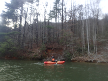
Put-in: Although you don't need a burley car... though some clearance is nice for the drive to take-out, the drive to put-in however pushed the limits of what my Highlander could do. And it isn't the whole thing... just one very steep and junky part about halfway up the road. Anyways, the shuttle is straightforward... just continue up the road another mile to the culvert over the river. Put-in there.
HTML Comment Box is loading comments...
