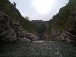
Tavignano (Gorge)
| Stretch: | Camp Ernella to the second bridge |
| Difficulty: | Class III to III+ |
| Distance: | 7.9 km |
| Flows: | ~600-?000 cfs (no gauge) |
| Gradient: | 33.5 fpm average |
| Put-in: | Camp Ernella off of N200 |
| Take-out: | Bridge over the Tavignano 5.7 km downriver |
| Shuttle: | 5.7 km, all paved |
| Season: | Spring from snowmelt/rain |
| Written: | © 2013 |
| Featured in Video A Wet State #72 and Kayak Session's Guide | |
And a huge thanks to Prijon for the boats they lent us!


Day 7:
So you might notice that there is no Day 6... that is because of some surprisingly cold weather that rolled in and dropped most of the rivers that were high on our list into the "too low" category. Well, that and the fact that only a few of our team were keen on boating class III rather than nothing at all. Such is life. Instead, that day we took a leisurely drive to see if the Upper Golo had water which it did not, then the Middle Golo which also had not. Then we went to Restonica which had water but the team had no motivation for the rock strewn boulder gardens. We did however decide to drive to the very top of the Restonica which was one of the most scenic ventures we went on and very worthwhile. There were also some nice slides at the top that if it weren't nearly snowing on us, perhaps the group would have motivated for... perhaps. Instead, we went back to the Camp Emella and got a nice dinner and took showers.
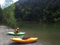
Day 7 the group split up. I nursing a pulled pec muscle and other members of the team having similar reasons decided to not go into the Upper Vecchio, regarded as one of the most difficult and dangerous sections of whitewater on the island. Instead, after driving shuttle for the guys, others of us put on to the river that we had been camping next to for the majority of our stay, the Tavignano.
The Tavignano Gorge is just class III in nature with perhaps one or two rapids that are a half step harder. But the scenery is the draw, even for some of the gnar boaters on the island. The river drops into shear walled gorges with walls 10 feet apart and rising 50 feet in the air, all the while, with fun rapids pinched in their confines. Our team of three walked away with smiles on our face and glad of our choice to take a mellow day and enjoy this section of superb river. Afterwards... we went to the coast and got some café while sitting on a lawn 20 feet off the Mediterranean... not a bad day to say the least!
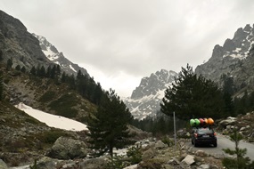
Finally, I apologzie for all of the GoPro and other video captures that I am pawning off as photos here... we tended to go fast on the water (putting on after 4 pm every day) and focused on taking video when we did hop out. Thanks to Paul Gamache for his contributions of photos as well as Darin McQuoid for his contribution of video that I took shots from.
Km 0.8:
- Dam (III). After a lake to warm up on, you can either portage right or run the fish ladder on the dam.
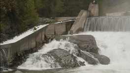
- First Surf Wave (III-). A nice rapid with eddy service for a great surf wave. Rapid is on a right hand bend. Eddy access is on surfer's left.
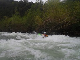
- First Gorge (III). Several rapids are pinched between the walls of a tight canyon. Lines are easy to spot and scenery is spectacular.
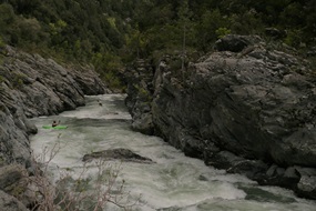
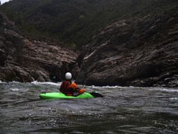
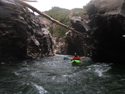
- Second Gorge (III to IV-). At the start of the second gorge is a tight rapid with a lot of water going right, into a sieved out area. It isn't hard to stay left though before working back right after the rock. Downstream are several more nice pinches with class III drops in them.
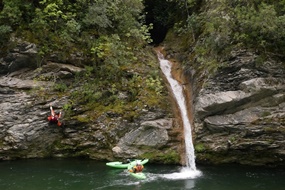
- Side Creek (III). A cool side creek drops into the river via a bowled out slide and falls. With some effort, you can climb up and boat it.
Directions: Use the GPS locations to get yourself to put-in and take-out... I wasn't driving most days and do not know enough of the directions to be useful.
Take-out: From the town of Caterragio, drive up the N200 15.2 Km to the first bridge over the Tavignano, this is take-out.
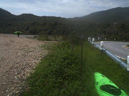
Put-in: Continue up N200 for 6.0 km to Camp Emella, this is put-in.
HTML Comment Box is loading comments...

