Tauernbach (Prosegg)
| Stretch: | Below Prossegg Road |
| Difficulty: | Class V- to V |
| Distance: | 0.7 miles |
| Flows: | 140 to 165 cms (150 cms felt medium). Check "The River App" |
| Gradient: | 109 fpm average |
| Put-in: | Prossegg rd Bridge |
| Take-out: | End of the road, when the portaging begins |
| Shuttle: | 800 km dirt drive, 500 km hike |
| Season: | Fall |
| Written: | © 2016 |
| Featured in A Wet State #115 and in A Wet State's contribution to World Kayak's Video Guide | |
Austria & More 2016: Day 8 Morning
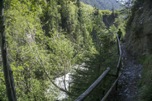
The last full day in the East Tirol region started out with a little bit of a mission. This run has a great short section of whitewater, with a mandatory rapid. But is also known for its heinous nature downstream, in the bottom half of the run. Due to this, we planned on egressing out of the canyon at the top of the first of many portage. We took the time to scout the river from the trail high above and spotted where we would likely climb out of the canyon and back up to the trail. Scouting the rapids from above while walking down, I began to grow more confident. None of it seemed that hard. While walking back up to the top though I spotted several different rapids that in fact made the nerves grow in my belly. The rapids didn't look overly difficult, but they did look steep, and I hadn't been boating my best throughout this trip yet. With that in mind I began doubting myself and questioning if I wanted to put on. Luckily for me (I think) this is a fairly common occurrence so I just put on anyways and hoped for the best.
The river starts with a partial portage that apparently was new this year. Below, the action starts immediately and continues all the way to the take-out eddy. Several drops will be scouted. I would highly recommend scouting the section with the mandatory just under the rotter foot bridge prior to dropping in. It would be impossible to scout it from the river and is a stacked section. Downstream you will find several great character class IV+ and V- rapids all staked on top of each other. I would only give a few class V rating on their own, but the day felt class V for sure.
I would also say that if you knew the run well, it would be hard to motivate to go to it often. The run is short. If you knew it and routed it I bet it would only take 15 minutes at the most. That followed by a Poison Sumac covered hike out to the train would just be hard to get fired up for. However, for a visiting person like me, I thought the run was great. Challenging rapids, great scenery, and a brief sense of adventure. Totally worthwhile.
Also, we had 150 cms which felt medium. This was also abnormal for late Spring, as this river is like the Isel Gorge and usually too high until the end of the glacial snow melt.
Thanks to Harald and Reiner Glanz and Jim Janney for sharing photos and for making the trip possible!
Last: Austria & More 2016: Day 7 Evening - Isel (Huben)
Next: Austria & More 2016: Day 8 Afternoon - Defereggenbach (Tunnel Run)
Mi 0.0:
- Partial Portage (U then IV+). This first rapid is new apparently, probably all of the crap from the construction just upstream. It is easy to walk on the right before putting on. We ferried over to scout and then had to bush whack to portage. Thought you can also run the bottom half from river left. It is a double drop.
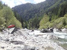
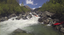
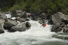
Boogie (IV). Downstream was a short section of boogie that we ran down the middle. It leads to eddies directly above the bridge drop.
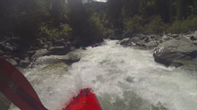
Under the Bridge (V- to V). Portaging this drop would be a bit of a pain... maybe not even possible unless you portage it from higher up. Scout from the trail before putting on. The drop is taller than it looks from scouting, maybe 8 feet or so into a ramping hole. The middle has a nice boof but as a rock directly behind it in the landing. We went down the left into the depth which kicked us out in varying degrees of control. At our flow, there was only a small eddy on the right before the next rapid.
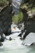
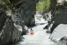
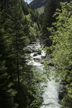
Pinch (V- to V). As you exit the previous rapid, there is a uniform ledge, you can run it center and drive left into an eddy to scout the next drop. If you scouted before putting on, or if one person gets out it is easiest to run straight through. I entered on the right of center through the top hole which set me up for the bottom move nicely. The bottom is a small drop you want to be center moving left before it pinches and drops into a weird hydraulic. As long as you are on the left you pop straight through.
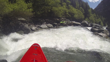
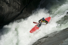
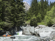
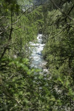
- Ledge (IV). Just downstream is a ledge maybe 8 feet tall. The bulk of the water goes left, though it leads to a huge piton. You can go just to the right of that, or just go off of the middle shallower part of the ledge. It is also easy to scout on the left.
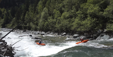
Mellow (III to III). Downstream there is a section of mellow water before you get to the final set.
- Busy 1 (IV+ to V-). The first rapid below the mellower section has a blind entrance and is worth scouting on the right. We entered middle and drove to the right where the river then starts cascading down a class IV drop before making a 90 degree turn right and dropping into a small hole. Getting too far right or left down the cascade is not ideal. The section is all continuous downstream until the Exit rapid...
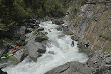
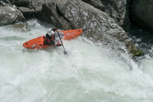
Lead-in (IV). Just below the previous rapid is a boogie section that leads to the lip of a very congested drop that is worth looking at to find a clean exit. There was a small eddy on the left.
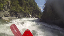
Busy 2 (IV+). Reiner dropped in and I saw him scramble to the right in a hurry and didn't see him appear downstream. I quickly got on a rock to ensure he was ok and he was perched on some rocks and gave me a signal to go down the middle, right through goal posts in the junky middle. I then had Harry and Jim follow me as we ran down
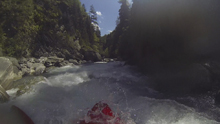
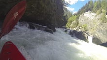
Slide Right (IV-). Reiner scouted this one on the left and gave us beta to go down the right right. It was a small slide that was pinched against the wall.
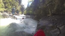
Boogie (III to IV). A short section of boogie led to the lip of the final rapid which you hopefully scouted from the trail as you cannot scout the bottom from the river. You can however eddy out at the lip on the left shore.
- Exit Drop (V). The line is to go down the entry slide on the rightside of the left channel as there is a nice kicker there to clear the hole. Then, book it to the left most small channel to hit the nice flake boof to exit. The water however is trying to push you to a more congested and more sticky channel over to the right. So take care.
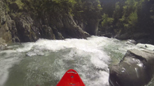
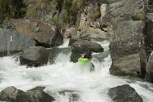
- Take-out! Do not miss! Just downstream of the last rapid is a huge house size rock on the right shore, get out BEFORE it. Do not go around it as you find yourself at the top of an unrunnable drop with no great portage options.
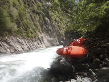
- You Messed Up (U). Unrunnable and difficult to portage once at the lip. Seriously... it is unrunnable sieve pile. If you miss take out, I think the best portage route would be far left. But, just don't miss the take-out and it won't be a problem.
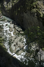
Put-in: From Lienz, travel North on B108 (Iseltaler Str.) for 31.9 km. You will pass Matrei in Osttirol and the Isel coming in from the left. Continue up river. Just before the town of Landschutz look for a left turn onto Gruben. Take this and quickly cross the river. This is put-in.
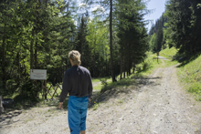
Take-out: Continue another km down what is now Prossegg Str. to the gate on the dirt road. There is a trail that begins here on the left. Follow this trail to the tunnel. You come up just 20 yards back up the trail from the little tunnel. The hike is less than a km.
HTML Comment Box is loading comments...
